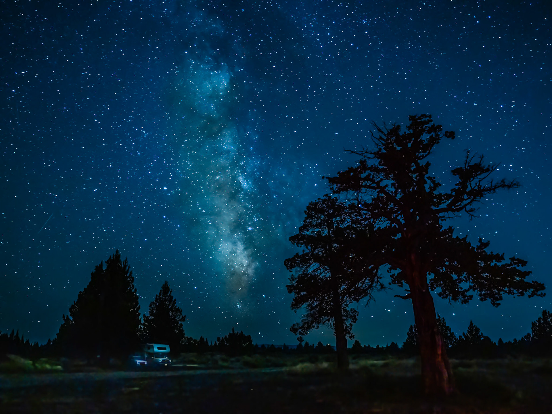
High Desert Milkyway: The Milky Way gives faint illumination to campers on a moonless evening near Bend Oregon.
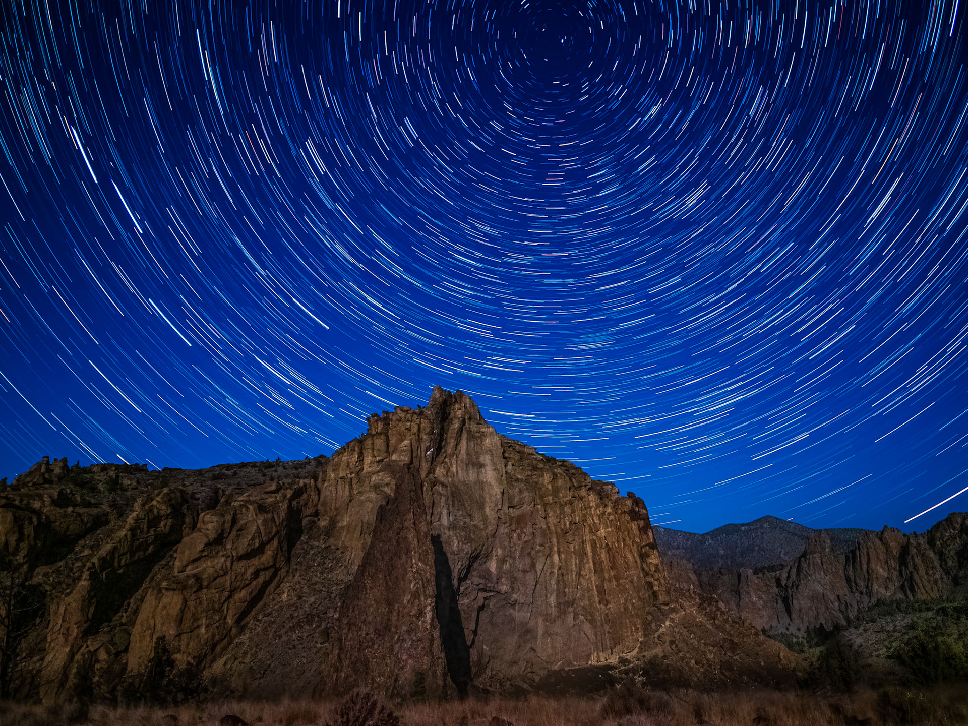
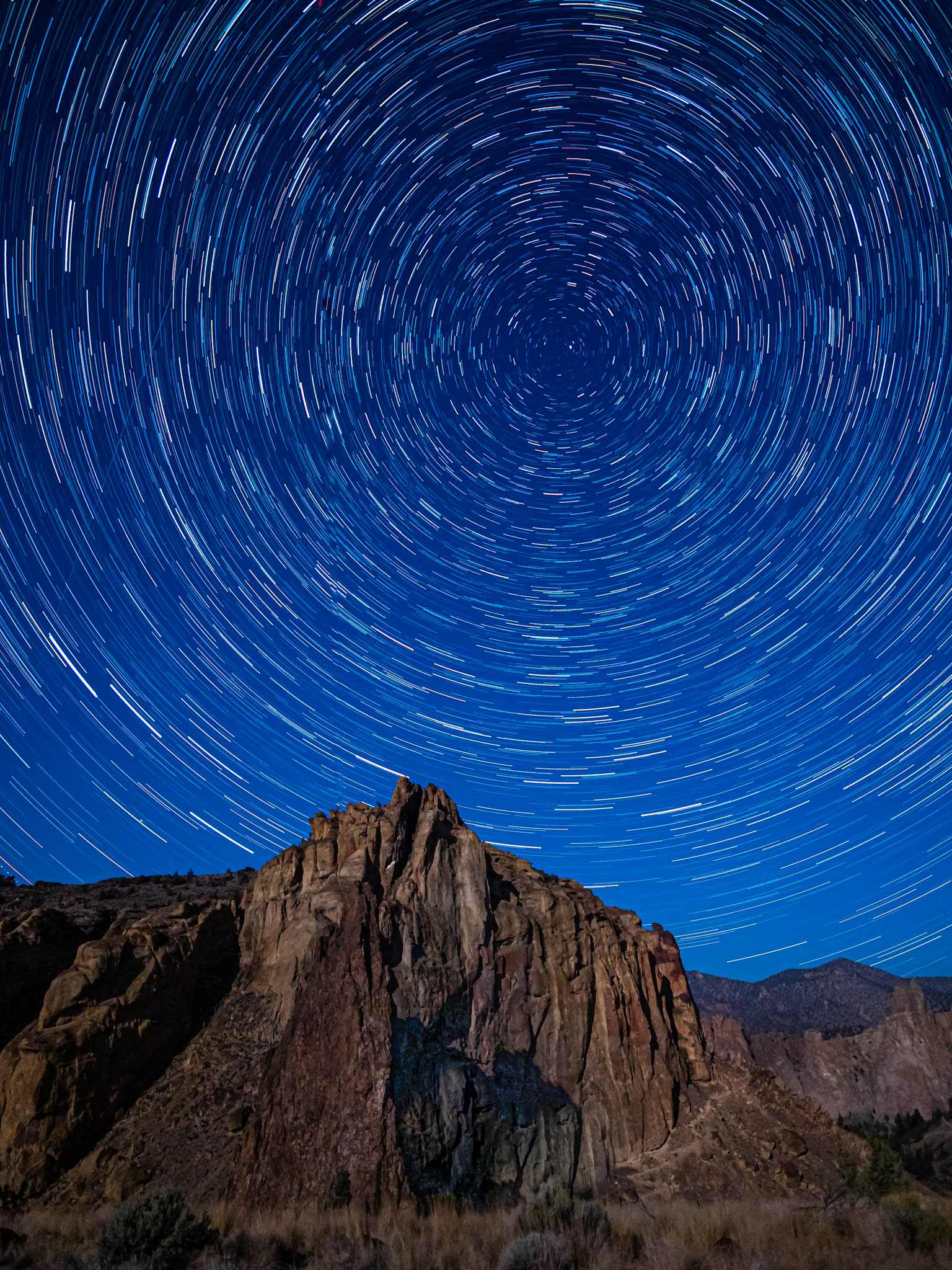
Starry Night at Smith Rock: A gibbous moon provided faint light to illuminate Smith Rock at night. A long exposure sequence captured Polaris and star trails rotating above the peak.
Les Williams - Smith Rock Star Trails: A gibbous moon provided faint light to illuminate Smith Rock at night. A long exposure sequence captured Polaris and star trails rotating above the peak.
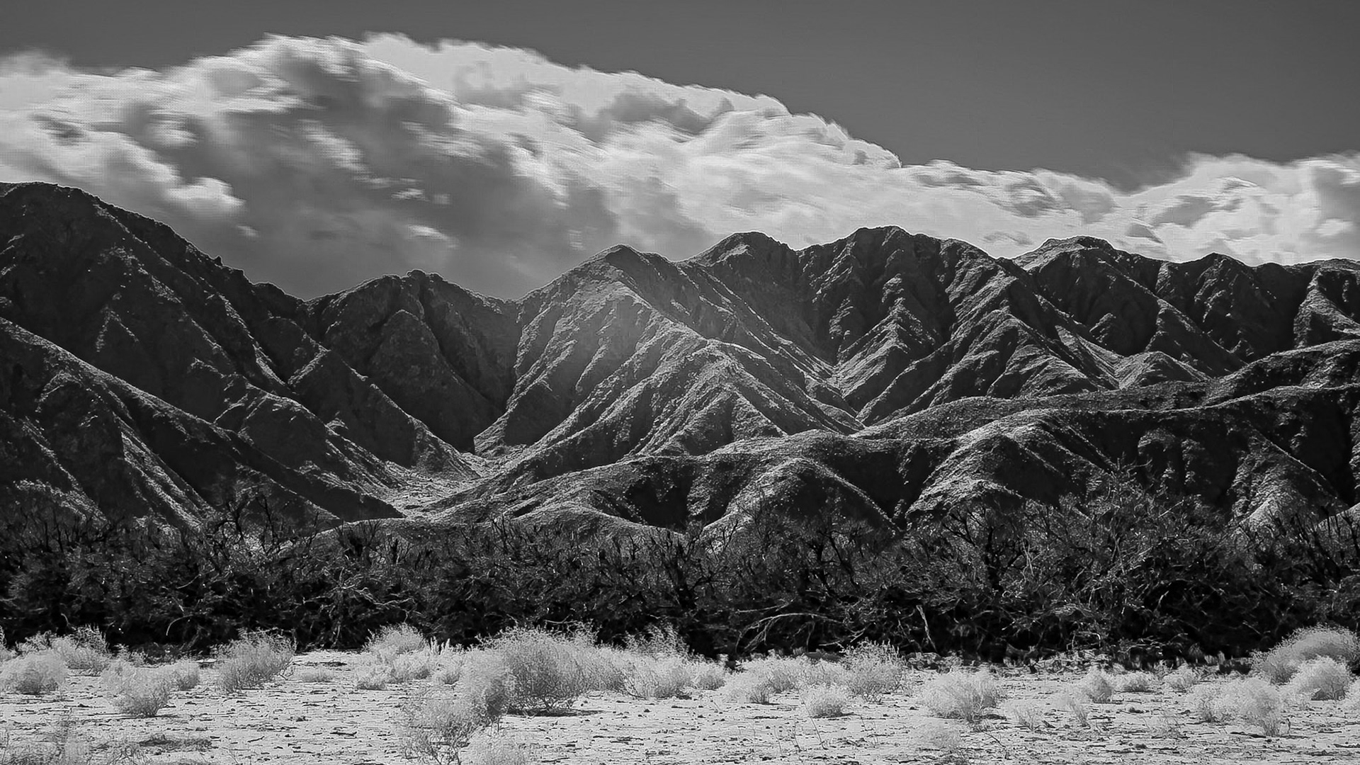
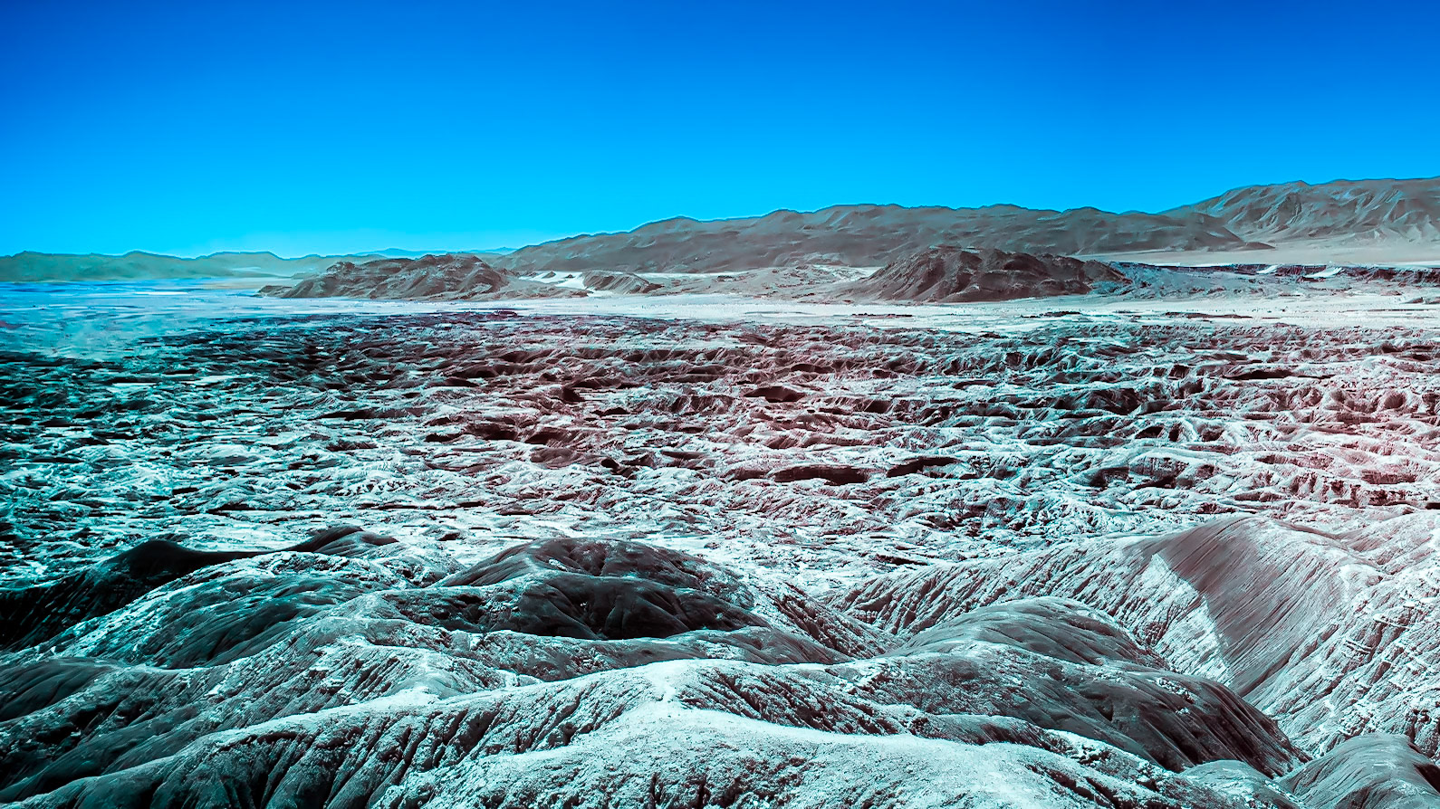
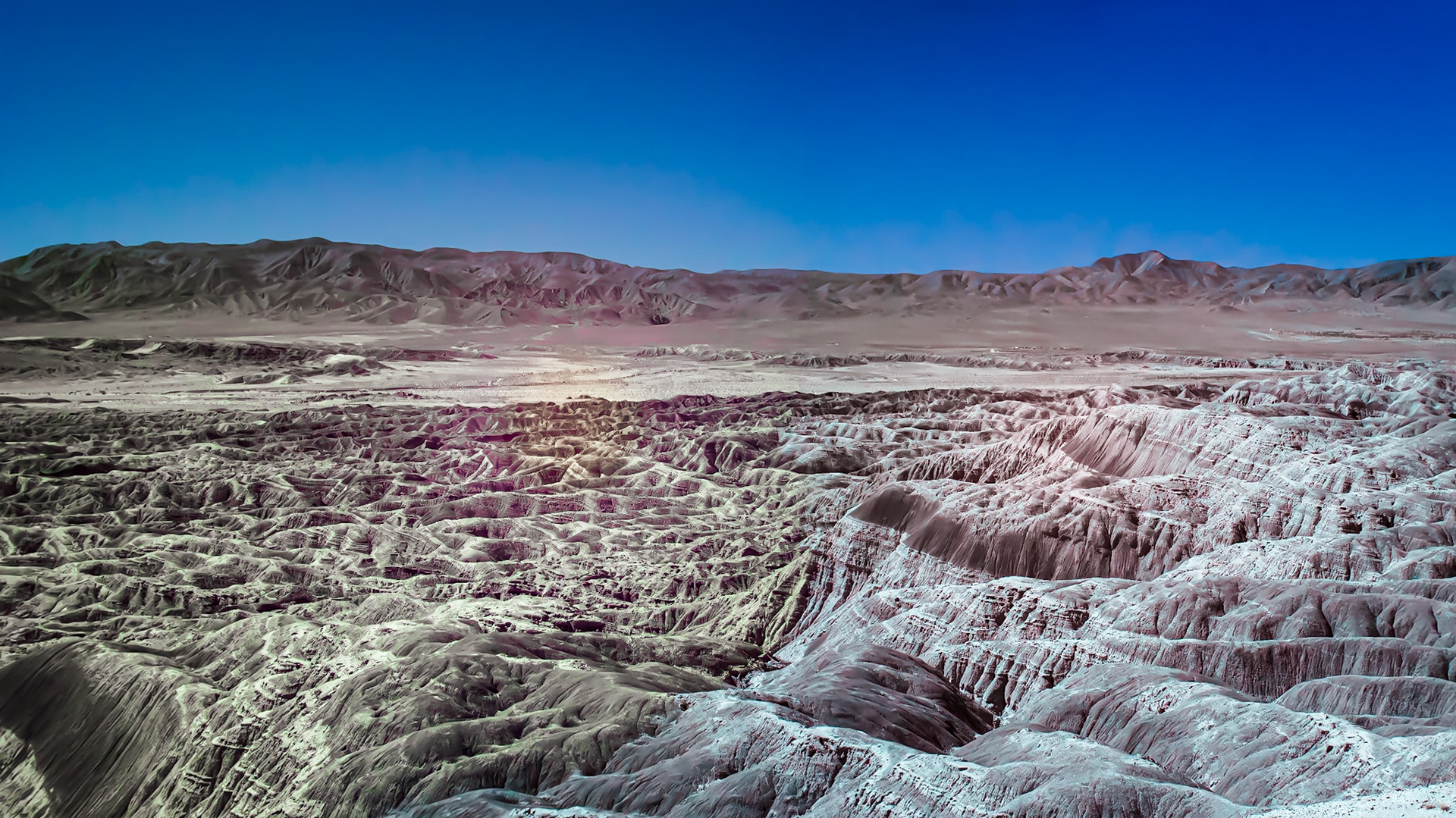
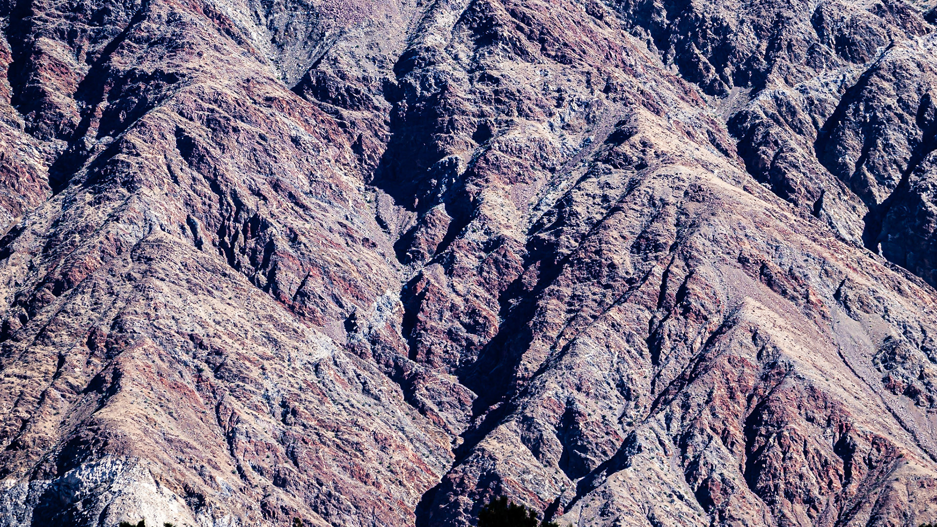
Borrego Badlands Layers: Steeply layered and highly eroded terrain of the Borrego Badlands in the Anza-Borregon Desert.
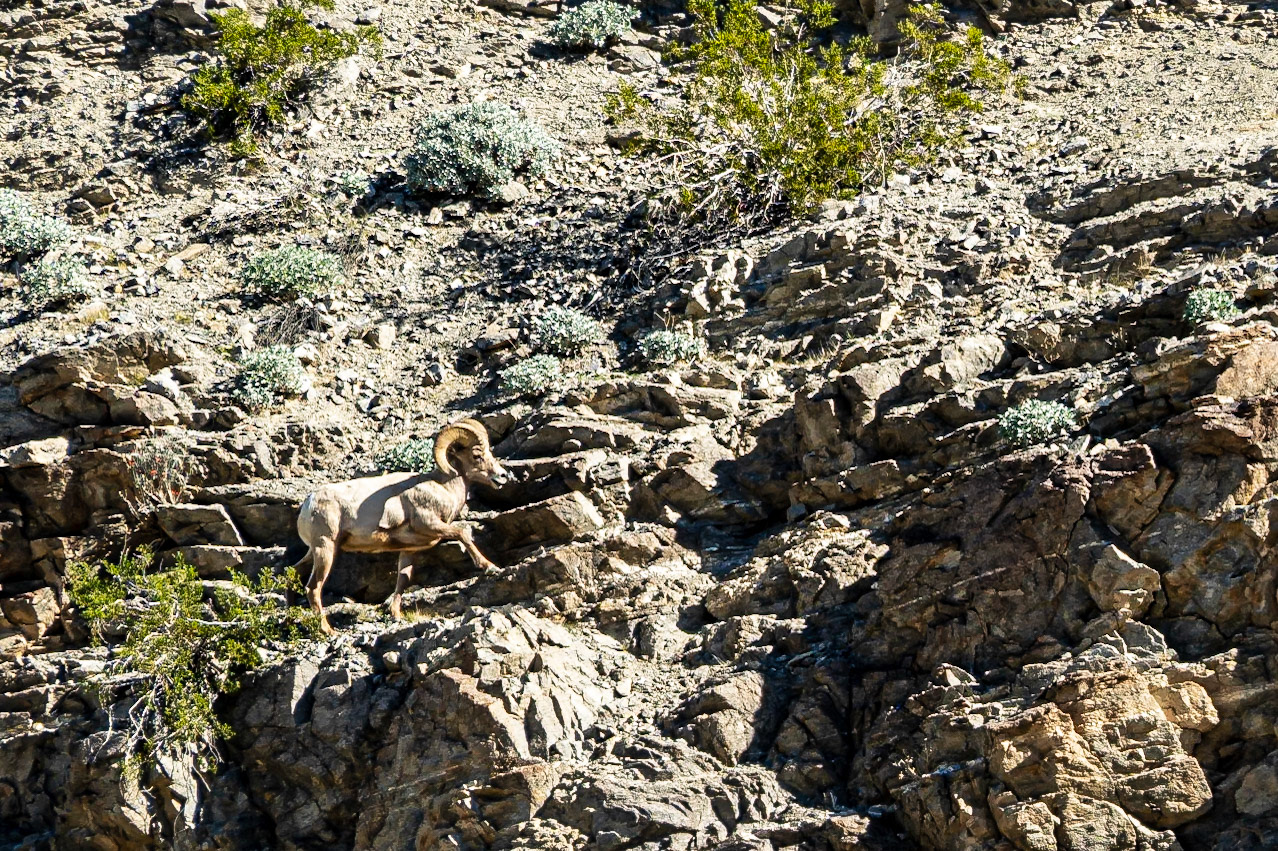
Bighorn Moving Uphill: A bighorn sheep ascending a rocky slope above Quartz Vein Wash in the Anza-Borrego Desert.
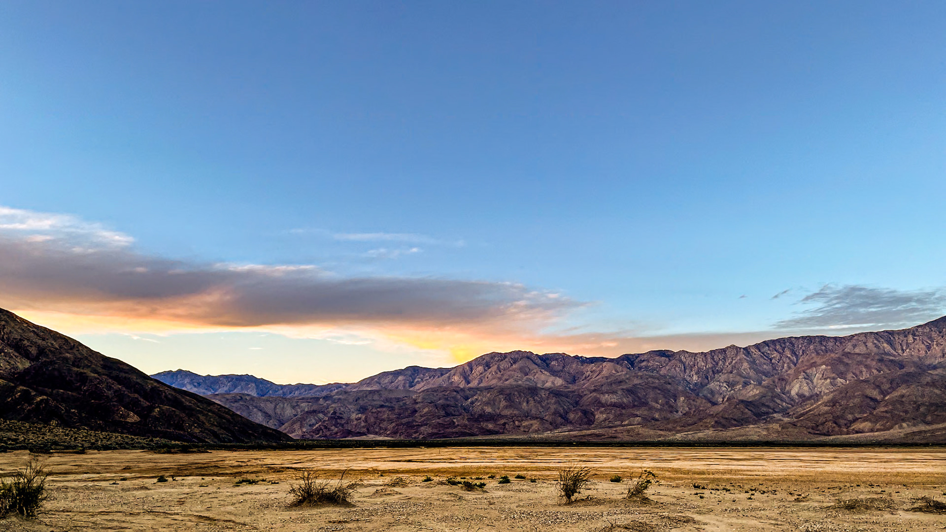
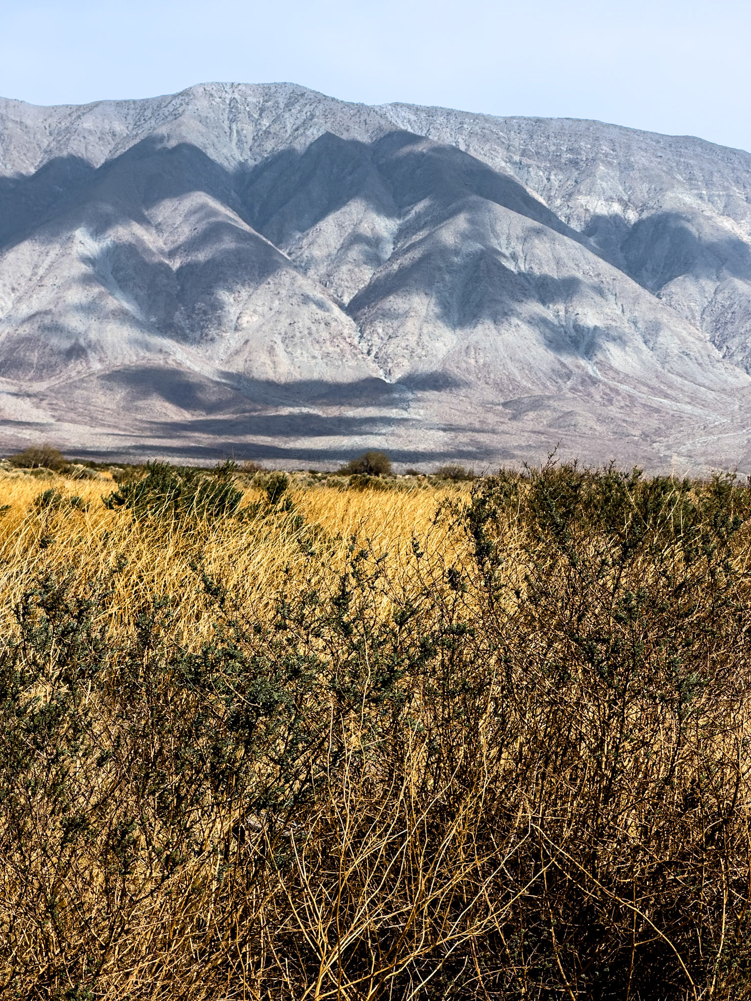
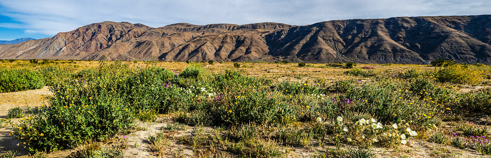
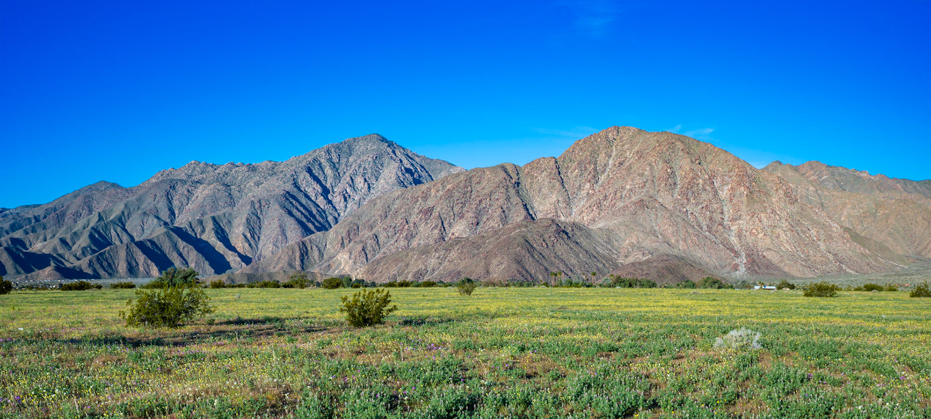
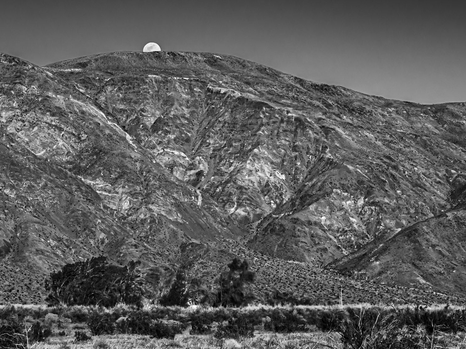
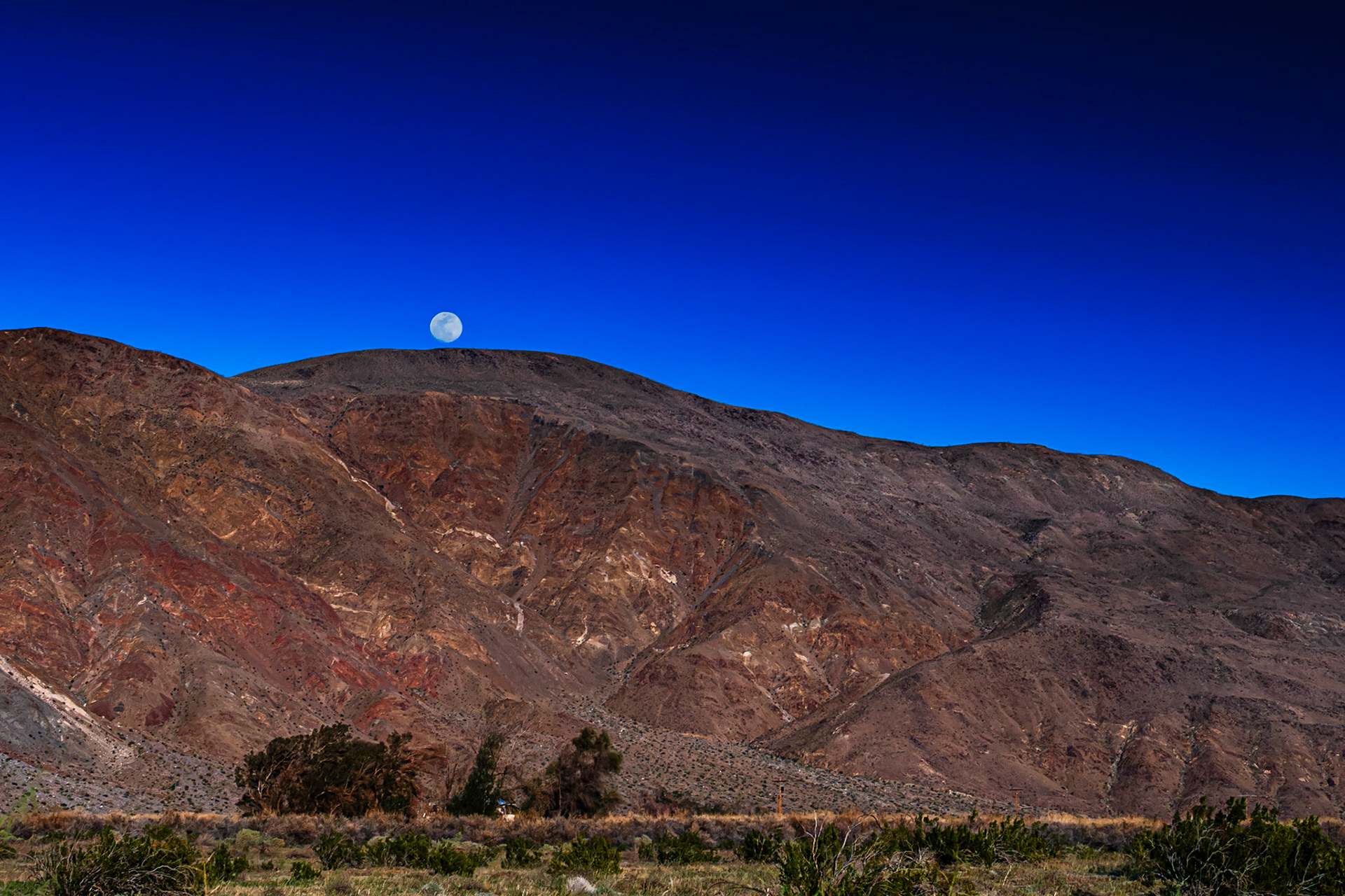
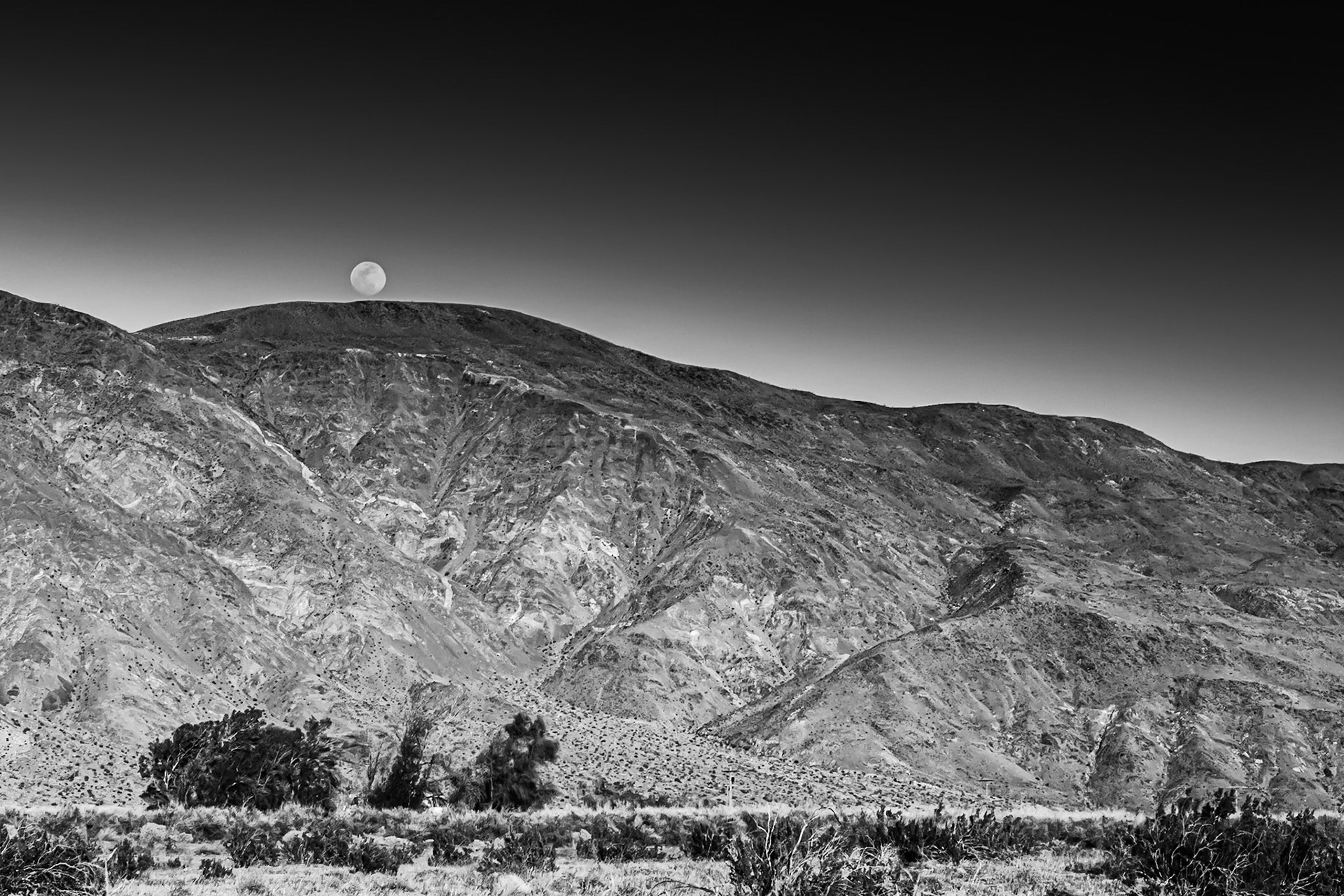
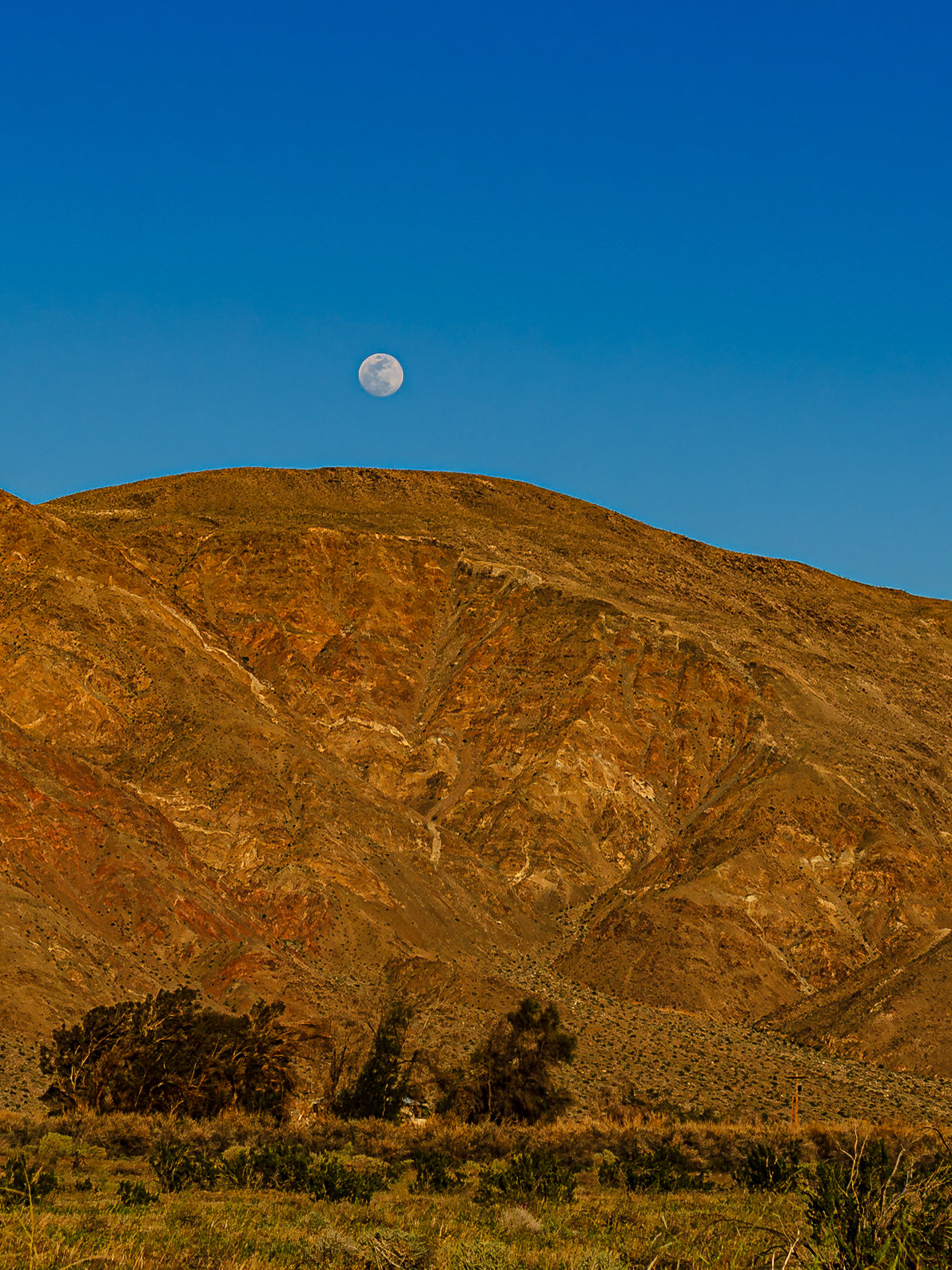
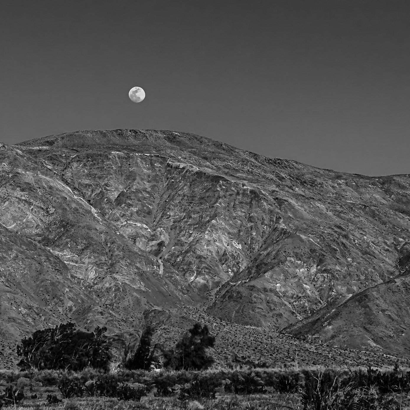
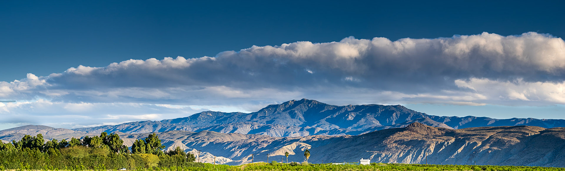
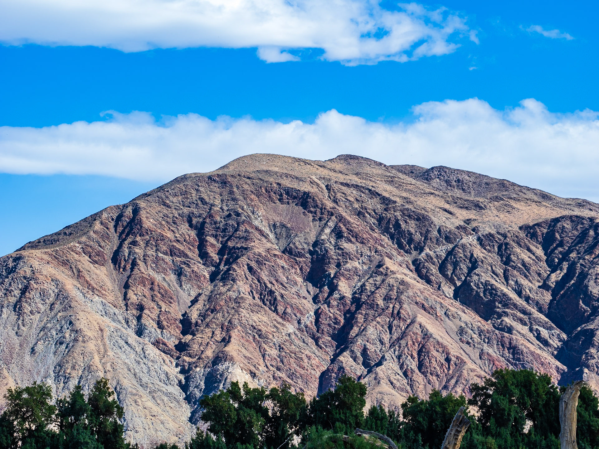
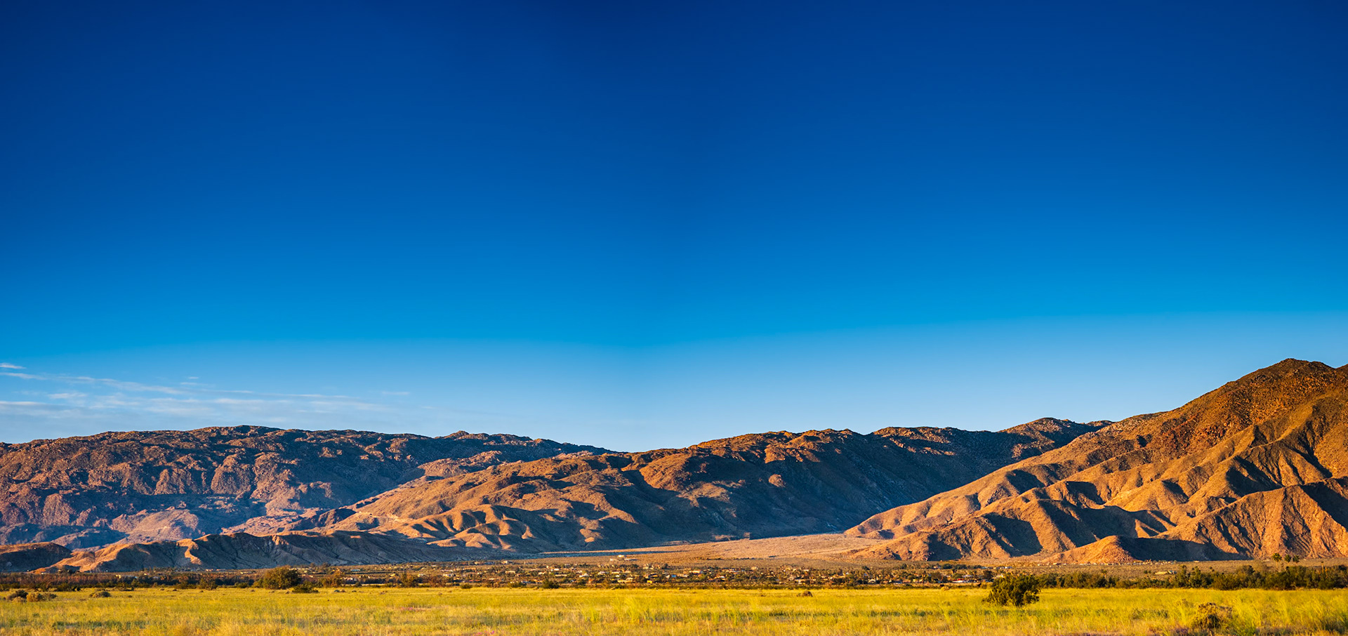
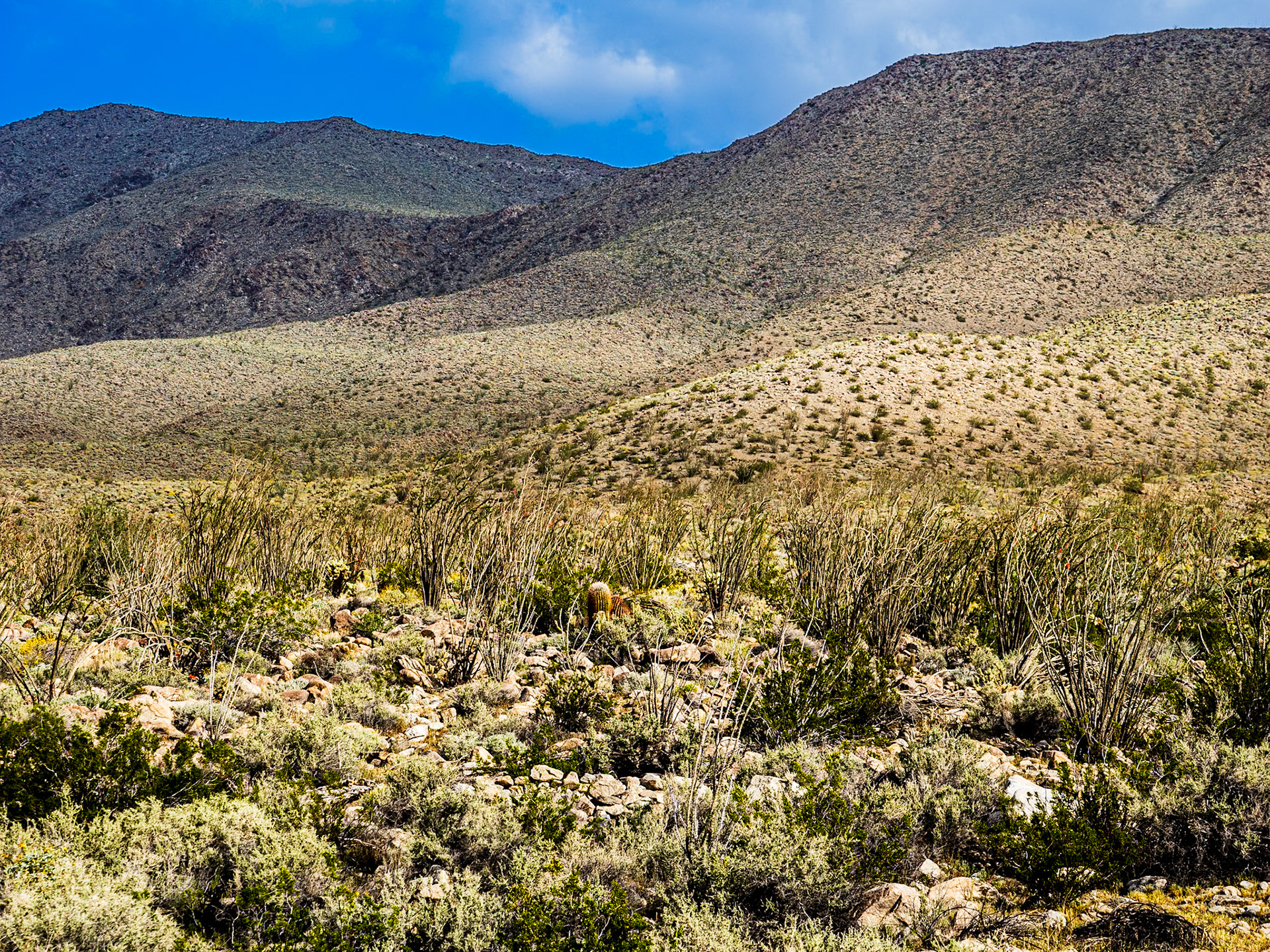
Santa Rosa Mountains: Viewed from Clark Dry Lake in tghe Anza-Borrego Desert.
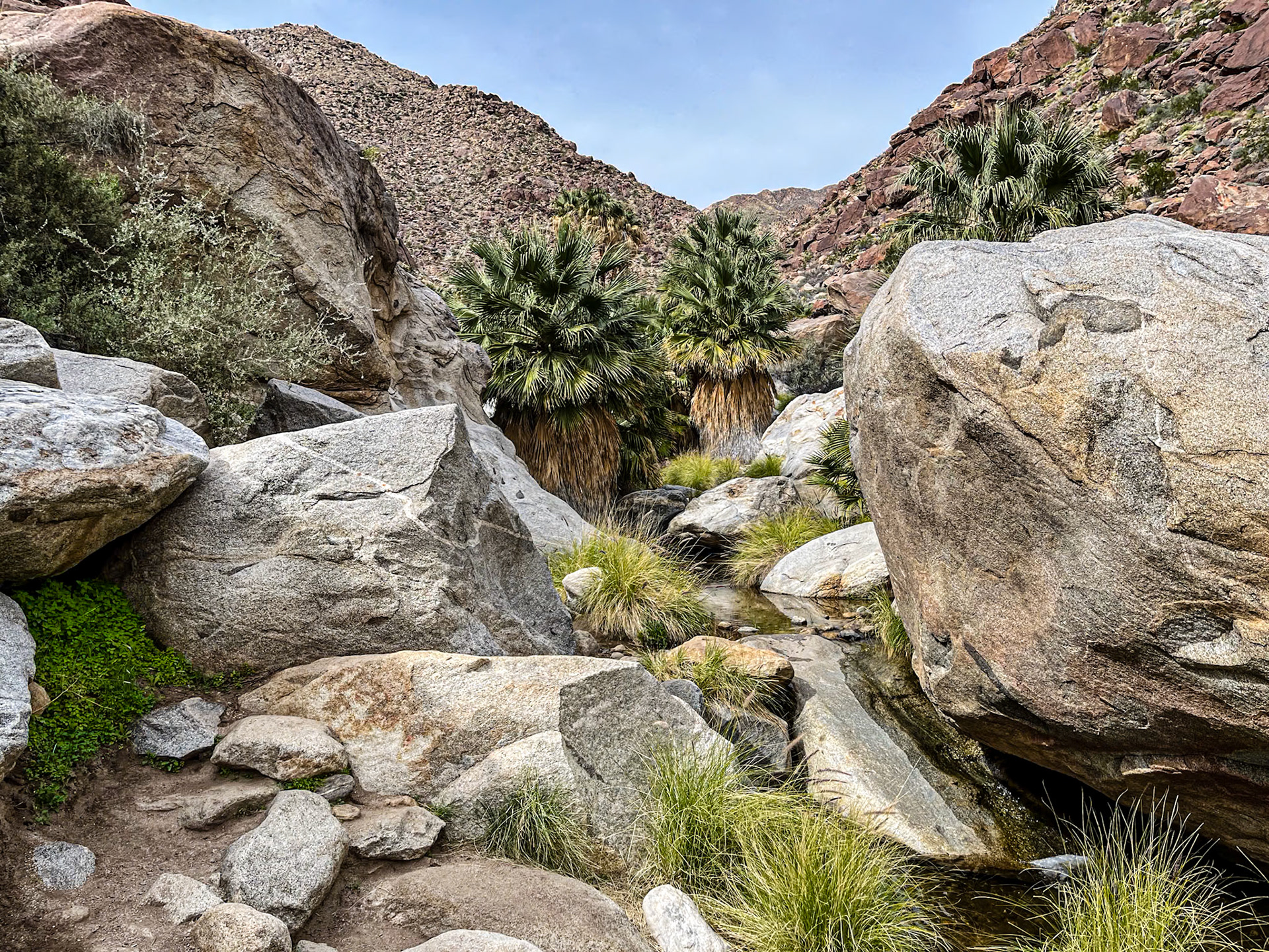
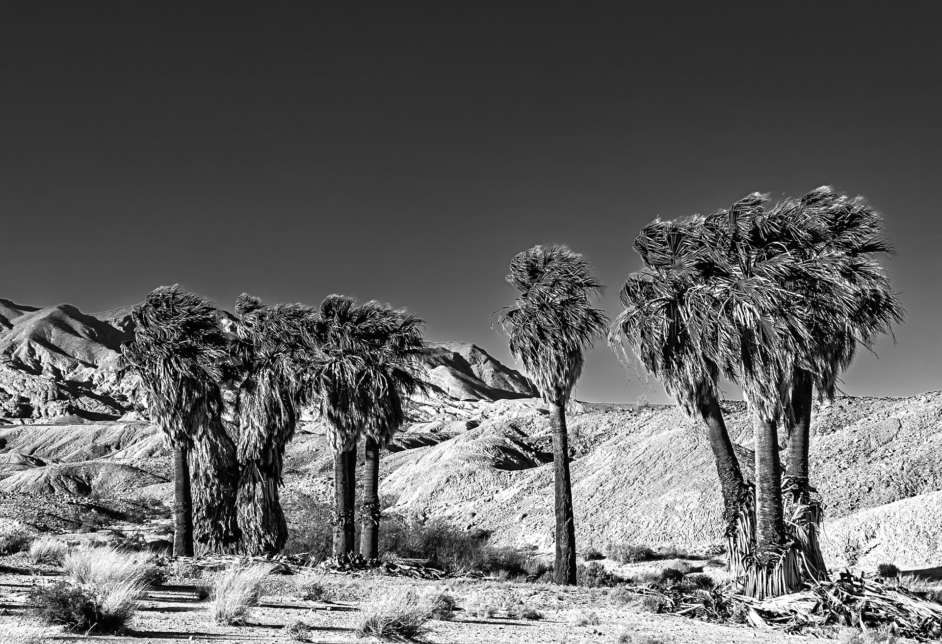
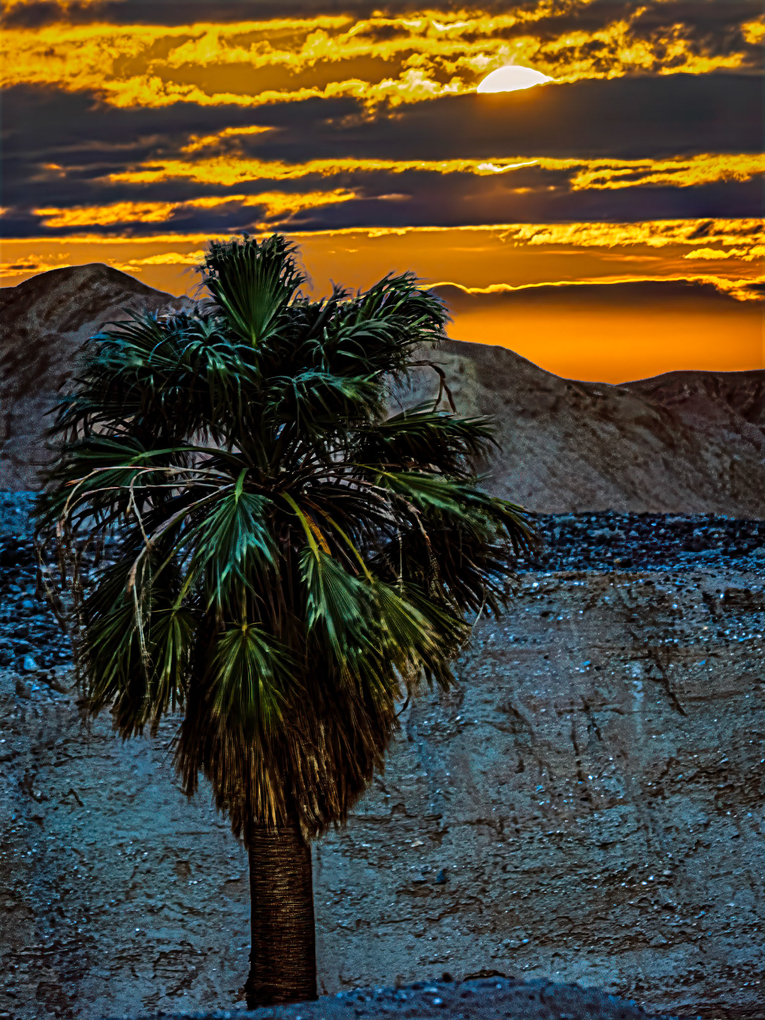
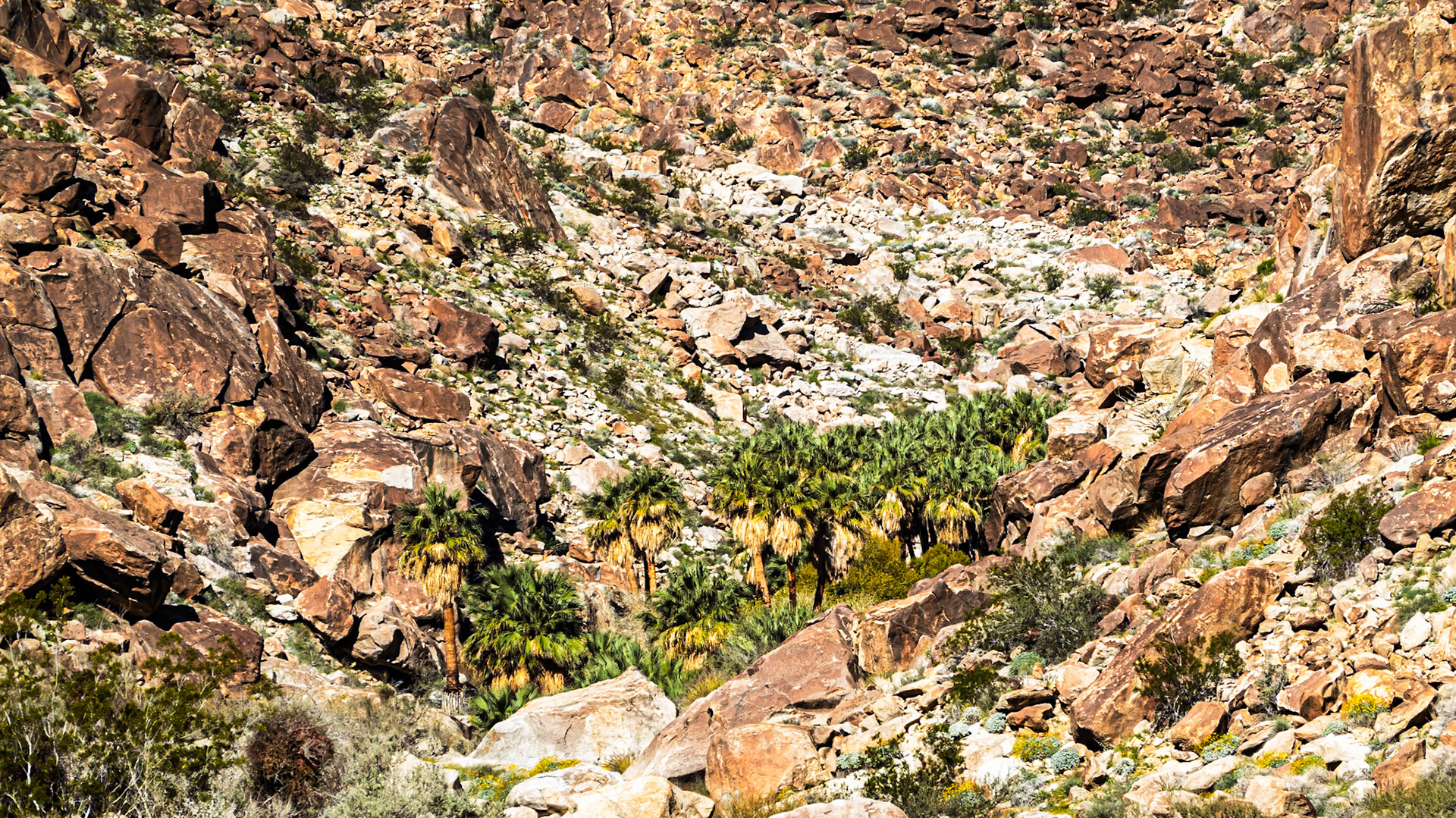
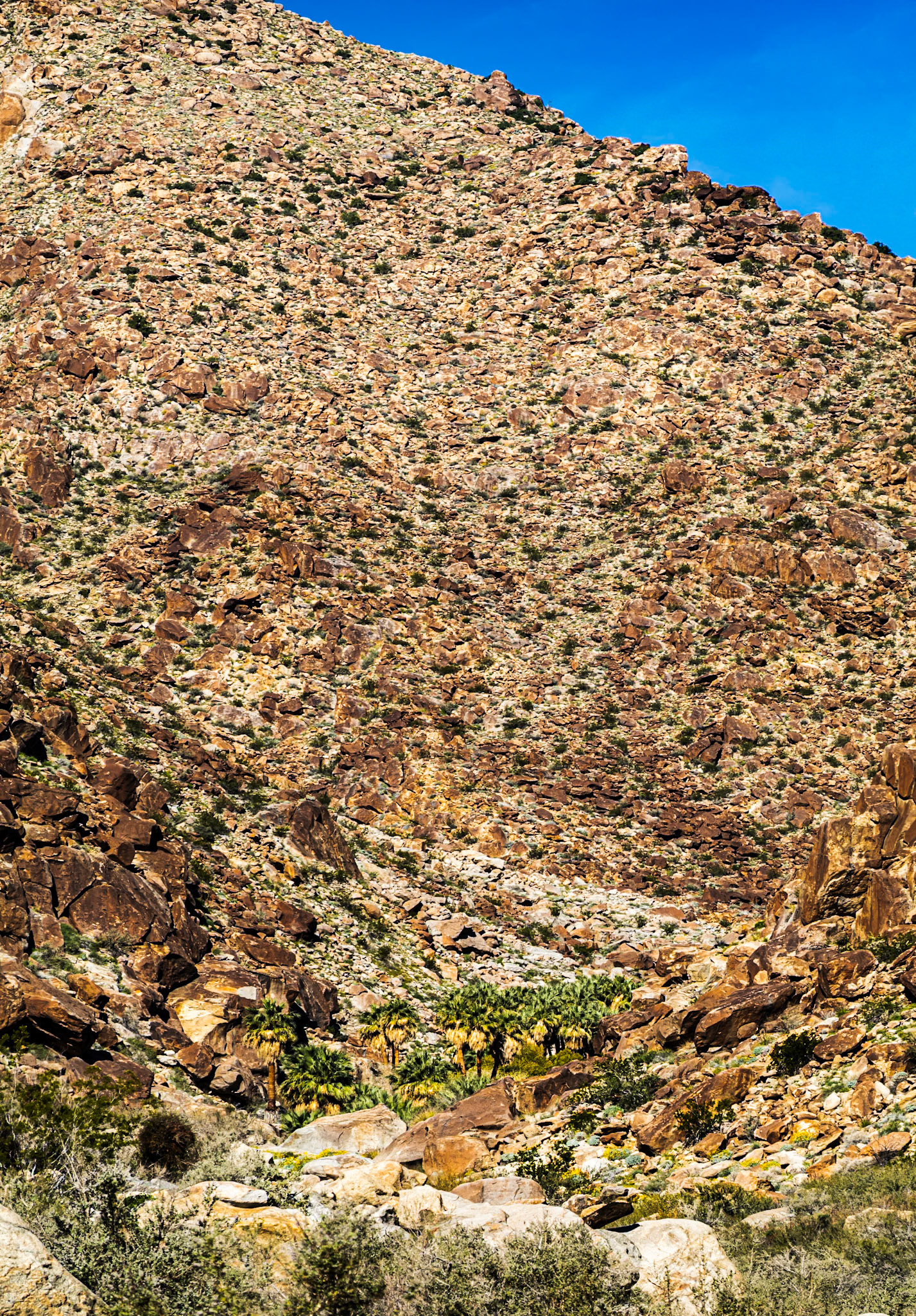
Palm Grove and Springs: The palm grove in Palm Canyon in the Anzo-Borrego Desert state park. The Grove is located along an ephemeral stream fed by runoff of infrequent rain intercepted by the surrounding San Ysidro mountains.
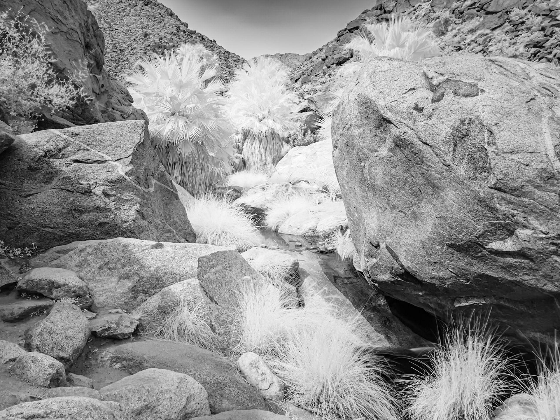
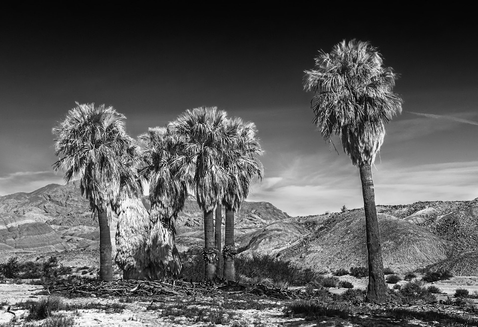
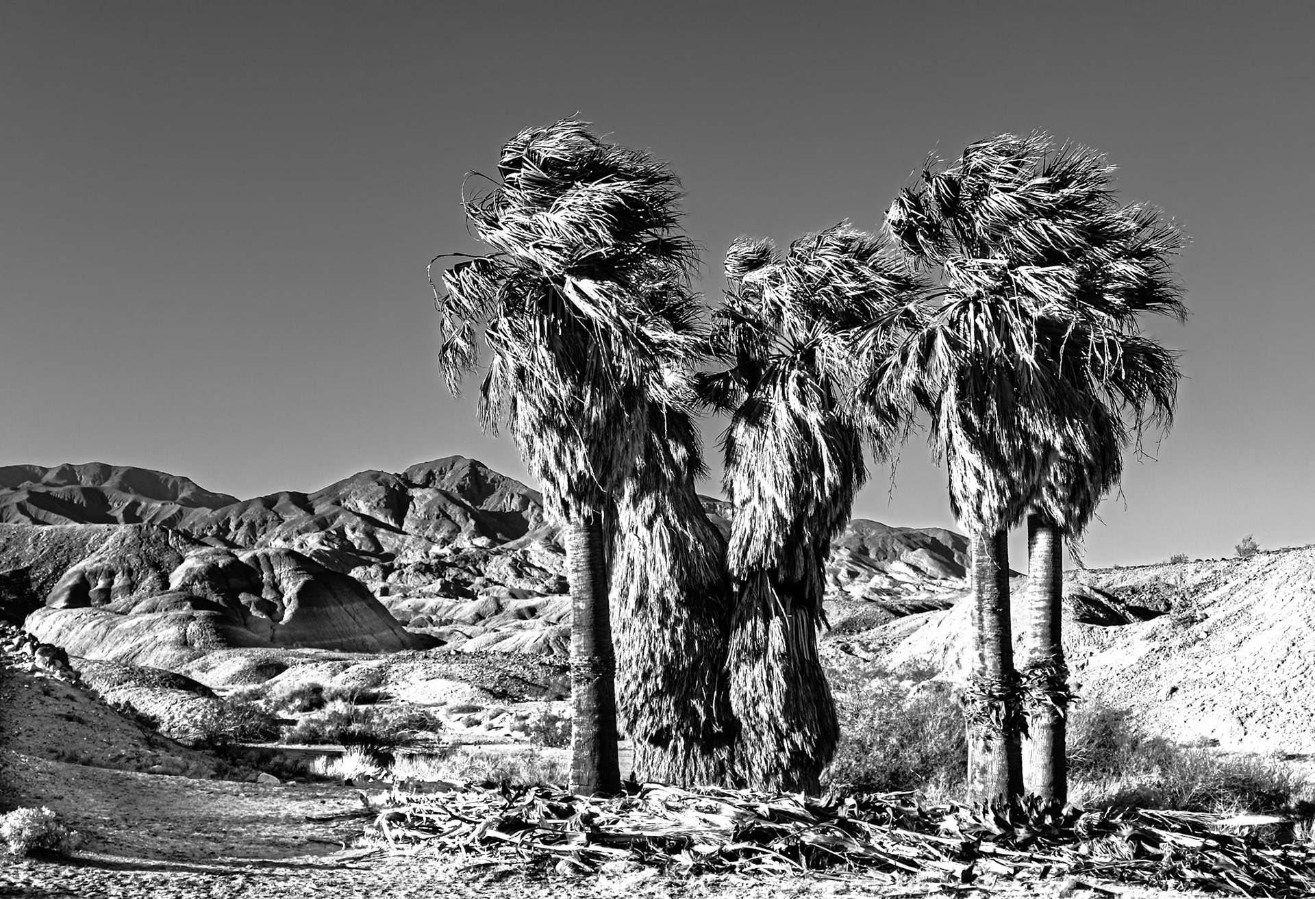
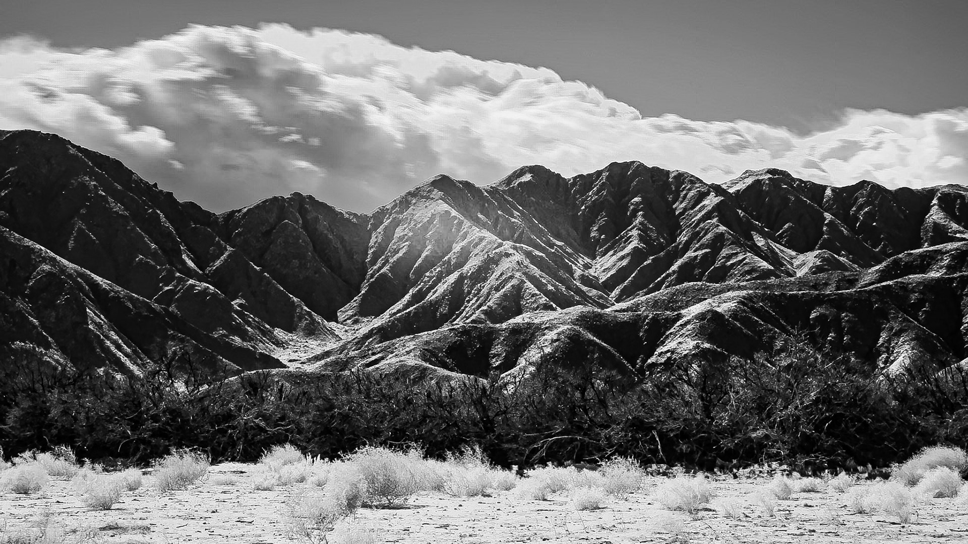
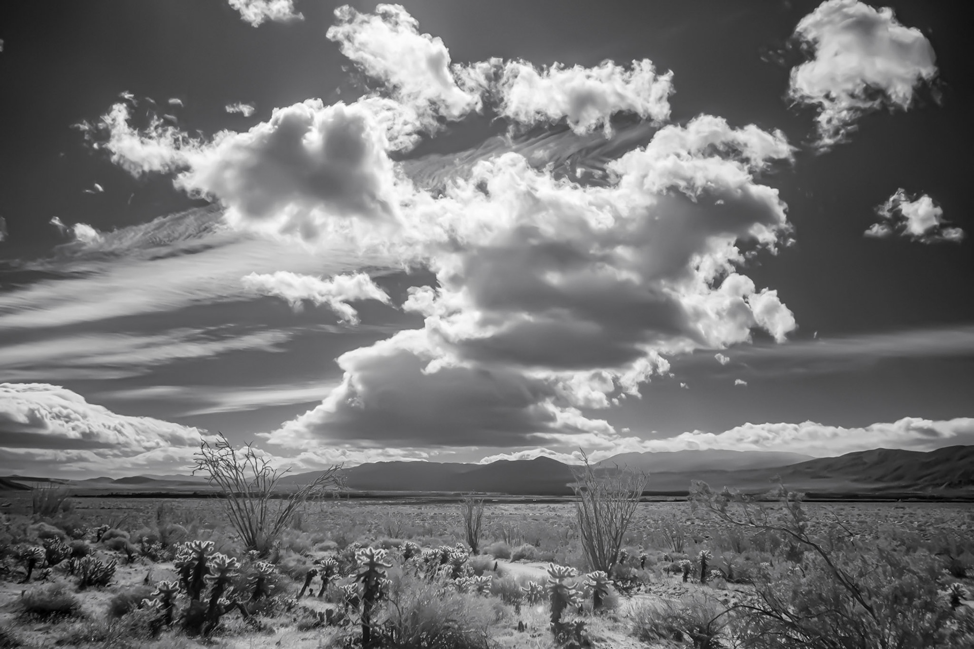
Palm Grove and Springs in Infrared: At the head of the Palm Canyon in Anza-Borrefgo State Park CA. This is an infrared image converted to black and white.
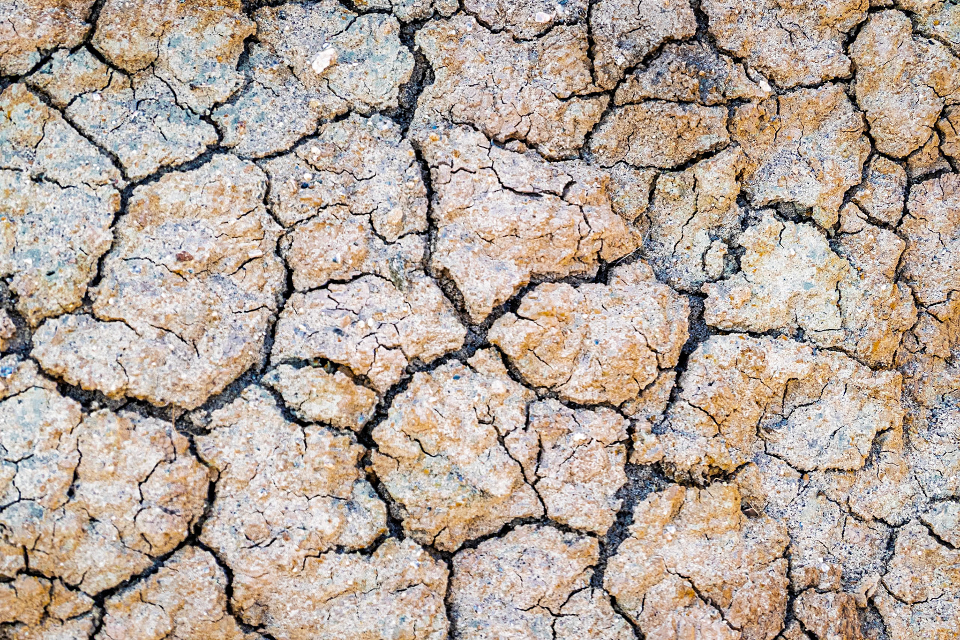
Desert Tobacco Over Cracked Earth: Desert tobacco (Nicotiana obtusifolia) rising over dry cracked soils on the desert floor at Calcite Canyon in the Anza-Borrego Desert.
A Very Dry Year: Parched earth in the Anza-Borrego Desert.
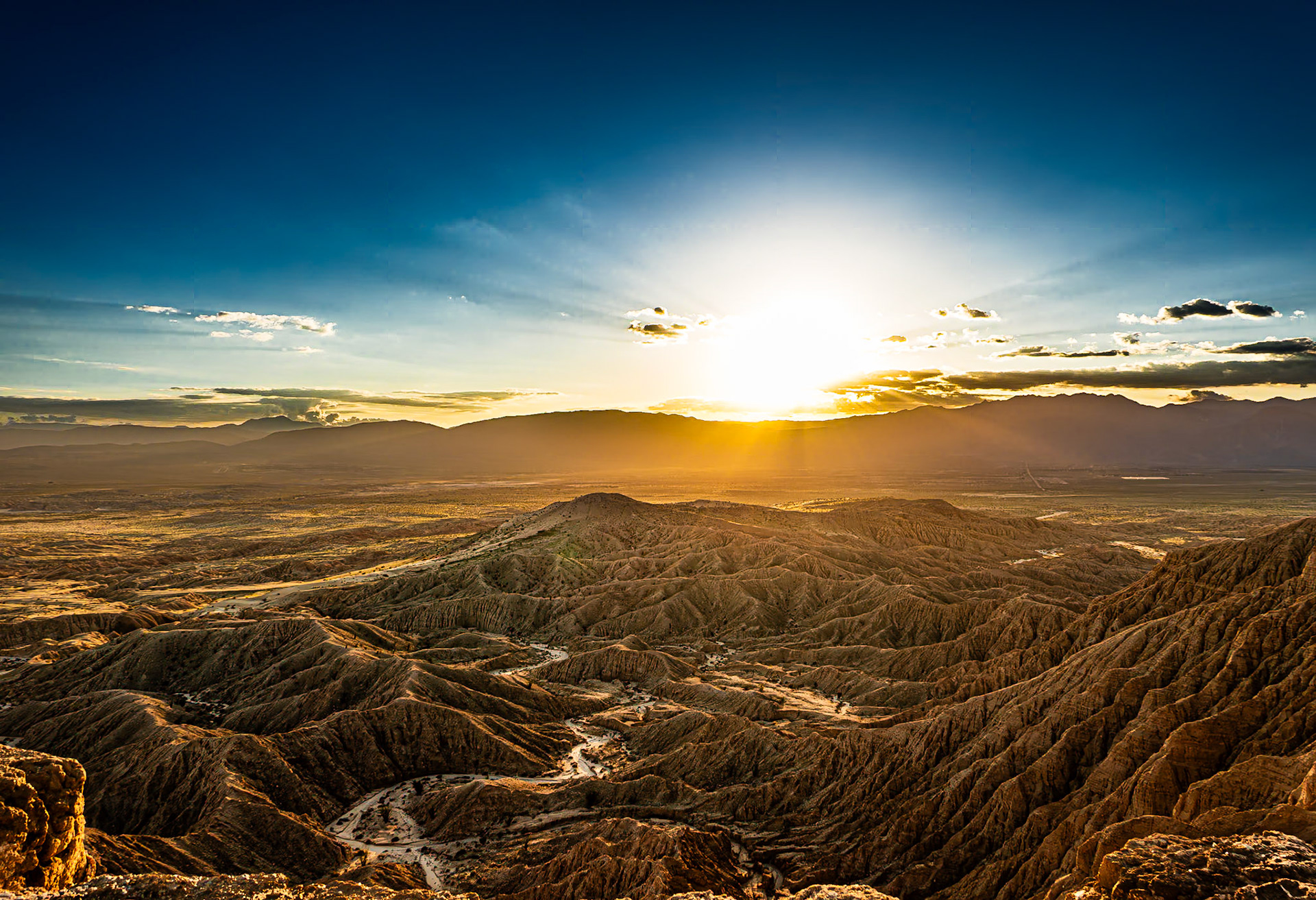
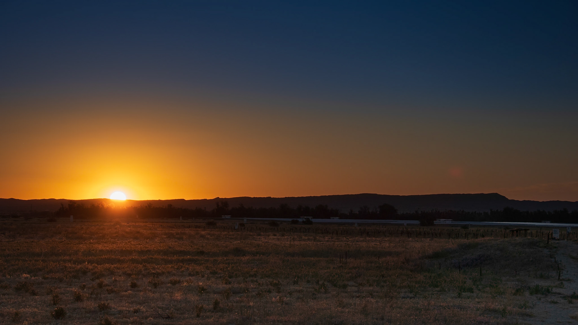
Borrego Sunset and Badlands: Sunset over the San Ysidro Mountains with the Borrego Valley and Badlands in the foreground. viewed from Font's Point in the Anza-Borrego Desert.
Sunset over the San Ysidro Mountains with the Borrego Valley and Badlands in the foreground. viewed from Font's Point in the Anza-Borrego Desert.
Borrego Sunset: Sunset over the San Ysidro Mountains with the Borrego Valley and Badlands in the foreground. viewed from Font's Point in the Anza-Borrego Desert.
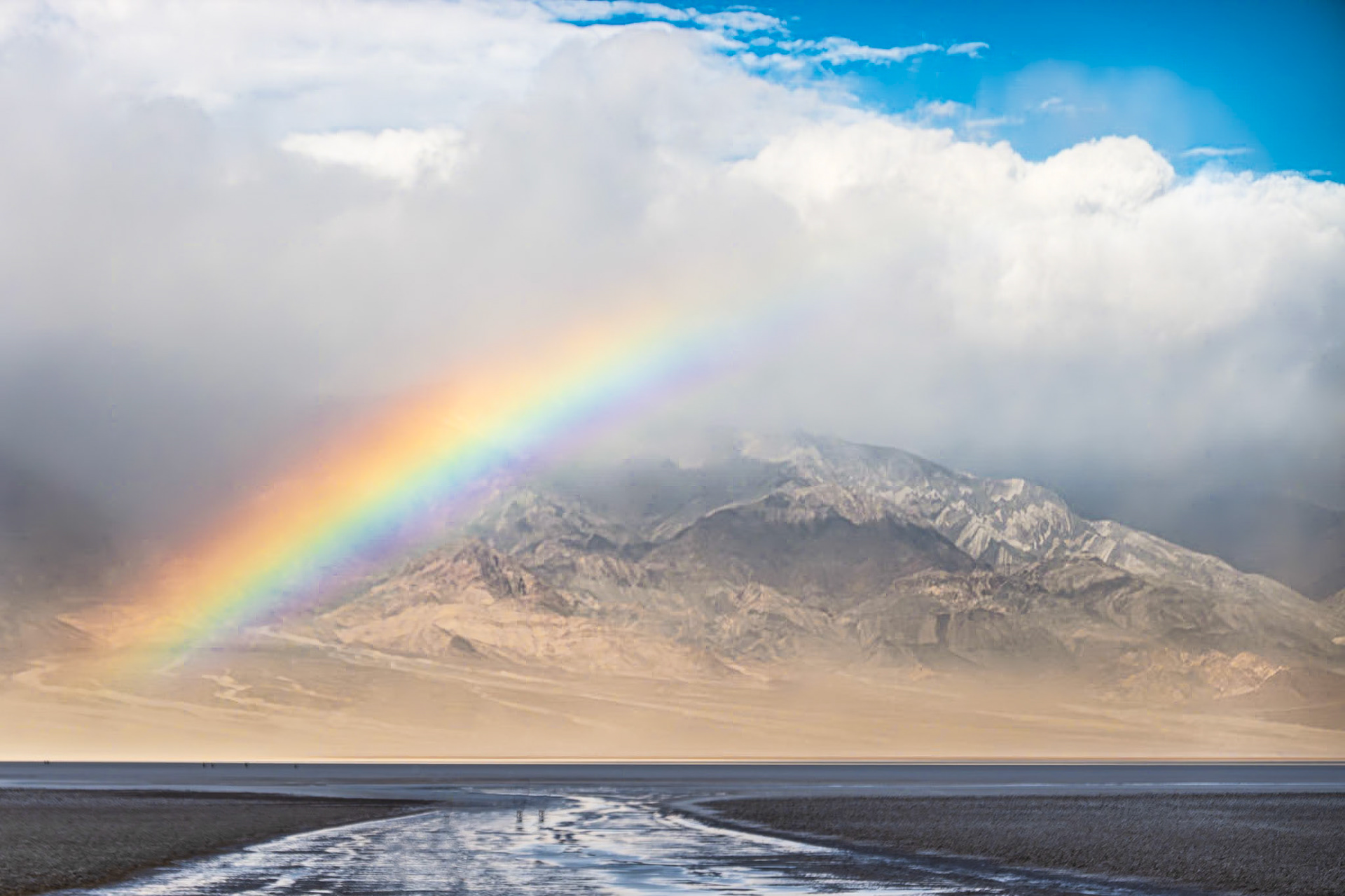
An ephemeral lake appears at Badwater Basin following unusual winter rains.
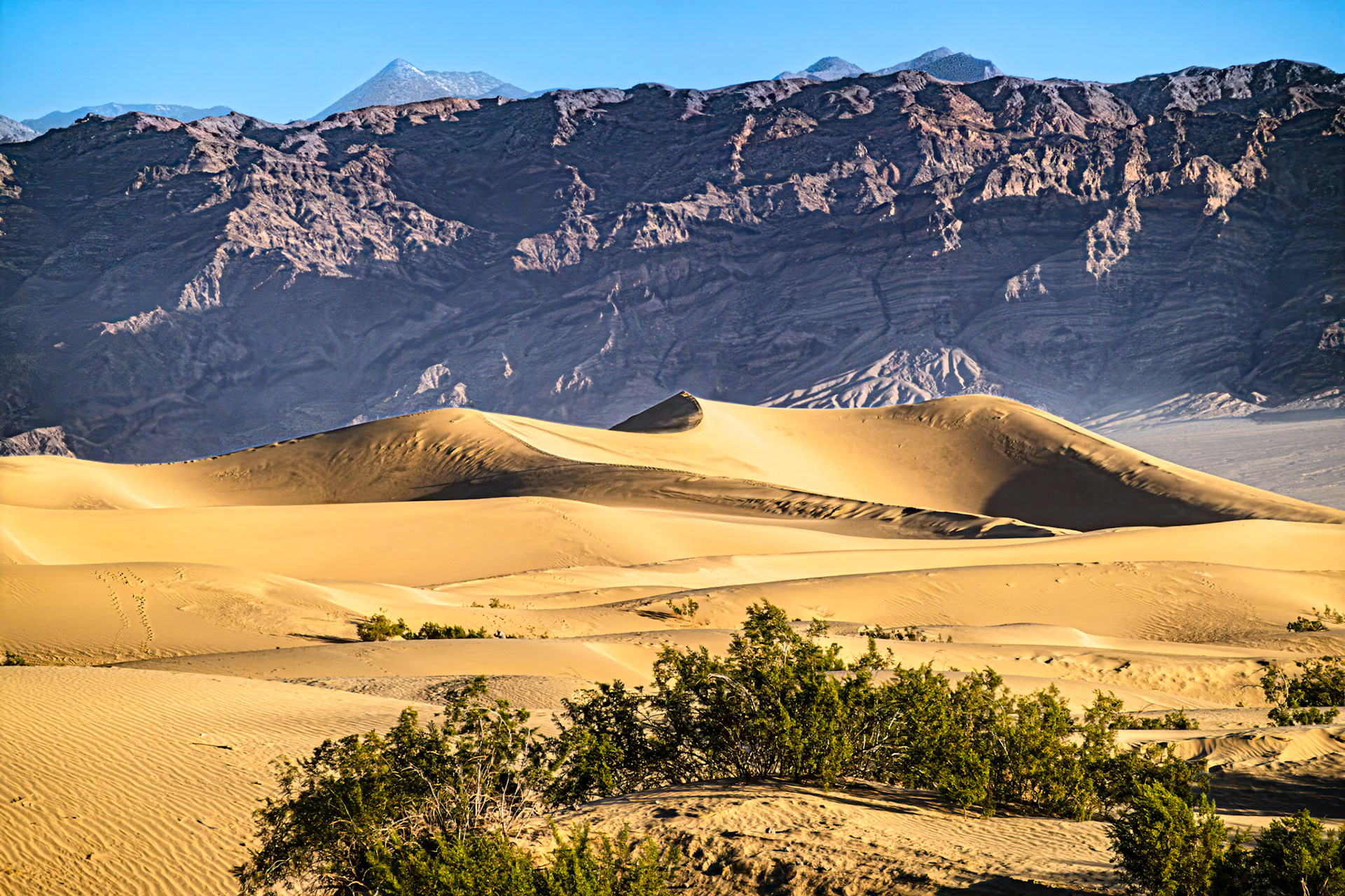
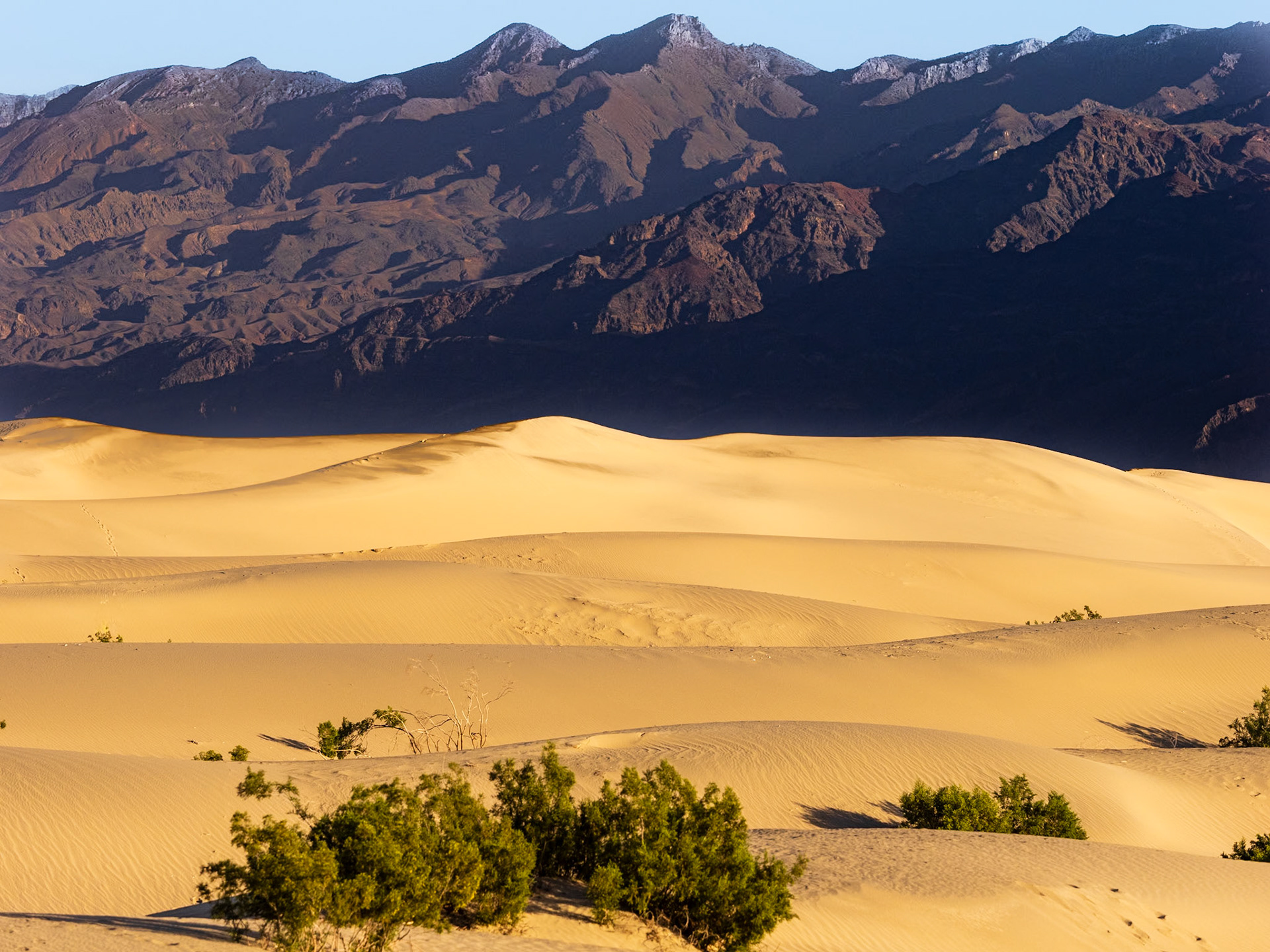
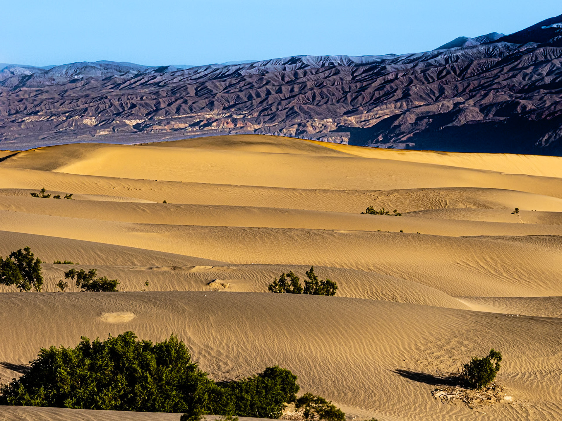
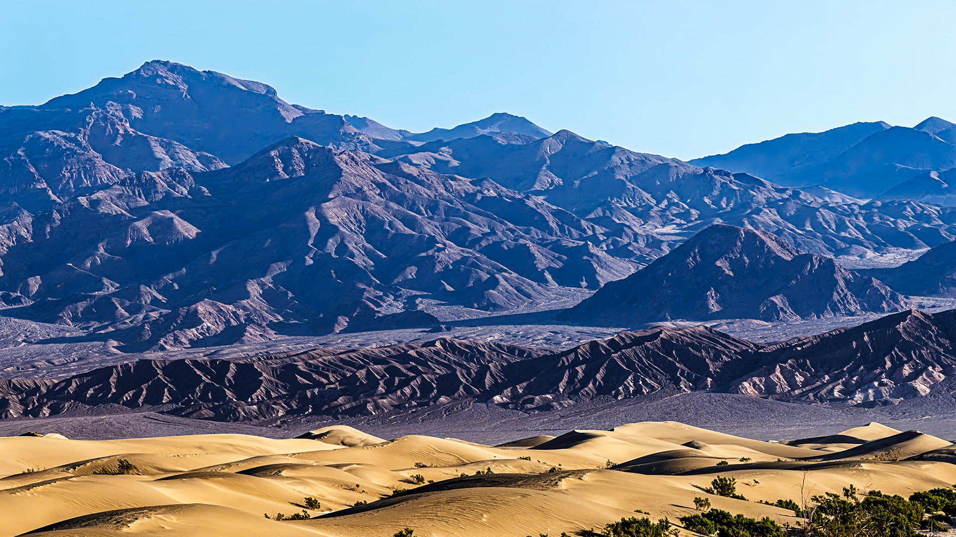
Death Valley Sand Dunes: Mesquite Flats sand dunes and the Grapevine Mountains in the background.
Mesquite Flats sand dunes and the Grapevine Mountains in the background.
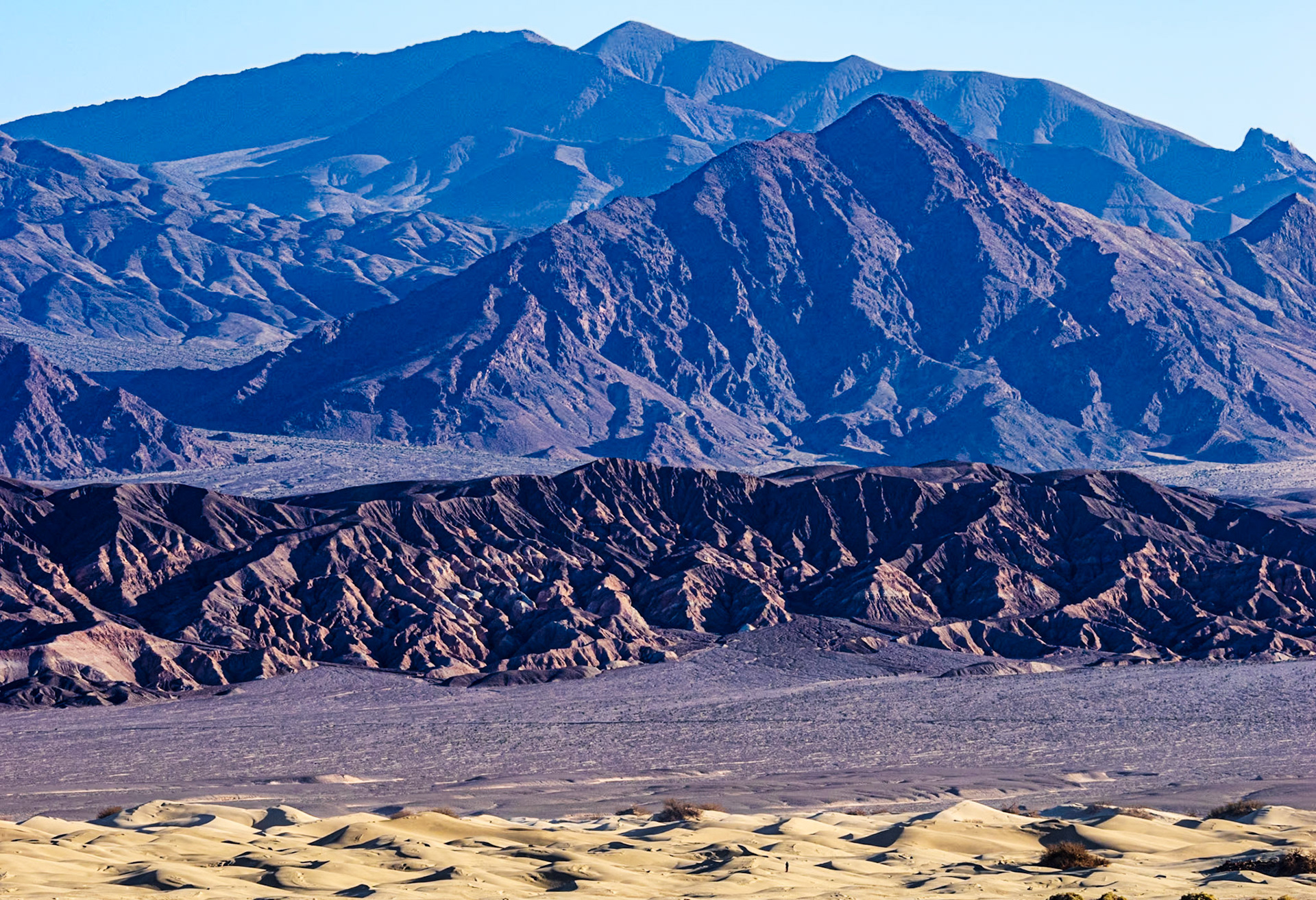
The Grapevine Mountains in the background.
Mesquite Flat Sand Dunes and Grapevine Mountains: The Grapevine Mountains in the background.
The Grapevine Mountains in the background.
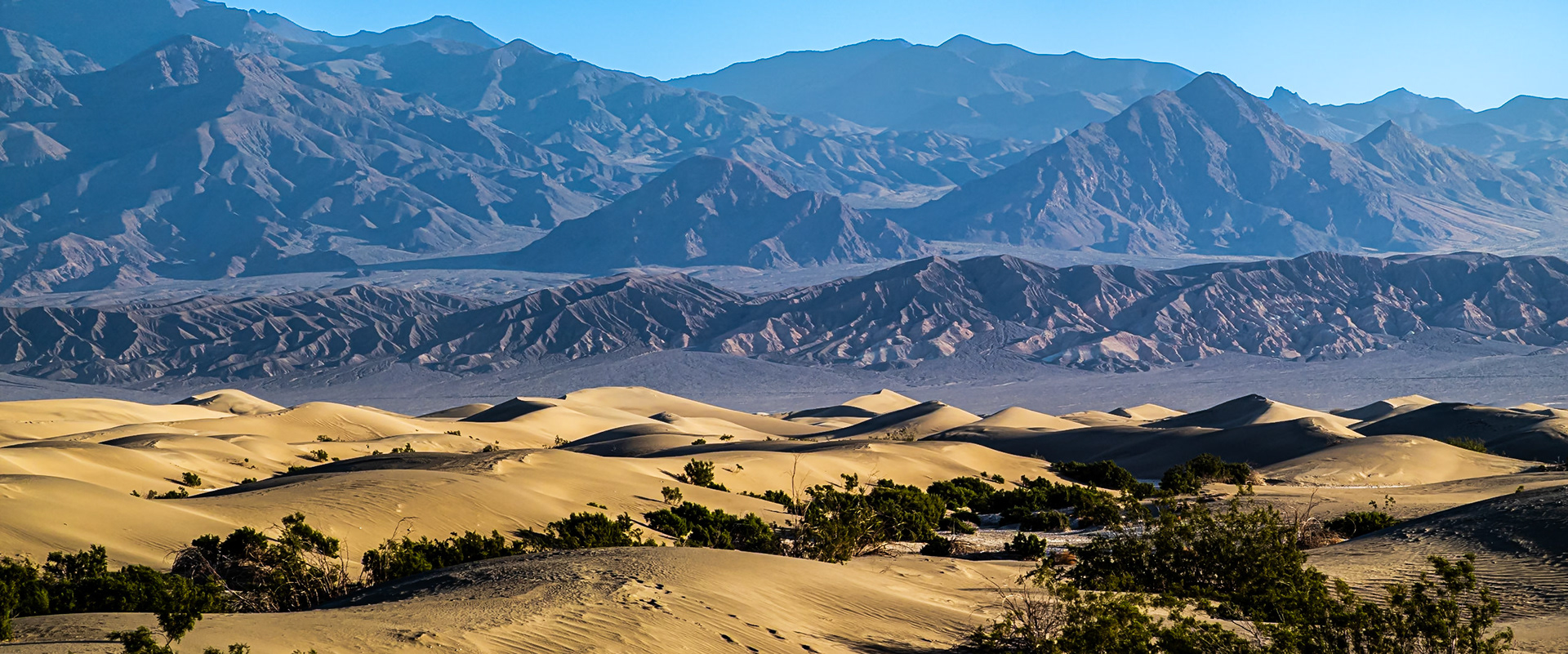
Dunes and Mountains: Mesquite Flats sand dunes and the Grapevine Mountains in the background.
Grapevine Mountains: In early morning light, the Grapevine Mountians rise from Death Valley with steep ridges and deeply shadowed ravines.
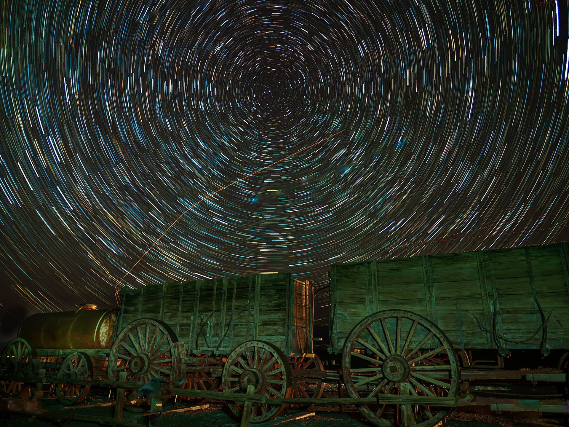
Wagons Under the Stars: 20-mule team wagons sit under a kaleidoscope of starsin Death Valley. These massive wagons with 7-ft high wheels were used to haul up to 10 tens of borax each over 160 miles to a railhaed in Mojave California.
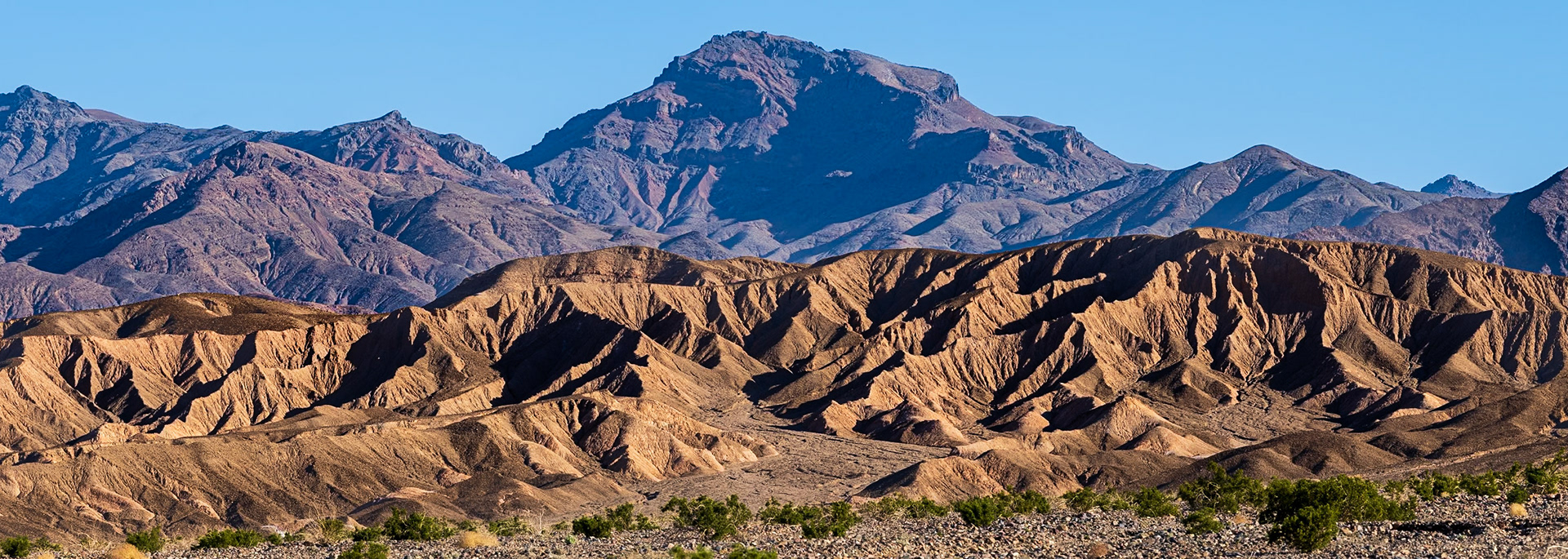
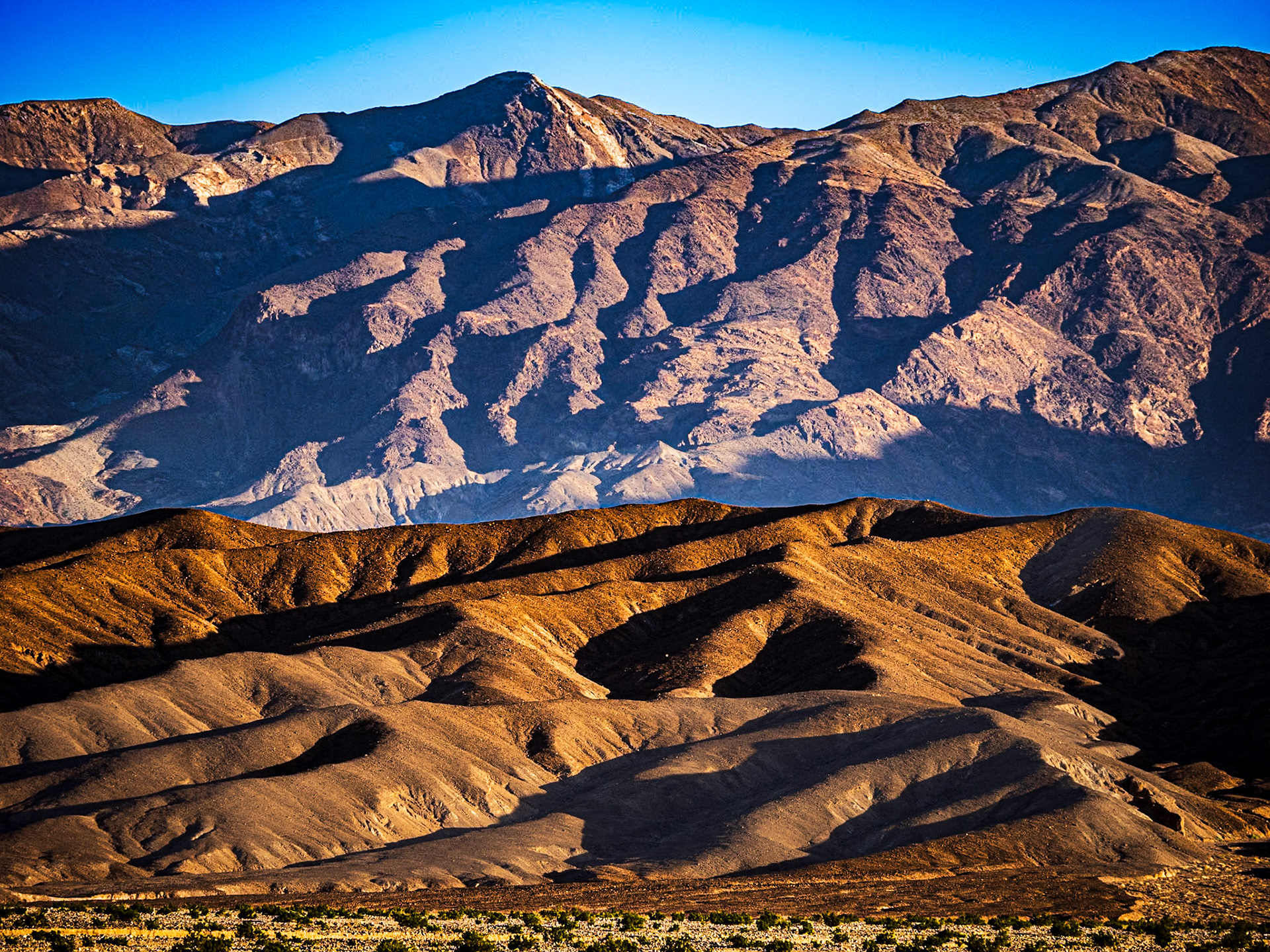
Funeral Mountains: In early morning light, the Funeral Mountians rise from Death Valley with steep ridges and deeply shadowed ravines.
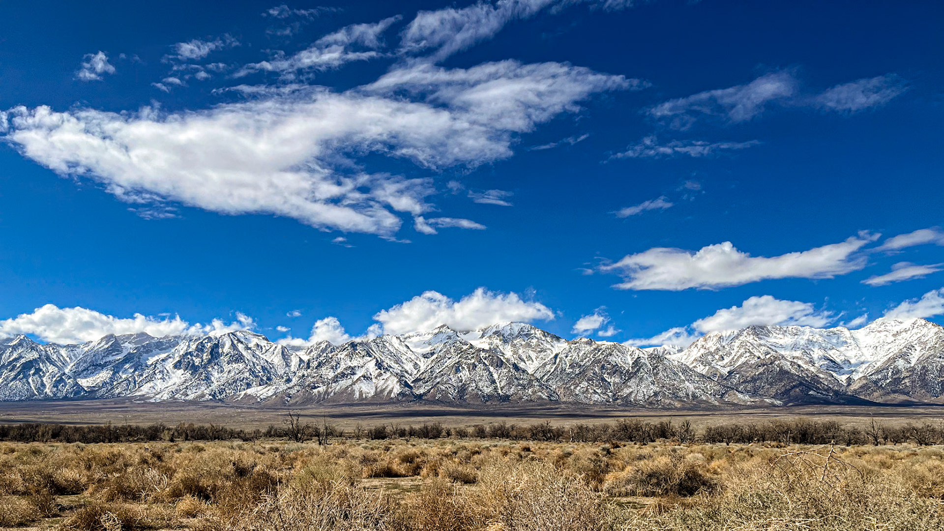
Owens Valley and the Sierrra Nevada: The magnifgicent Sierra Nevada Mountains viewed across the Owens Valley from the Manzanar National Historic site (formerly a WWII era Japanese Internment Camp). The Owens Valley is high desert sitting at about 4,000-ft and receiving less than 5 inches of rain per year.
Owens Valley and the Sierrra Nevada: The magnifgicent Sierra Nevada Mountains viewed across the Owens Valley from the Manzanar National Historic site (formerly a WWII era Internment Camp). The Owens Valley is high desert sitting at about 4,000-ft and receiving less than 5 inches of rain per year.
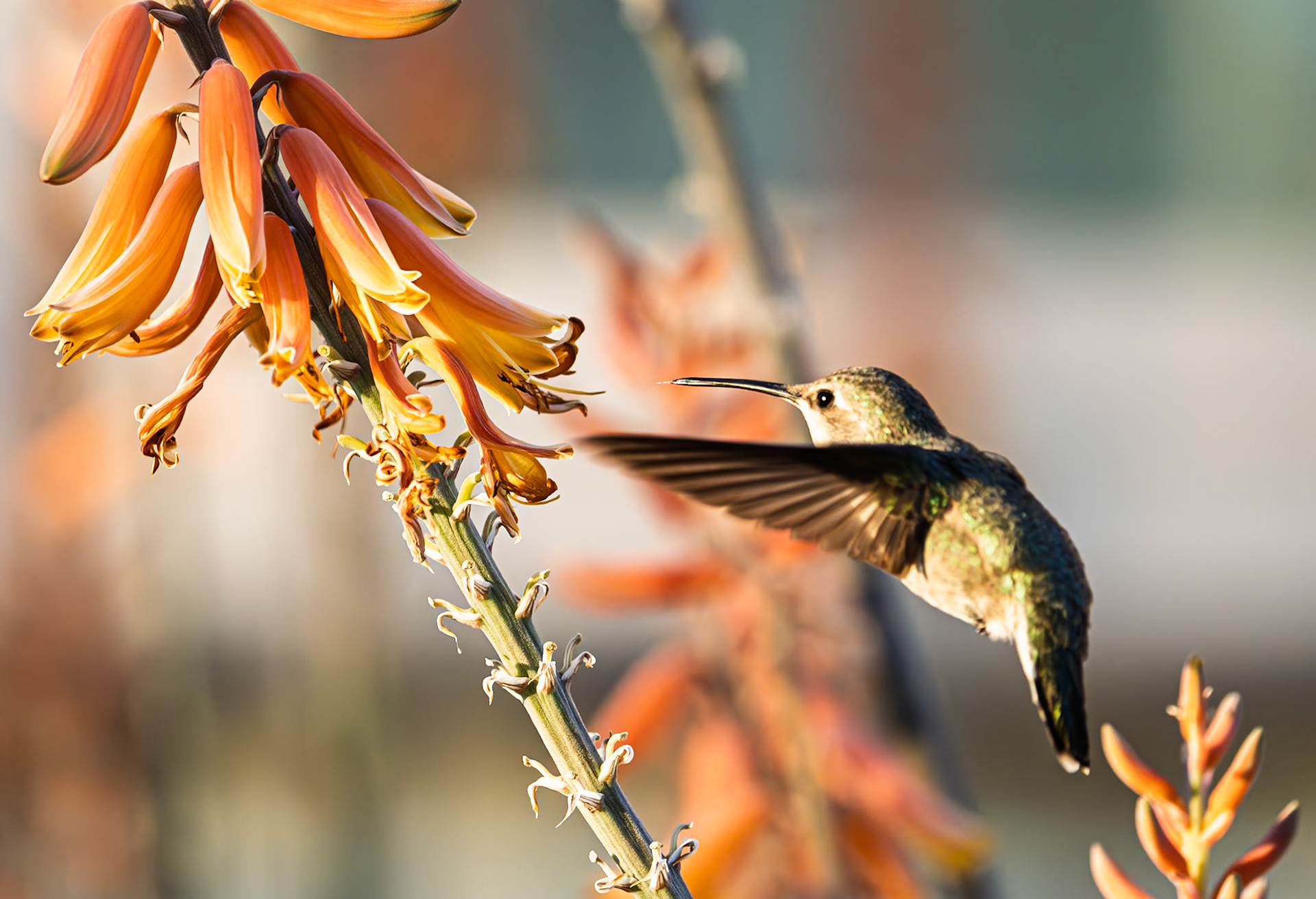
Anna's Humming Bird: Approaching an Aloe vera blossom
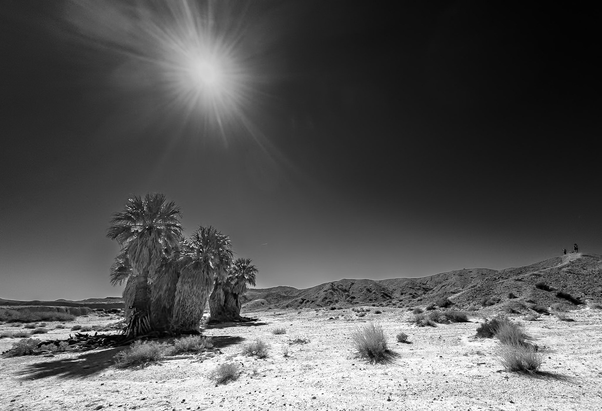
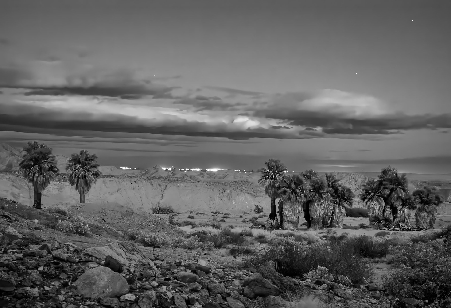
17 Palms Oasis B&W: In the Anza-Borrego Desert
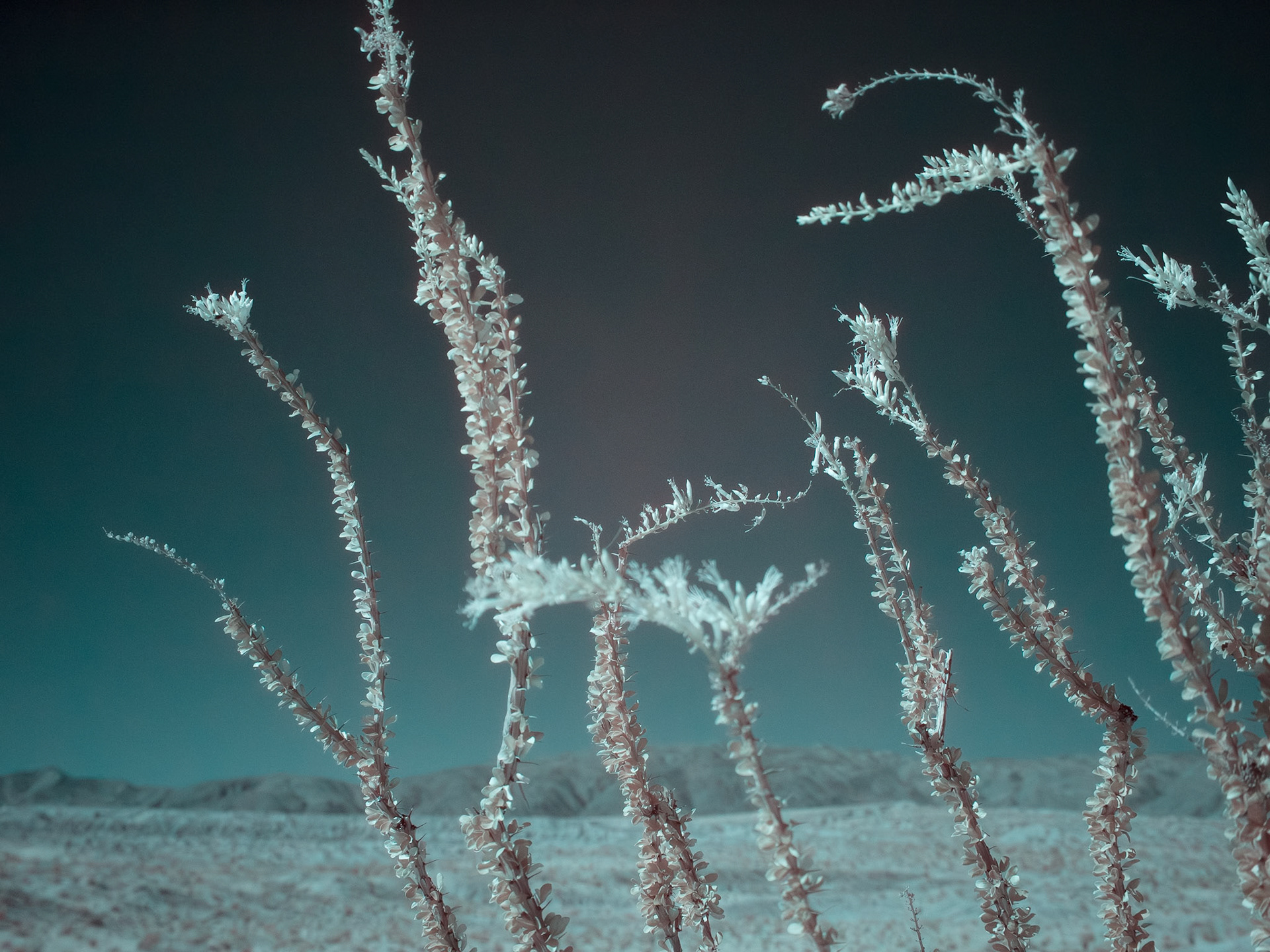
Ocotillo Blooming: An infra-red image of an Ocotillo in so-called stress bloom caused by an extremely long period of dry weather.
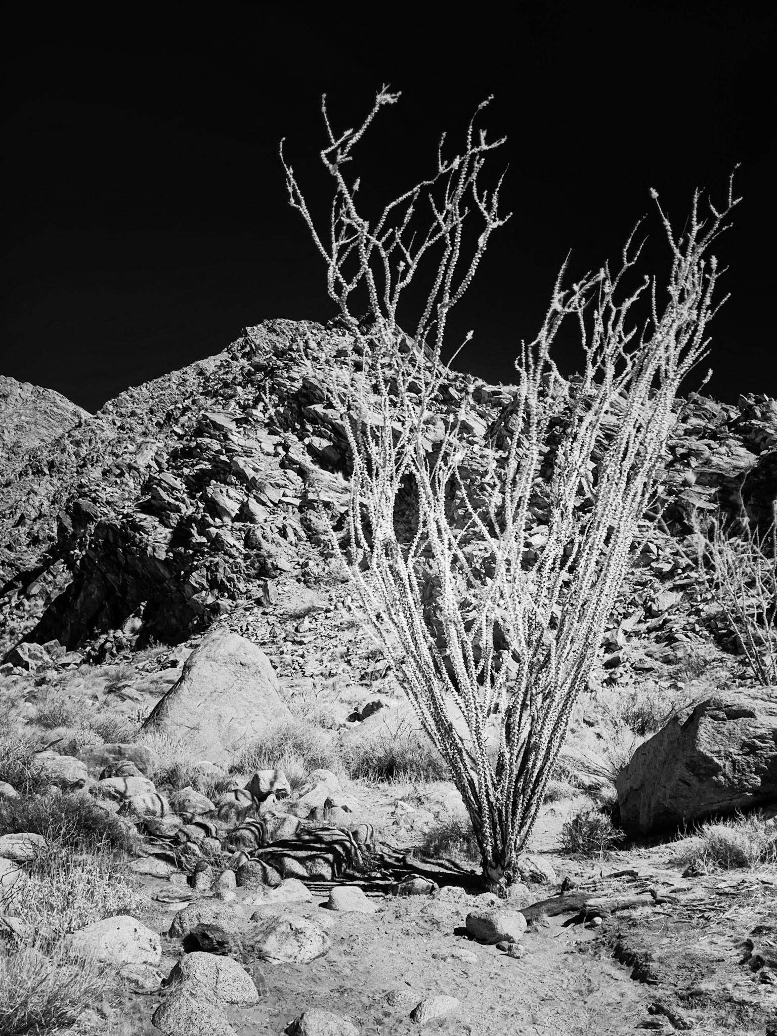
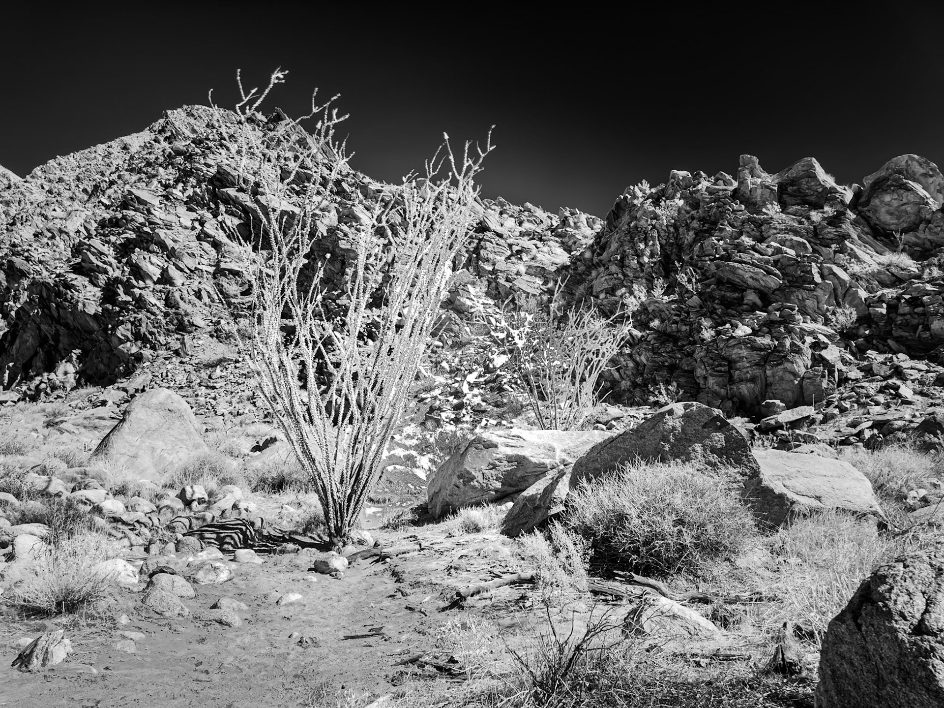
Palm Canyon Ocotillo: An Ocotillo at trallside on the hike to the Palm Grove. An infra-red image taken with an iP{hone equiped with a 720 nm IR filter.
An Ocotillo at trailside on the hike to the Palm Grove. An infra-red image taken with an iPhone equiped with a 720 nm IR filter.
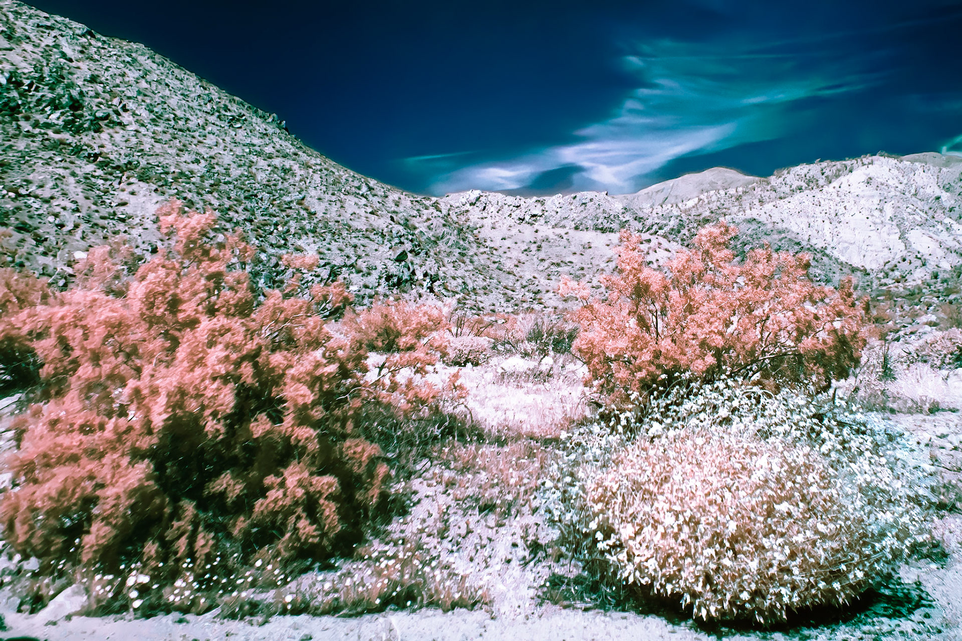
Indian Head Mountain IR: Indian HeadMountain viewed from the Palm Canyon trail in the Anza-Borrego State Park. An infra-red image taken with an iPhone equiped with a 720 nm IR filter.
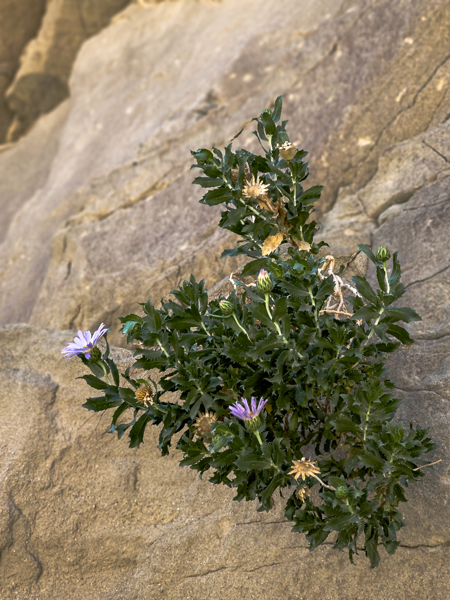
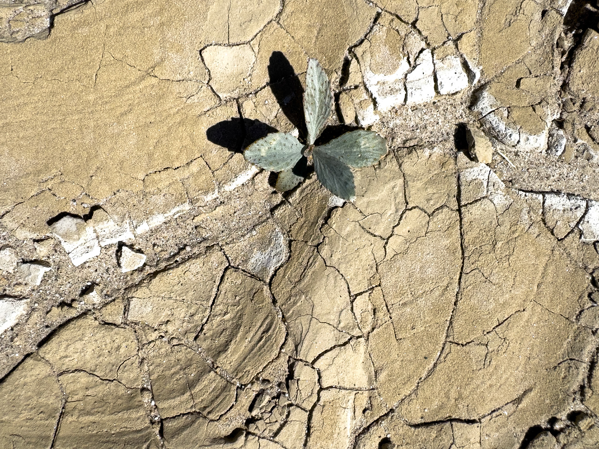
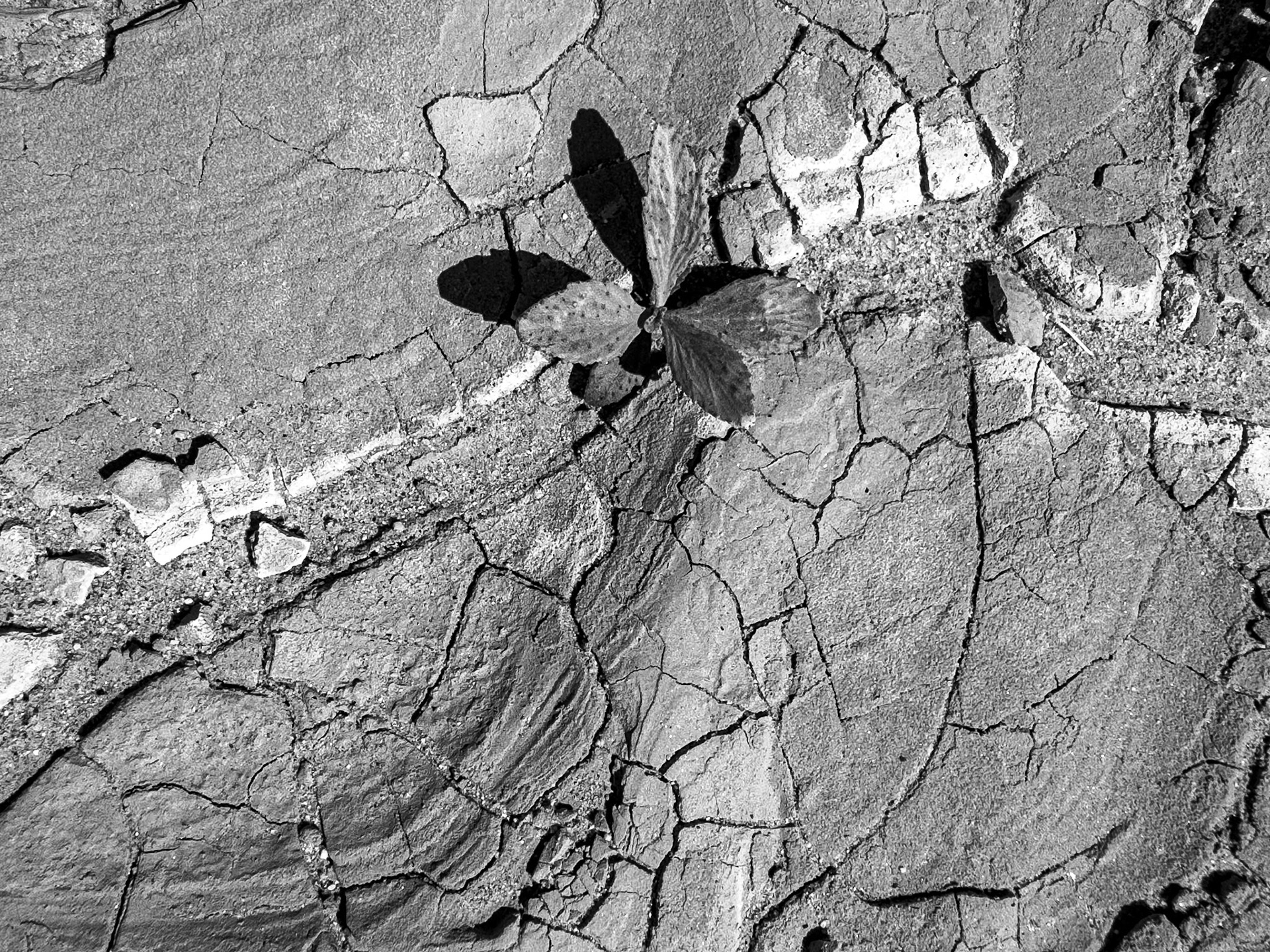
Desert Opportunist: This Mojave Aster (Xylorhiza tortifolia) is a perennial sun-loving subshrub native to the American southwest. It is heat and drought tolerant. It favors growth on rocky slopes, in canyons or dry, flat areas at about 2,000 to 5,500 feet. Although this particular specimen seems highly opportunistic in seeding itself and growing from a crevice on a nearly vertical rock wall in the Fish Creek-Sandstone Canyon area of the Anza-Borrego Desert State Park.
Parched Earth & Nascent Tree: The smoketree (Psorothamnus spinosus) is hardy drought tolerant shrub native to the desert washes the American southwest and the northern Gulf of California. This particular specimen persistently emerges from parched soils of a dry arroyo joining Fish Creek Wash in the Anza-Borrego Desert State Park.
Parched Earth & Nascent Tree: The smoketree (Psorothamnus spinosus) is hardy drought tolerant shrub native to the desert washes the American southwest and the northern Gulf of California. This particular specimen persistently emerges from parched soils of a dry arroyo joining Fish Creek Wash in the Anza-Borrego Desert State Park.
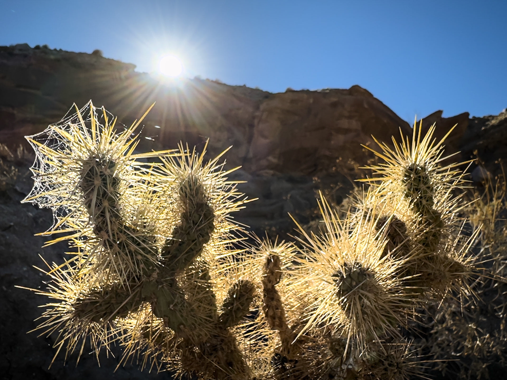
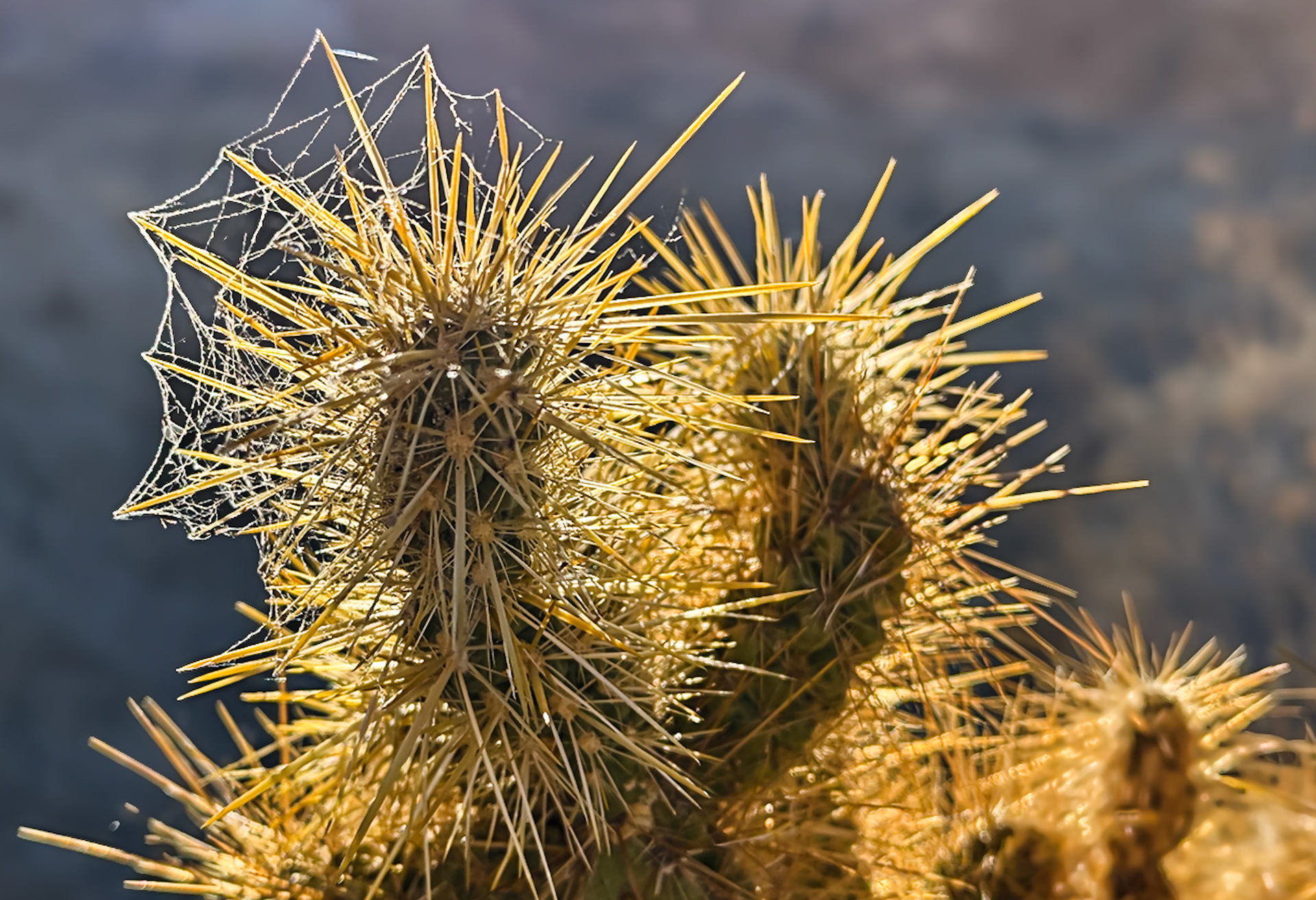
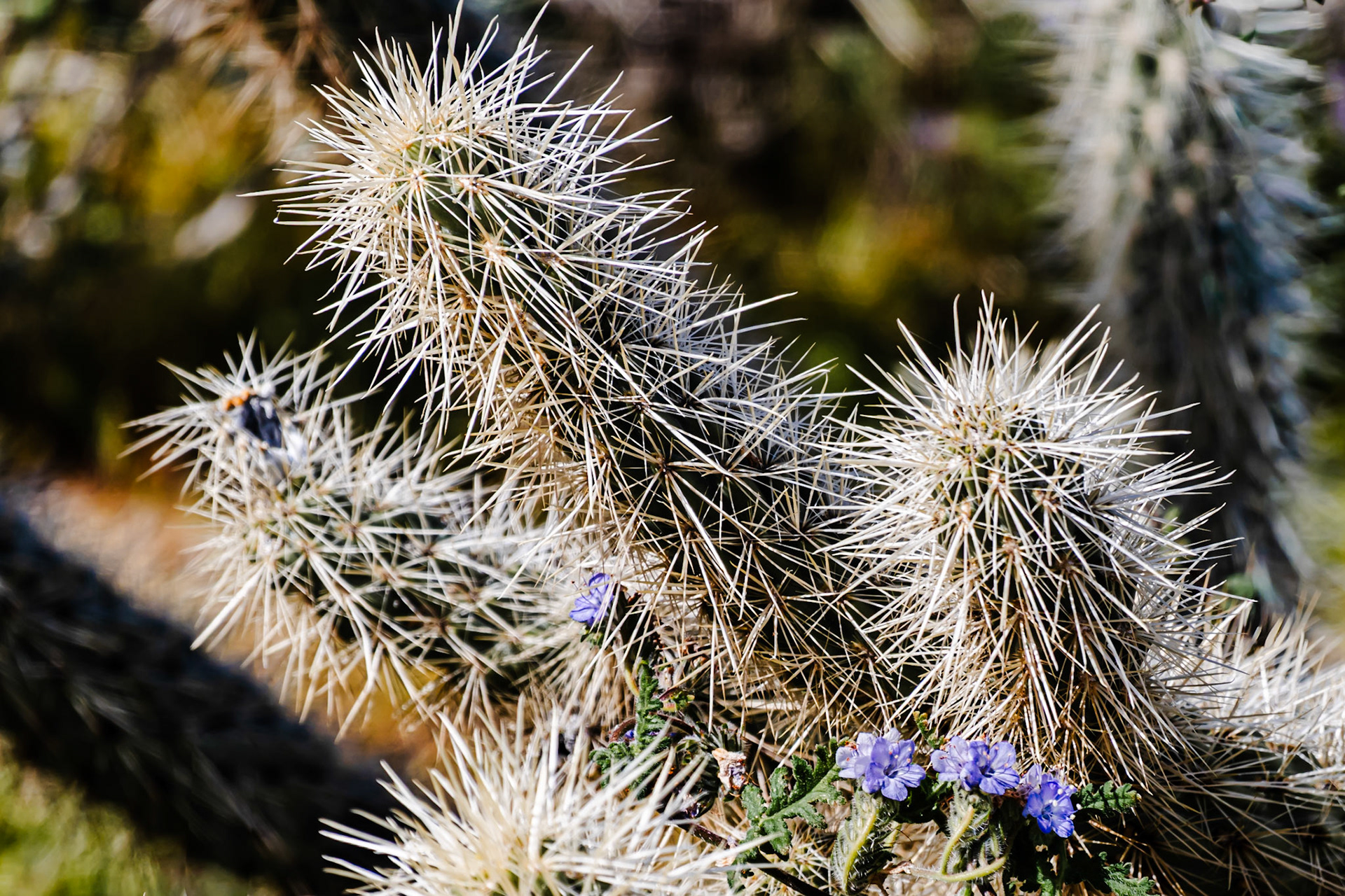
Sun Rays on Silver Cholla: Wearing a dewy spider-web crown, this Silver Cholla glows in late afternoon light as the sun sets behind the Sandstone Canyon wall in the Anza-Borrego Desert State Park.
Web Crowned Cholla: Morning dew lingers on a spider web woven into the spines of this
Face of Santa Rosa: Cloud shadows drift across the wrinkled ridges and valleys to give a face to Santa Rosa Mountain.
Santa Rosa's Face: Cloud shadows drift across the wrinkled ridges and valleys to give a face to Santa Rosa Mountain.
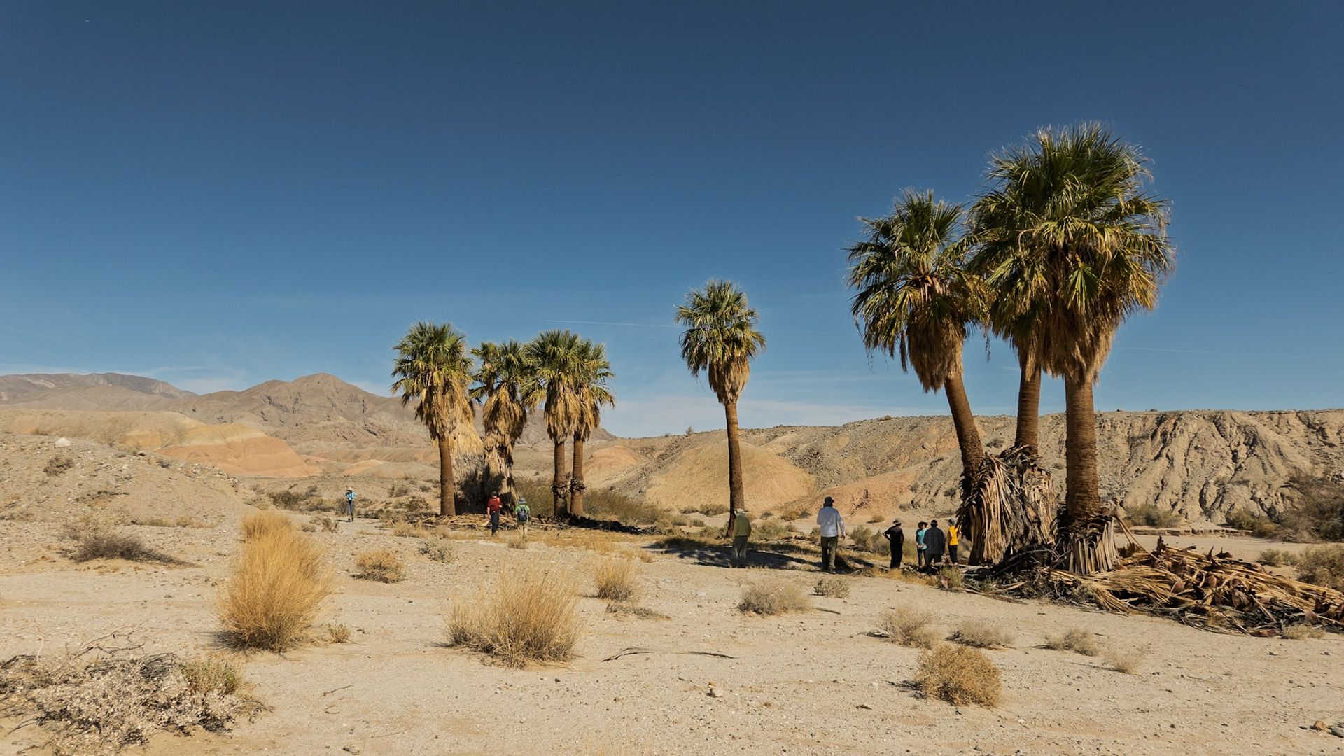
Five Desert Palms: Five native California fan palms at the 17 Palms Oasis in the Anza-Borrego Desert.
Palm Oasis: A grove of 9 trees at the 17 Palms Oasis in the Anza-Borrego Desert State Park.
Abandoned Farmhouse: An abandoned house sits at the edge of orange groves near the mouth of Coyote Canyon in the Anza Borrego Desert. The star trails were captured with 120 15-sec images taken with an OM Systems OM-5 camera and composited in-camera to produce the final image. The foreground exposure was supplemented with light painting while the camera was procuring the 120 individual images.
Stars Above San Ysidro: Soft moonlight and a clear starry sky washes gentle light over an orange grove near Borrego Springs and the nearby San Ysidro mountains.
Stars Above San Ysidro: Soft moonlight and a clear starry sky washes gentle light over an orange grove near Borrego Springs and the nearby San Ysidro mountains.
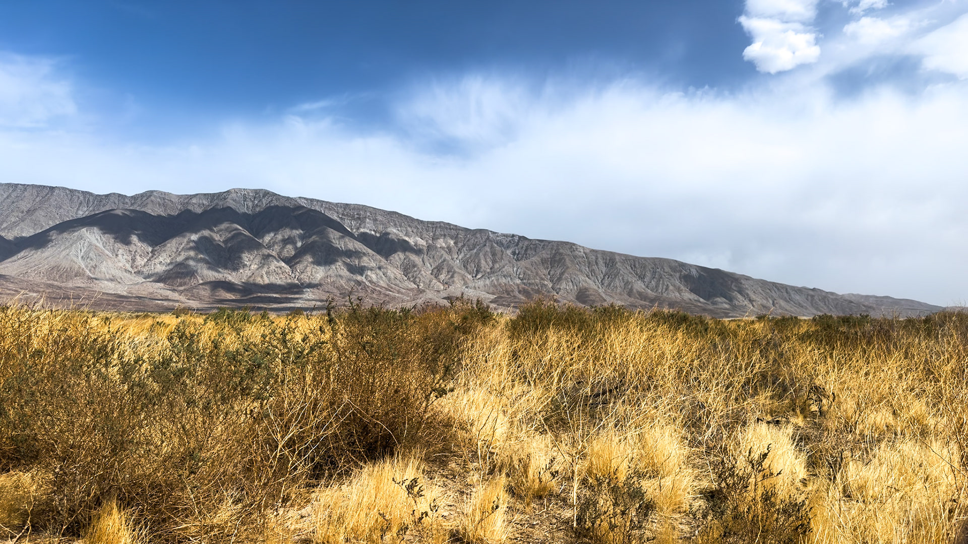
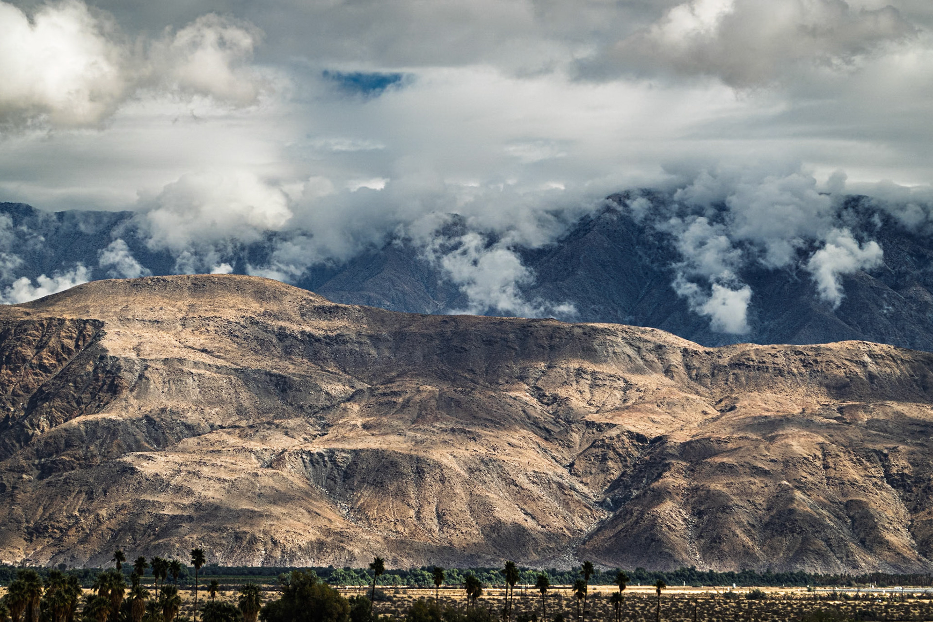
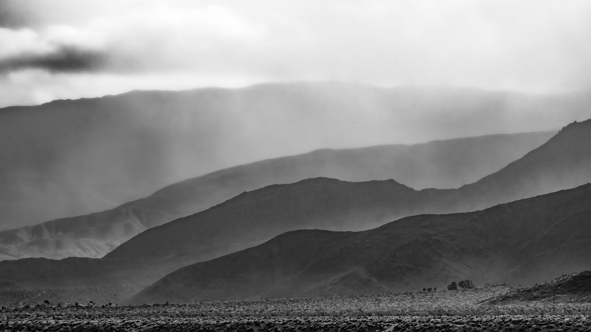
A weather system pushes clouds up the San Ysidro Mountains portending rain for a parched Anza-Borrego Desert.
A weather system pushes clouds up the San Ysidro Mountains portending rain for a parched Anza-Borrego Desert.
Borrego Springs Under the Stars: Looking west toward the San Ysidro Mountains.
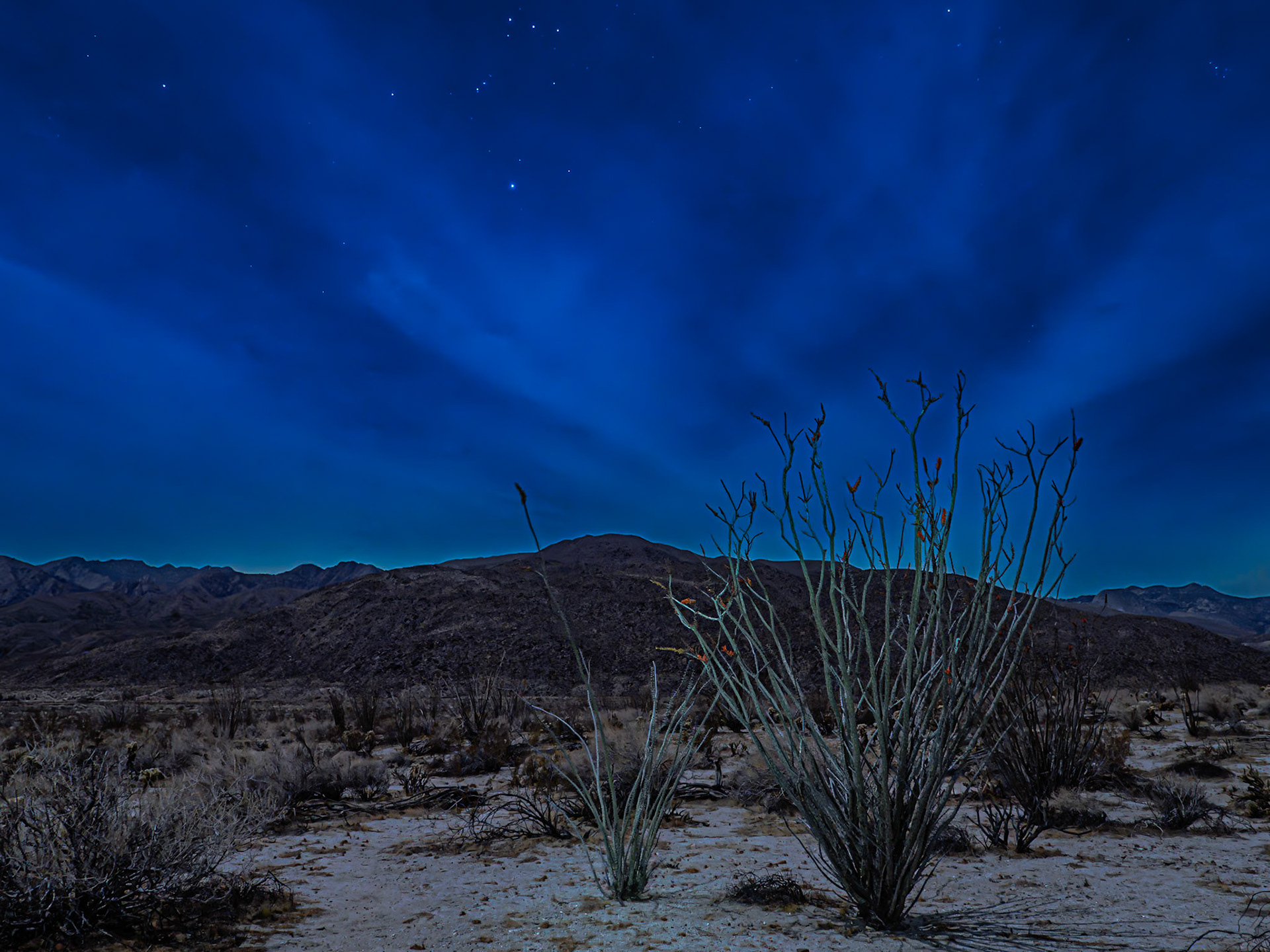
Ocotillo Under Orions Belt: Light from a near full moon filters through a cloudy sky with stars peeking out over blooming Ocotillo cactus in Coyote Canyon, Anza-Borrego Desert State Park. The three stars of Orion's Belt stand astride Rigel at the top center of the image. Light painting was used to highlight the ocotillo in the foreground in an 8-sec long-exposure image taken with an OM Systems OM-5 camera. The image was processed in Adobe Lightroom using available global and masking tools.
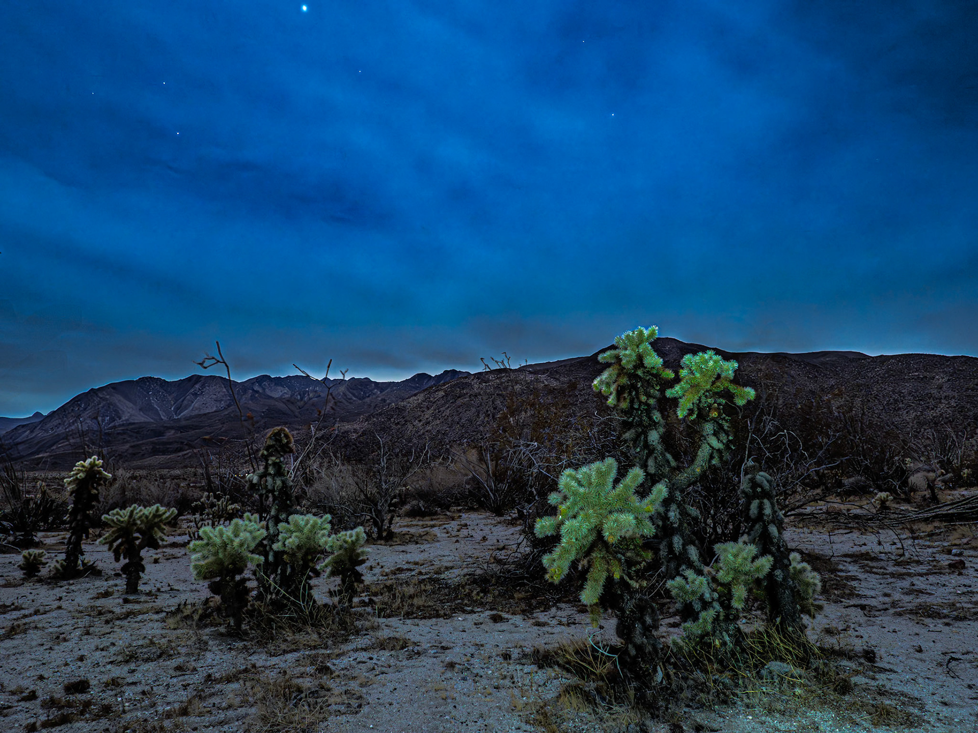
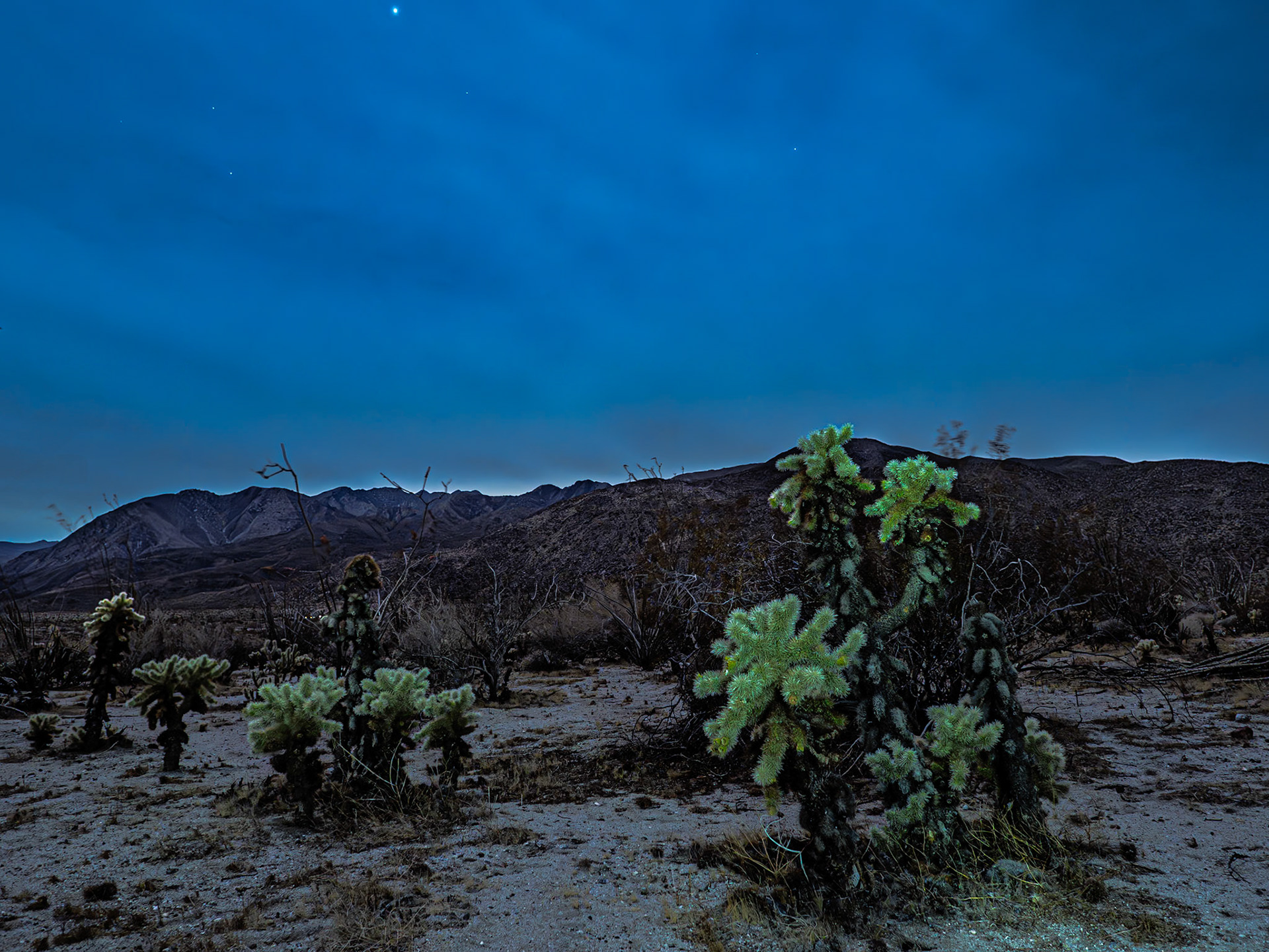
Cholla in Moonlight: Light from a near full moon filters through cloudy skys with stars peeking out over Cholla cactus in Coyote Canyon.
Cholla Moonlight: Light from a near full moon filters through cloudy skys with stars peeking out over Cholla cactus in Coyote Canyon.
Santa Rosa Clouds: Coyote Mountain in the foreground with clouds spilingl over the Santa Rosa Mountains into the Clark Valley that separates the two ranges.
Palo Verde Under Desert Clouds: A blue palo verde in the Anza-Borrego Desert State Park sits beneath storm clouds pushing over the San Ysidro Mountains. An infrared image converted to black and white.
Gathering Clouds: Coyote Mountain in the foreground with clouds spilingl over the Santa Rosa Mountains into the Clark Valley that separates the two ranges.
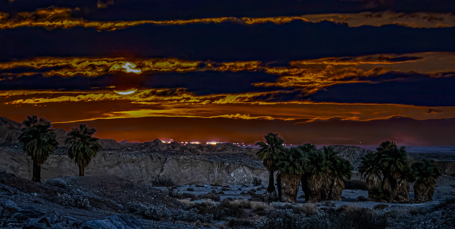
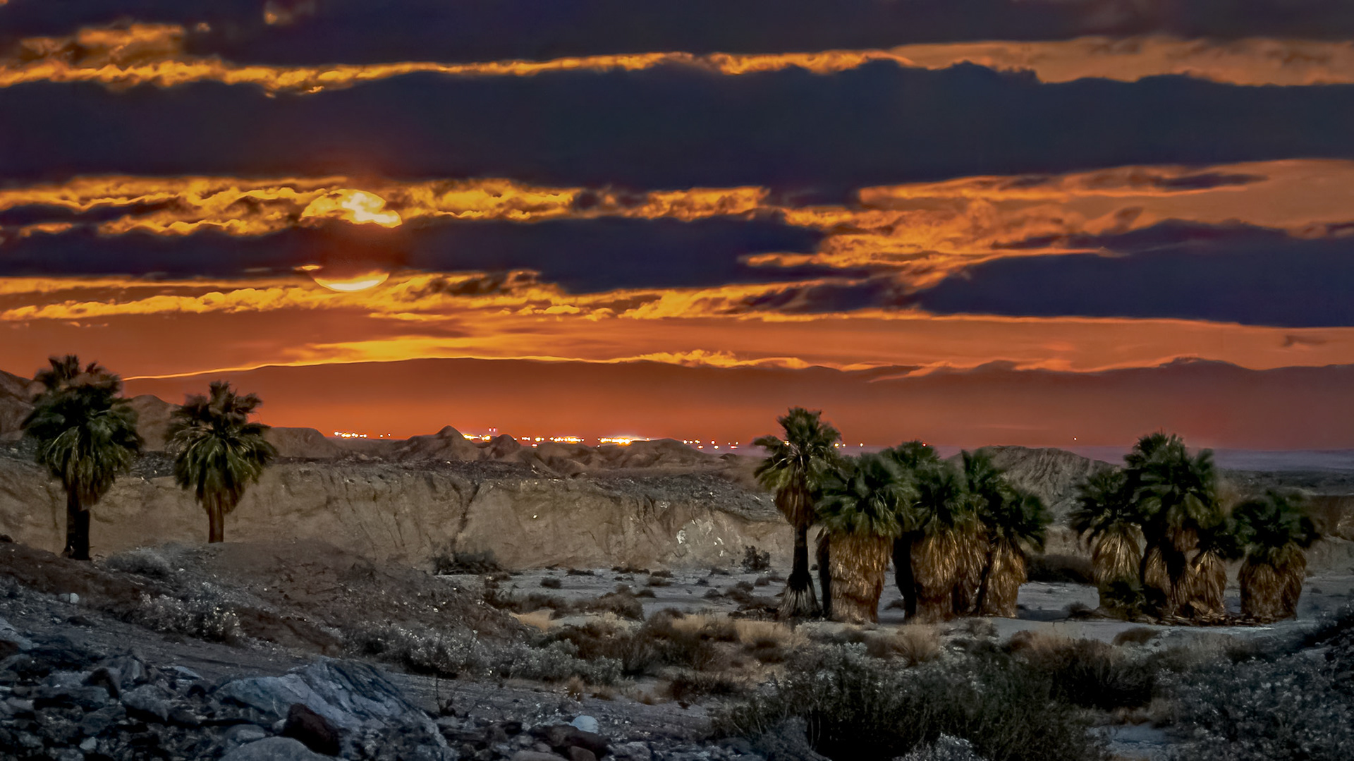
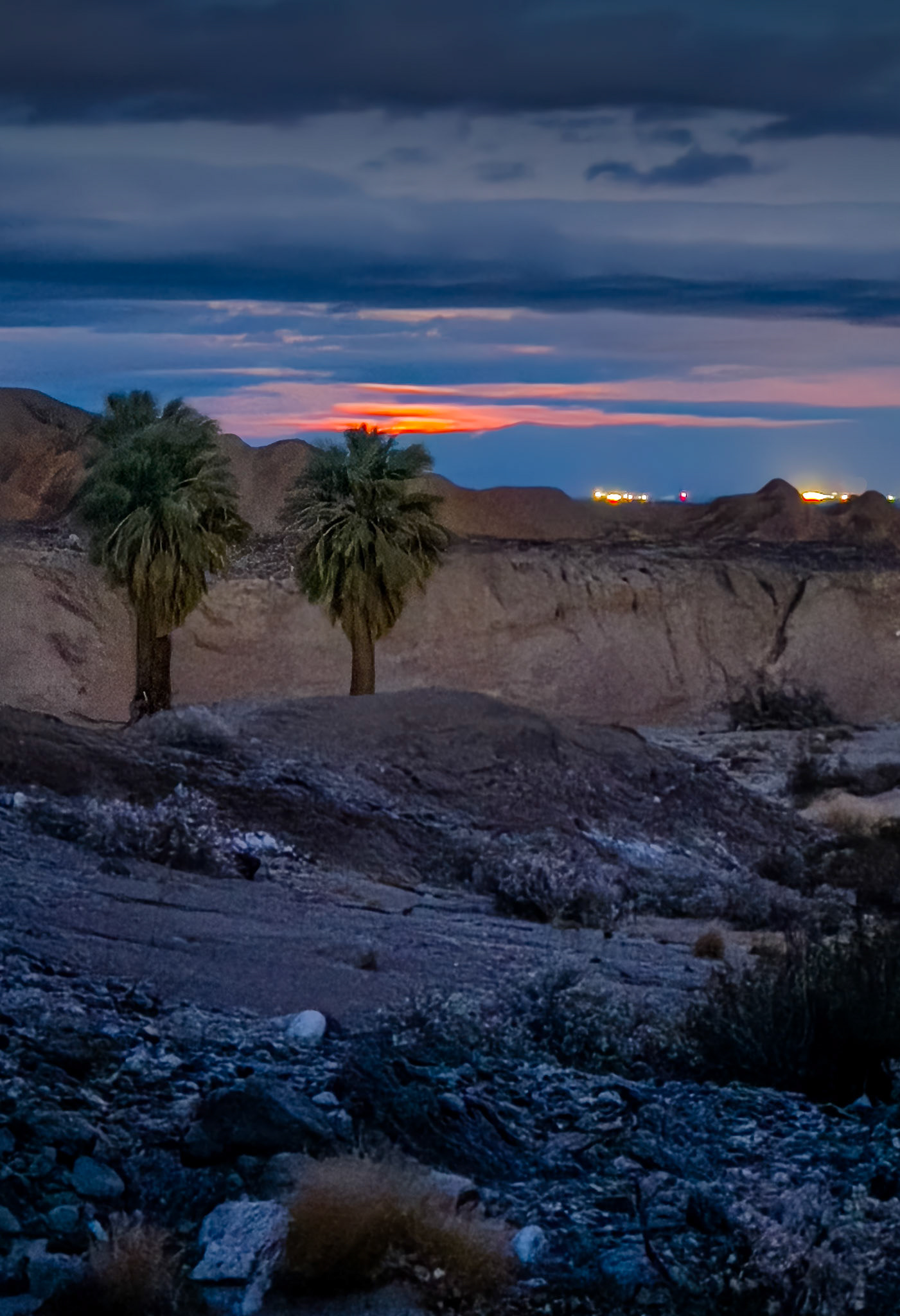
Palm Moonrise: Moonrise at 17 Palms Oasis. A blend of two photos. The palm in the foreground was photographed in the golden hour around sunset. The moonrise in the background was photographed in twilight almost an hour after sunset.
Oasis Moonrise: At the 17 Palms Oasis looking east towrds tthe Salton Sea.The palm grove in the foreground was photographed in the blue hour after sunset. The moonrise in the background was photographed in twilight almost an hour after sunset.
Oasis Moonrise: At the 17 Palms Oasis looking east towrds tthe Salton Sea.The palm grove in the foreground was photographed in the blue hour after sunset. The moonrise in the background was photographed in twilight almost an hour after sunset.
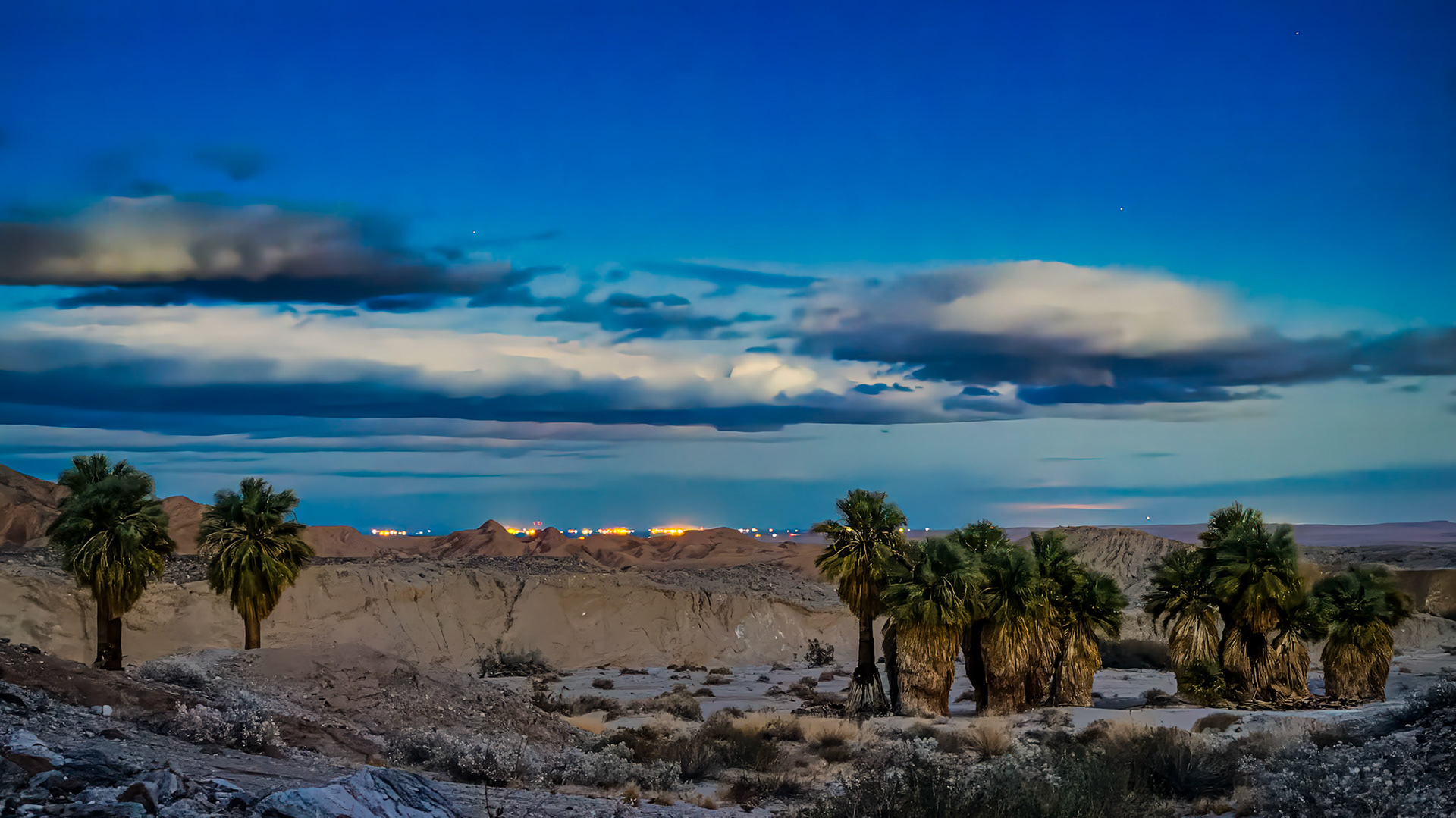
Oasis Blue Hour: The blue-hour after sunset and a few minutes before moonrise over the 17 Palms Oasis in the Anza-Borrego State Park. The lights of Salton City peek over the surrounding bluffs of the Arroyo Salado. Image taken with an iPhone 15 Pro in night mode and processed in Adobe Lightroom with available global and masking tools.
Oasis Blue Hour: At the 17 Palms Oasis looking east towrds tthe Salton Sea.
Moonrise Over the Palms: At the 17 Palms Oasis looking east towards Salton City and the Salton Sea. Photographed as the moon was breaking above the horizon on the cusp of twlight just before dark..
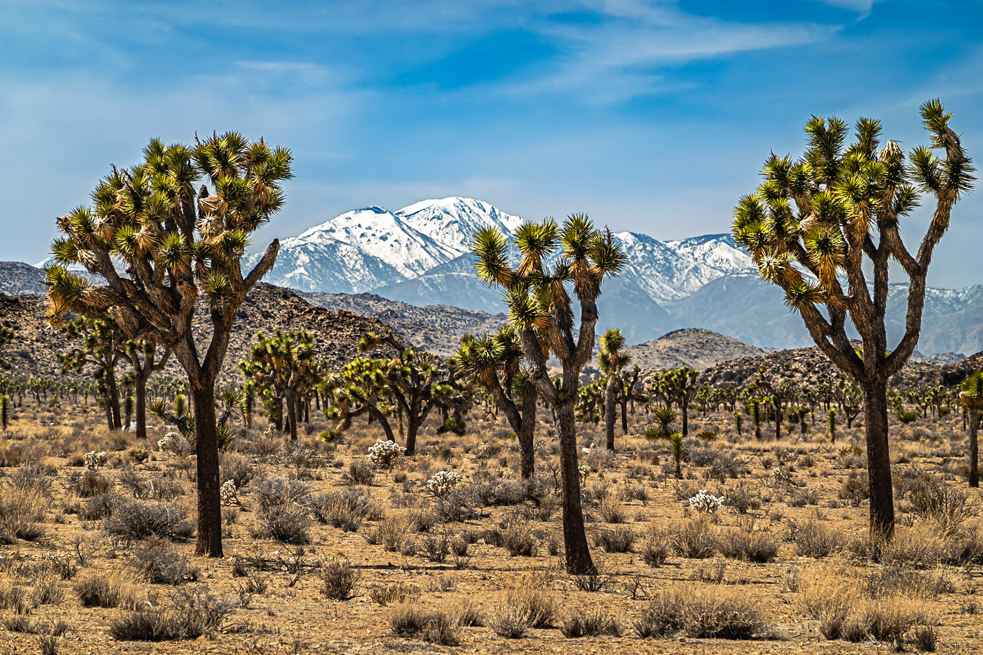
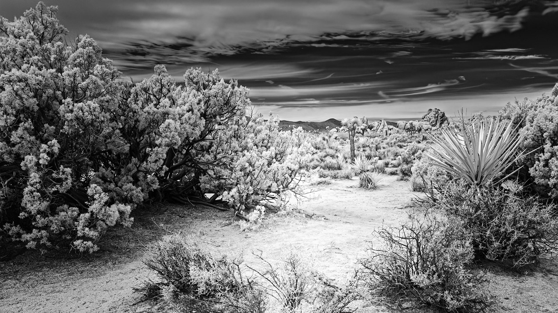
High Desert Cool Nights: Much of Joshua Tree National Park is in the southern end of the Mojave Desert and is flanked to the west by the San Bernardino Mountains.
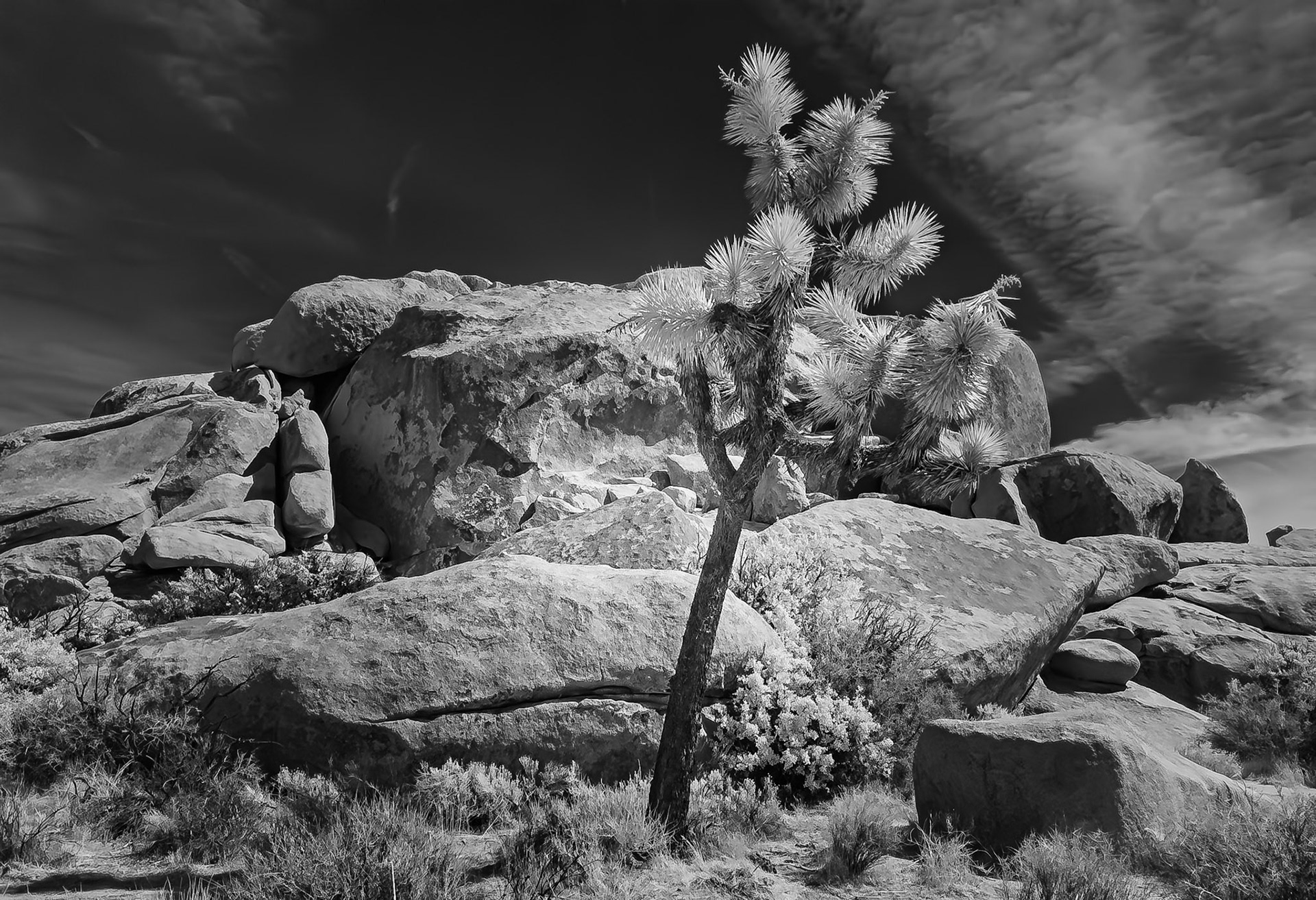
Joshua Tree Standing Alone: Seen along the Cap Rock loop trail In Joshua Tree National Park. Image taken with Lightroom Mobile camera on an iPhone equipped with a 70 nm infra-red filter.
Desert Trail: The Geology Tour in Joshua Tree National Park provides numerous stops to stretch your legs and venture off to nearby vistas and rock formations.
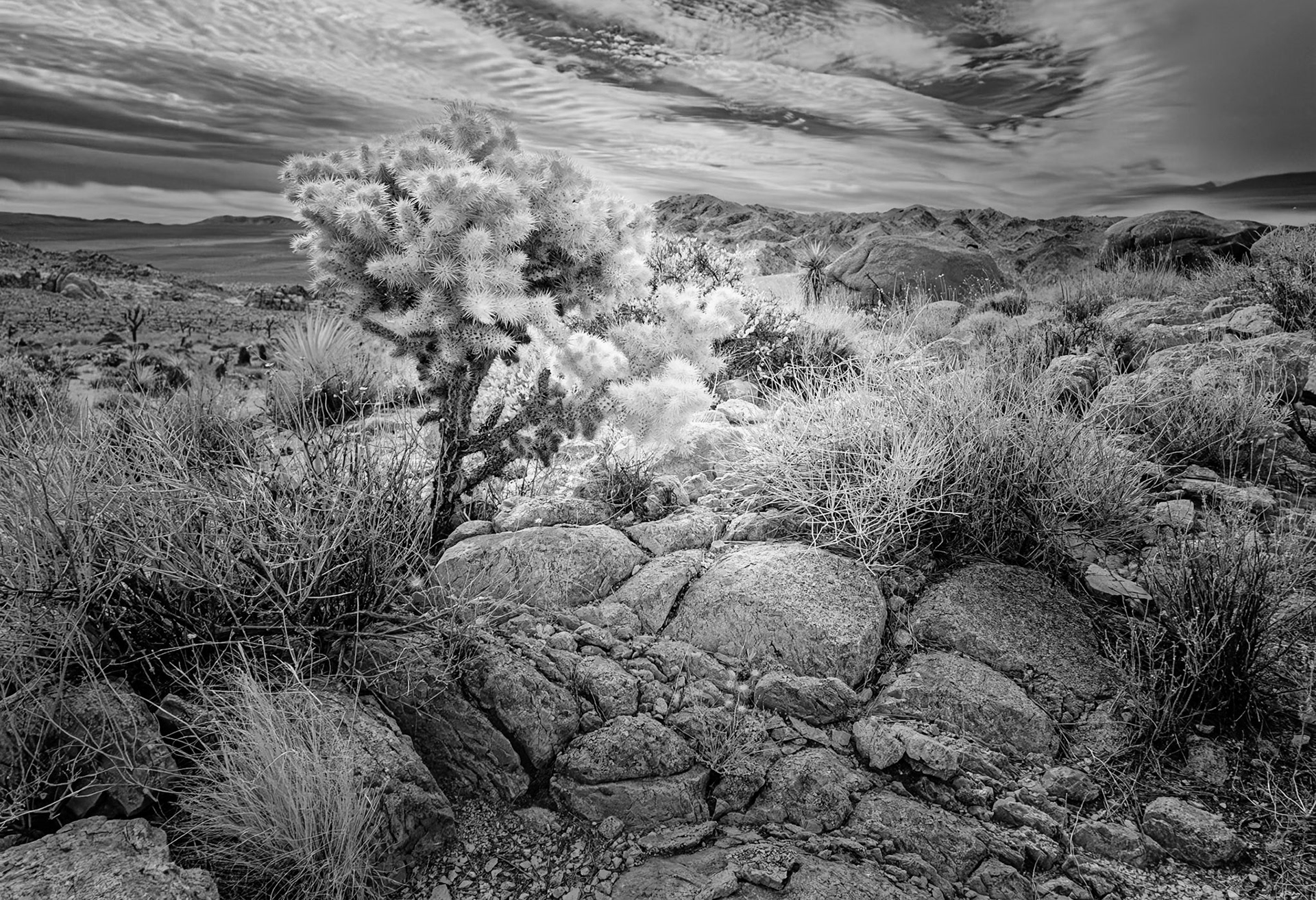
Silver Cholla on the Rocks: Overlooking the Pleasant Valley and the Little San Bernardino Mountains to the south in Joshua Tree National Park.
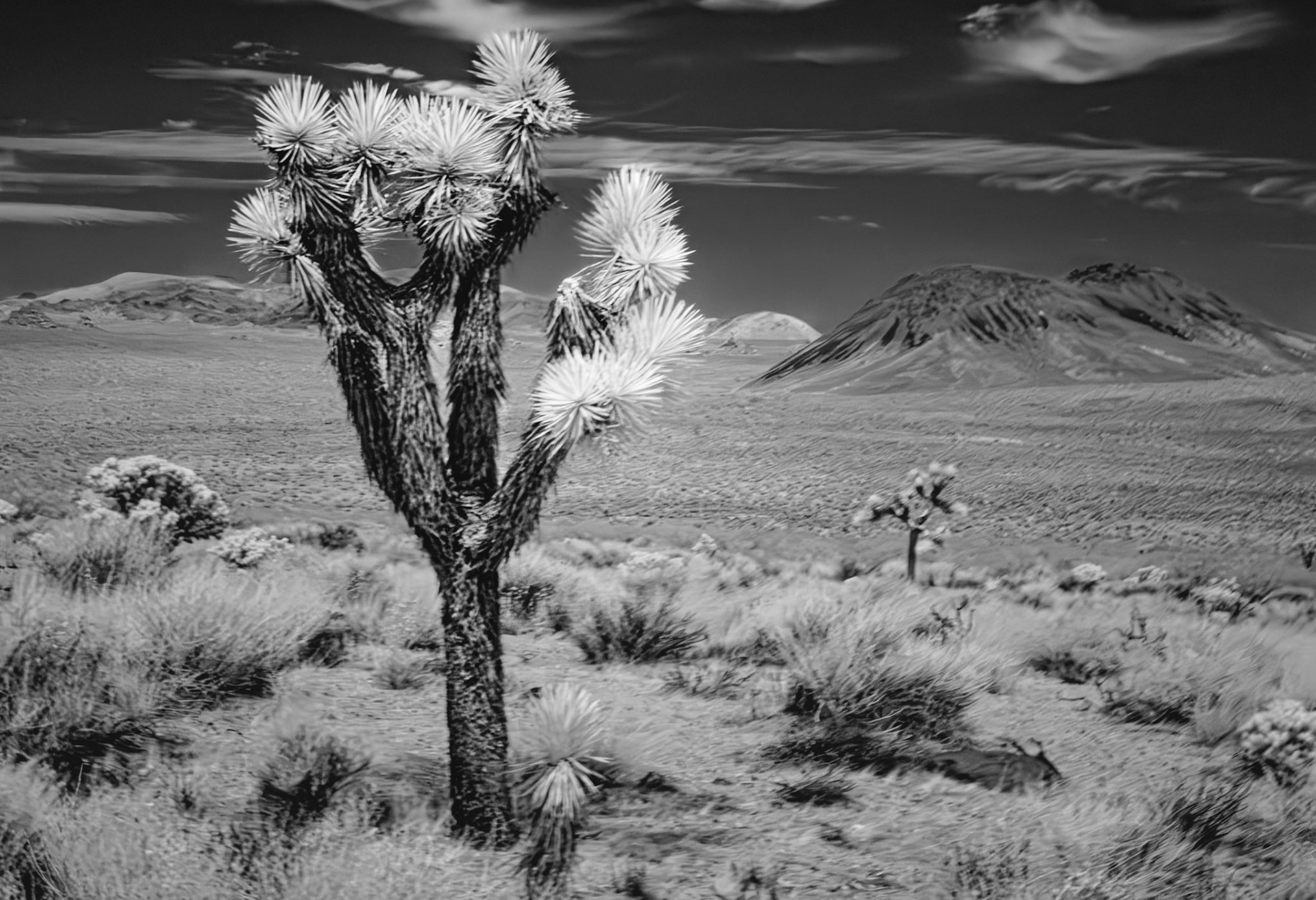
Desert Volcano: This is a magnificant stop along the Geology Tour 4WD road in Joshua Tree National Park. A Joshua Tree looks over the Queen Valley and the Malapai Hill . The Malapai Hill is a relatively young volcano .
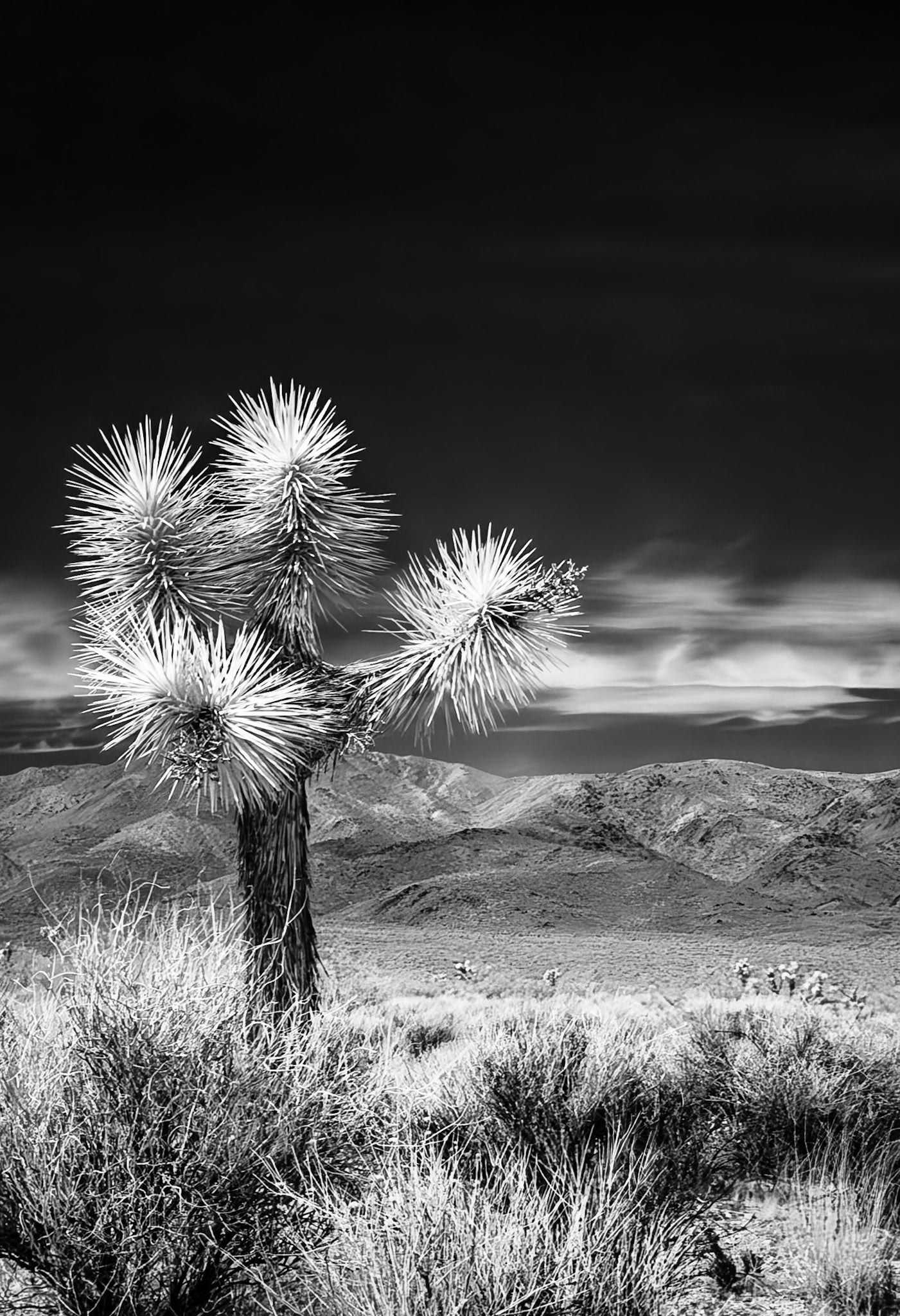
Sentinel Joshua Tree: Overlooking Pleasant Valley and the Hexie Mountains. An infra-red image converted to black and white.
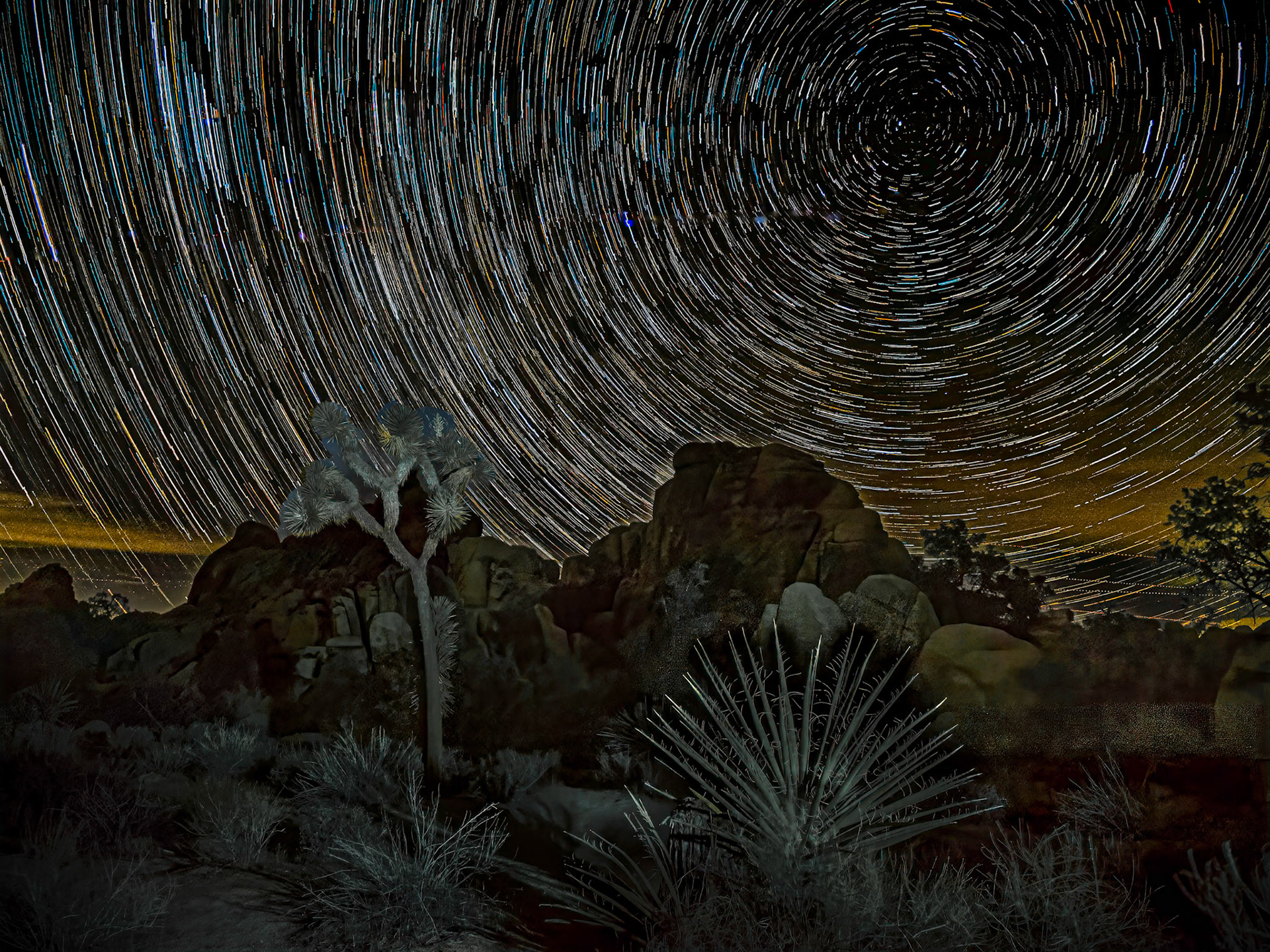
Star Trails over Joshua Tree: Viewed from the Hidden Valley trail head, star traiils rotate about Polaris with a Joshua Tree and Yucca in the foreground. This is a "live composite" image taken from 120 15-sec photos at about 10 PM under a moonless sky and very windy conditions. Foreground illumination was provided by light paiinting for a few seconds with a flashlight.
Desert Blister Beetle: Foraging on a brittlebush flower in the Anza-Borrego Desert State Park
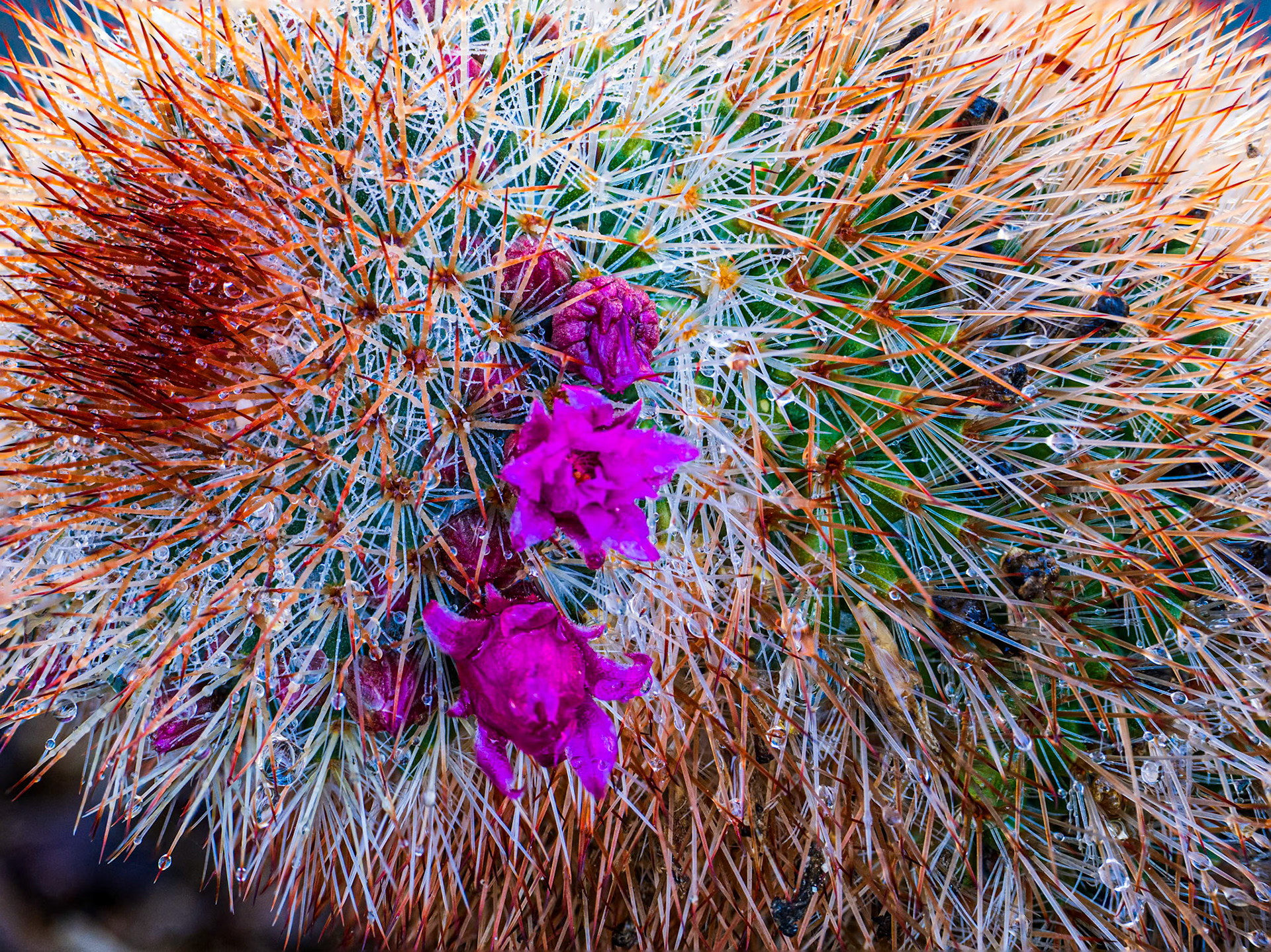
Dewey Hedgehog Cactus: Rain drops cling to the spines on this hedgehog cactus in the Anza-Borrego Desert State Park.
San Ysidro Panorama: Clouds gathering to push over the San Ysidro Mountains onto the Anza-Borrego Dersert.
Road to Coyote Canyon FCIR: Clouds threaten rain over the San Ysidro Mountains at the head of Coyote Caanyon in the Anza-Borrego Desert State Park. False color infrared (720 nm) image.
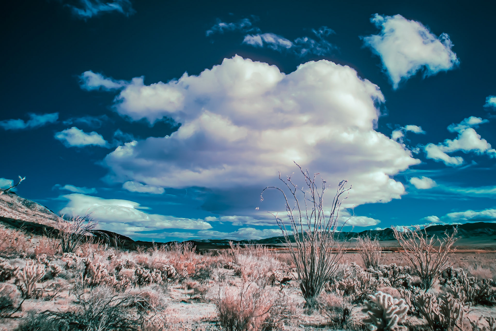
Desert Clouds Over Cholla and Ocotilo IR B&W.: Desert clouds pass over Coyote Canyon following a late winter rain in the Anza-Borrego Desert State Park. Infrared image (720 nm) coverted to B&W.
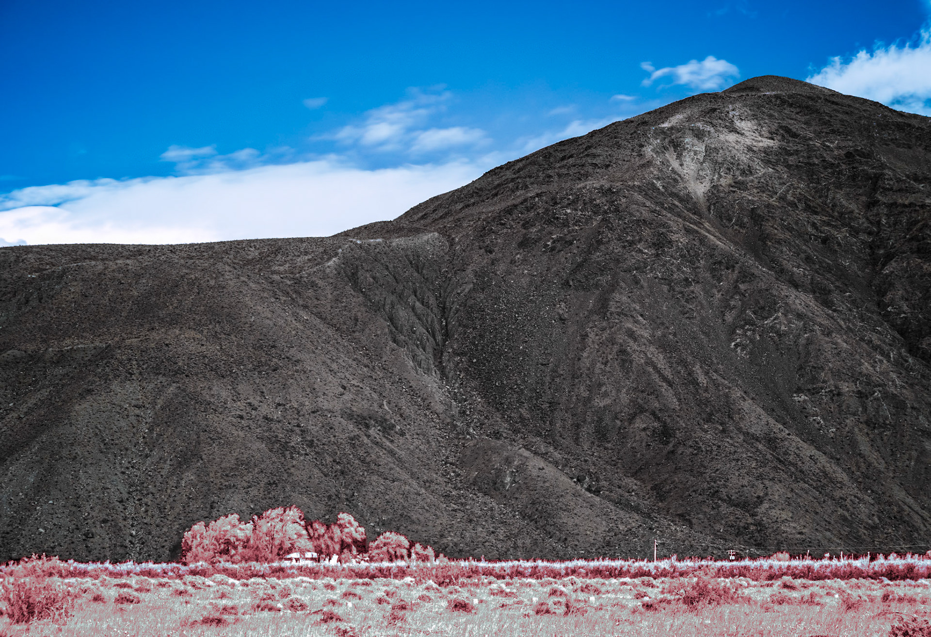
Farmhouse Under the Mountain IRFC: A farmhouse sits in a copse of trees a the base of Coyote Mountain in Anza-Borrego Desert State Park. Infrared (720 nm) false color image.
Desert Clouds Panorama- IRFC: Clouds drift over Coyote Canyon in Anza-Borrego Desert State Park. The panorama is a composite of multiple Infrared (720 nm) false color images.
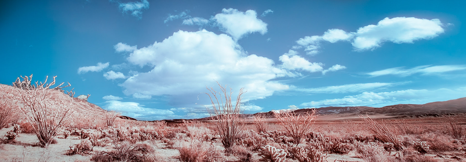
Ocotillo and Cholla Under a Cloud - IRFC: In Coyote Canyon, Anza-Borrego Desert State Park. Infrared (720 nm) false color image.
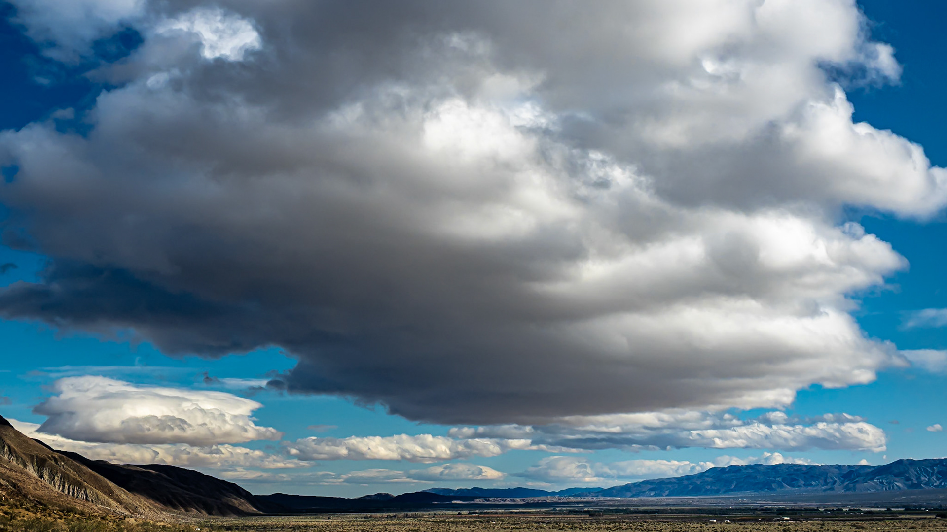
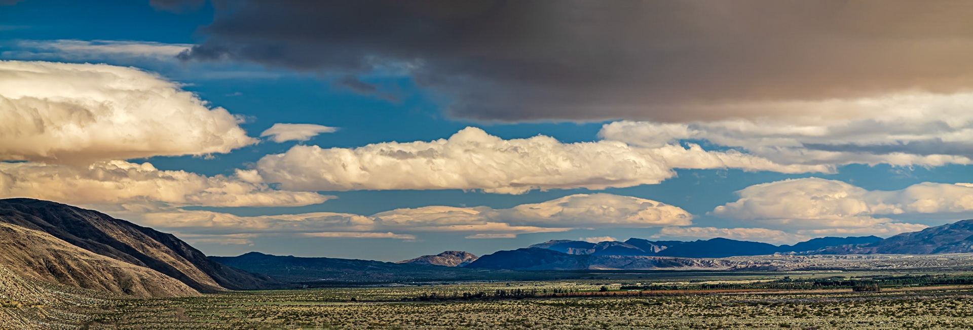
Desert Clouds: These puffy stratocumulus clouds look ominous but usually signify dry weather or light rain.
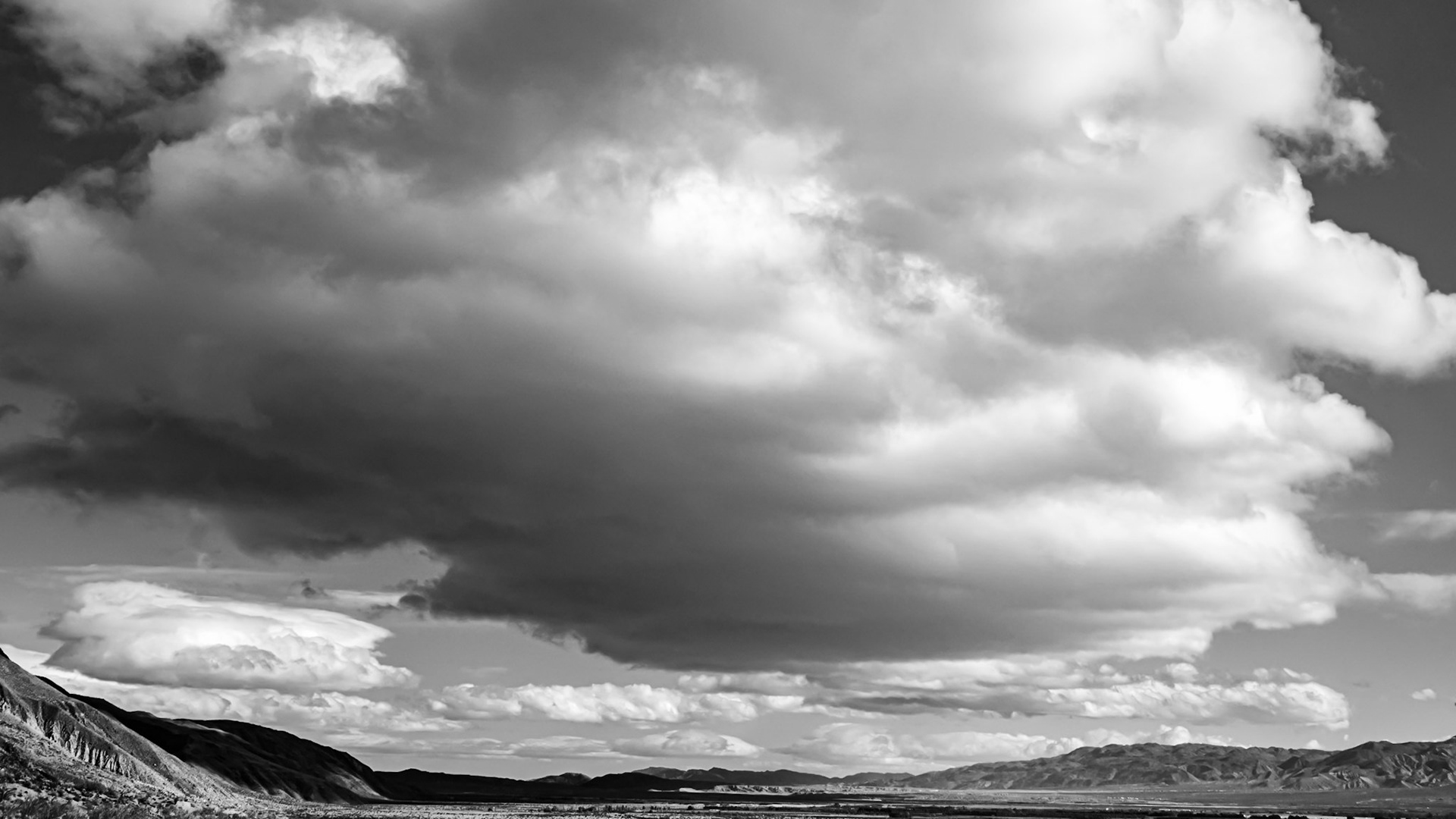
Desert Clouds - B&W: These puffy stratocumulus clouds look ominous but usually signify dry weather or light rain.
Desert Clouds: These puffy stratocumulus clouds look ominous but usually signify dry weather or light rain.
Misty Ridges: Low clouds and mist rising over the ridges and valleys that flank Indian Head mountain in the Anza-Borrego Desert State Park.
Pick Me Not: This ferociously spined hedgehog cactus seems to be protecting the diminutive flowers of the intertwined Lacy Phacelia, a common flowering plant found in the deserts of southern California.
Palm Oasis: A desert oasis at the head of Palm Canyon is fed by rain captured as runoff from the surroudning San Ysidro Mountains or by spring-fed groundwater. The oasis is frequently visited by bighorn sheep.
Palm Canyon Oasis: A desert oasis at the head of Palm Canyon is fed by rain captured as runoff from the surroudning San Ysidro Mountains or by spring-fed groundwater. The oasis is frequently visited by bighorn sheep.
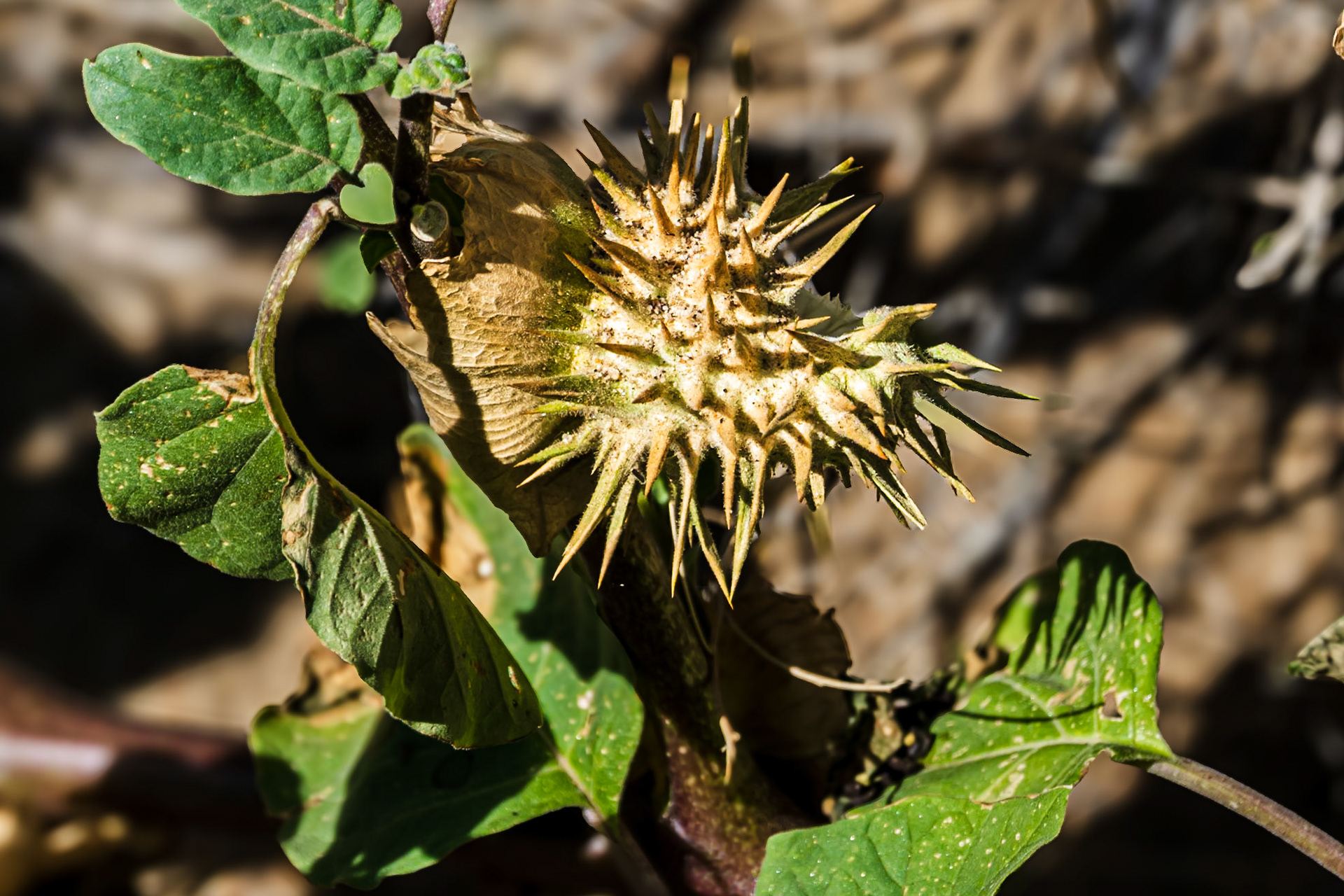
Sacred Datura: Native American cultures used this this toxic but nevertheless psychoactive plant in sacred rituals and ceremonies such as initiation rites for young men.
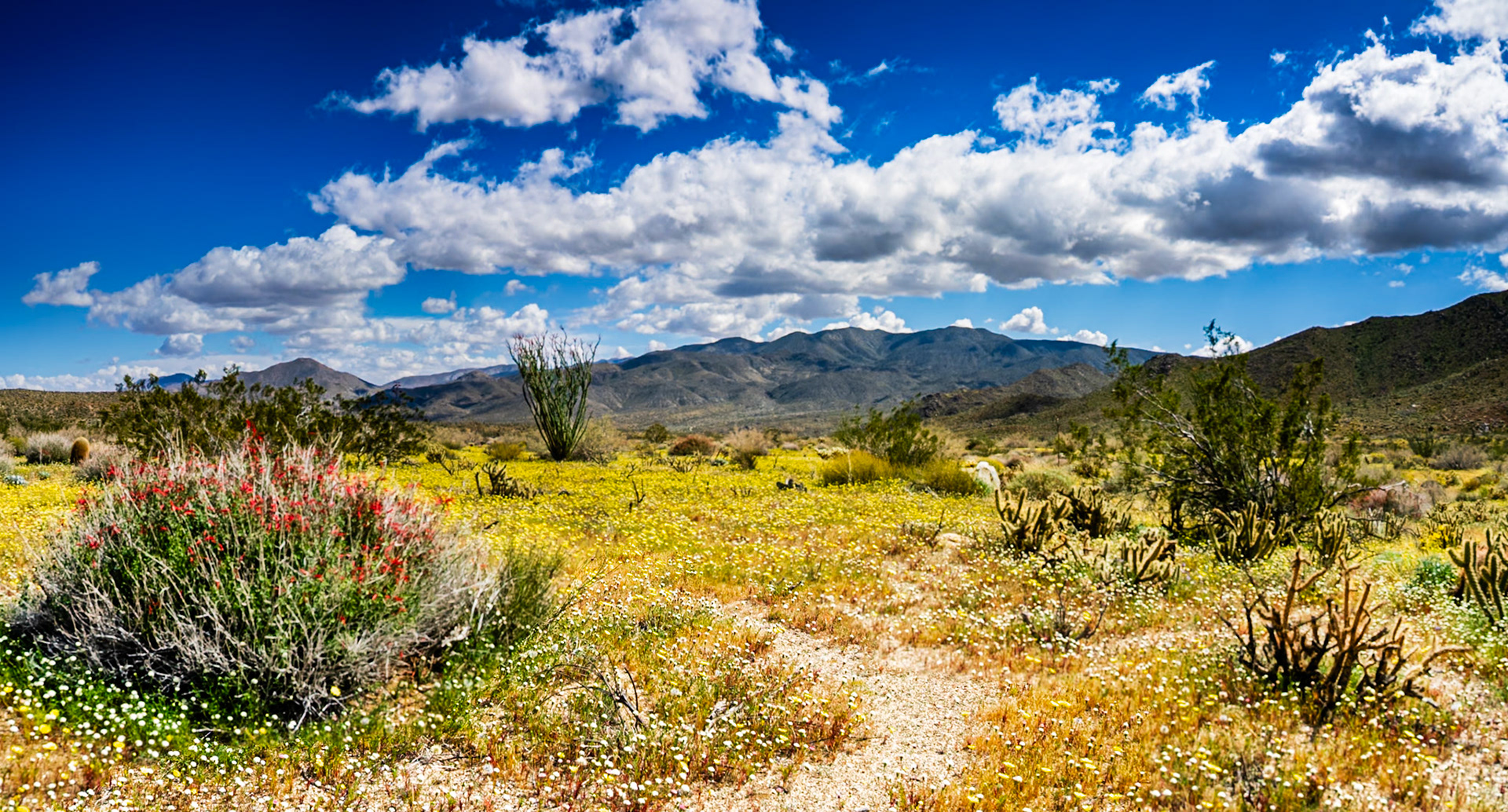
Borrego Valley Wildflowers: Wildflowers carpet the Borrego Valley at the foot of Coyote Mountain in the Anza-Borrego Desert.
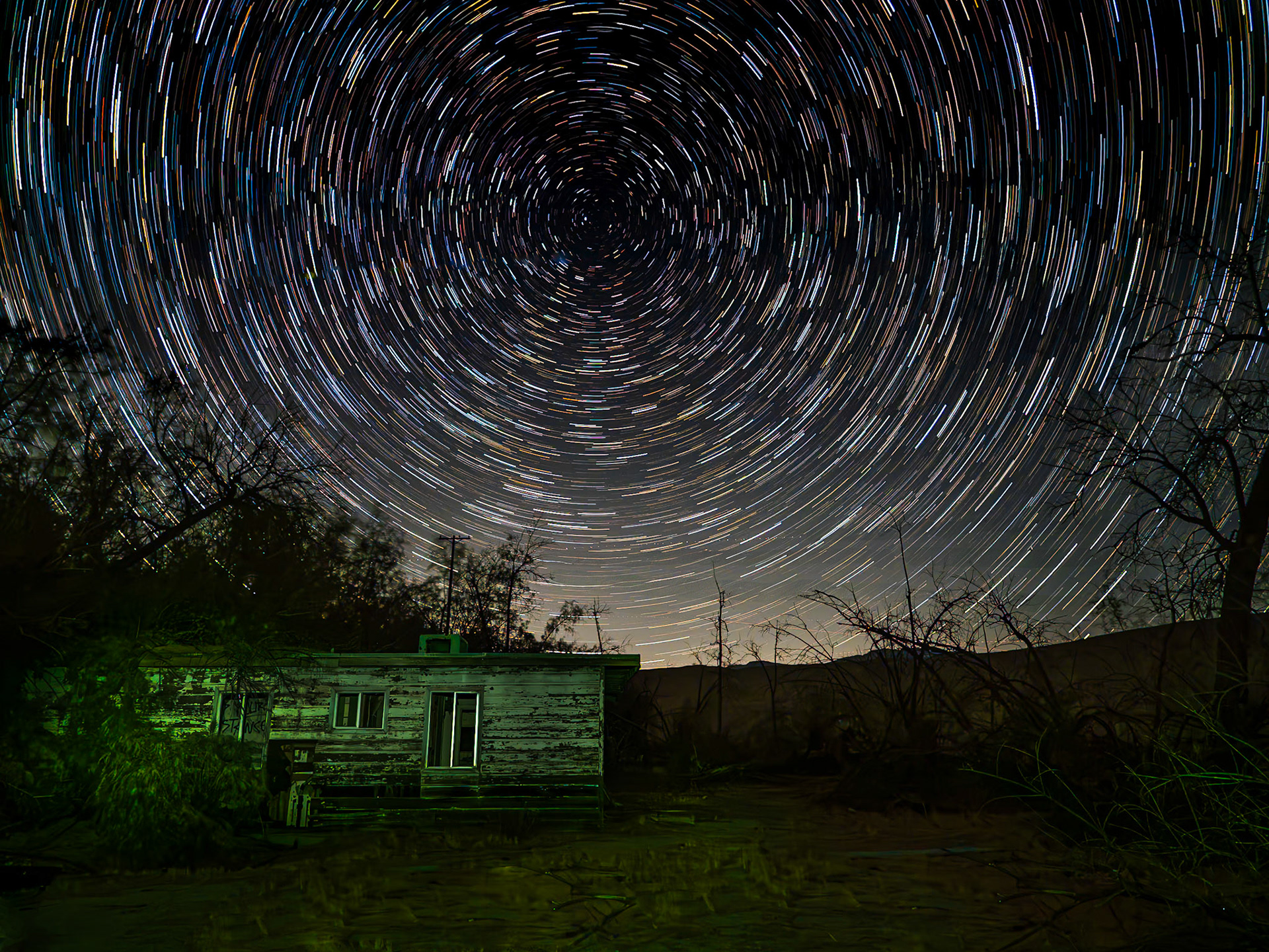
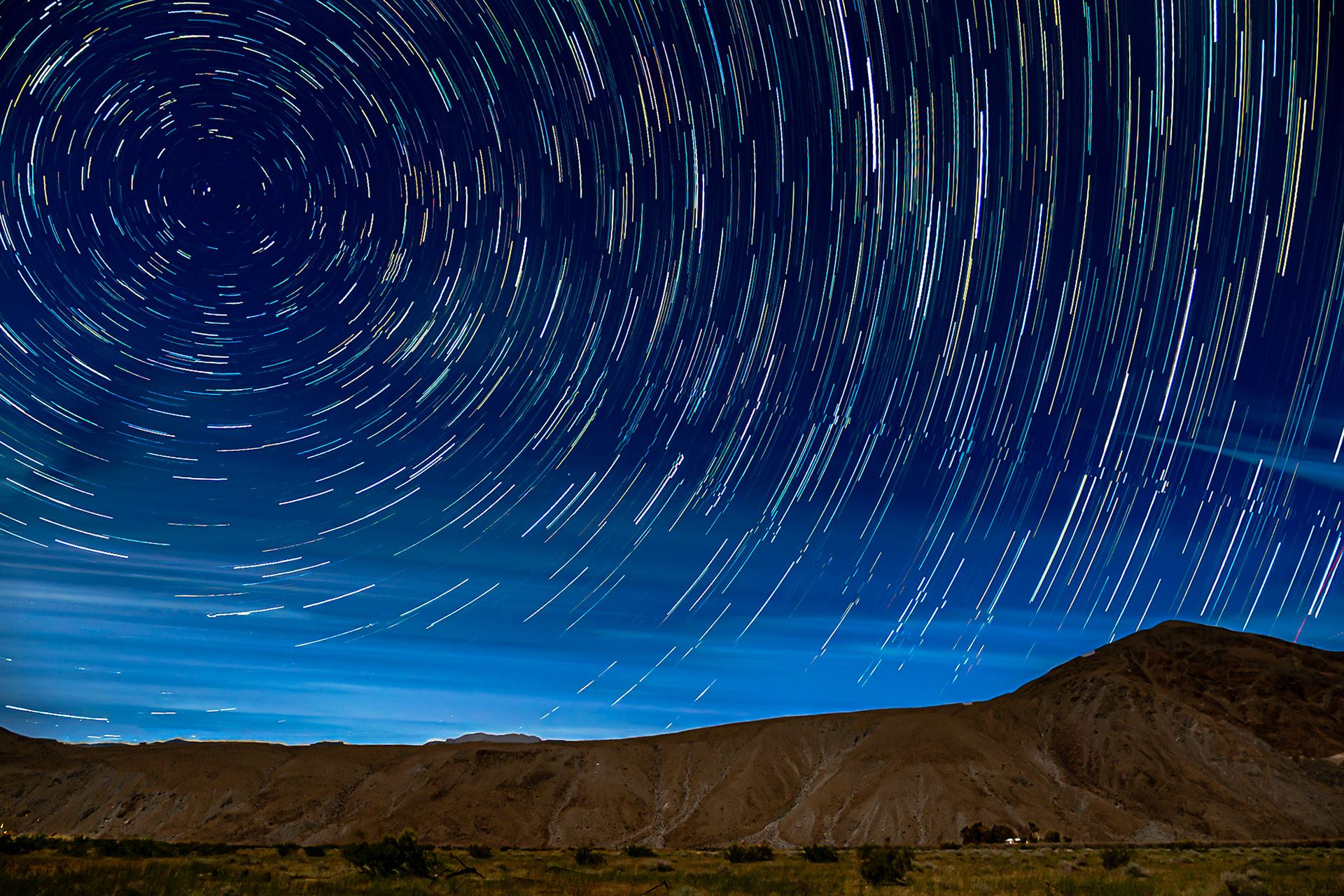
Borrego Valley Startrails: Startrails swirl over a solitary Borrego-Valley farmhouse seen at the foot of Coyote Peak on a soft moonlit night.
:
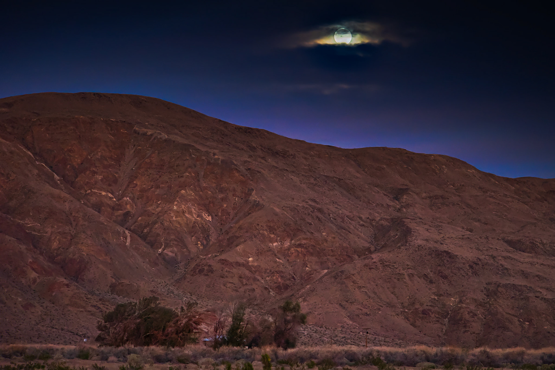
Moon Light on Coyote Mountain: A waxing gibbous moon gives faint illumination to Coyote Mountain and a desert homestead nestled in a copse of trees near the entrance to Coyote Canyon in the Anza-Borrego Desert State Park.
Desert Dandelion Meadows: A carpet of desert dandelion turns toward the morning light in the Borrego Valley.
Desert Shrubs- IRFC: Creosote Bush and Cheesebush at the head of Butler Canyon in Anza-Borrego Desert State Park. Infrared (720 nm) false color image.
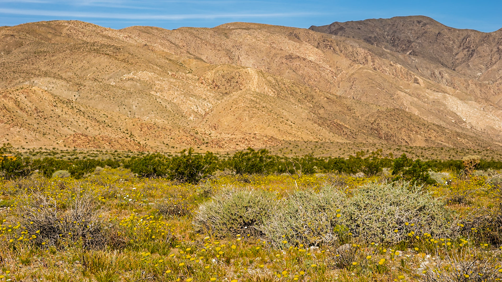
Green and Yellow Desert: Yellow flowers of desert dandelion amid the green and yellow of creostoe bush and burrobushsprinkled across the Clark Valley and the slopes of the Santa Rosa Mountains in the Anza-Borrego Desert.
Moonrise over Coyote Mountain : Viewed across the creosote-bush studded, alluvial plain near the entrance to Coyote Canyon in the Anza-Borrego Desert. A house nestled in a copse of willows sites at the far side of the plain at the foot of the mountain.
Moonrise over Coyote Mountain : Viewed across the creosote-bush studded, alluvial plain near the entrance to Coyote Canyon in the Anza-Borrego Desert. A house nestled in a copse of willows sites at the far side of the plain at the foot of the mountain.
Evening Moonrise: Viewed across the creosote-bush studded, alluvial plain near the entrance to Coyote Canyon in the Anza-Borrego Desert. A house nestled in a copse of willows sites at the far side of the plain at the foot of the mountain.
Evening Moonrise: Viewed across the creosote-bush studded, alluvial plain near the entrance to Coyote Canyon in the Anza-Borrego Desert. A house nestled in a copse of willows sites at the far side of the plain at the foot of the mountain.
Golden Hour Moonrise over Coyote Mountain : Viewed across the creosote-bush studded, alluvial plain near the entrance to Coyote Canyon in the Anza-Borrego Desert. A house nestled in a copse of willows sites at the far side of the plain at the foot of the mountain.
Golden Hour Moonrise over Coyote Mountain : Viewed across the creosote-bush studded, alluvial plain near the entrance to Coyote Canyon in the Anza-Borrego Desert. A house nestled in a copse of willows sites at the far side of the plain at the foot of the mountain.
An Eye in the Sky: The rising moon peeks through the cloud cover looking over a farmhouse nestled in a copse of trees at the foot of Coyote Mountain in the Anza-Borrego Desert.
Santa Rosa Mountains IRFC: The Santa Rosa mountains viewed from the short wash section of the Thimble Trail in the Anza-Borrego Desert State Park. Infrared (720 nm) false color image.
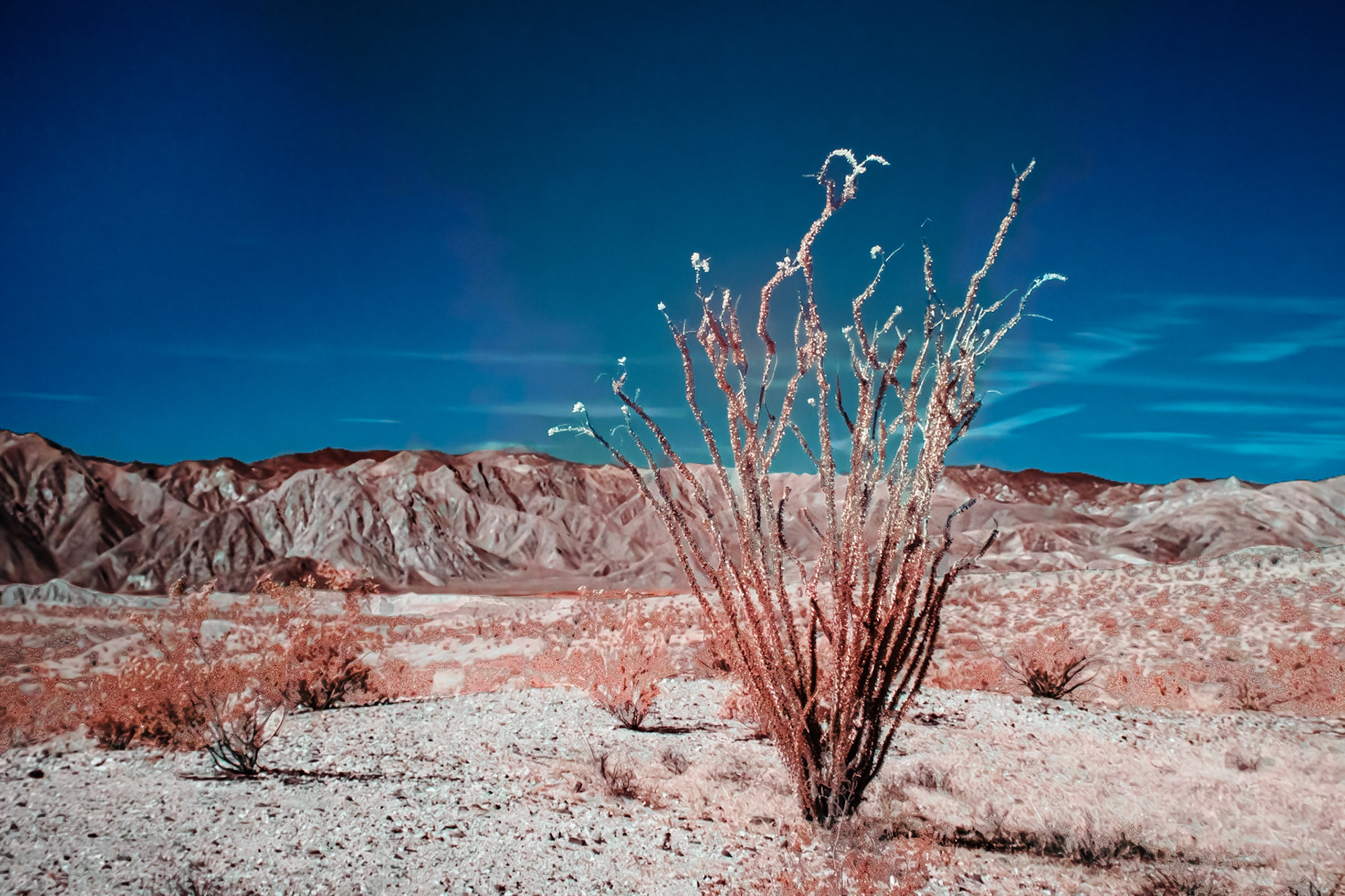
Ocotillo in Bloom - IRFC: Ocotillo in bloom along the Thimble Trail in the Anza-Borrego Desert State Park, Infrared false color image, 720 nm filter.
Ocotillo Blooms - IRFC: Ocotillo blooms along the Thimble Trail in Anza-Borrego Desert State Park. Infrared false color image taken through a 720 nm filterr.
Ocotillo and Blue Sky - IRFC: Ocotillo blooms along the Thimble Trail in Anza-Borrego Desert State Park. Infrared (720 nm) false color image.
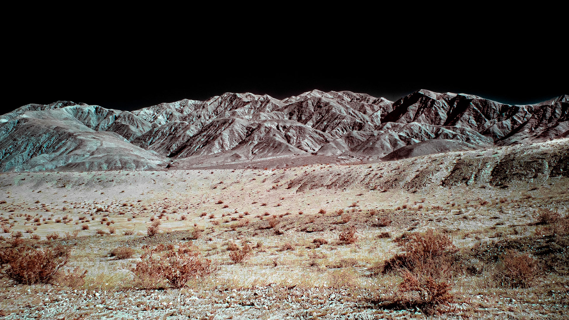
Borrego Badlands and Twin Buttes - IRFC: The Borrego Badlands, the East and West Buttes of Borrego Mountain and the Salton Sea viewed from Vista del Malpais. Panorama of several infrared (720 nm) false color photos.
Borrego Badlands & San Ysidro Mountains - IRFC: Infrared (720 nm) false color image of the Borrego Badlands & San Ysidro Mountains viewed from Vista del Malpais.
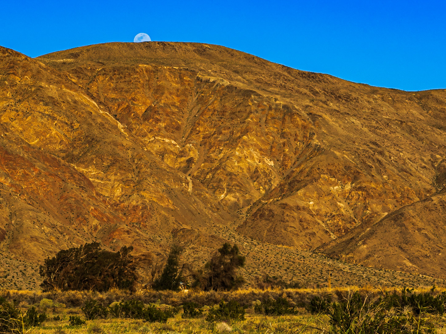
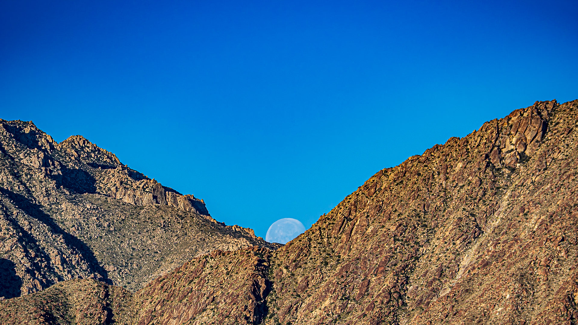
San Ysidro Moonset: Moon set behind the San Ysidro Mountians drenched in the cinnamon glow of dawn's early morning light.
Blue Hour Moonset : A notch of the San Ysidro Mountains near Indianhead peak catches a setting moon in early March morning.
Mountain Clouds Panorama: Stormy weather threatens over the San Ysidro Mountains, Anza-Borrego Desert State Park.
Dyiing on the Vine: Climate change, water rights and scarcity wrought the collapse of this once promising orchard.
Coyote Mountain: In the Anza-Borrego Desert State Park
Coyote Mountain Abstract: In the Anza-Borrego Desert State Park
Borrego Valley Sunrise : Looking across the Borrego Valley alluvial plain towards Font's Point.
Desert Dandelion: A carpet of desert dandelion turns toward the morning light in the Borrego Valley.
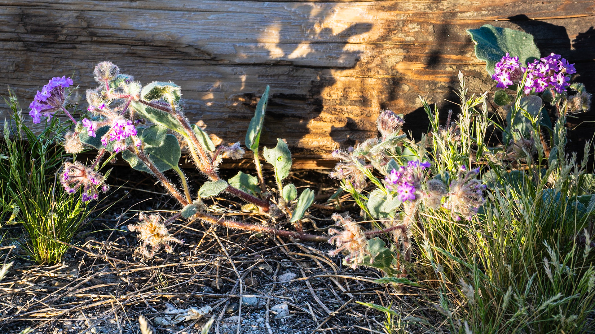
Opportunistic Verbena: In the Anza-Borrego State Park.
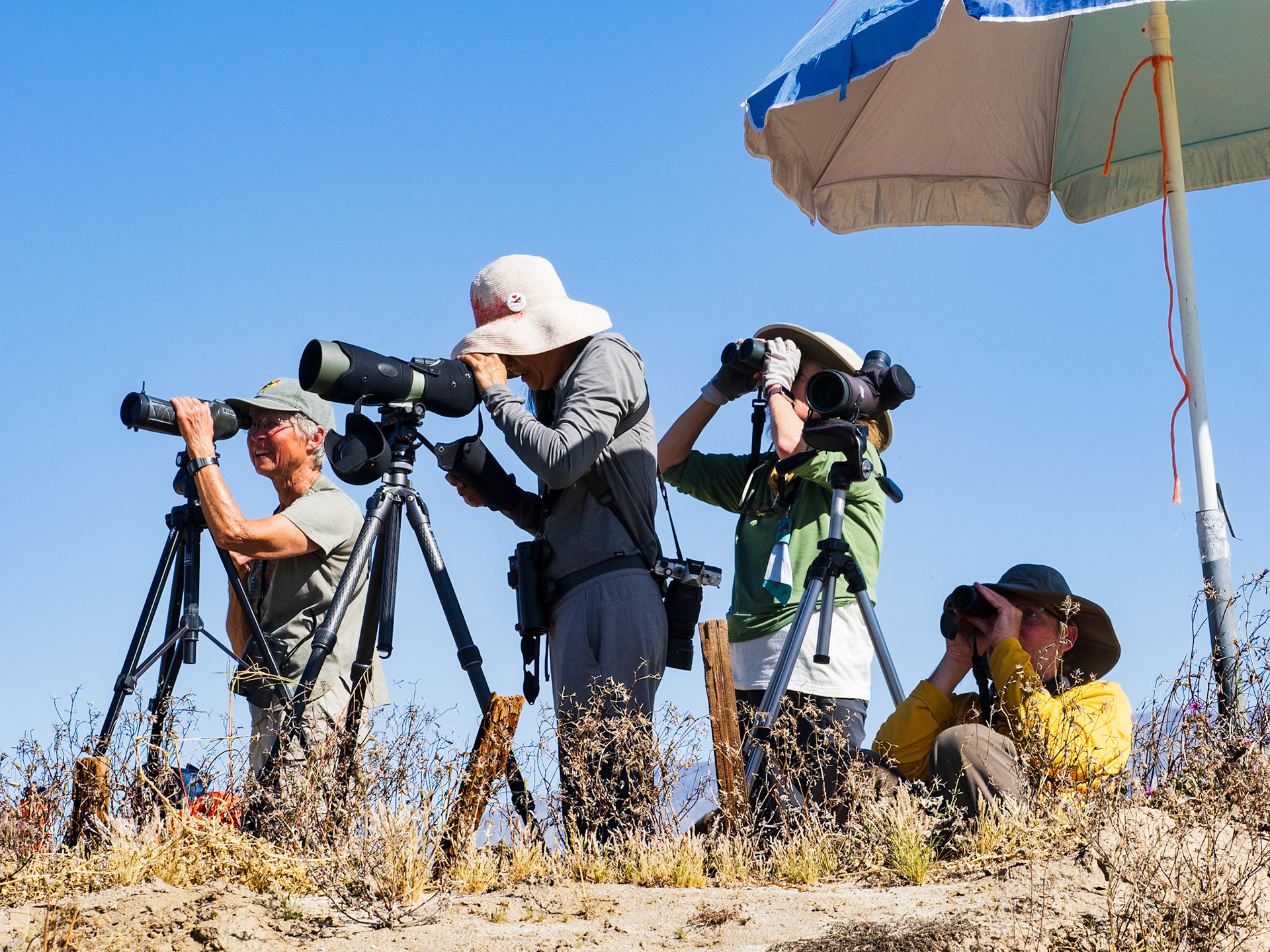
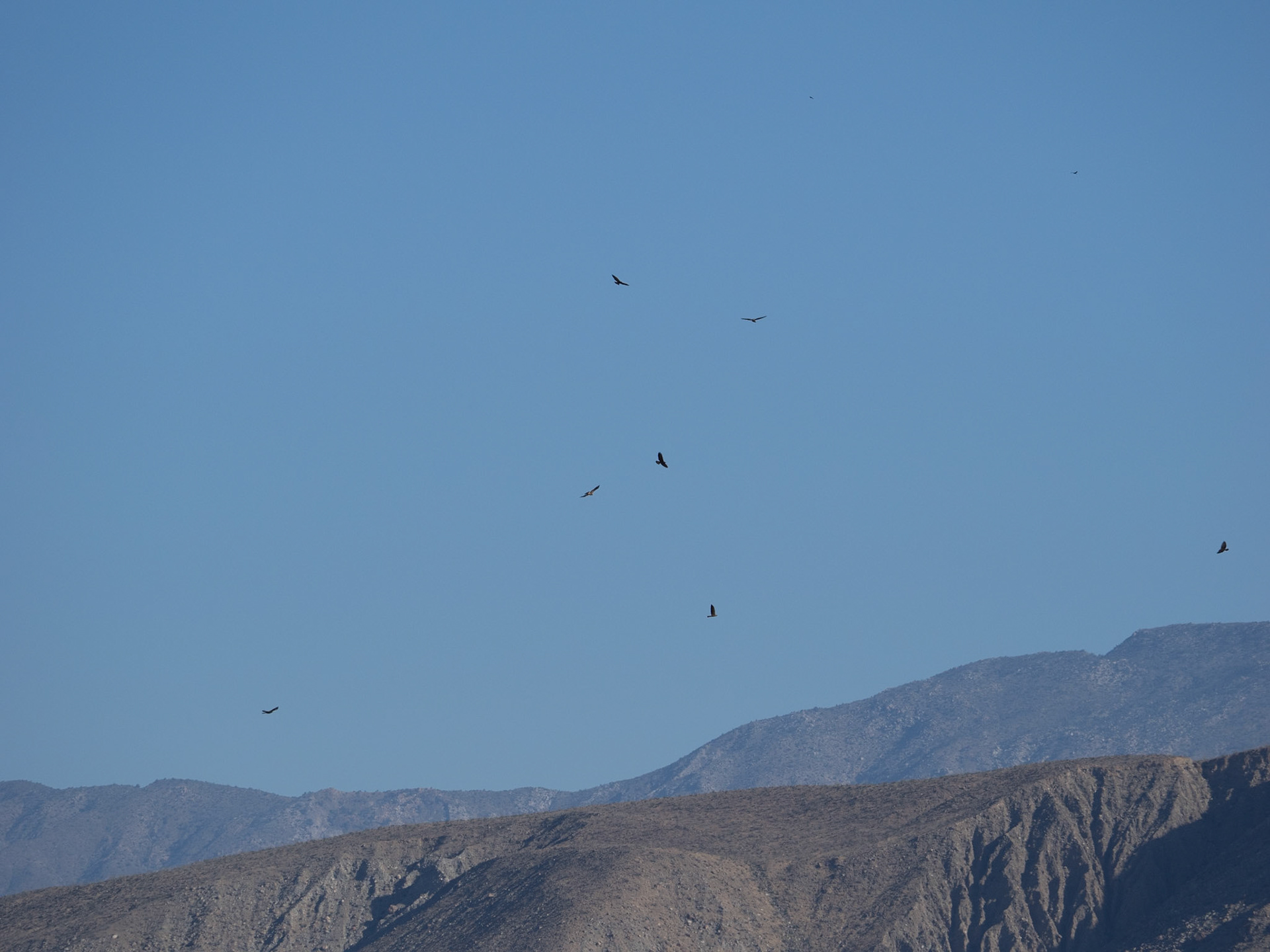
Hawk Watchers: The Hawkwatch is an annual event in Borrego Springs. Volunteers gather in late February and early March to document the northern migration of the Swainson's hawk originating in the grasslands of Argentina enroute to breeding ground in the western U.S. and Canada.
Yaqui Flats: A barrell cactus shares space on this rocky slope dominated by a community of Ocotillo cacti.
Cactus on the Rocks: Barrel cactuss emergng from boulders on Yaqui Flats, Anza-Borrego Desert State Park,
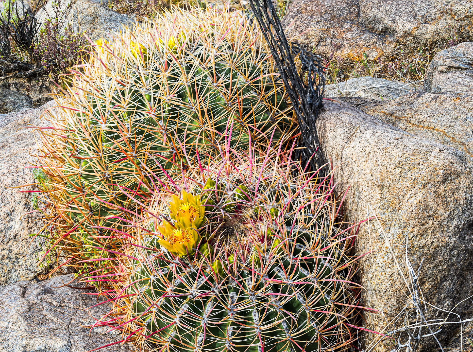
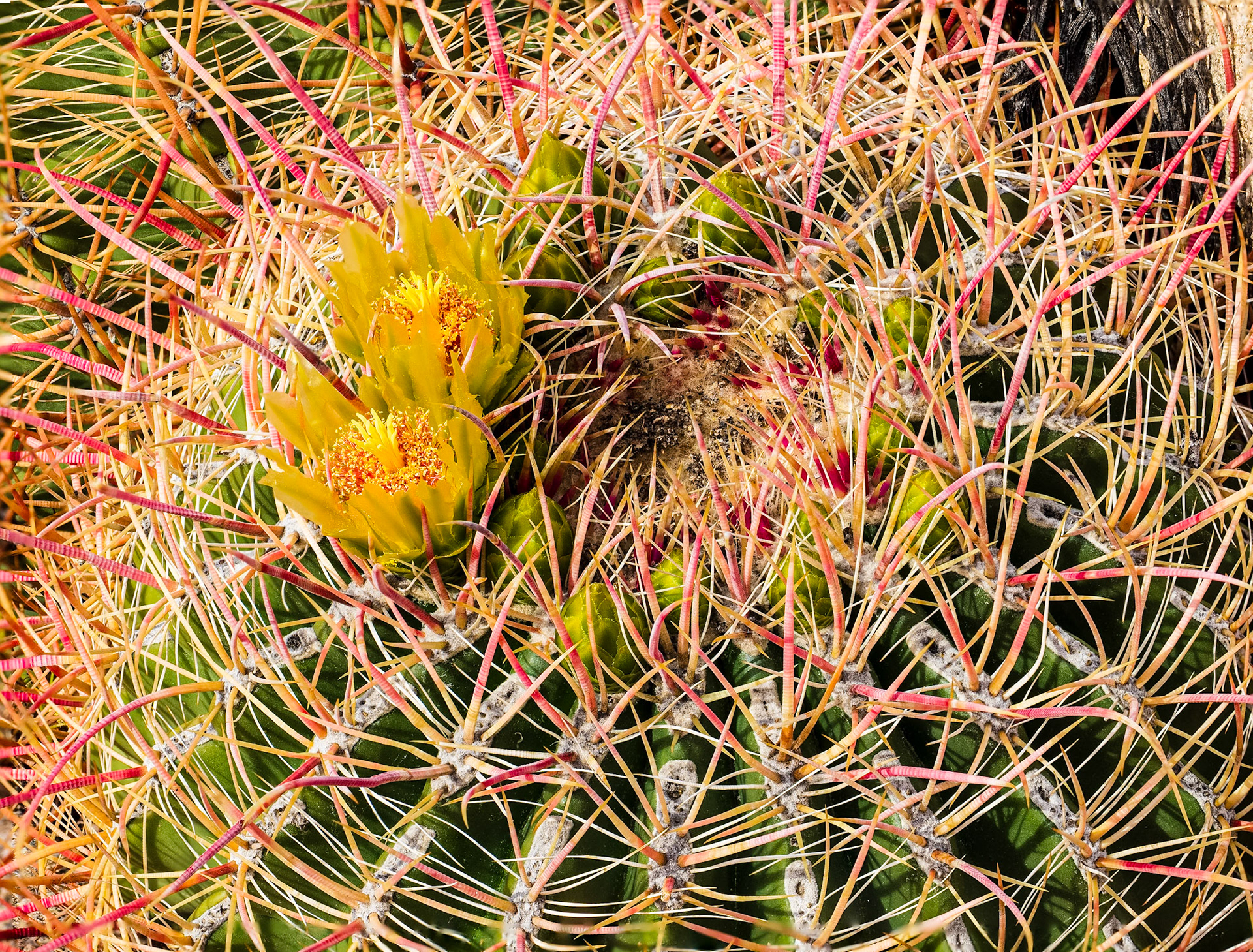
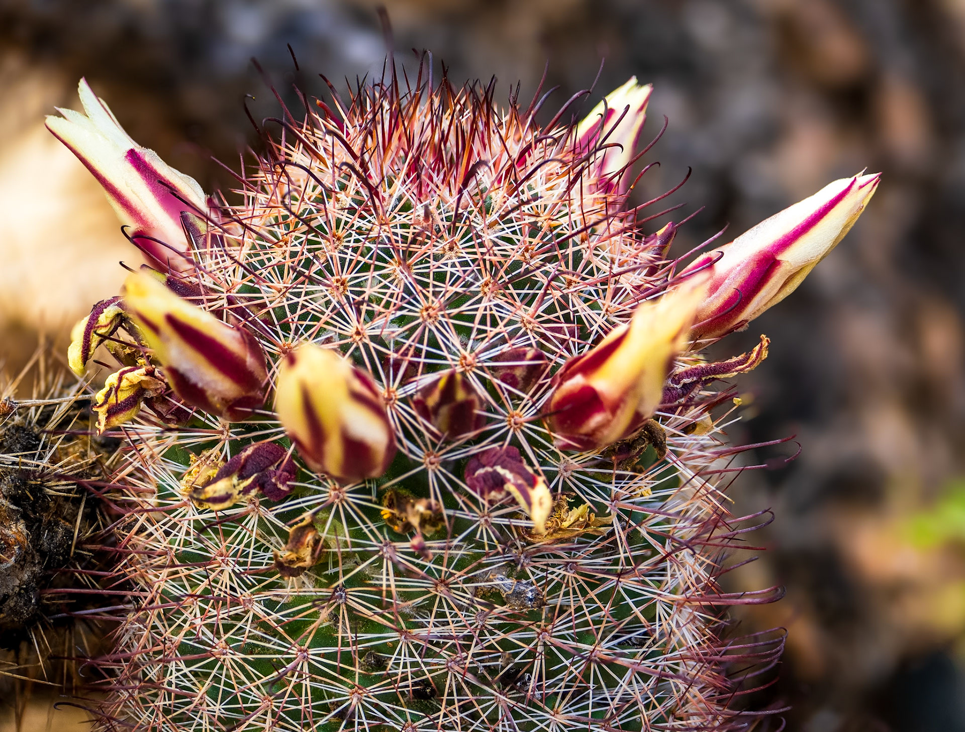
Barrel Cactus in Bloom: Yaqui Flats, Anza-Borrego Desert State Park.
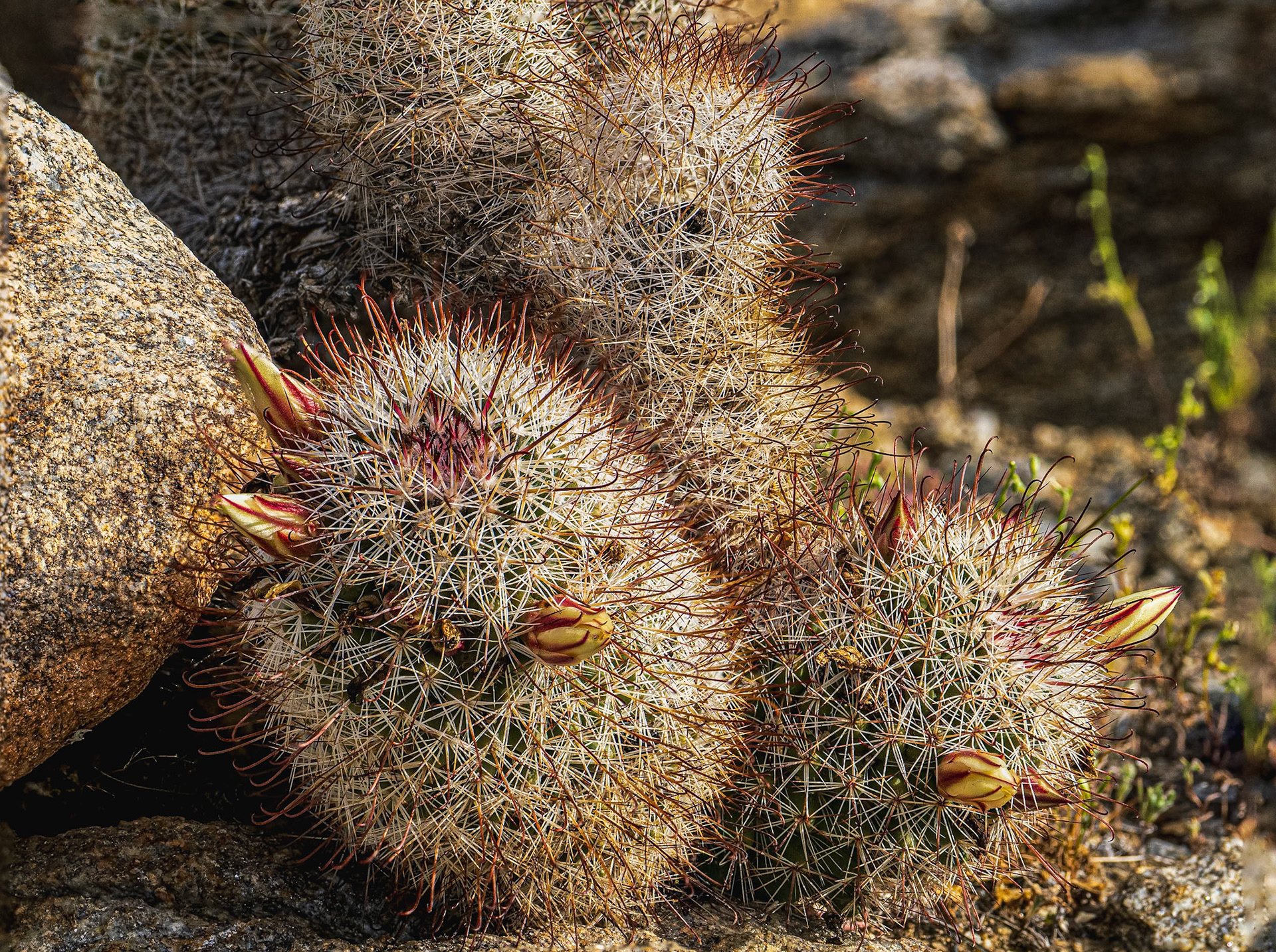
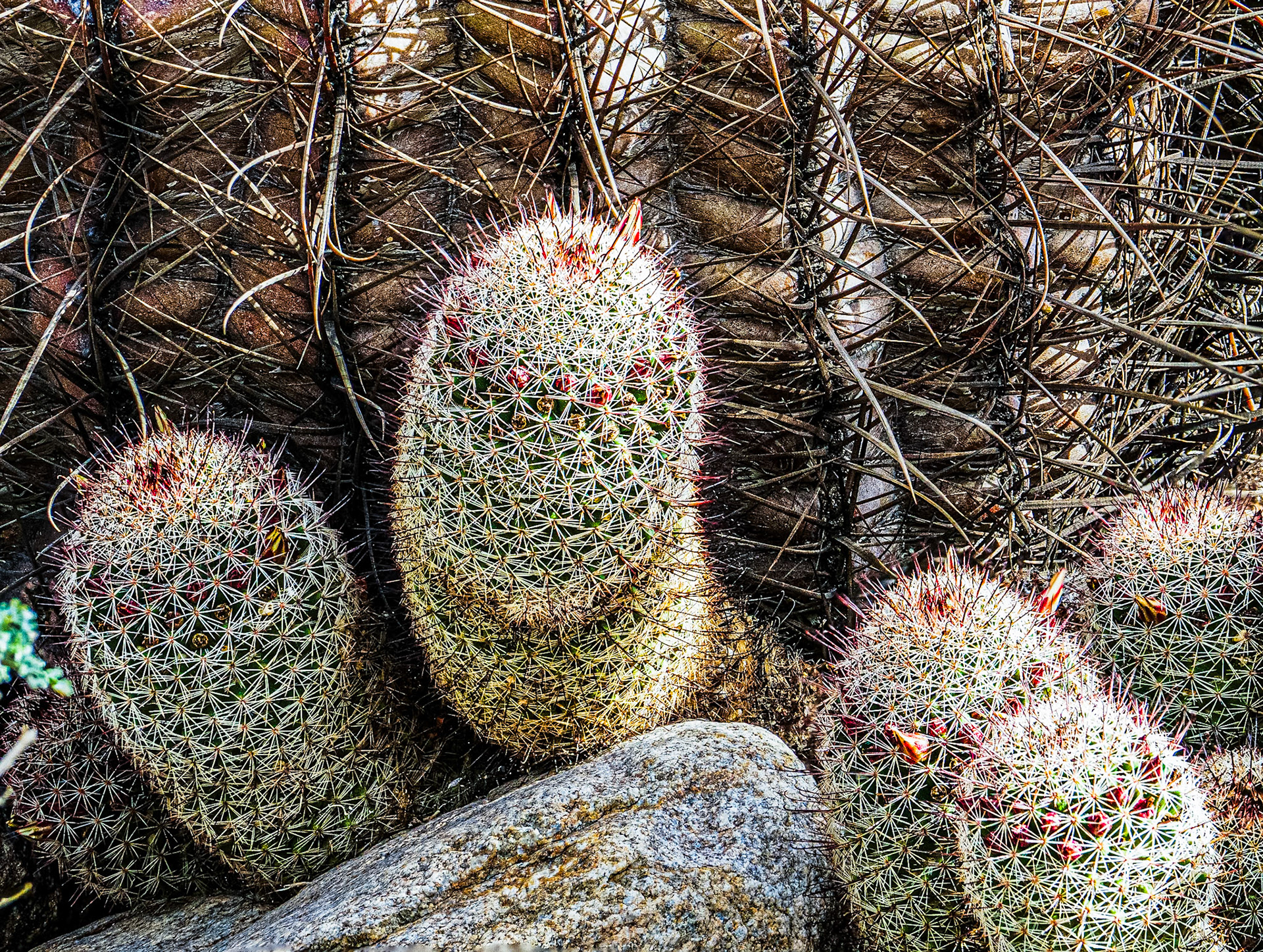
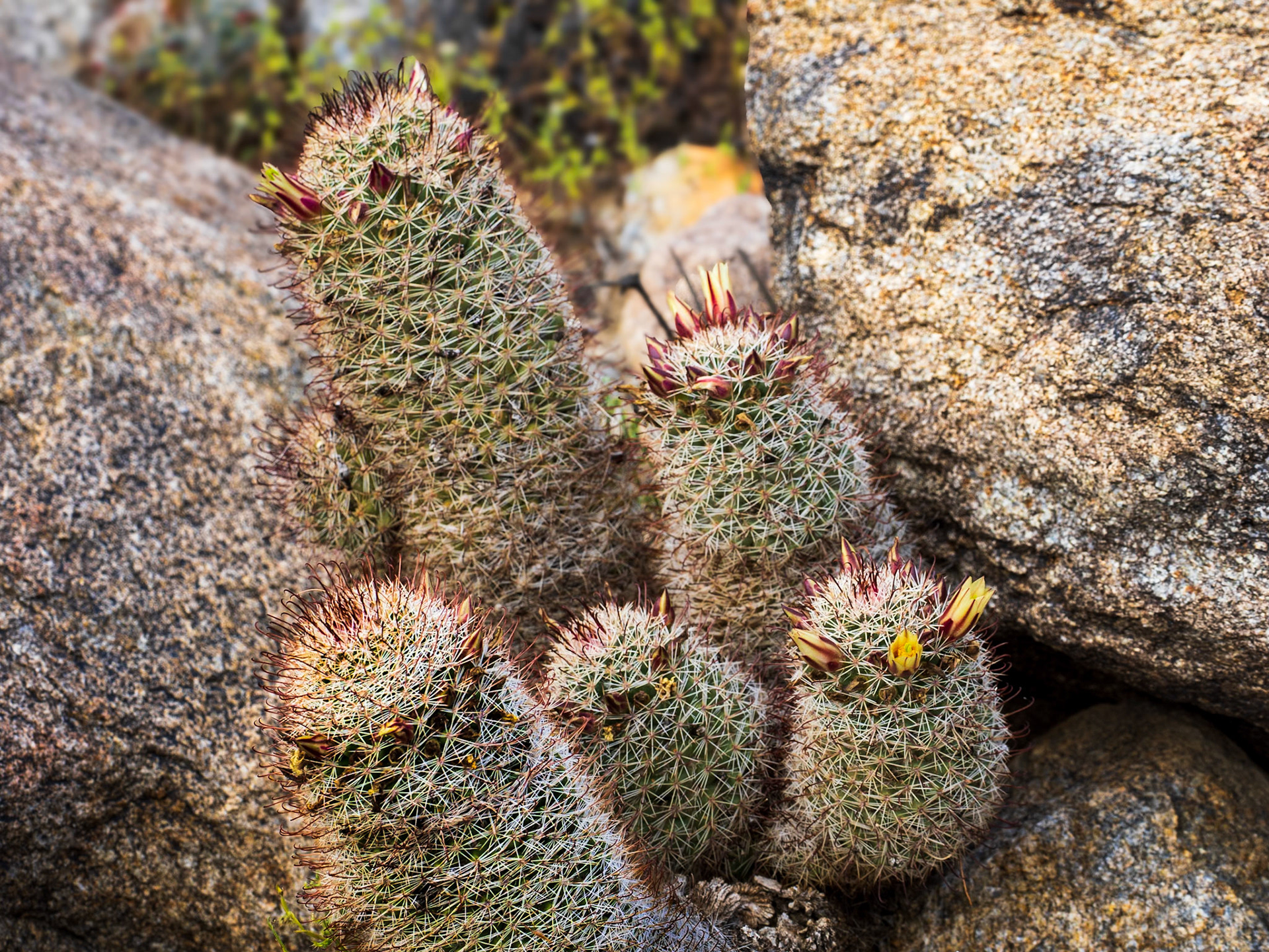
Fishhook Cactus: Yaqui Flats, Anza-Borrego Desert State Park.
Fishhook Cactus: Yaqui Flats, Anza-Borrego Desert State Park.
Fishhook Cactus: Yaqui Flats In the Anza-Borrego State Park.
Fishhook Cactus: Yaqui Flats, Anza-Borrego Desert State Park.
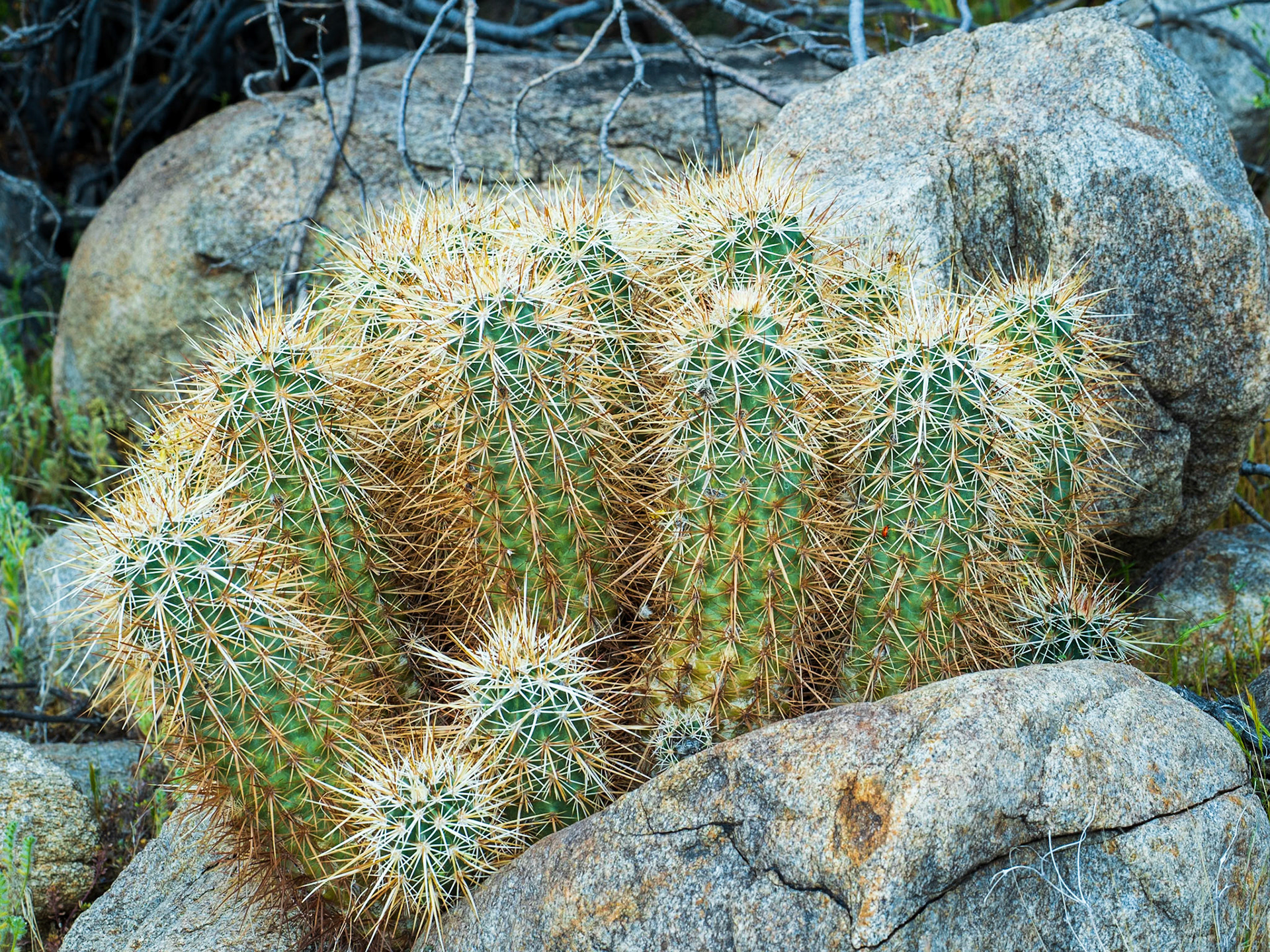
Cactus on the Rocks: Hedgehog cactus at Yaqui Flats In the Anza-Borrego State Park.
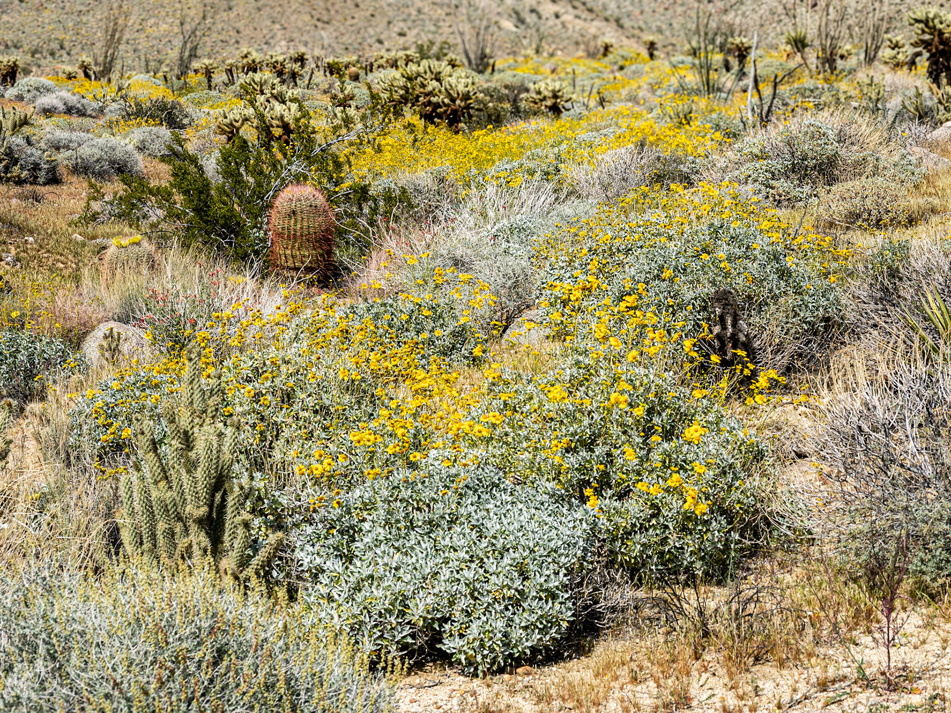
Yellow Desert: Creosote bush,chuparosa, barrel cactus and teddy bear cholla seem to float on a sea of desert dandelion. Yaqui Flats in the Anza-Borrego Desert State Park.
Desert Eden: A diverse desert plant community emerges on a yellow sea of flowering brittlebush at Yaqui Flats in the Anza-Borrego Desert State Park. In additopn to the brittlebush plants pictured in this slice of the desert include barrel cactus, chuparosa, hedgehog cactus, teddy bear cholla, ocotillo and Mojave yucca.
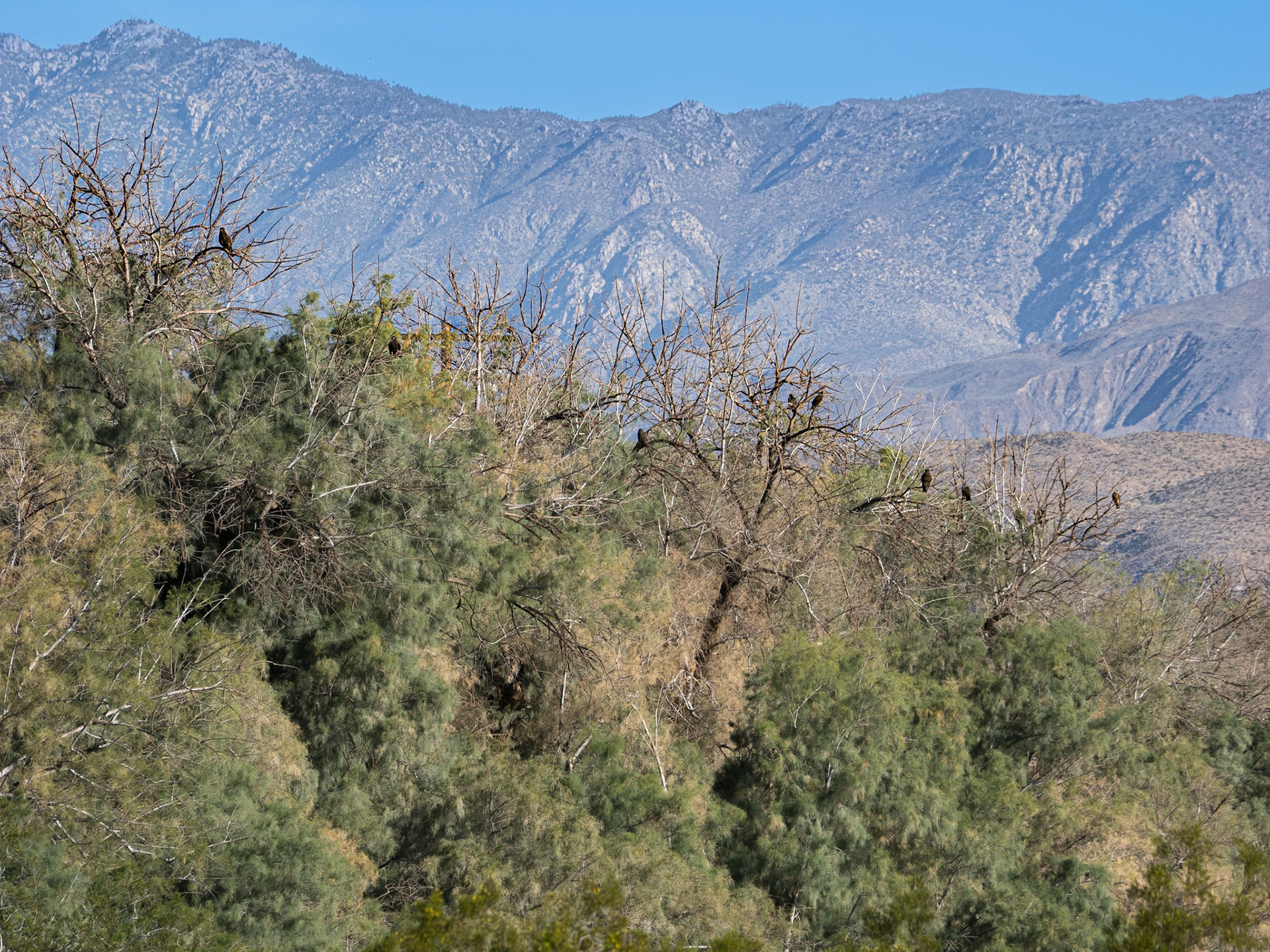
Hawkwatch: Swainson'as hawks roost overnight in a grove of tamarisk trees. They are wating to catch a a lift on a "thermal" of warm morning air to continue their migration north.
A Kettle of Hawks: A group (aka kettle) of Swainsons hawks catch a lift on a "thermal" of warm morning air to continue their migration north.
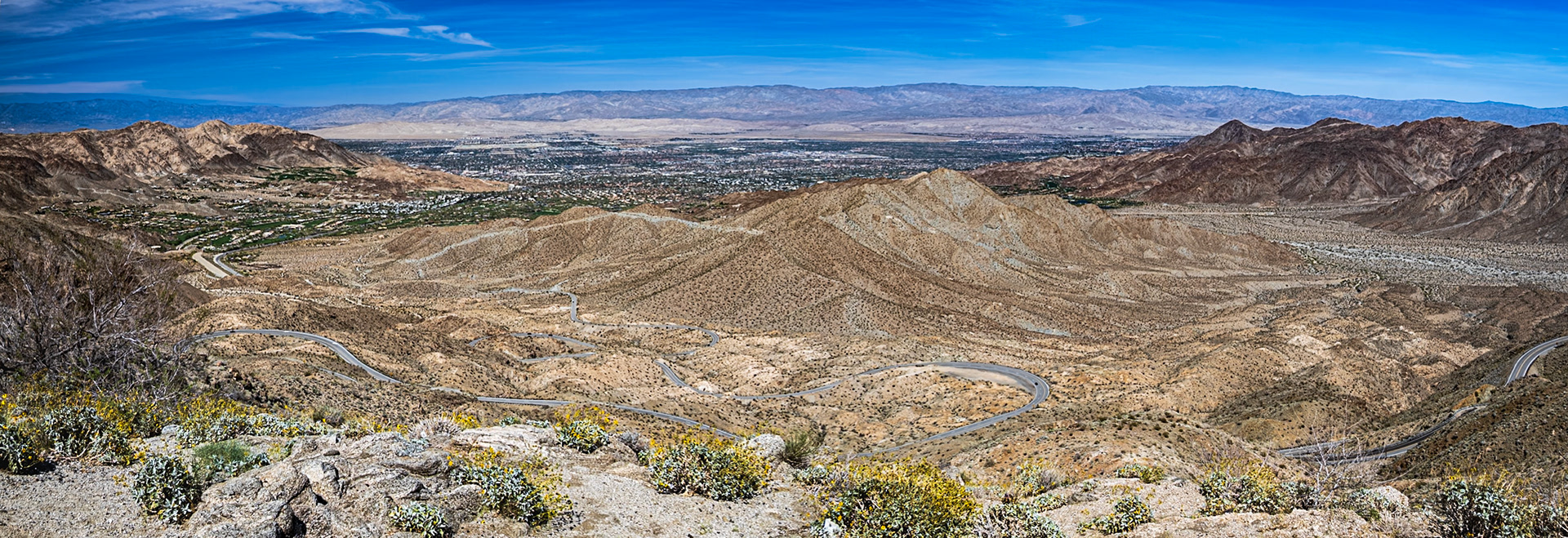
Serpentine Road: A serpentine road winds its way from Palm Desert up to the Santa Rosa and San Jacinto mountains.