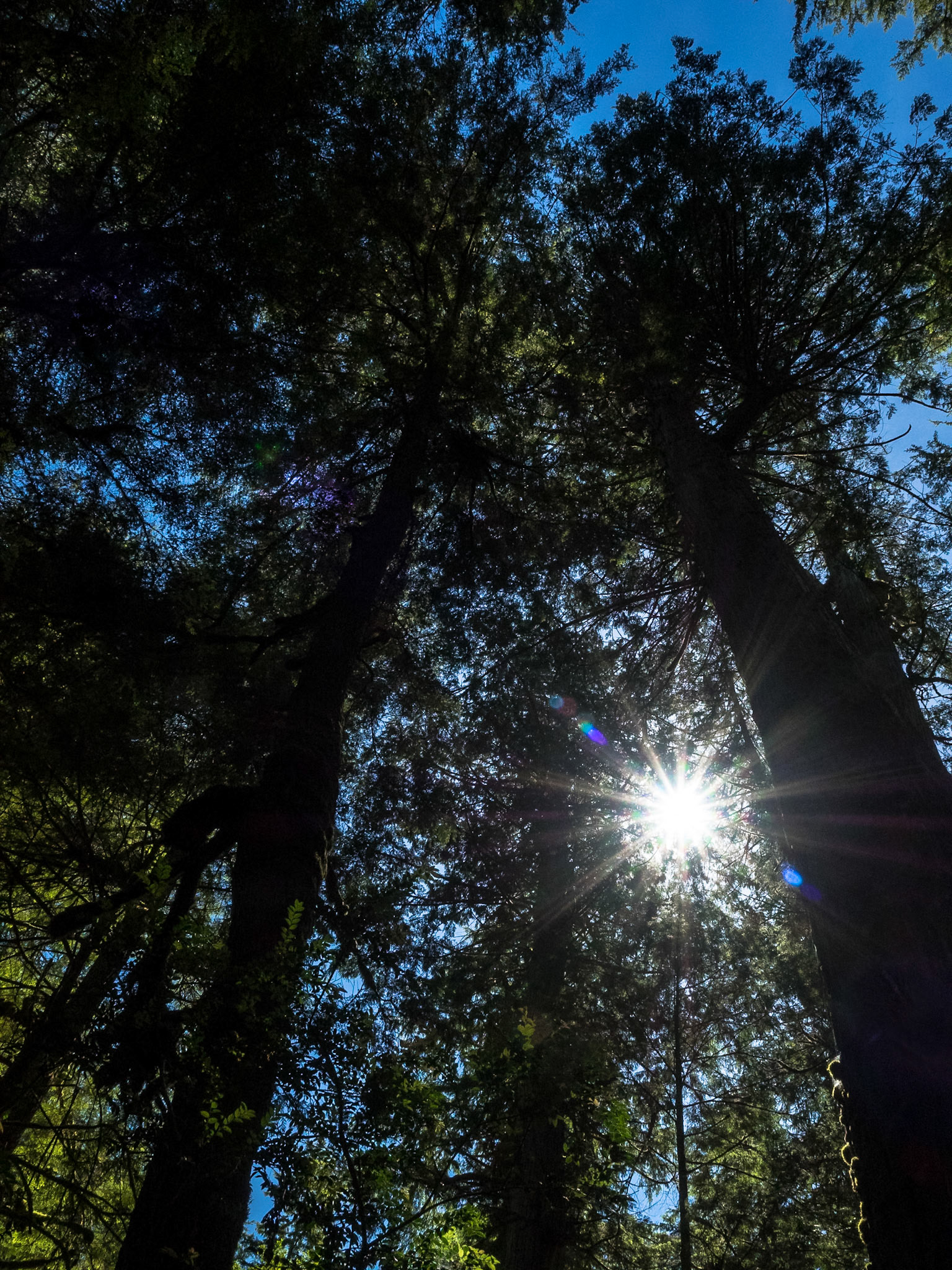
Old Growth Canopy: Light filters through the high canopy of a mixed old-growth forest of western hemlock and western red cedar on the trail from Lake Ozette to the Olympic National Park Coast and Marine Sancturary.
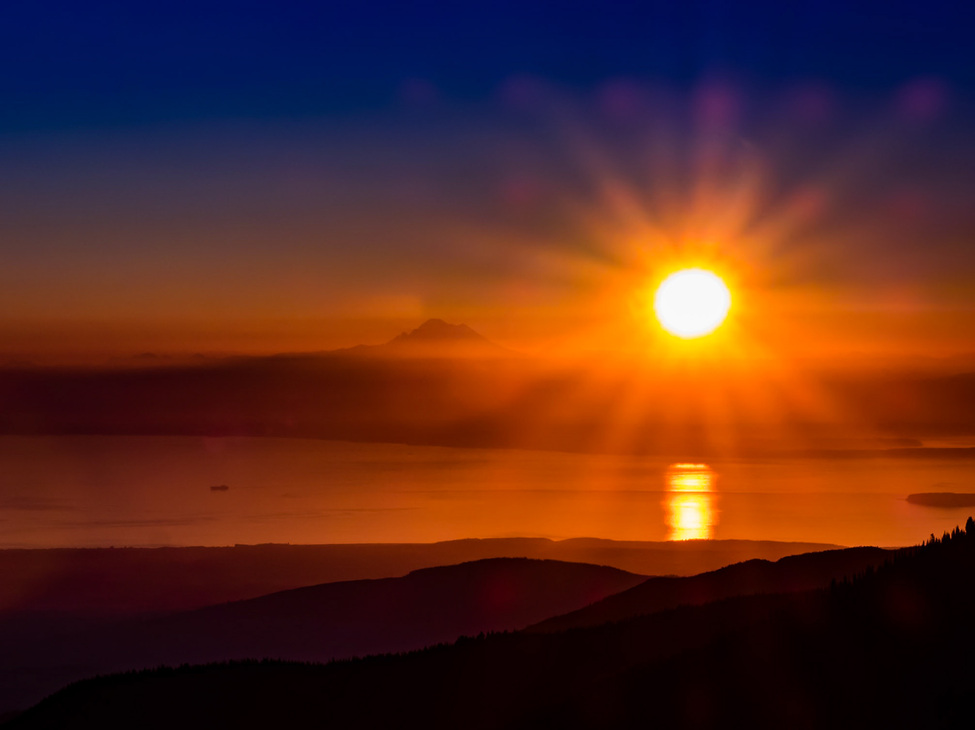
Sunrise: Over Mt. Baker, the Eastern Straits of Juan de Fuca and the foothills of the Olympic Mountains.
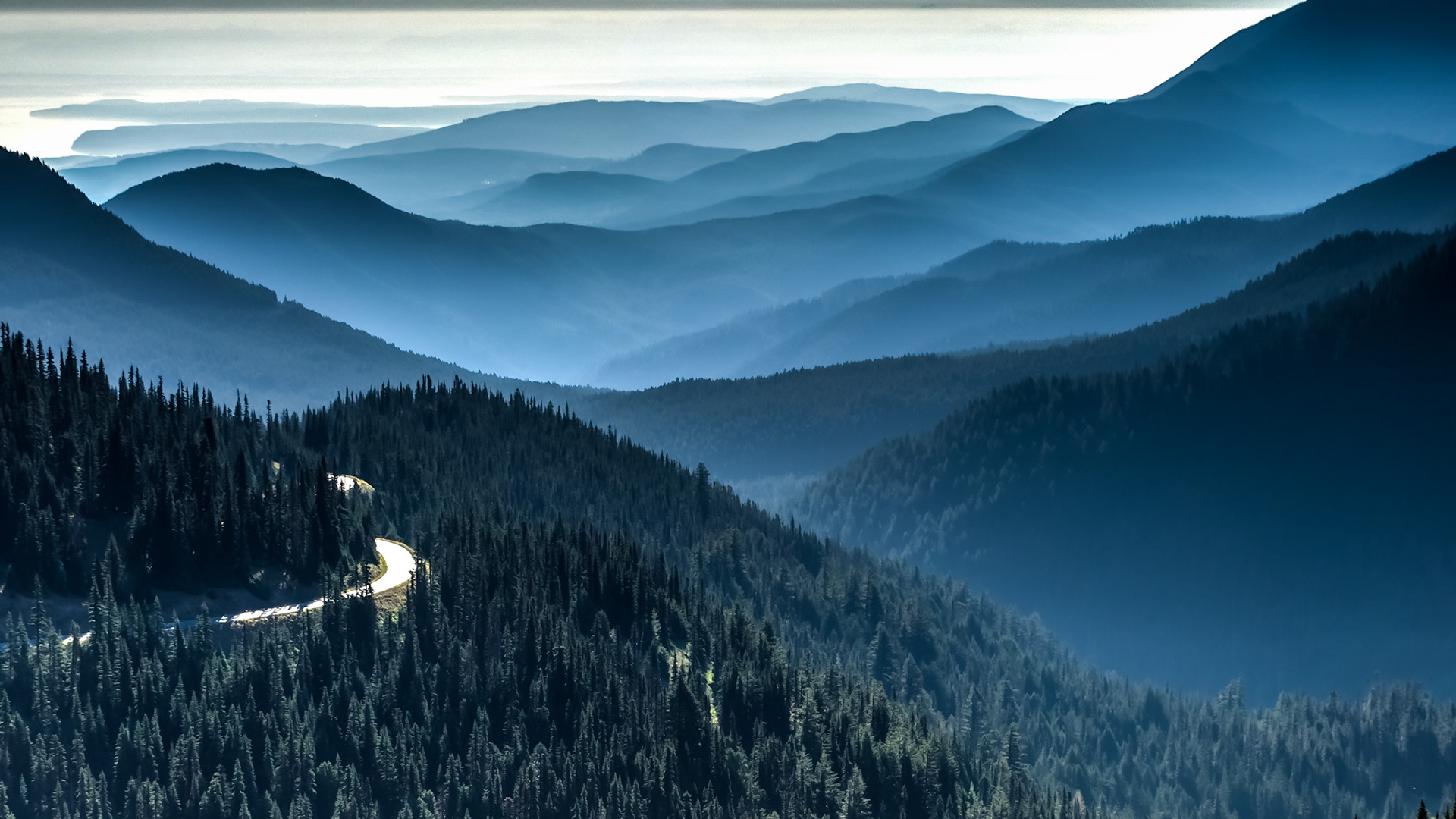
Mountains to the Sea: The road from Hurricane Ridge descends about 5,200 feet the through the foothills of the Olympic Mountains to the Straits of Juan de Fuca near Port Angeles WA.
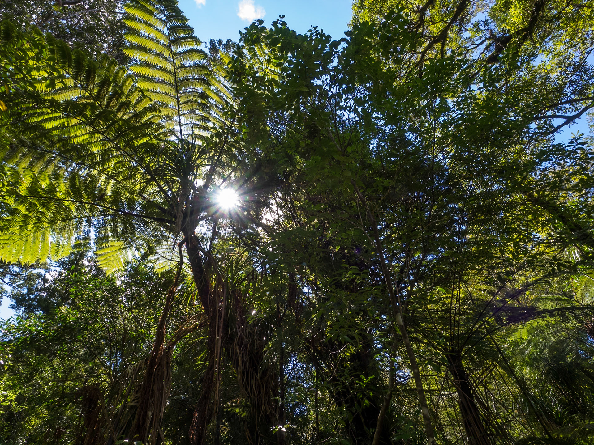
Sun Breaking through the Canopy: In the Waipoua Forest NZ.
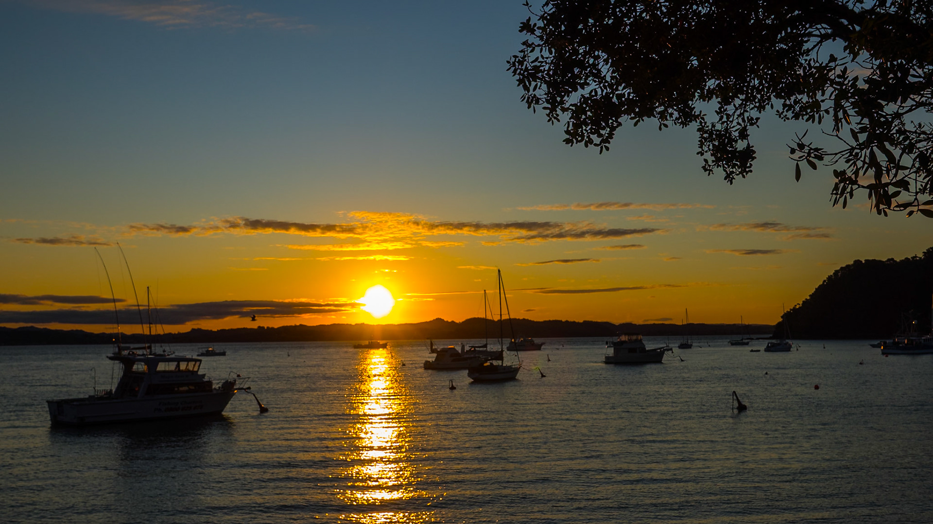
Sunset on the Strand: In Russell NZ near the Duke of Marlborough Hotel
Entering Abel Tasman National Park: At Marahau NZ
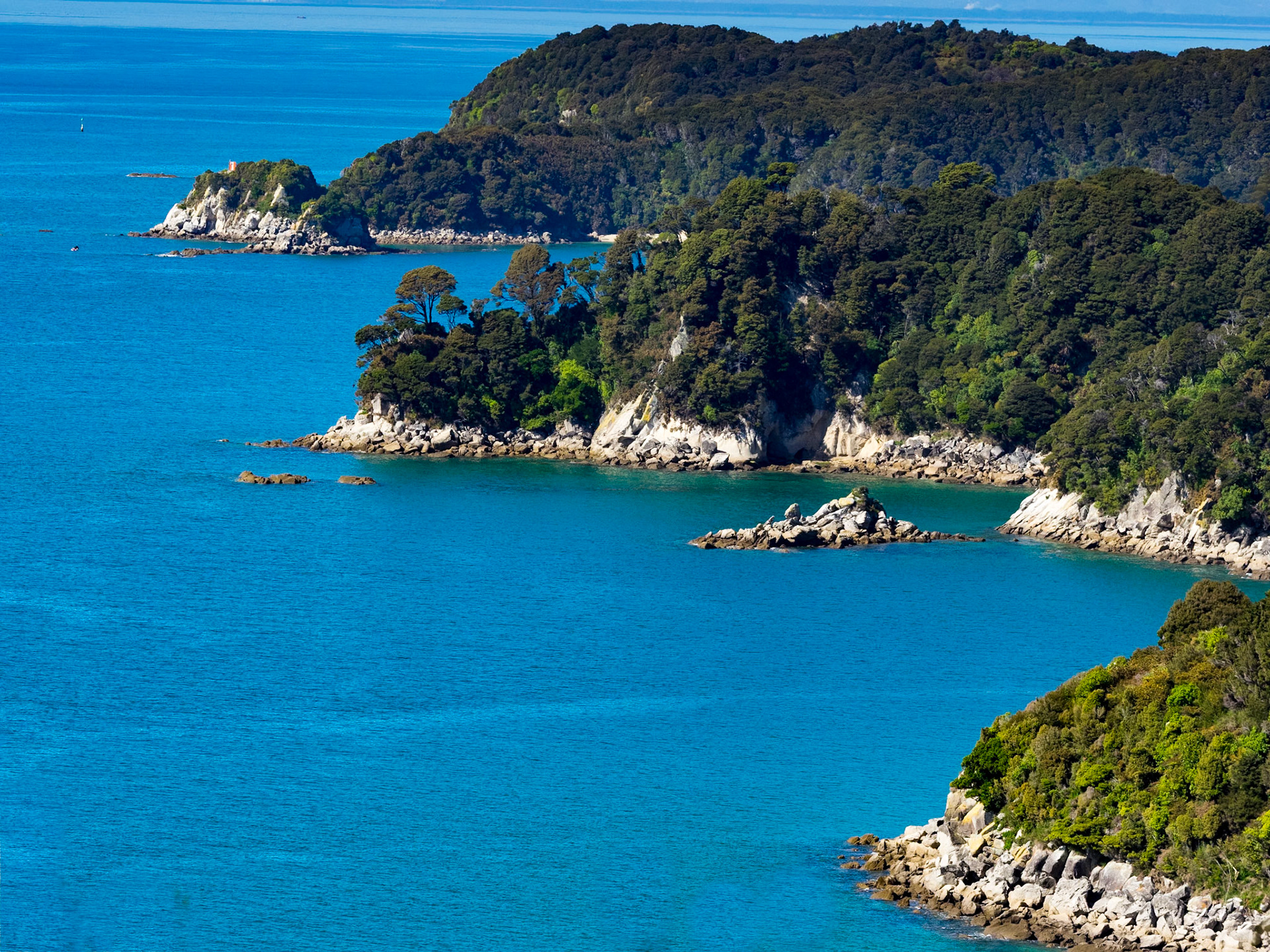
North Head, Pitt Head and Tasman Bay: At Abel Tasman National Park NZ
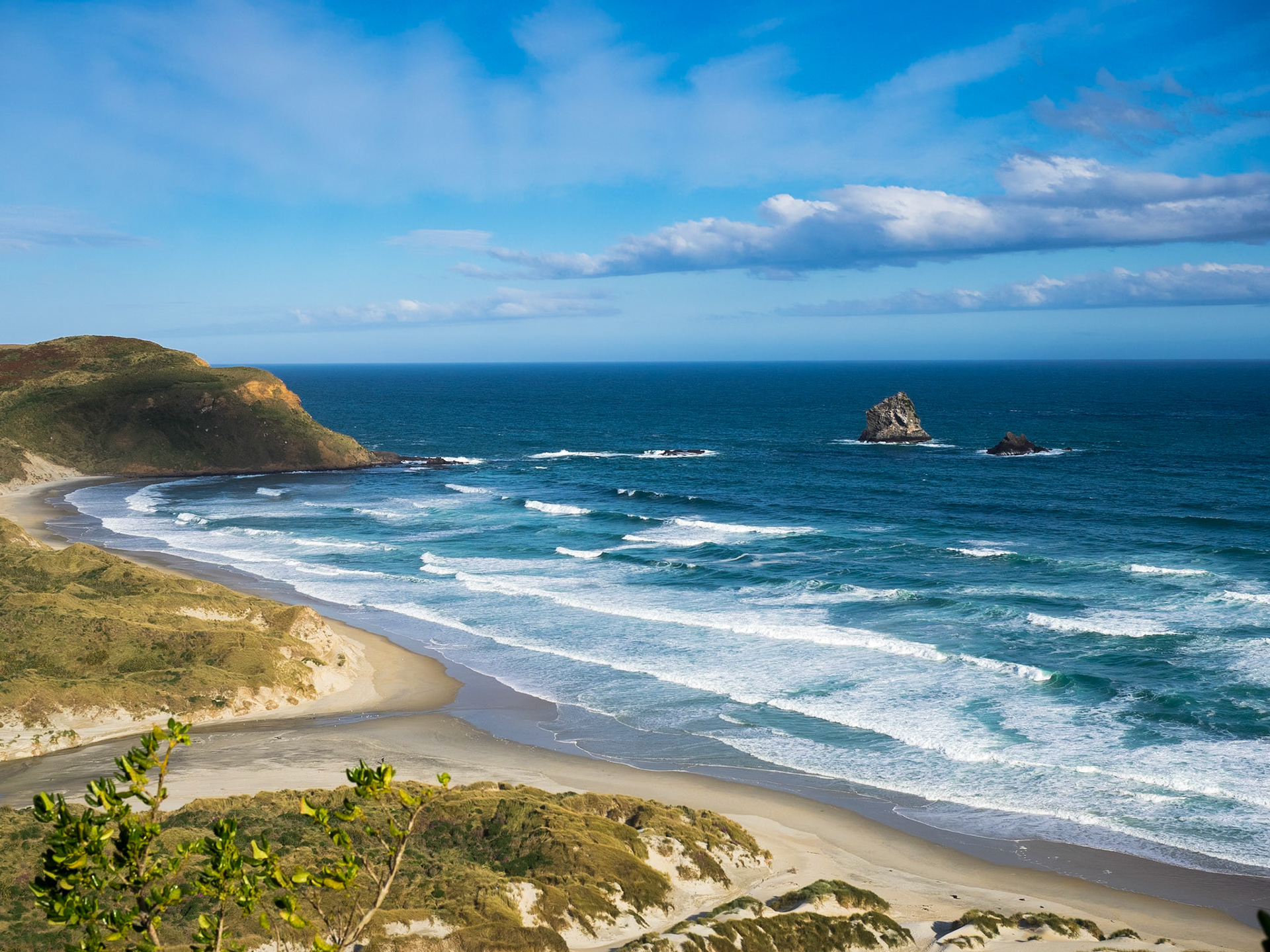
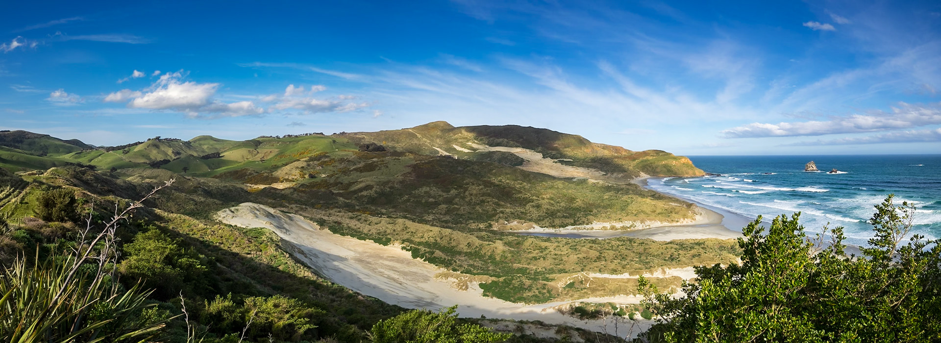
Sandfly Bay and Beach: A penguin viewing hide sits above the far end of the beach.
The Dunes at Sandfly Bay: Facing almost due south, Sandfly Bay gets its name from the flying sand carried on strong Antarctic winds.
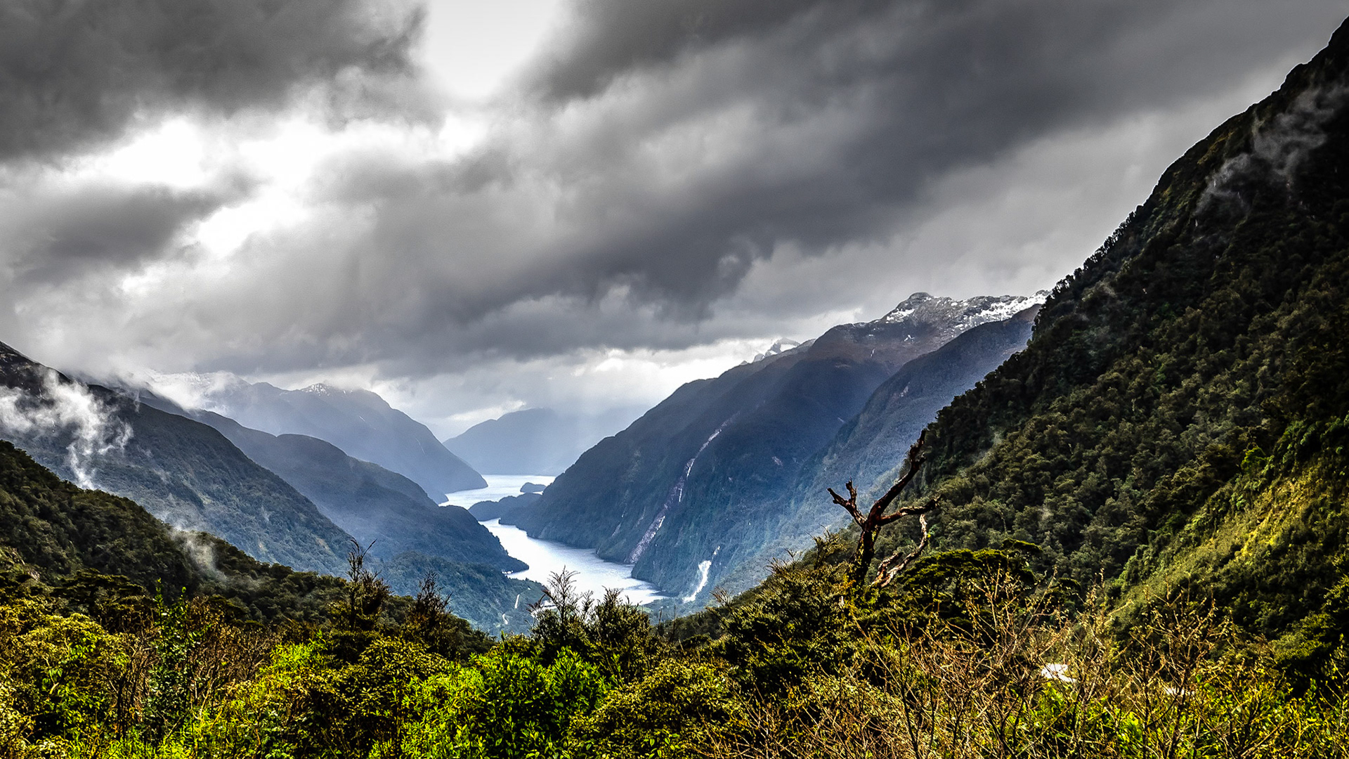
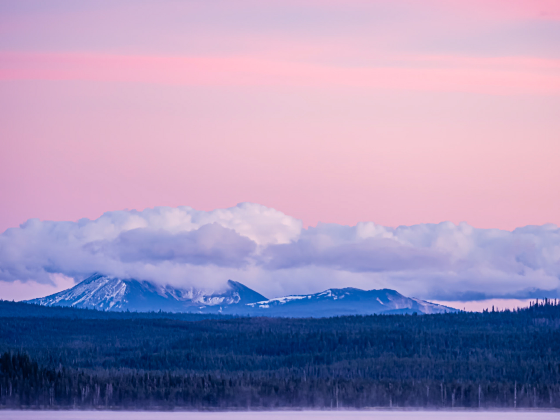
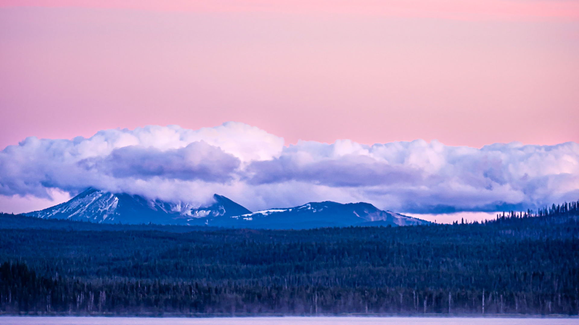
Rakituma - the Threatening Sky - Over Doubtful Sound NZ: Doubtful Sound on a stormy day, flanked by snow-capped peaks and rain-driven cascades. Viewed from the Wilmot Pass Road.
Misty Shoreline, Doubtful Sound NZ: Forest and mountains of Doubtful Sound slumber under a blanket of cool fog and mist, emerging for a moment as our vessel drifts by and then returning to undiisturbed solitude.
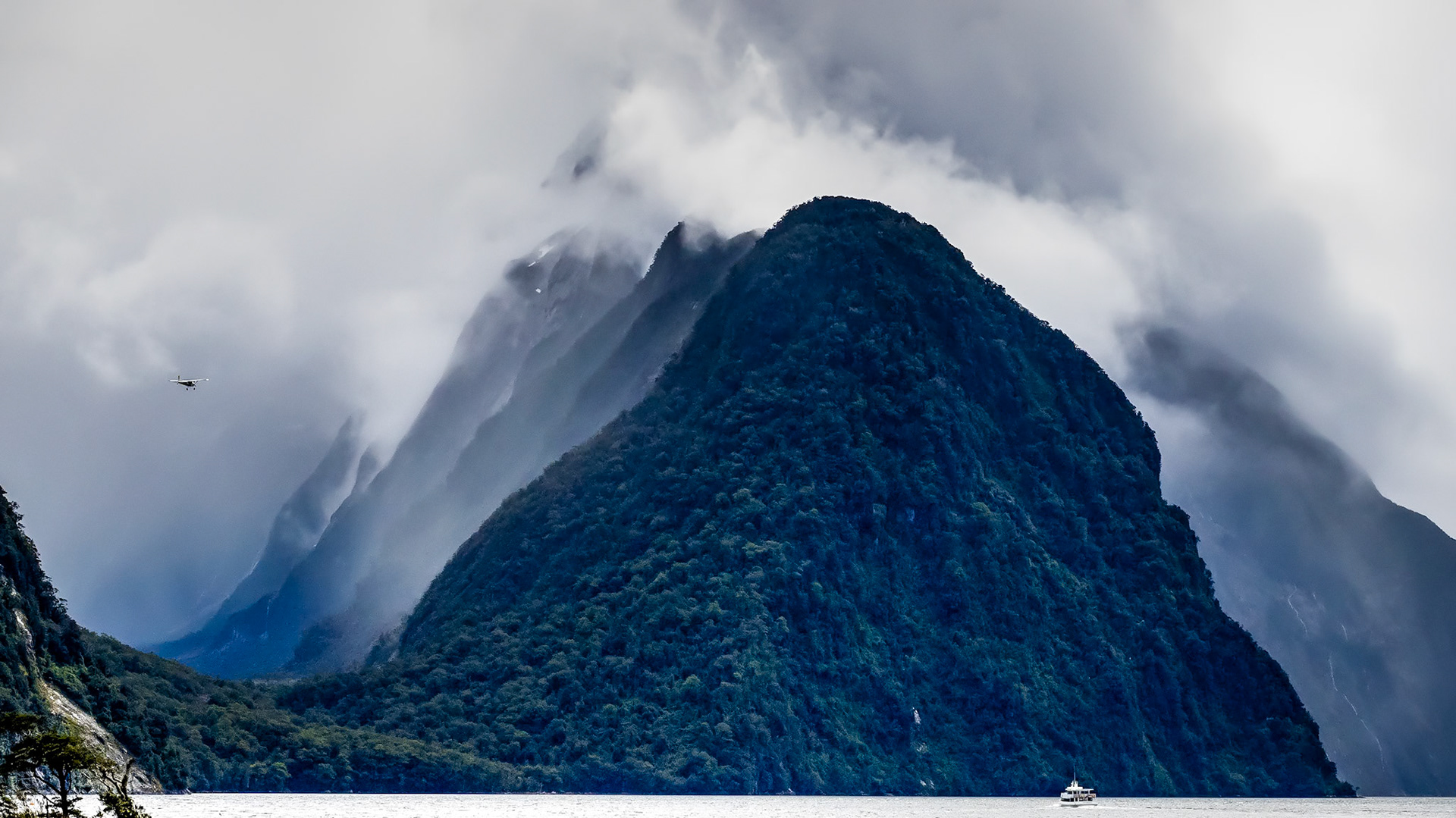
Mitre Peak, Milford Sound NZ: Cloud-shrouded Mitre Peak sits behind its smaller sister Footstool Mountain and is flanked on the left by Sinbad Gully, a hanging valley.
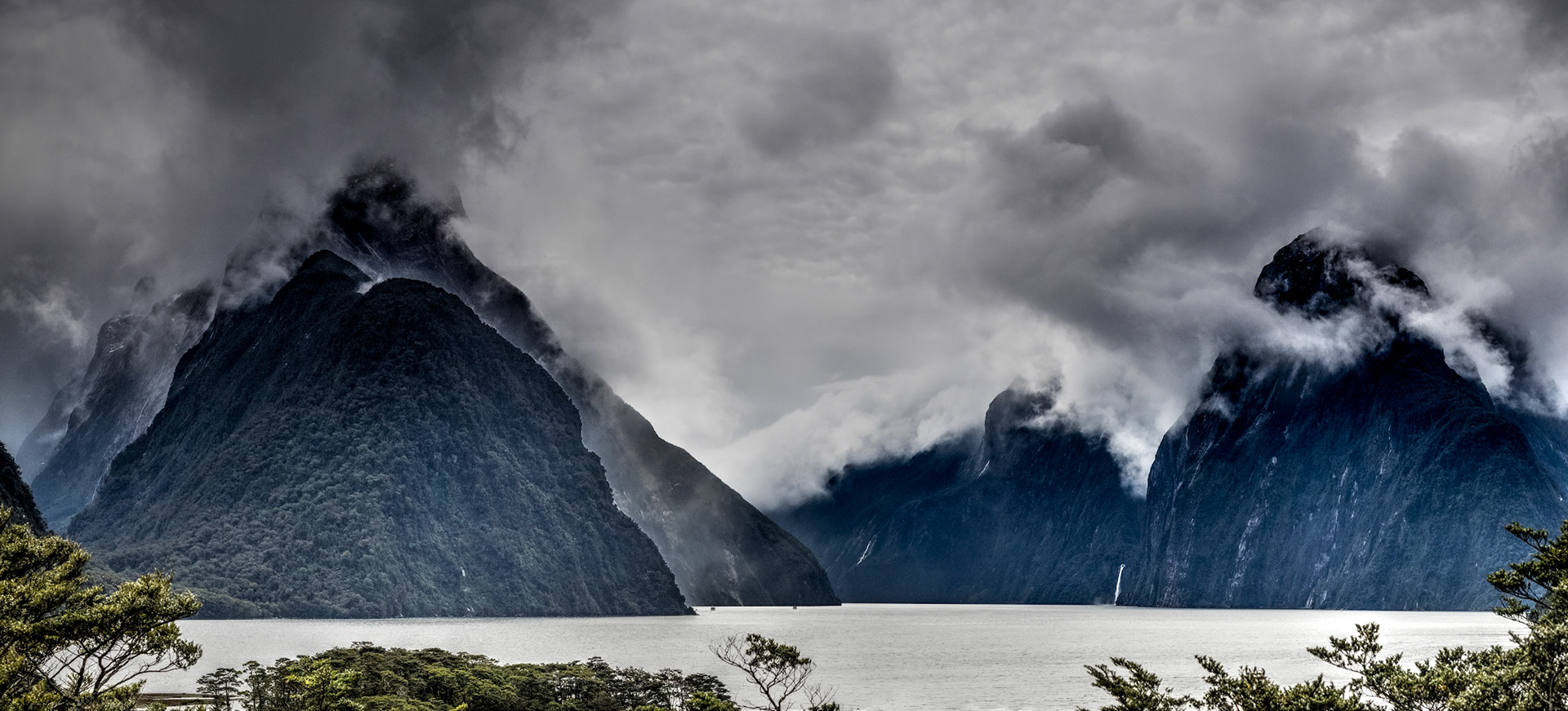
Milford Sound NZ: Milfourd Sound is flanked by 1,683-meter Mitre Peak on the left and the 1,300-meter Lion Peak on the right. The 151-meter Stirling Falls exits a hanging valley at the foot of Lion Peak.
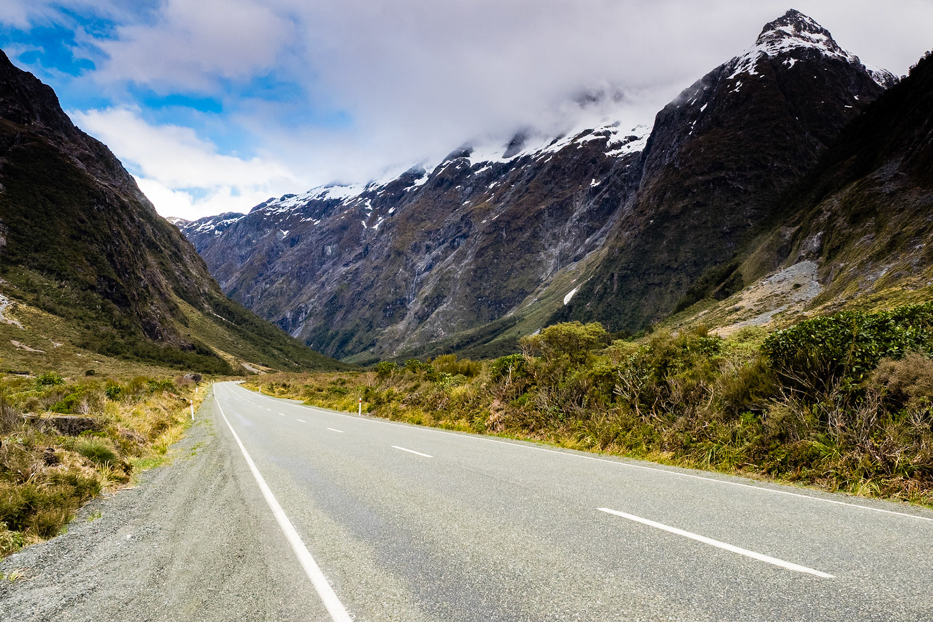
Highway to Middle Earth, Hollyford River Valley NZ: The Miilford Sound Highway passes through the Hollyford River Valley guarded by snow dusted peaks of the Southern Alps.
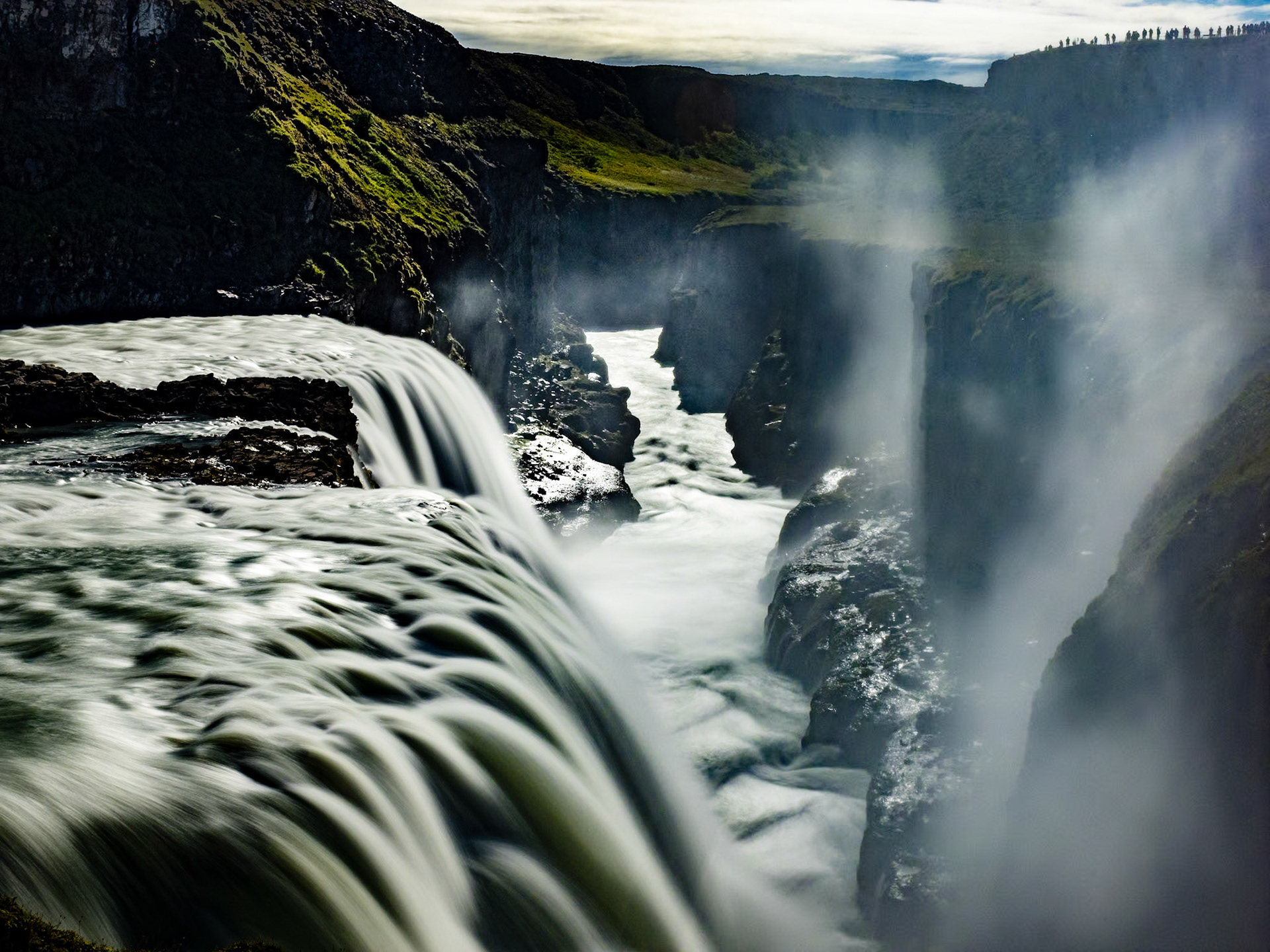
Into the Chasm at Gullfoss, Iceland: The lower of Gullfoss' two falls cascades into a steep ravine at the head of the Golden Circle Loop near Reykjavik Iceland.
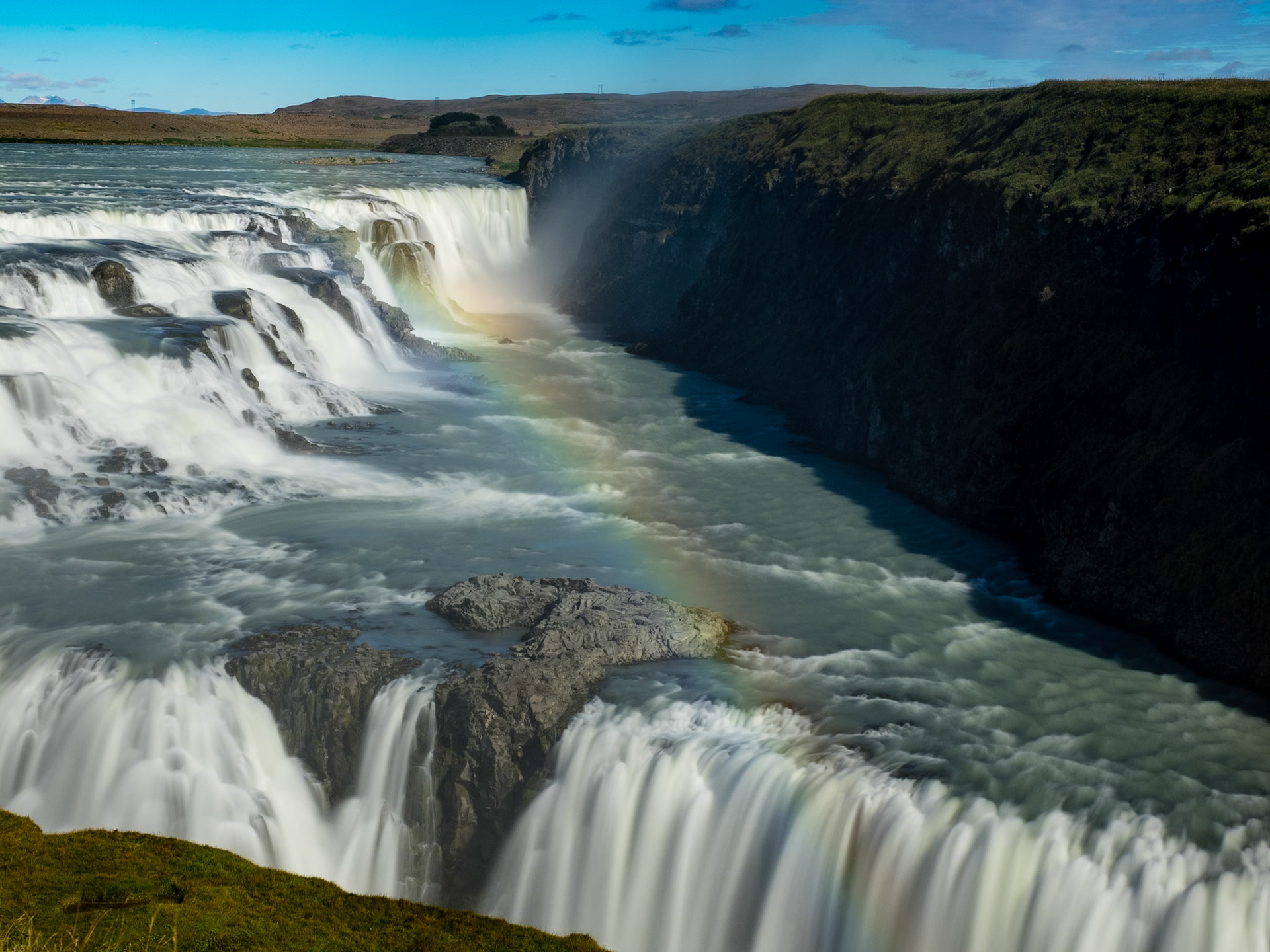
Rainbow Over Gullfoss, Golden Circle Iceland: Two cascades in the Hvita River form Gullfoss (Golden Falls) near Reykjavik Iceland.
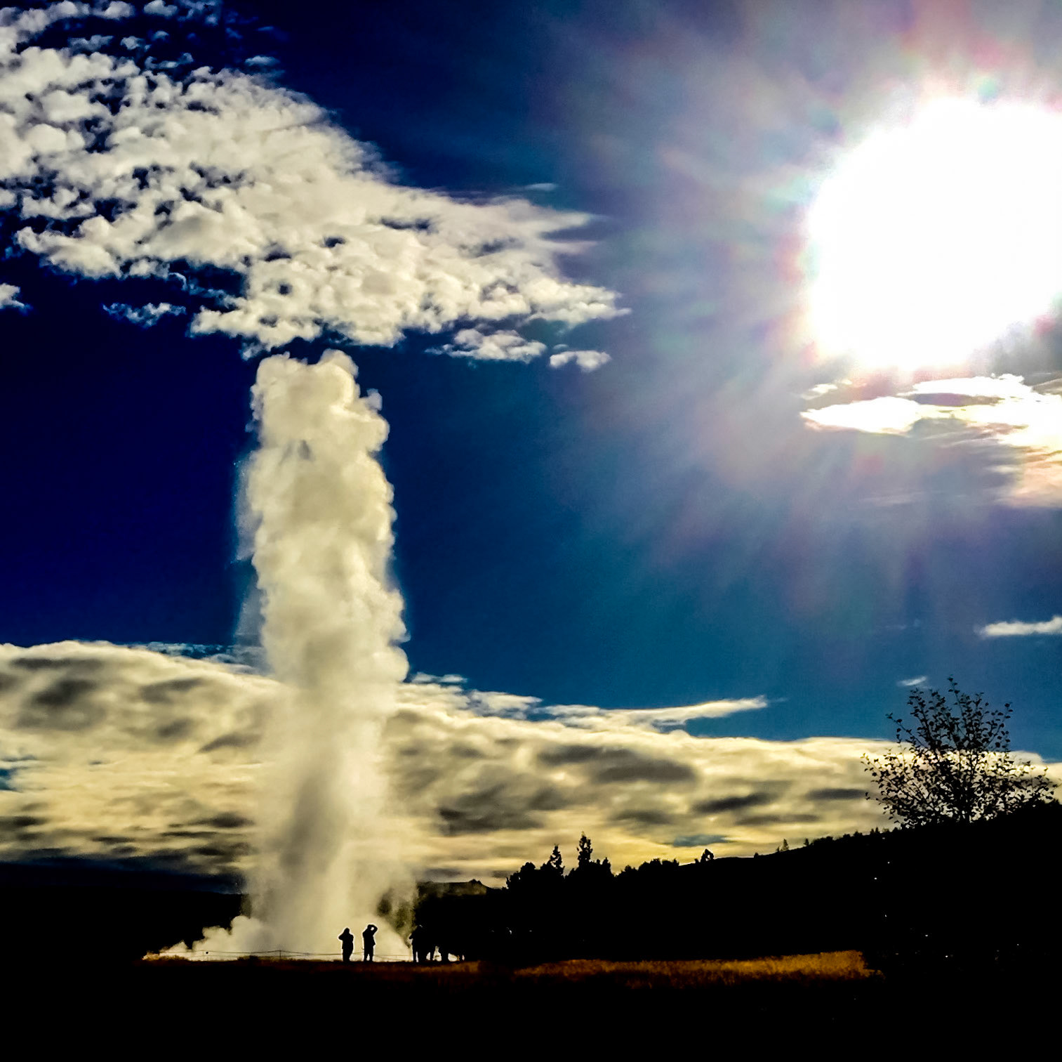
Stokkur Geyser Iceland - Reaching for Sun: Stokkur Geyser spouts regularly at the Geysir Center on the Golden Circle near Reykjavik Iceland.
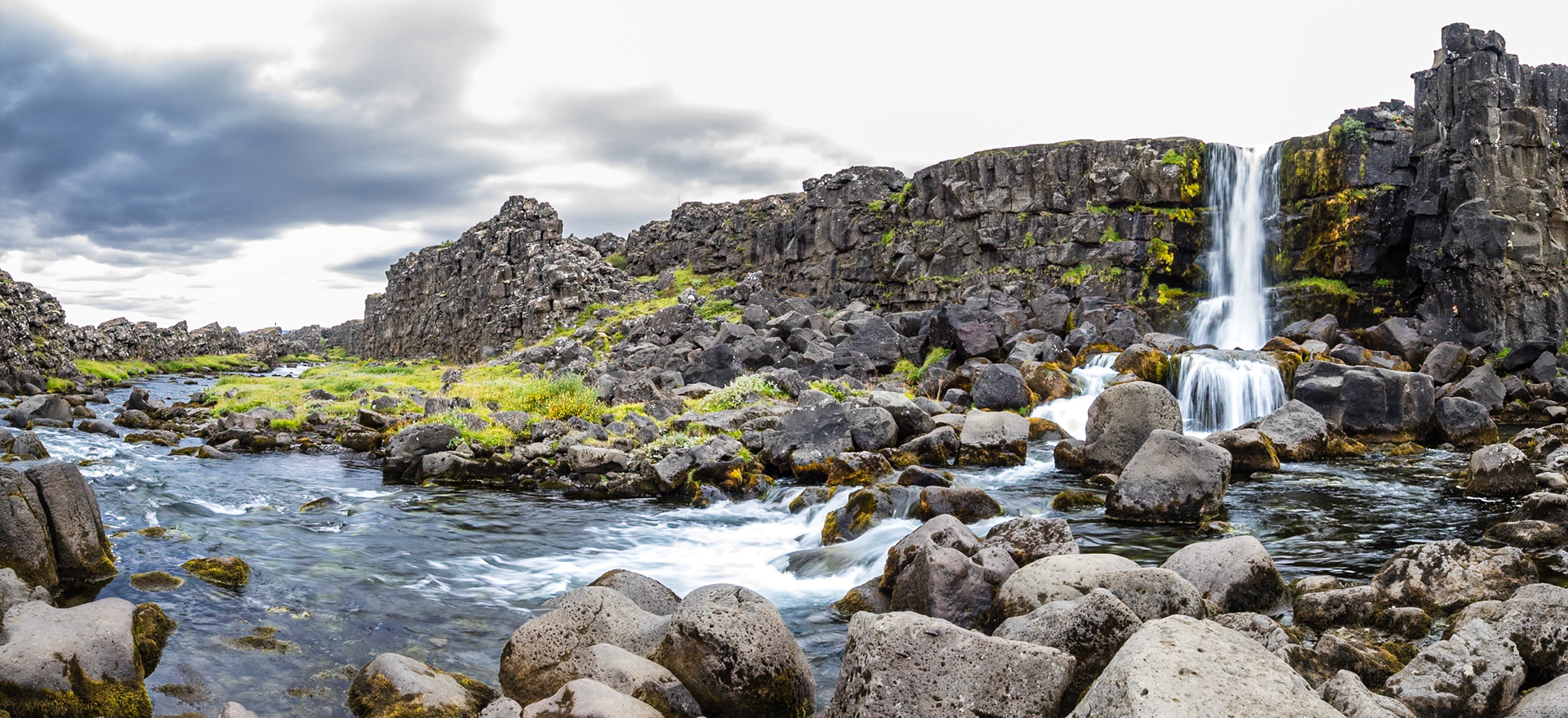
Oxara River and Waterfall, Pingvellir Iceland: The Oxara River cascades into a fissure that descends to the floor of the rift valley at Pingvellir.
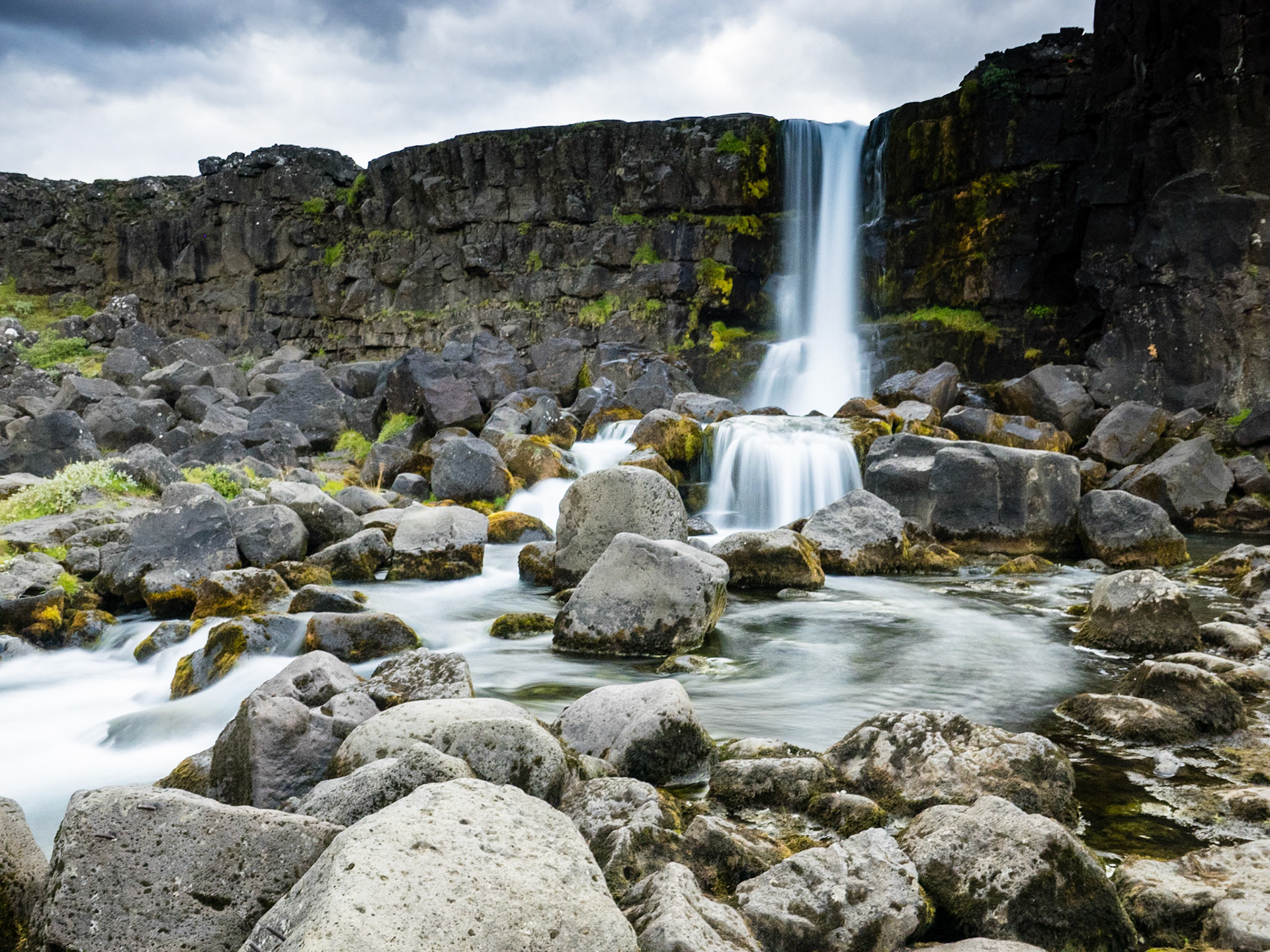
Oxara Waterfall, Pingvellir Iceland: The Oxara River flows off of the western (North American) plate over a basalt cliff en route to the rift valley floor at Pingvellir.
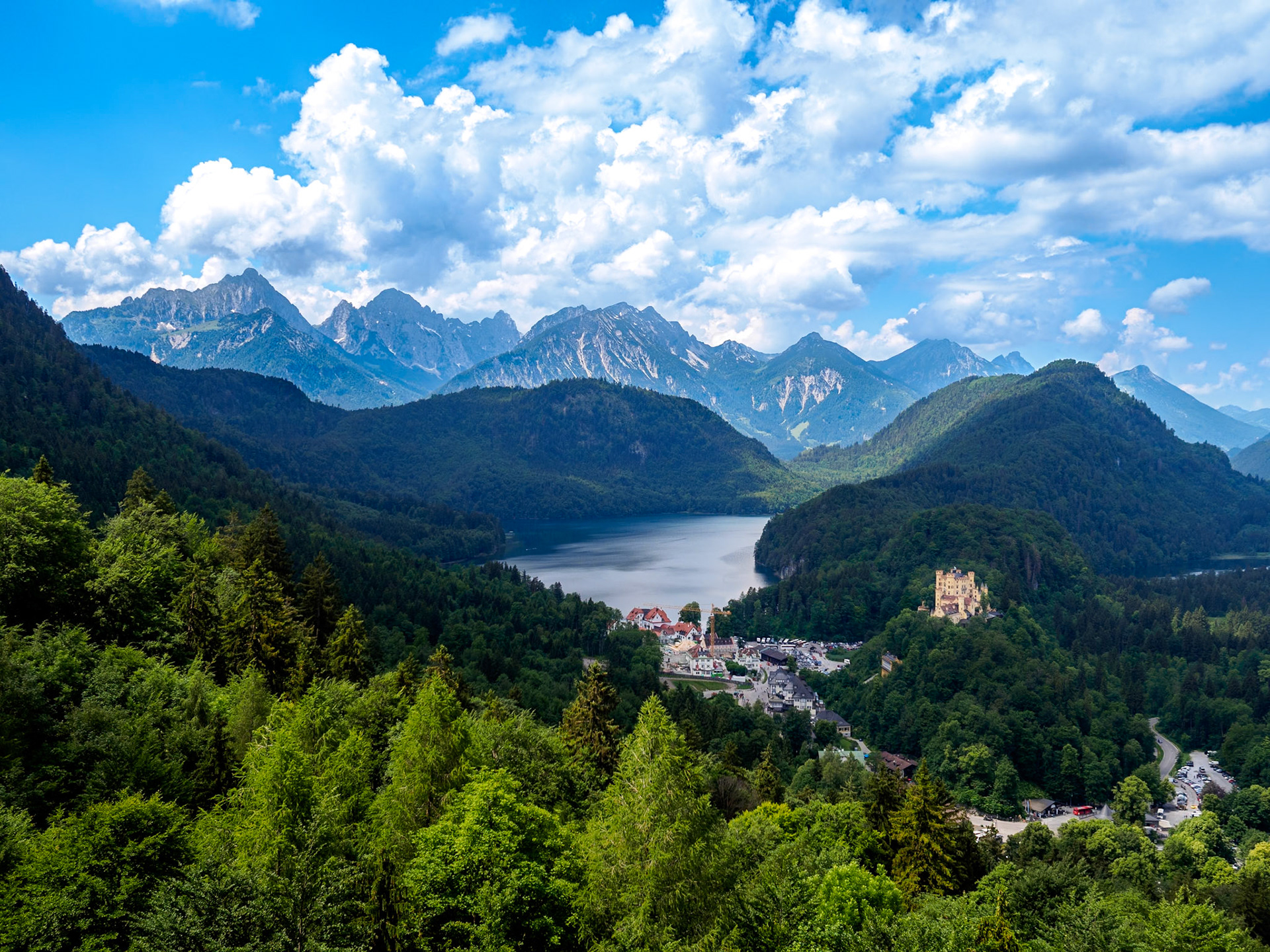
Hohenschwangau and Alpsee Lake: Hohenschwangau Village and Castle viewed from Neuschwanstein Castle
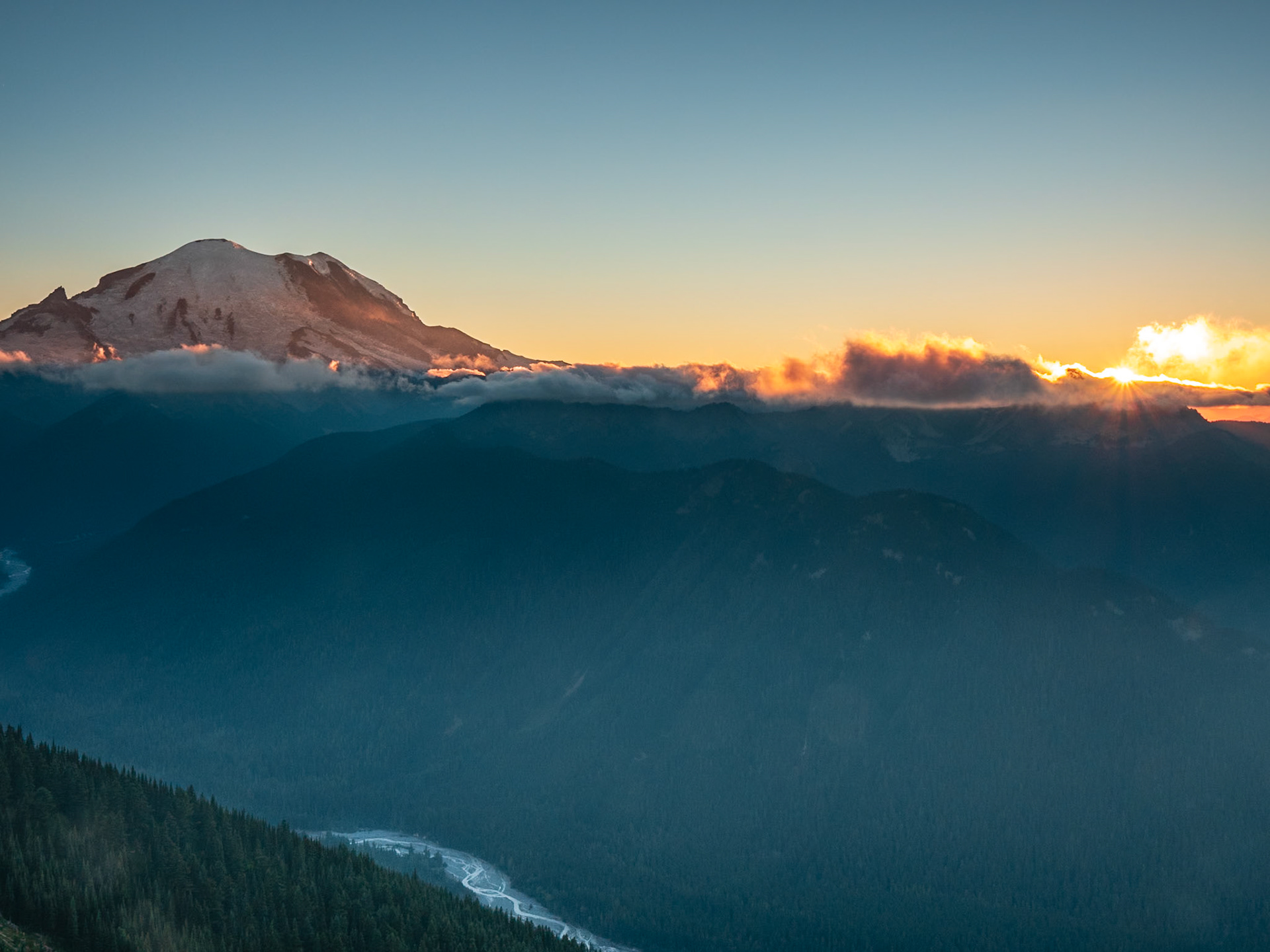
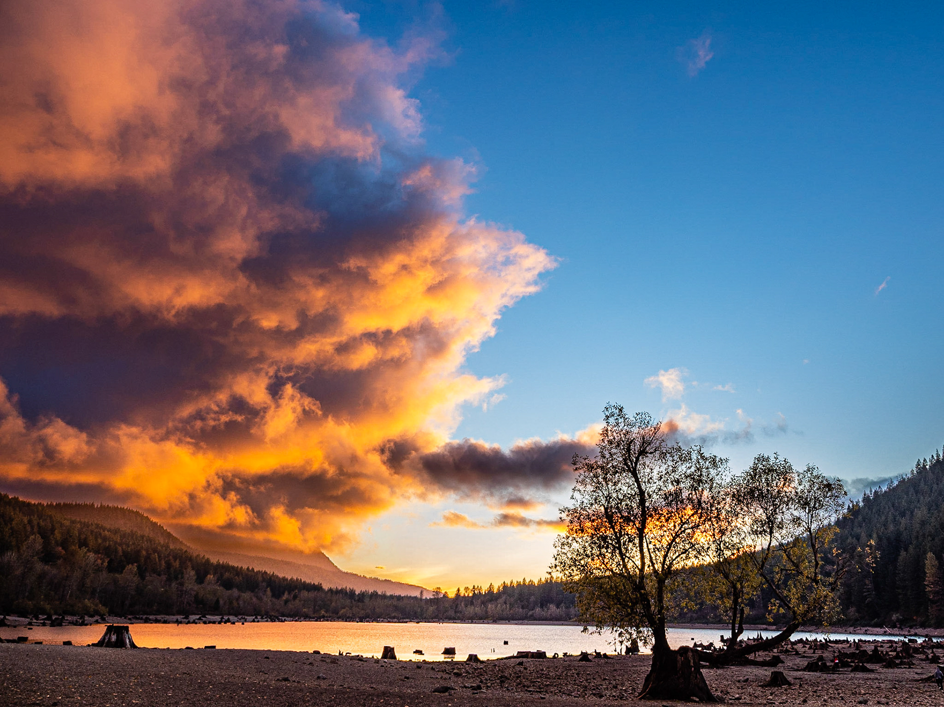
Mt. Rainier Sunset: Viewed from the top of Crystal Mountain, Mt. Rainier basks in a sunset filtered through low clouds.
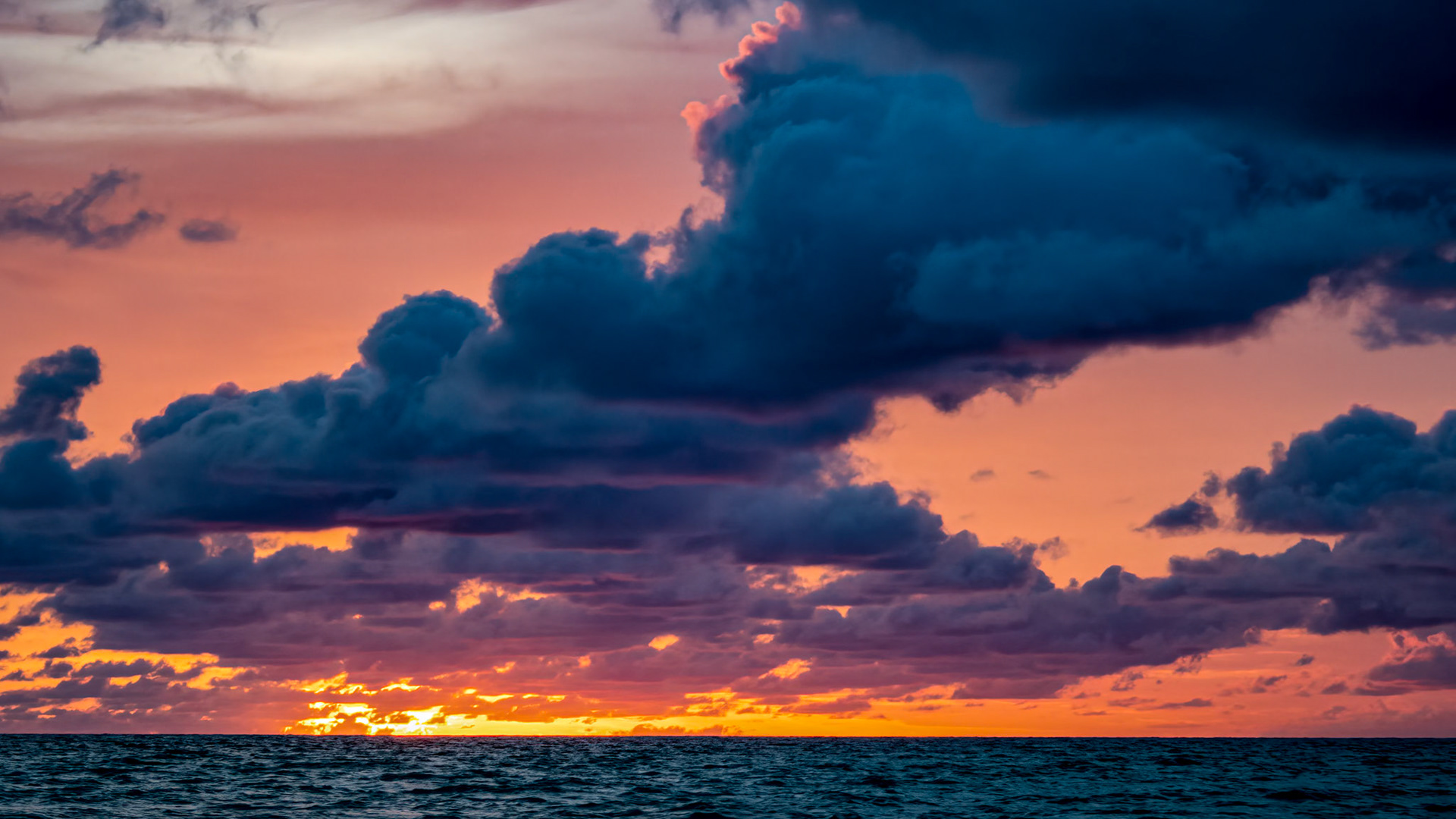
Dawn on South Andros Island, Bahamas: OLYMPUS DIGITAL CAMERA
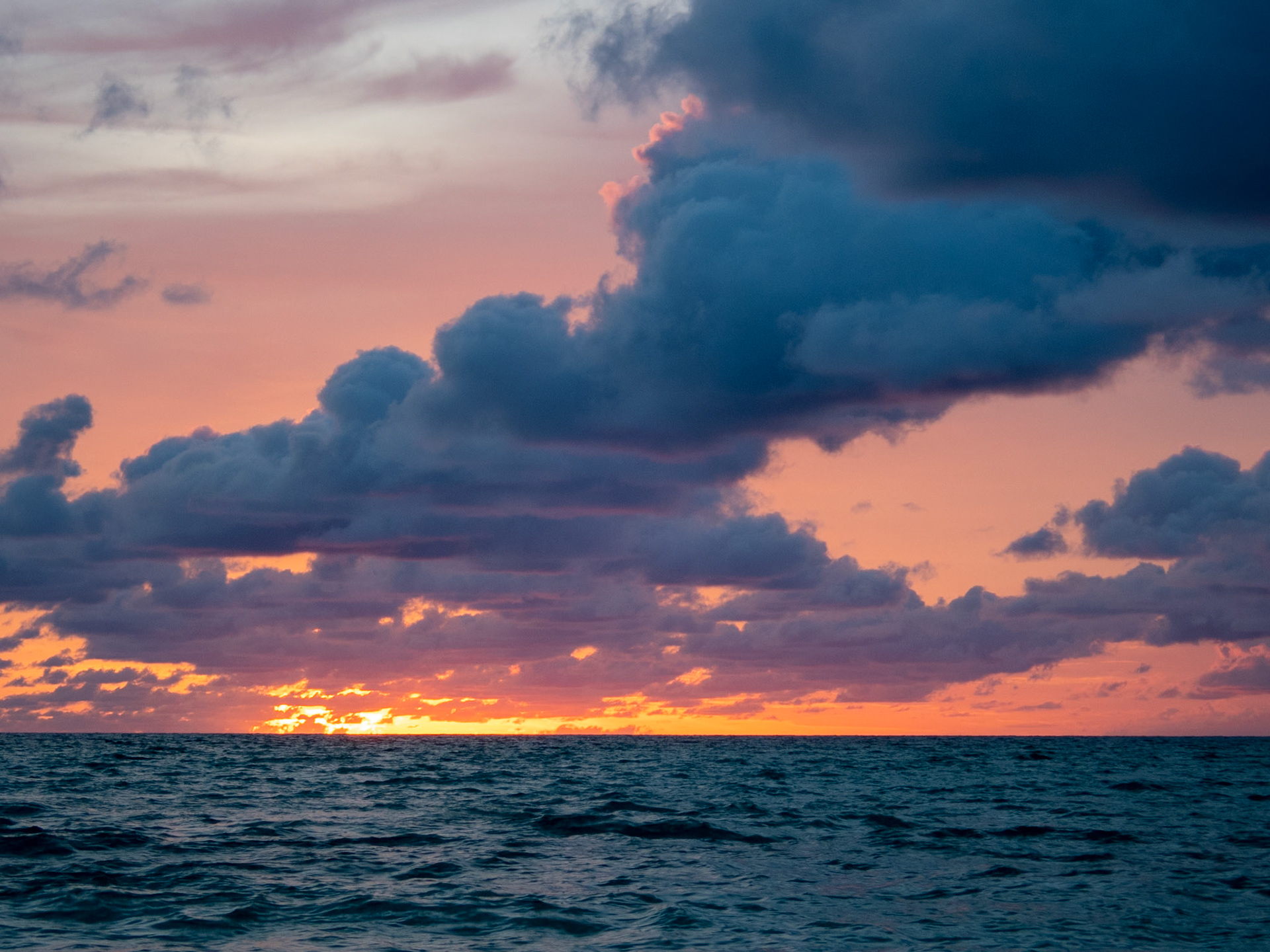
Dawn on South Andros Island, Bahamas: OLYMPUS DIGITAL CAMERA
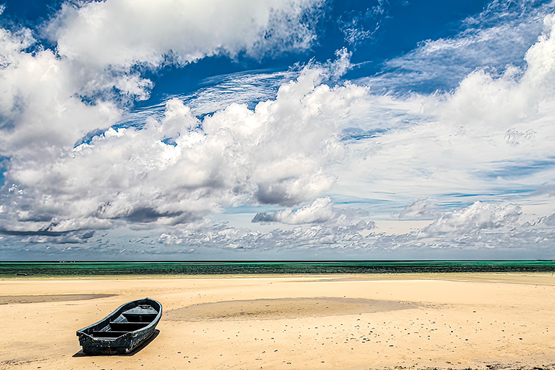
Boat on the Beach: South Andros Island, Bahamas
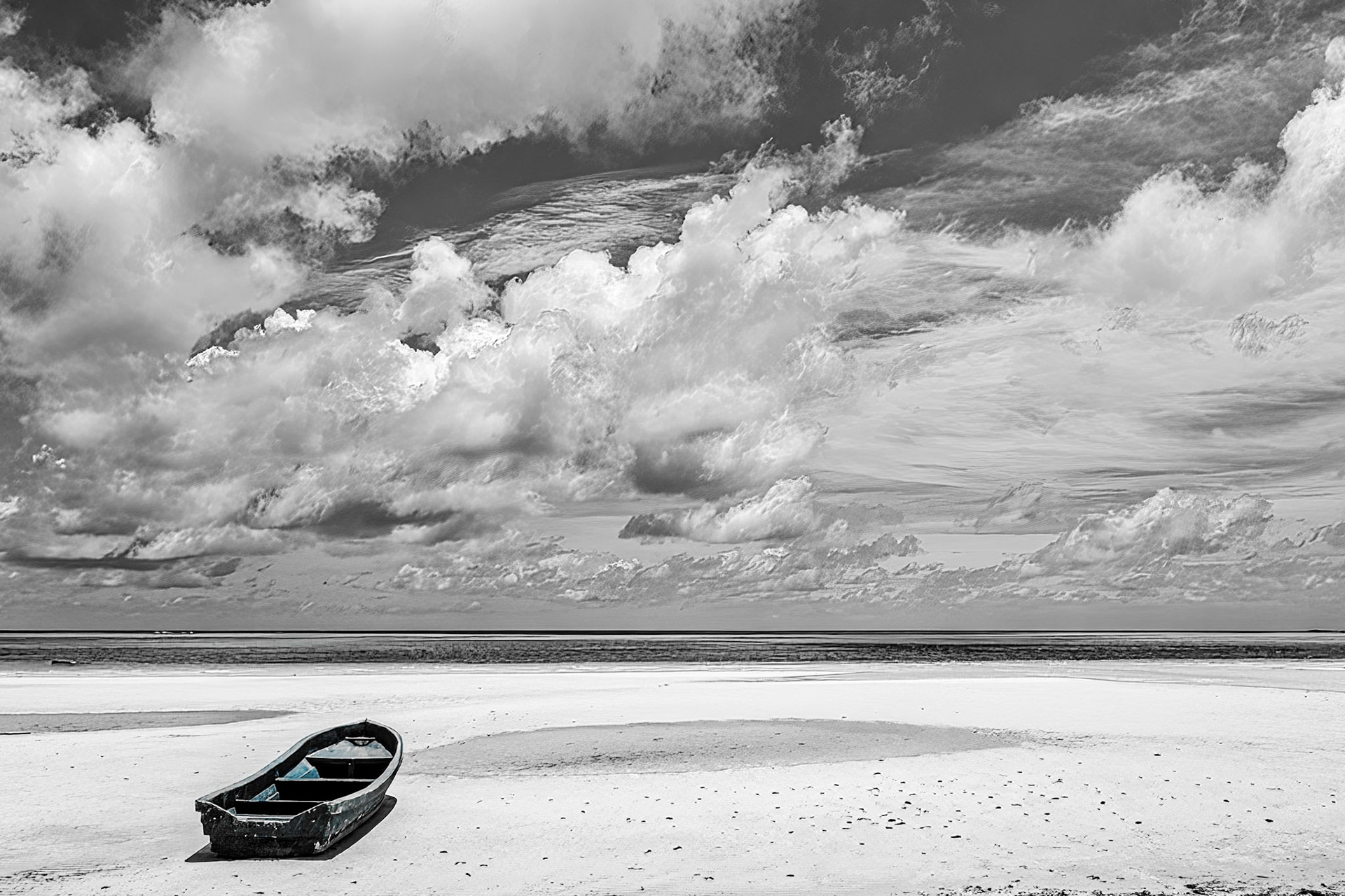
Boat on the Beach B&W: South Andros Island, Bahamas
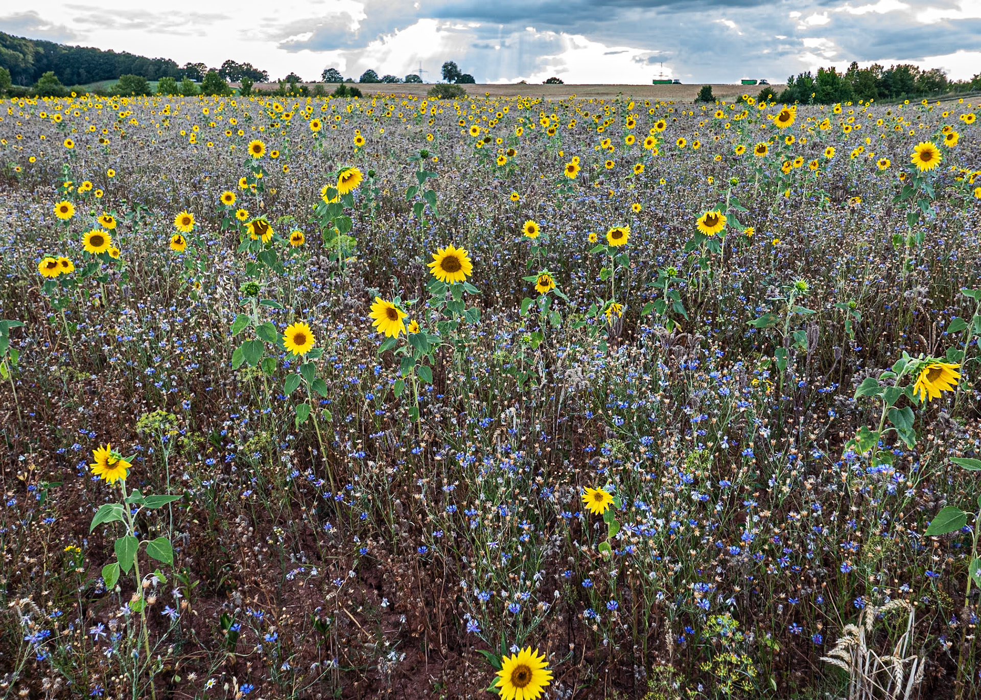
Sunflower Field: Farmers field in Münchweiler en der Alsenz Germany
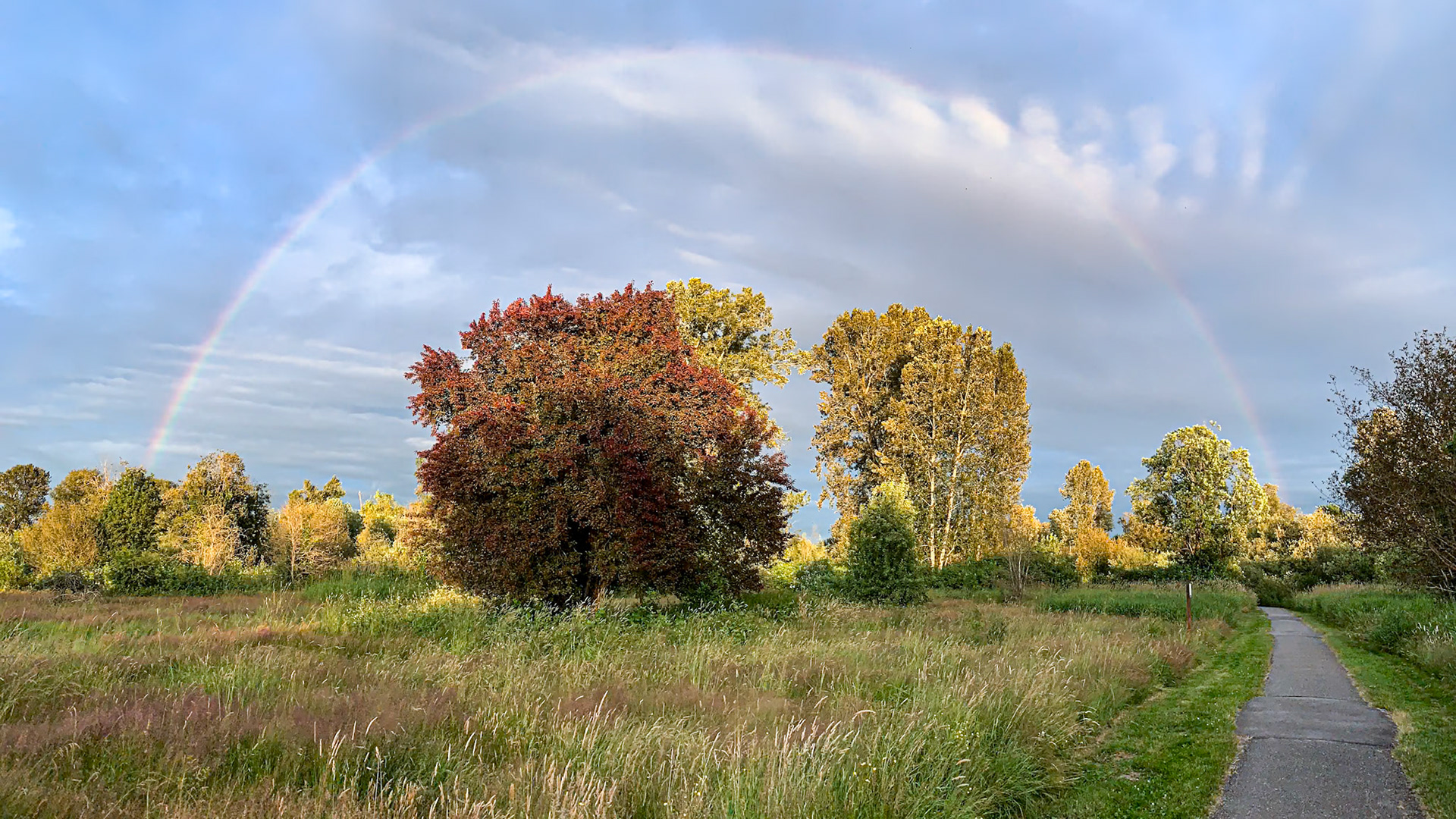
Under the Rainbow: The Heron Trail loops under a rainbow at Marymoor Park in Redmond WA.
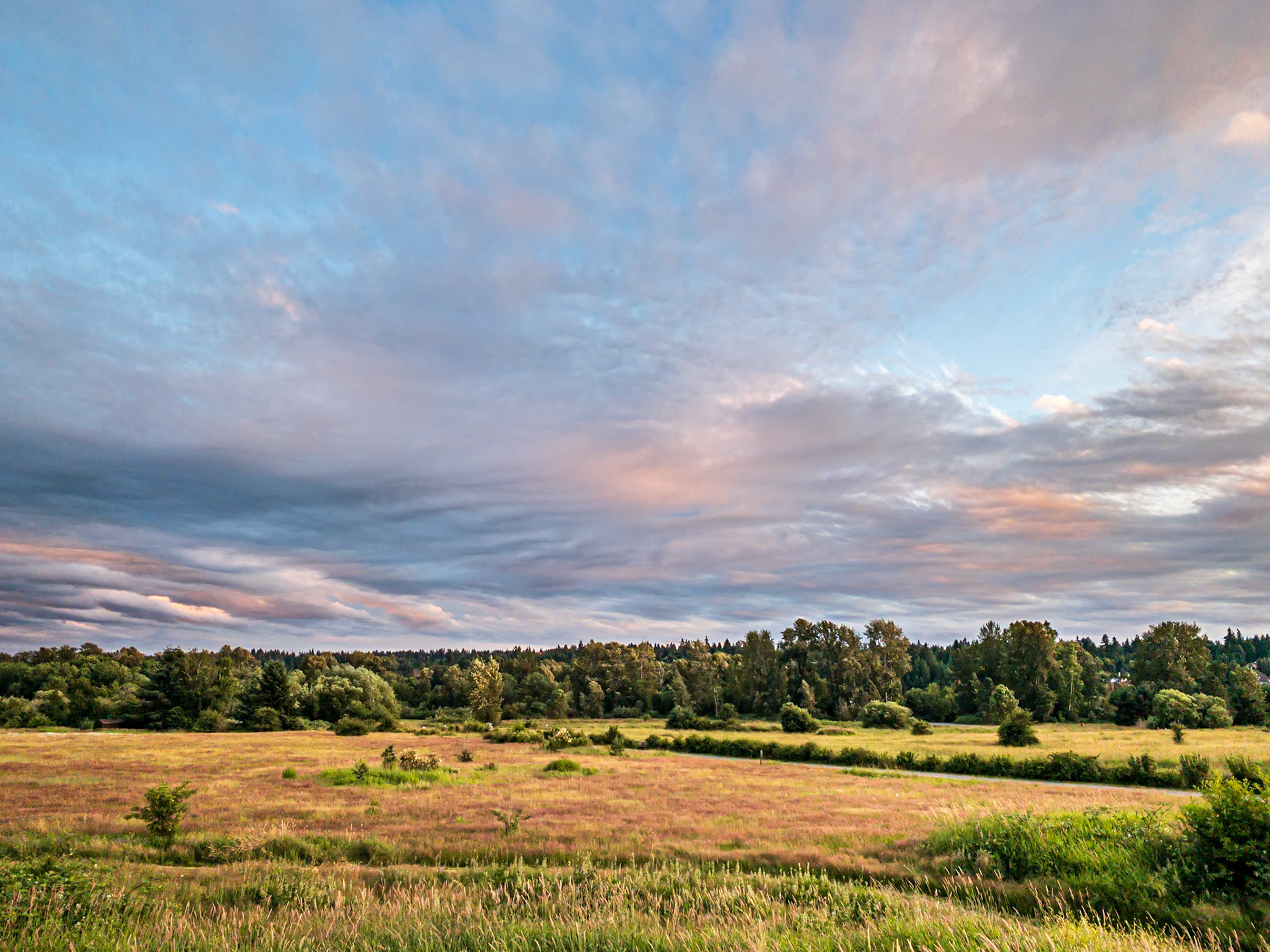
Birding Meadows: The upland meadows at Redmond Washington's Marymoor Park provide great habitat for viewing many bird species year round.
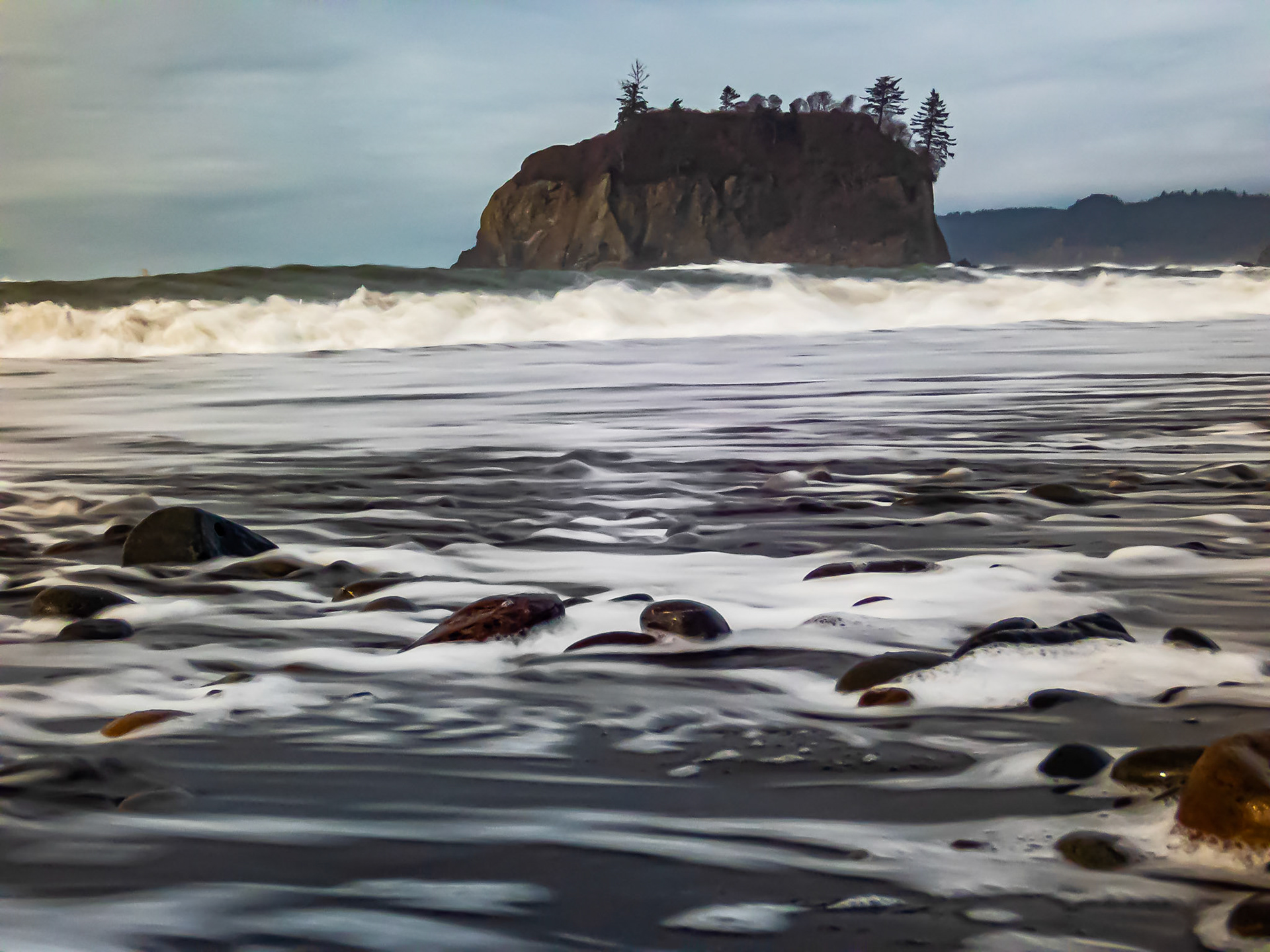
Rocky Shore Beach Swash: At Ruby Beach on the Olympic Peninsula, Washington.
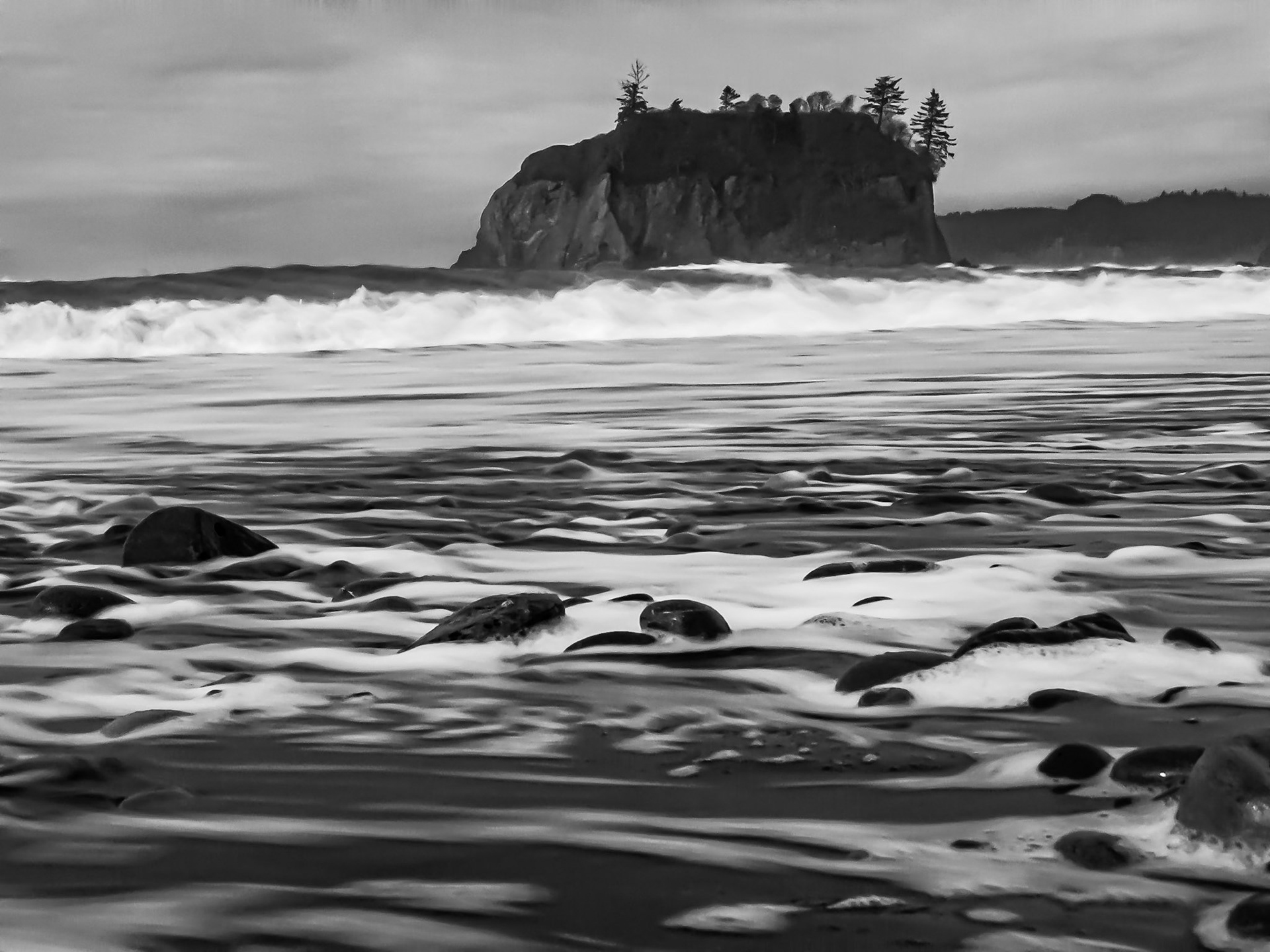
Rocky Shore Beach Swash B&W: At Ruby Beach on the Olympic Peninsula, Washington.
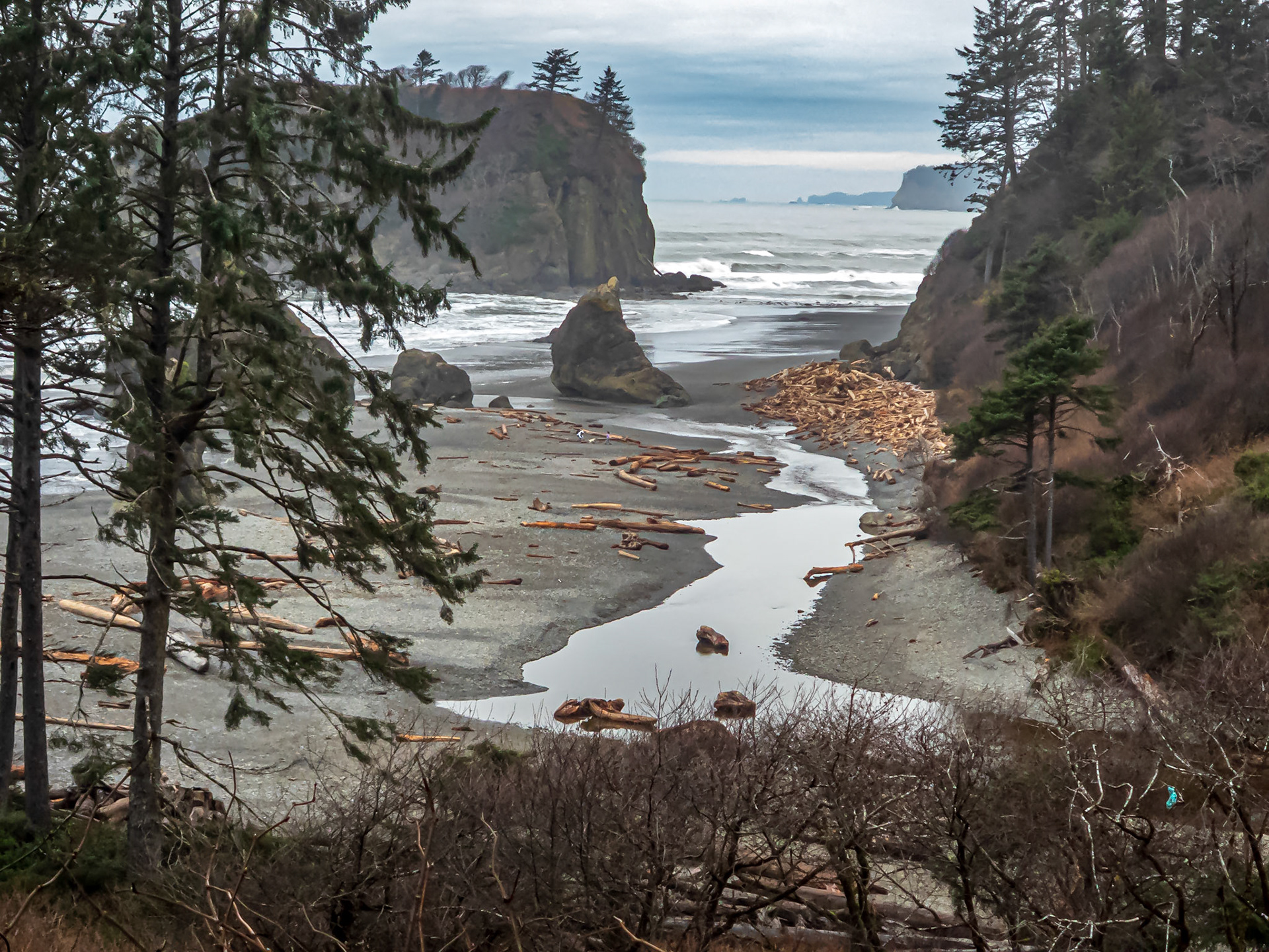
Ruby Beach Washington: A cool , dry but overcast day on the Olympic Peninsula.
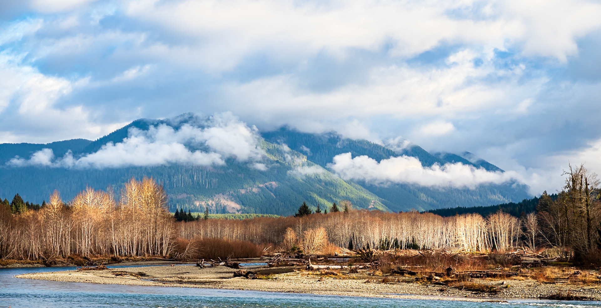
Hoh River Mist: The Hoh River flows past red alder and Sitka spruce forest in the Hoh River Rainforest.
Lower Hoh River: The Hoh River flows past red alder and Sitka spruce forest in the Hoh River Rainforest.
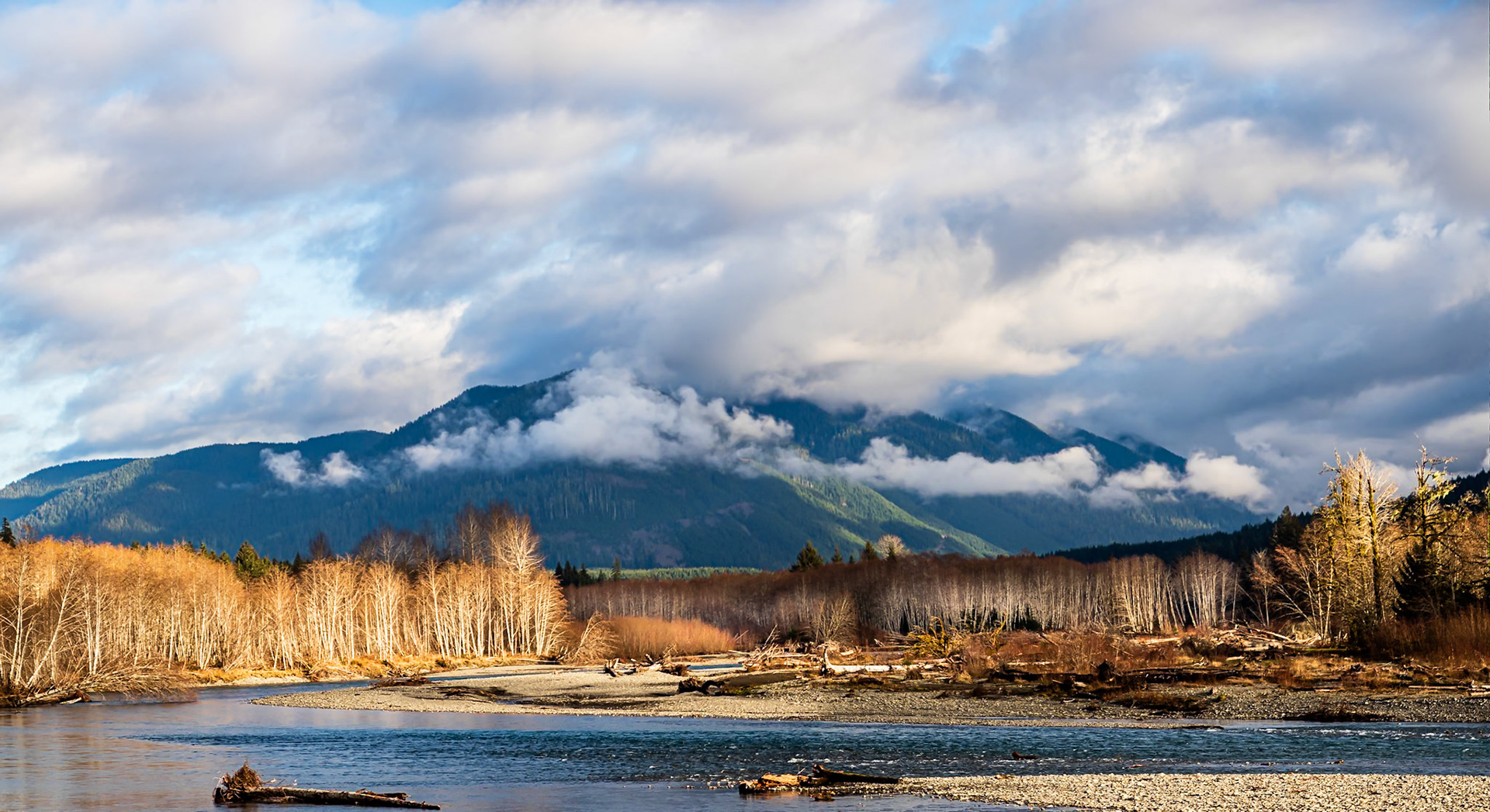
Bend in the Hoh: The Hoh River winds through Sitka spruce and red alder rain forest.
Bend in the Hoh: The Hoh River winds through Sitka spruce and red alder rain forest.
Sentinel Spruce: This wind-pruned Sitka spruce stands guard over the washed out beach access at Kalaloch Lodge on the Washington Coast.
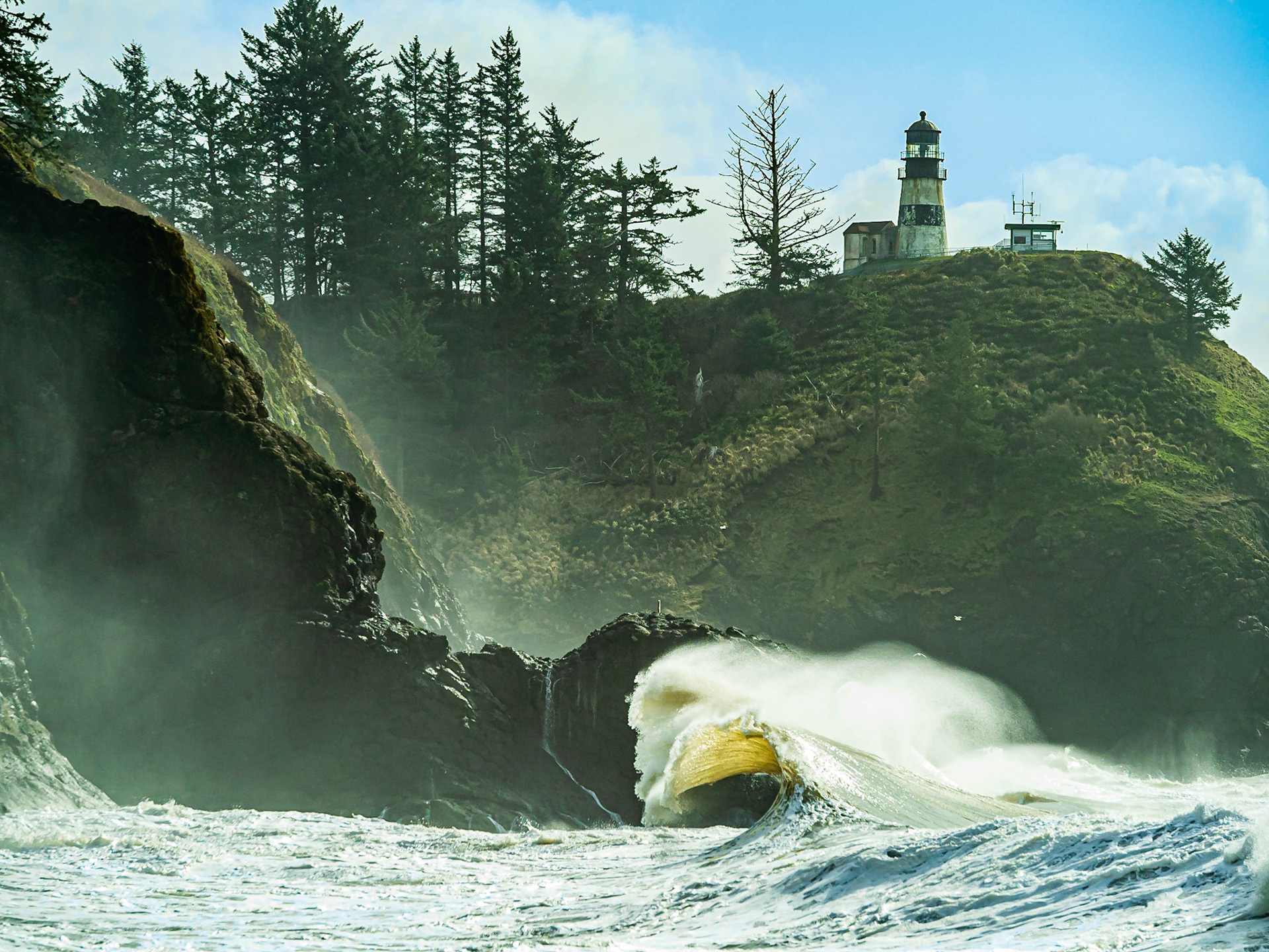
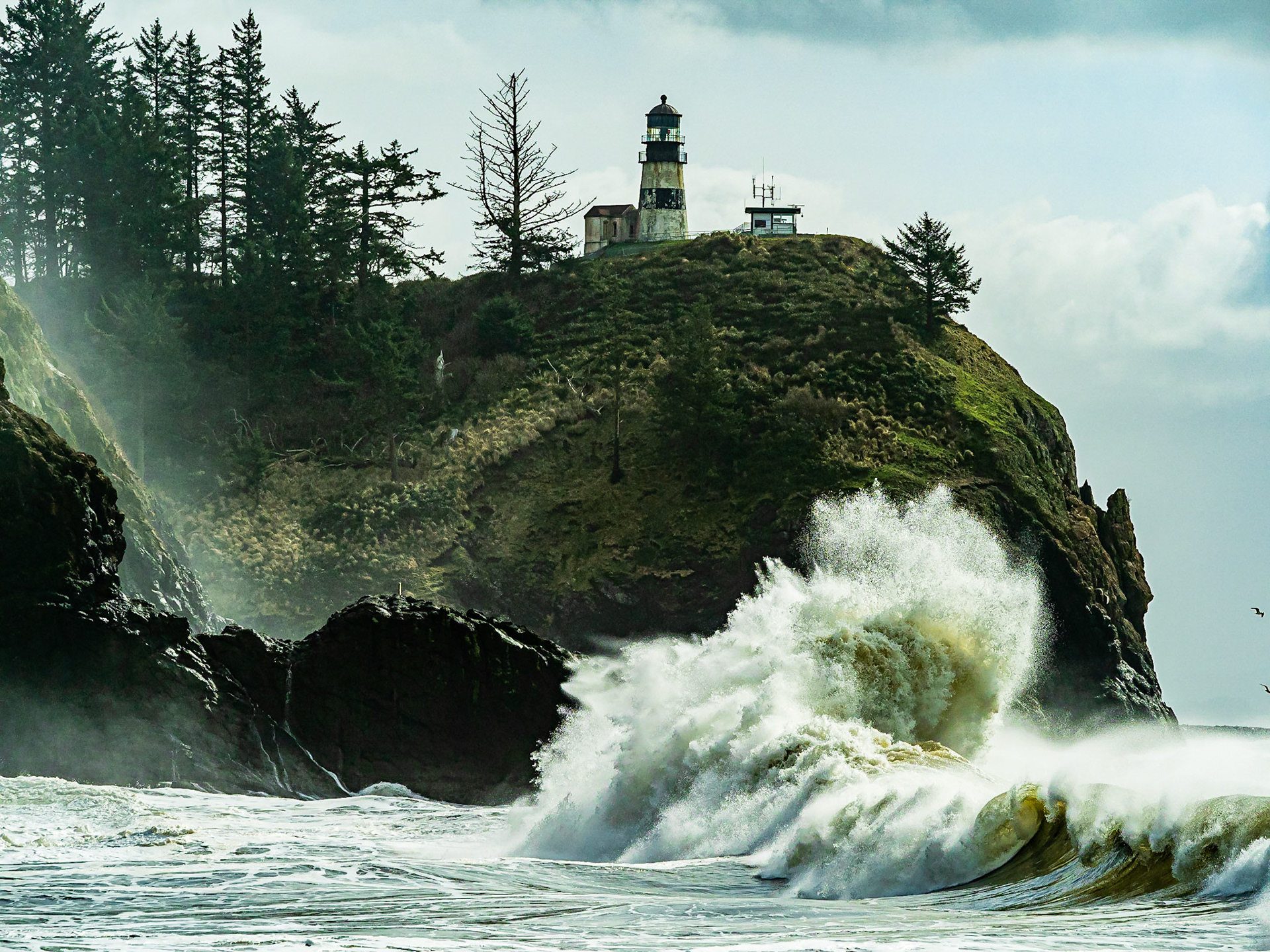
Cape Disappointment Wild Waves: On days with extreme high tides spectacular waves crest under the lighthouse as they break on the cliffs at Wakiki Beach Cove.
Cape Disappointment Wild Waves: On days with extreme high tides spectacular waves crest under the lighthouse as they break on the cliffs at Wakiki Beach Cove.
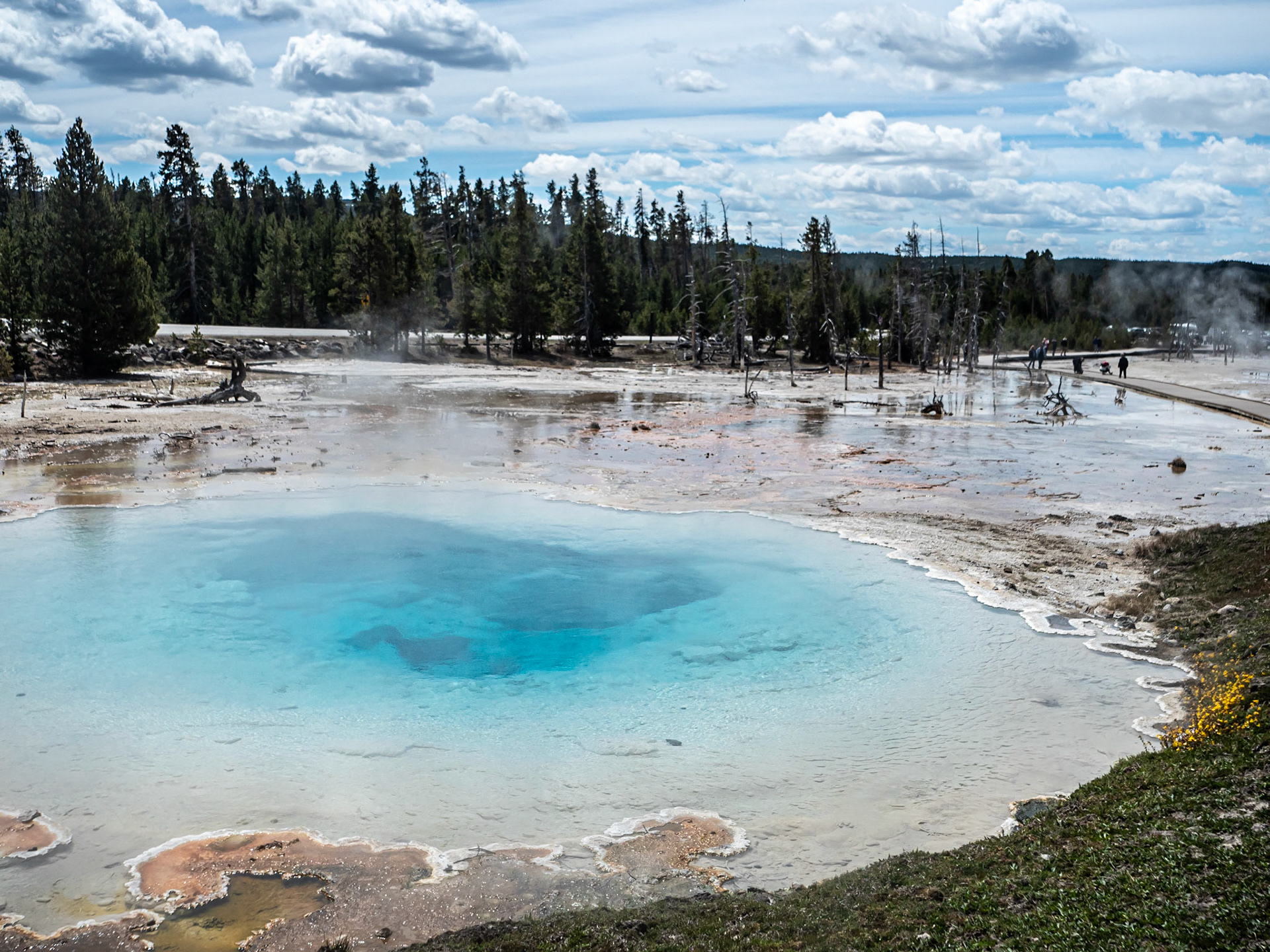
Blue Hot Spring: One of the hot springs at Fountan Paint Pots located in the Lower Geyser Basin, Yellowstone National Park.
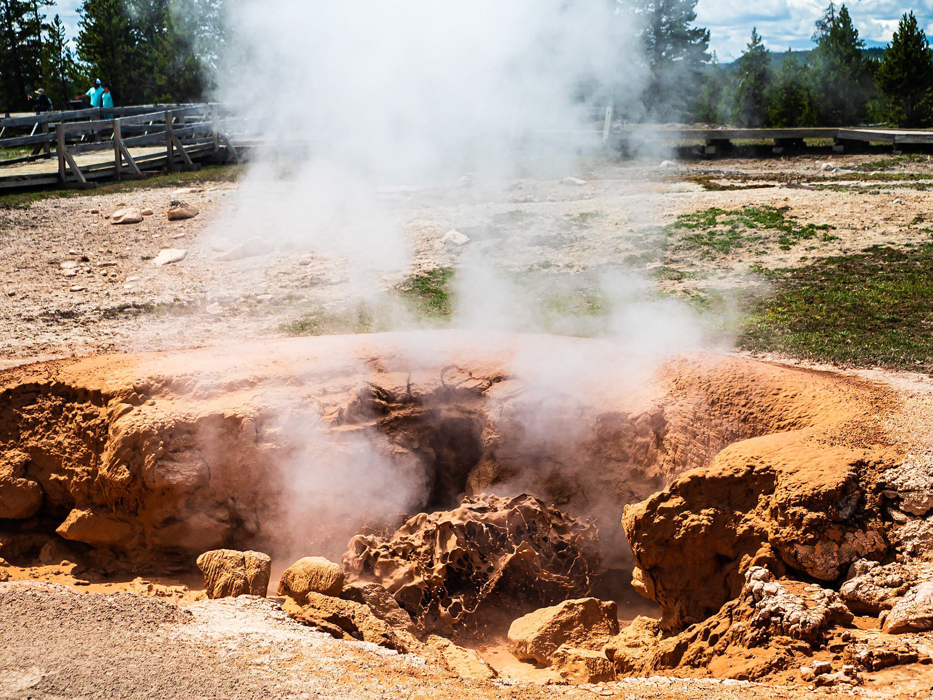
Bubbling Mud: One of the hot springs at Fountan Paint Pots located in the Lower Geyser Basin, Yellowstone National Park.
Vat of Bubbling Mud: One of the hot springs at Fountan Paint Pots located in the Lower Geyser Basin, Yellowstone National Park.
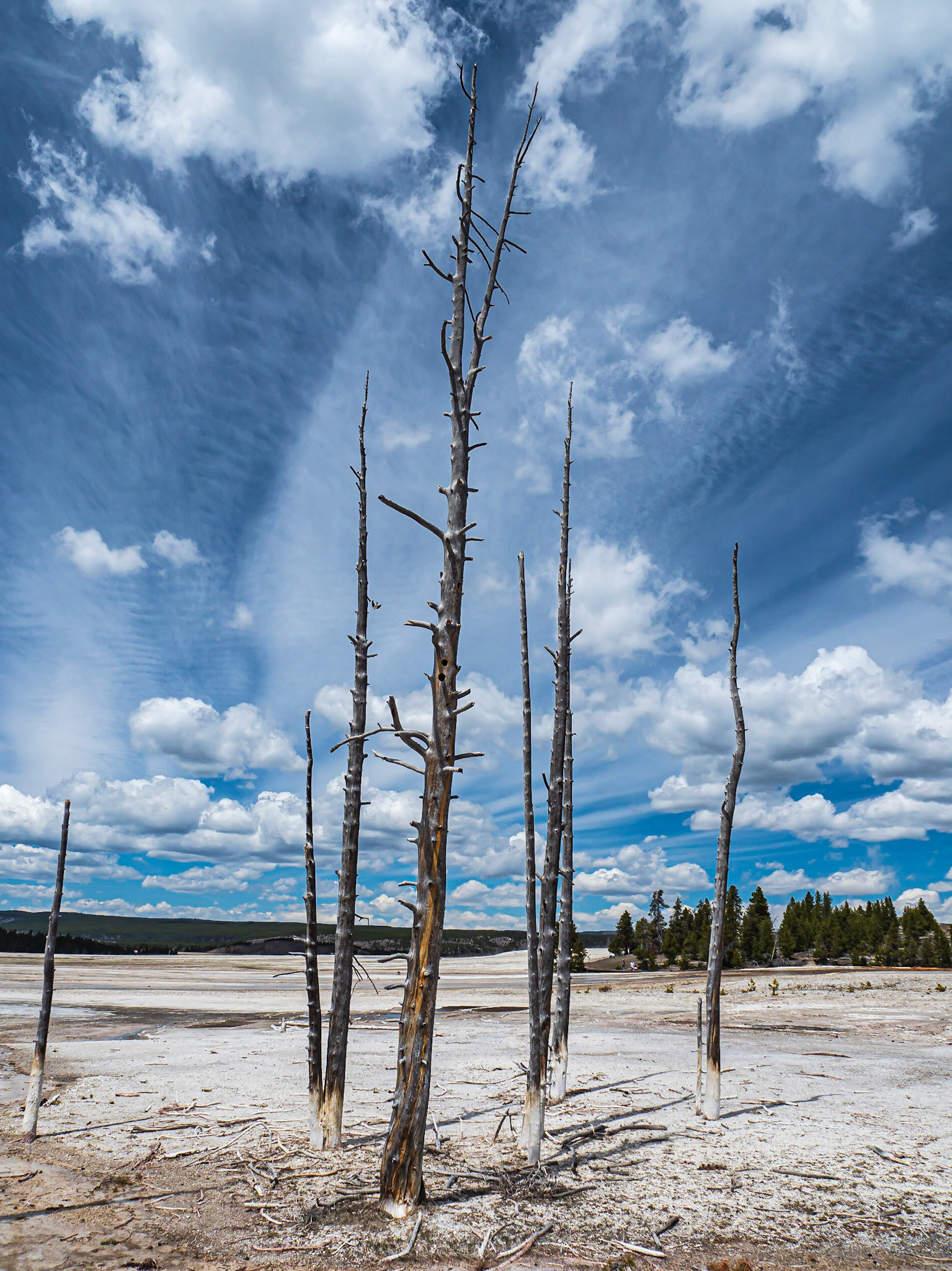
Snags: Once proud conifers succumb to heated groundwater, hot springs and the forces of mother nature in the Lower Geyser Basin in Yellowstone Natinal Park.
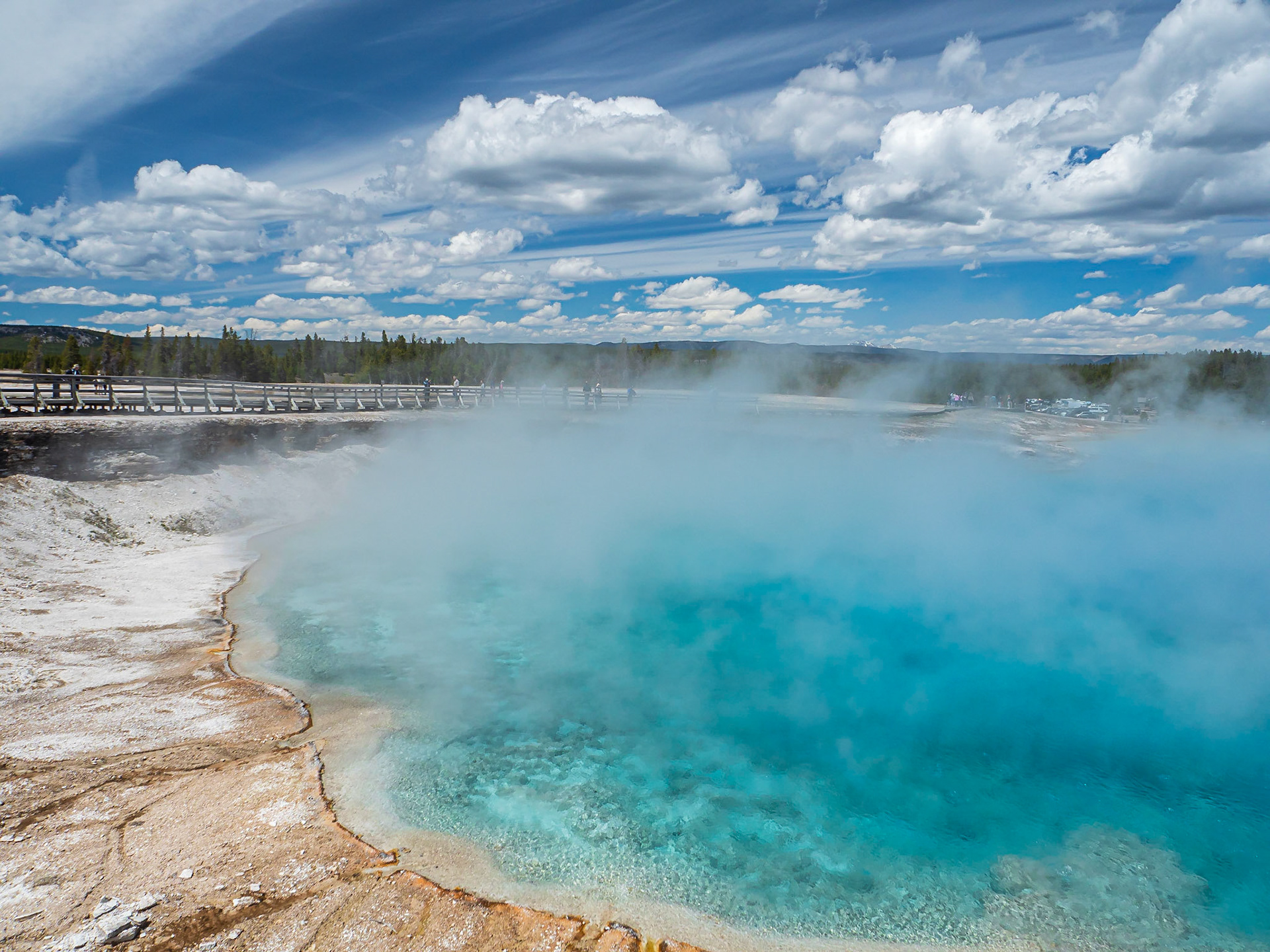
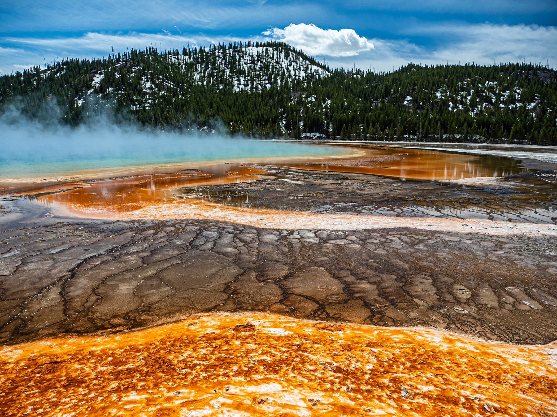
Grand Prismatic Hot Springs: Rising steam and brilliant blue waters are hallmarks of the Grand Prismatic Spring in the Mid Geyser Basin of Yellowstone Natioinal Park.
Grand Prismatic Spring: Steam rises from the Grand Prismatic Spring in the Midway Geyser Basin of Yellowstone National Park. The hot spring is flanked by richly hued mineral and microbial mats.
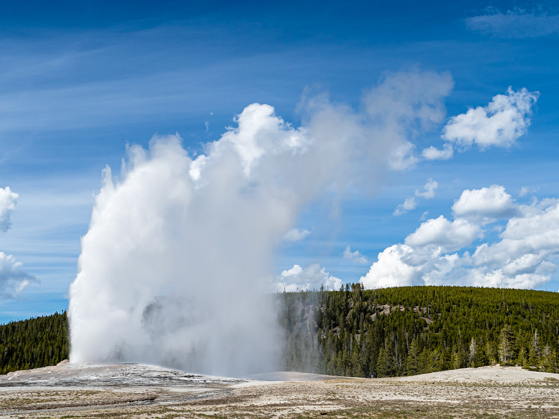
Old Faithful: The iconic geyser erupts on schedule in Yellowstone National Park's Upper Geyser Basin.
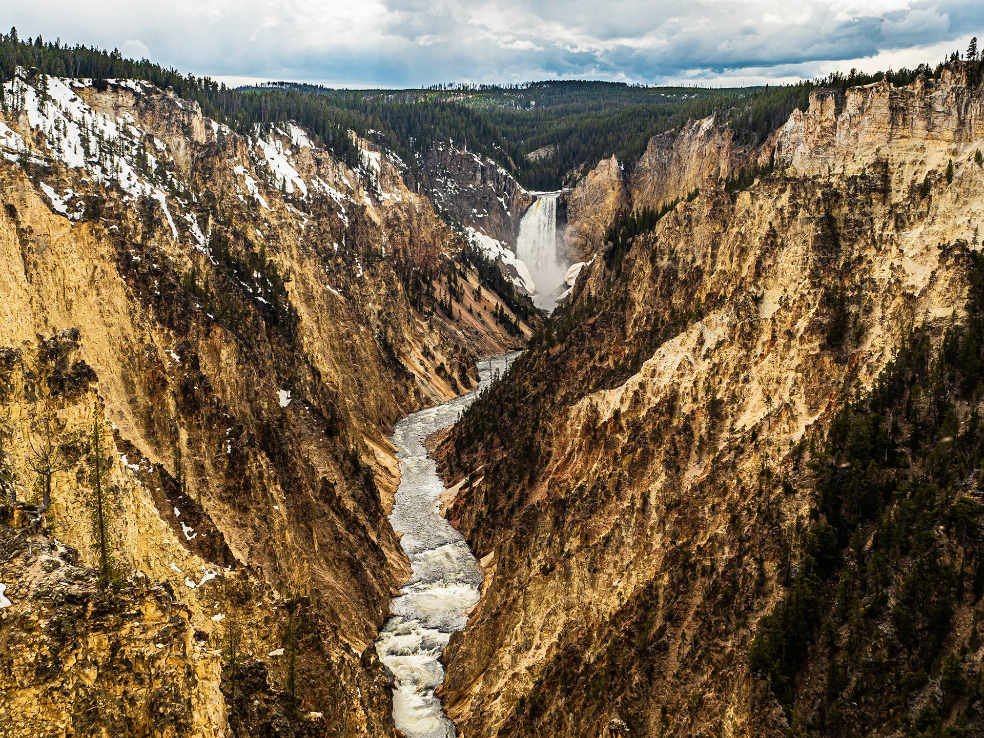
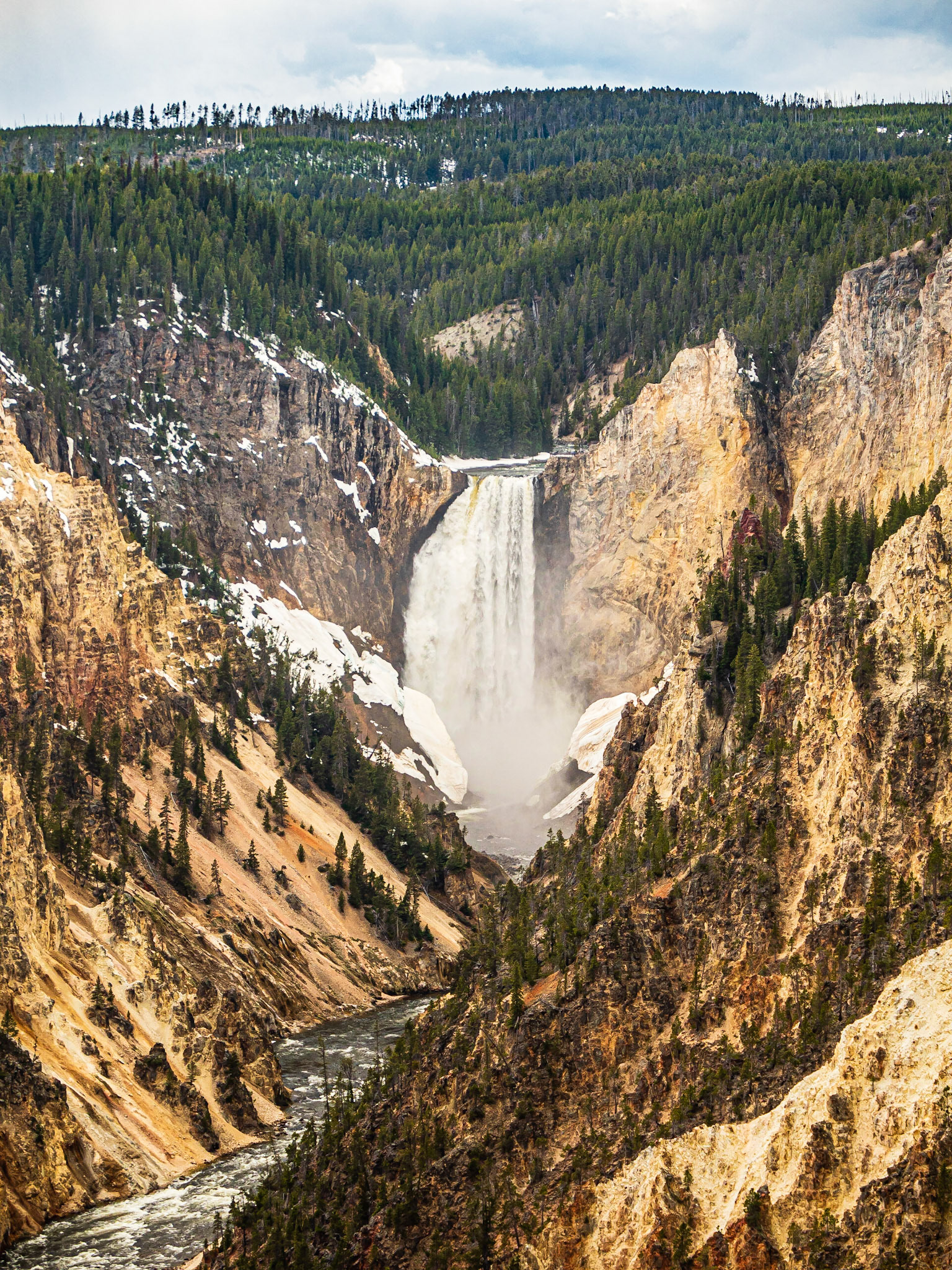
Lower Falls, Grand Canyon of the yellowstone: The Yellowstone River cascades over two falls before cutting its way through the Grand Canyon of the Yellowstone.
Lower Falls, Grand Canyon of the yellowstone: The Yellowstone River cascades over two falls before cutting its way through the Grand Canyon of the Yellowstone.
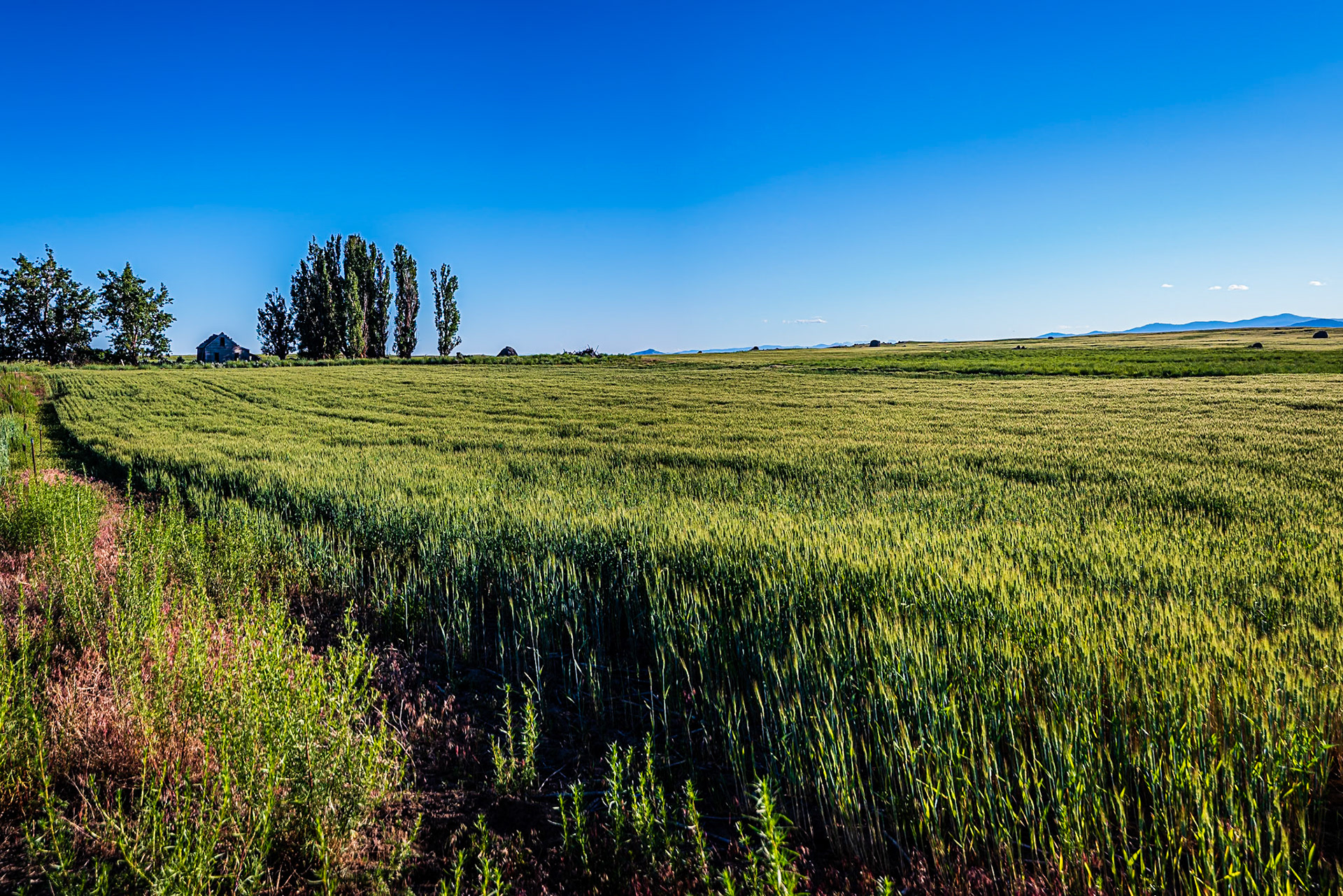
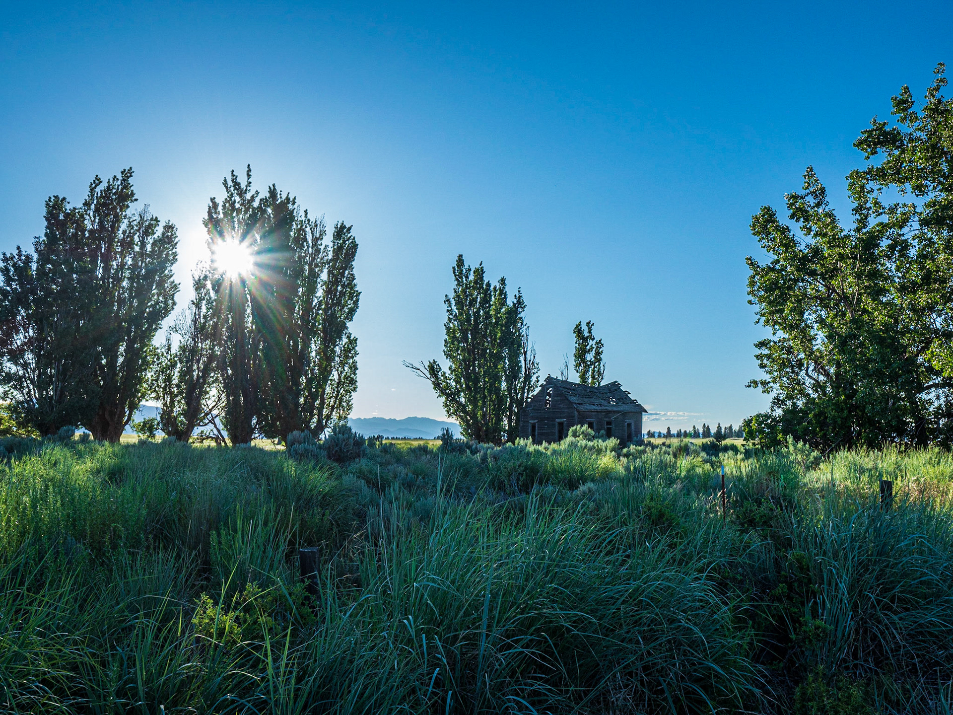
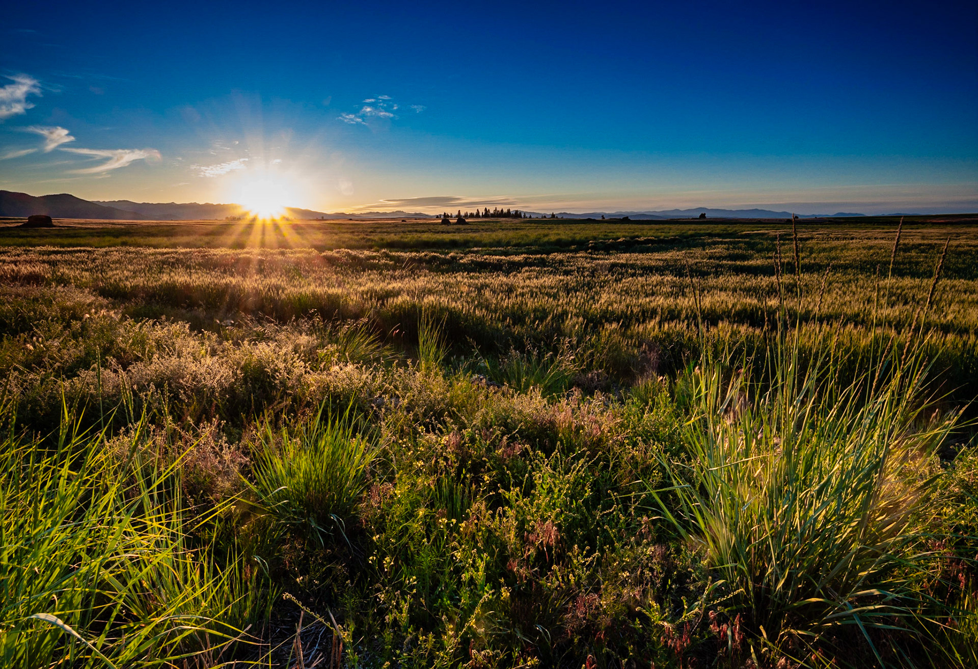
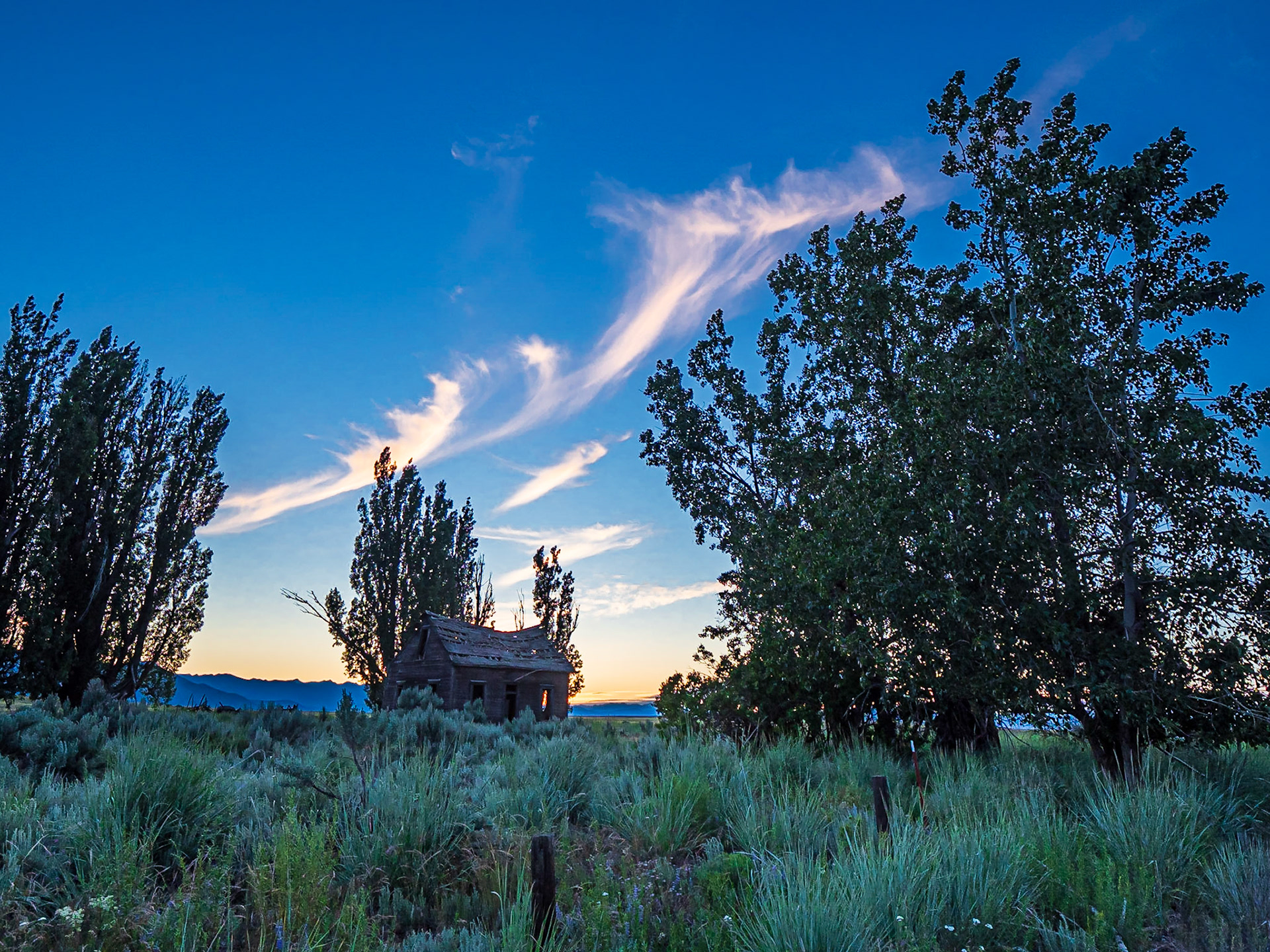
Old Homestead: An old homestead nestled among shade trees watches over a field of wheat on the Waterville Plateau. Large haystack rocks in the field are erratics left behind by retreating glaciers.
Abandoned Homestead: Afternoon sun setting on an old homestead nestled among shade trees on the Waterville Plateau near Dyer Washington.
Plateau Sunset: Sunset on fields of dryland wheat on the Waterville Plateau near Dyer Washington. Haystack rocks in the distance are glacial erratics left by retreating icesheets.
Abandoned Homestead: An old homestead nestled among shade trees on the Waterville Plateau near Dyer Washington.
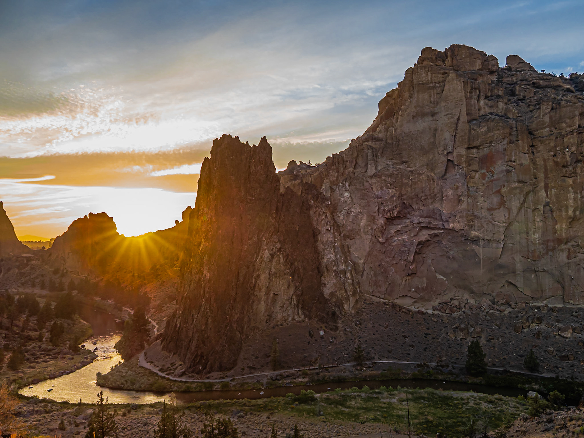
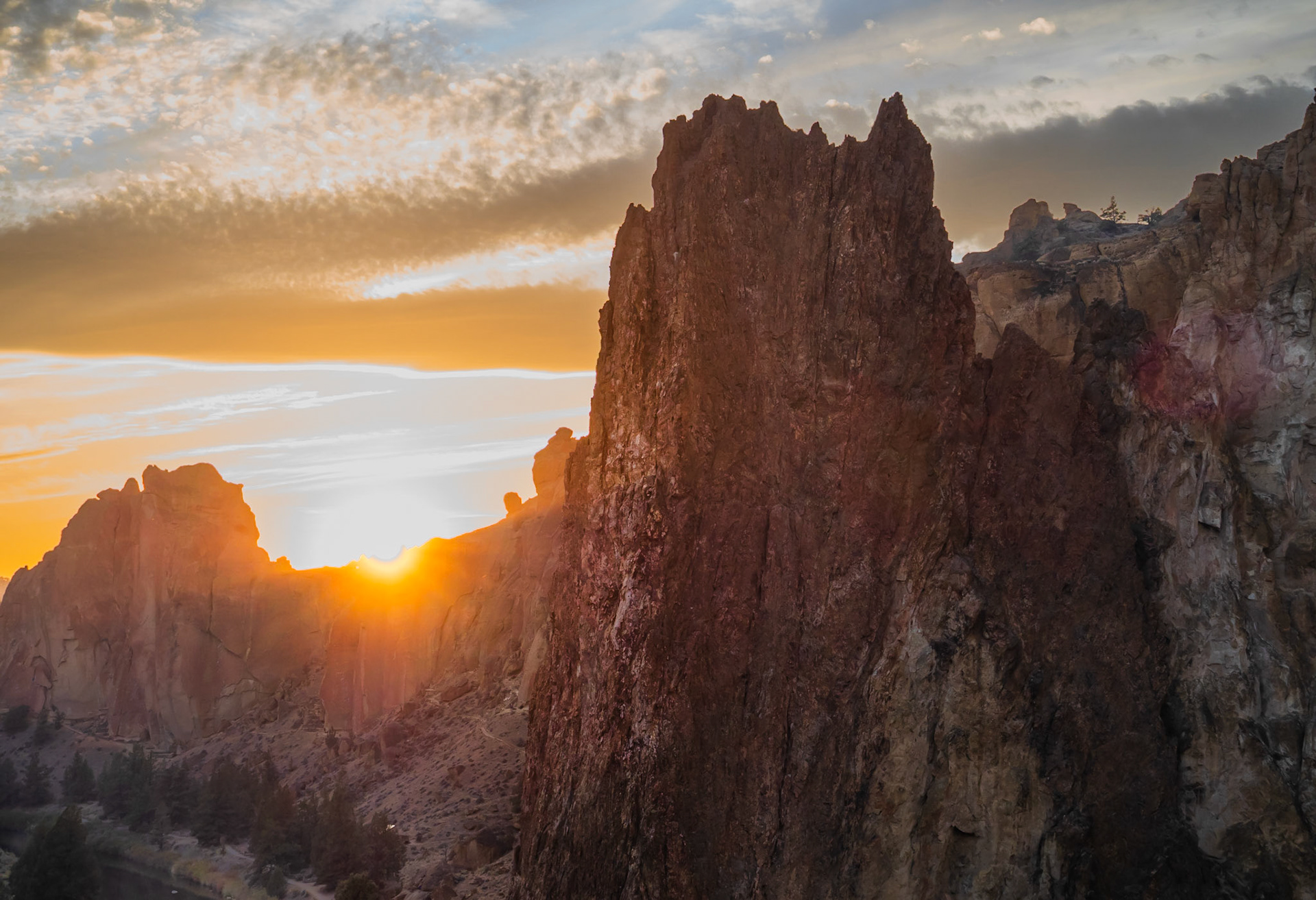
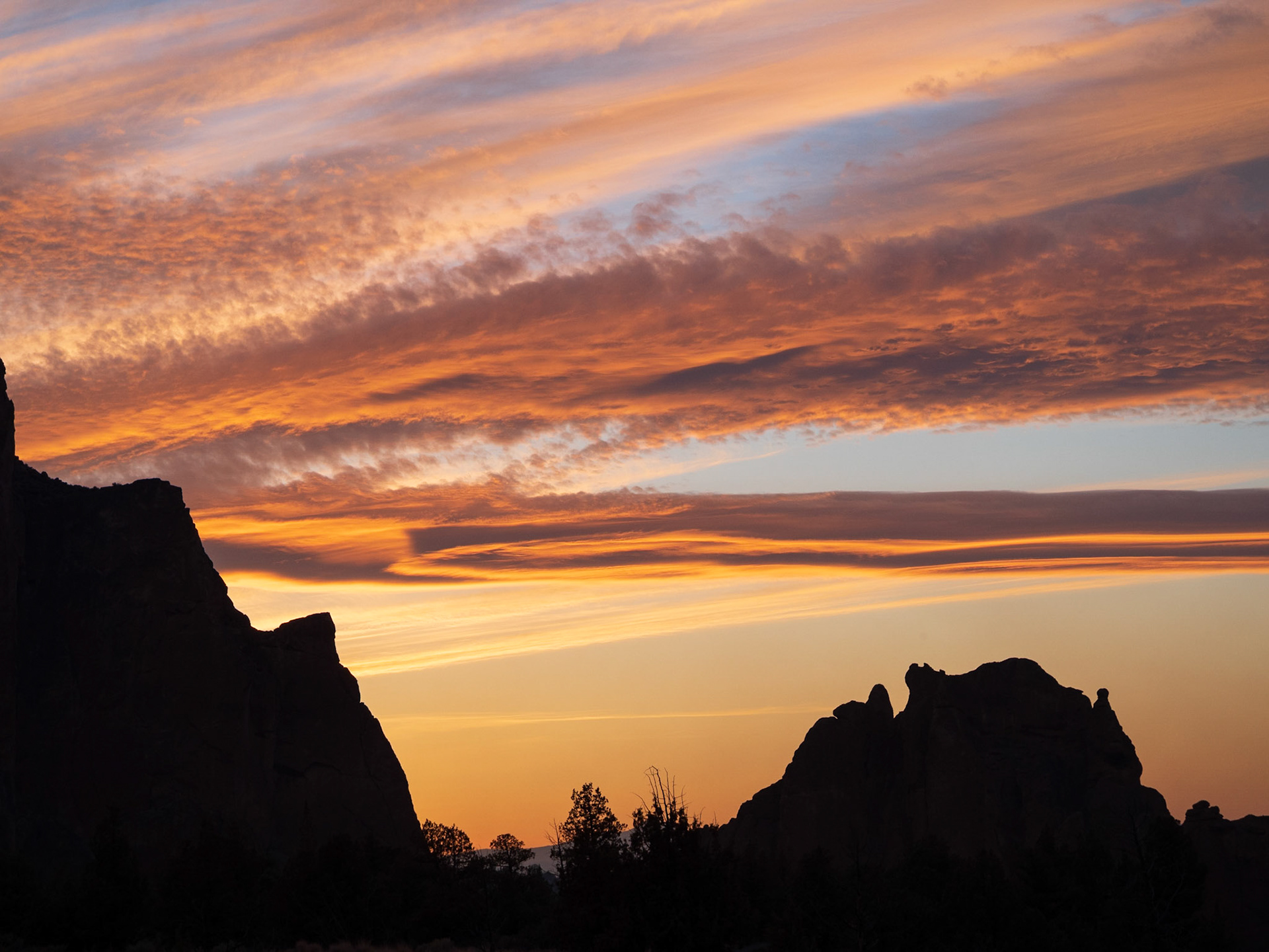
Sunset at Smith Rock: Sunset warms the face of Smith Rock and the Crooked River as it winds around the mountain.
Last Rays at Smith Rock: The last few rays of sunset spill over a craggy ridge onto Crooked River and the face of Smith Rock in Oregon's high desert.
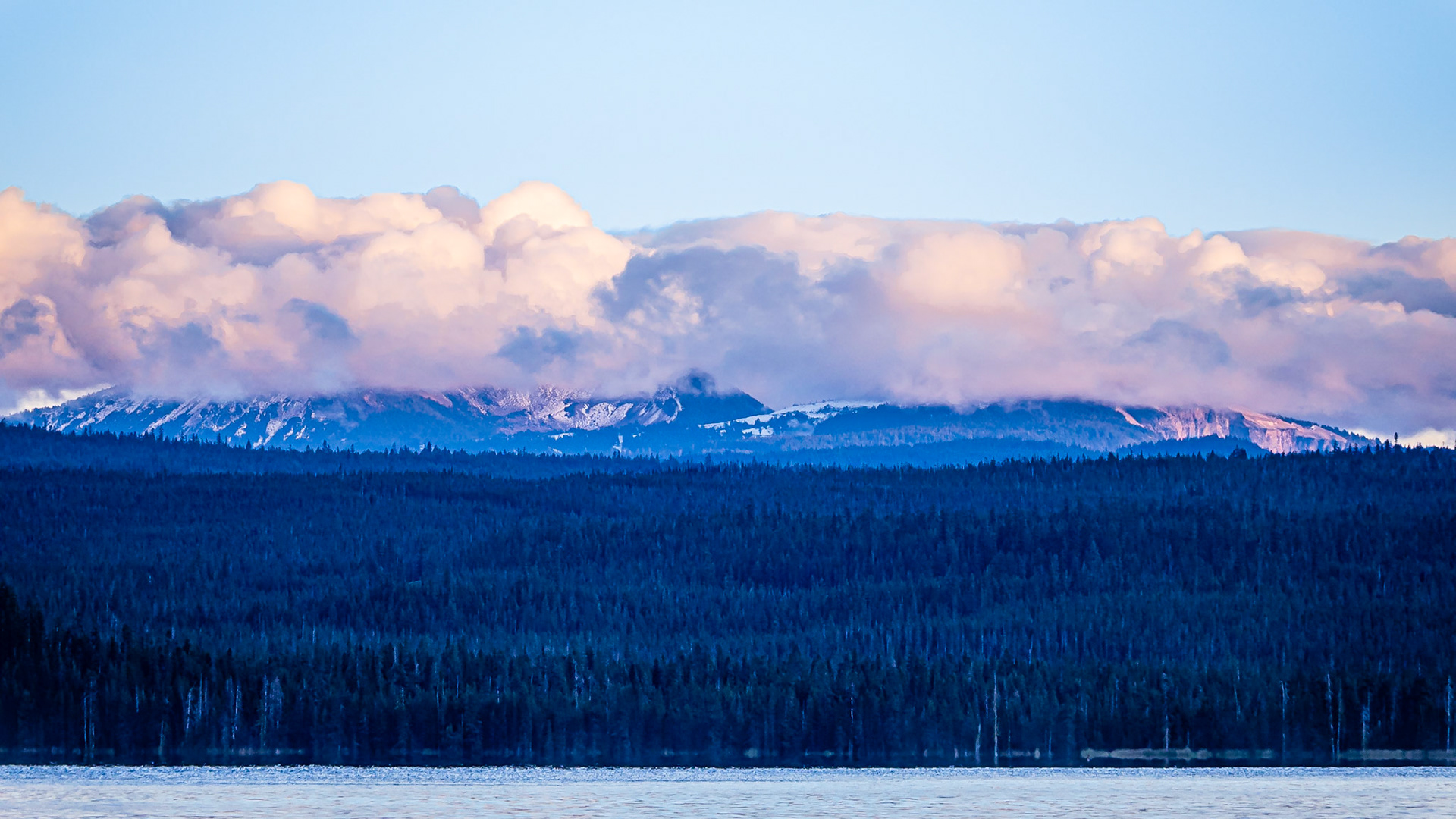
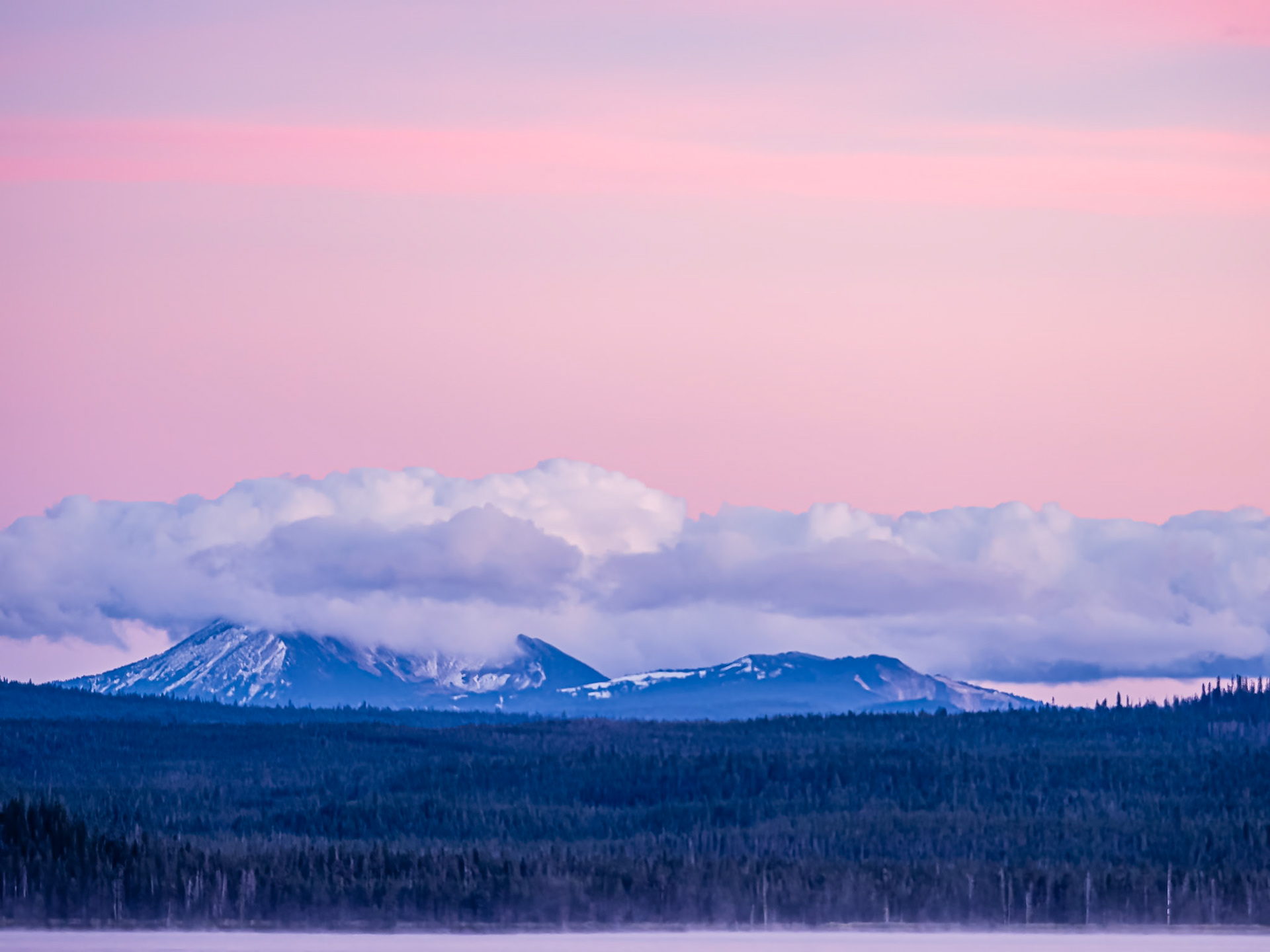
Mt. Mazama Golden Hour: Mt. Mazama cloaked in clouds following a refreshing day of wind, rain and snow that was greatly needed to drive away forest fire smoke.
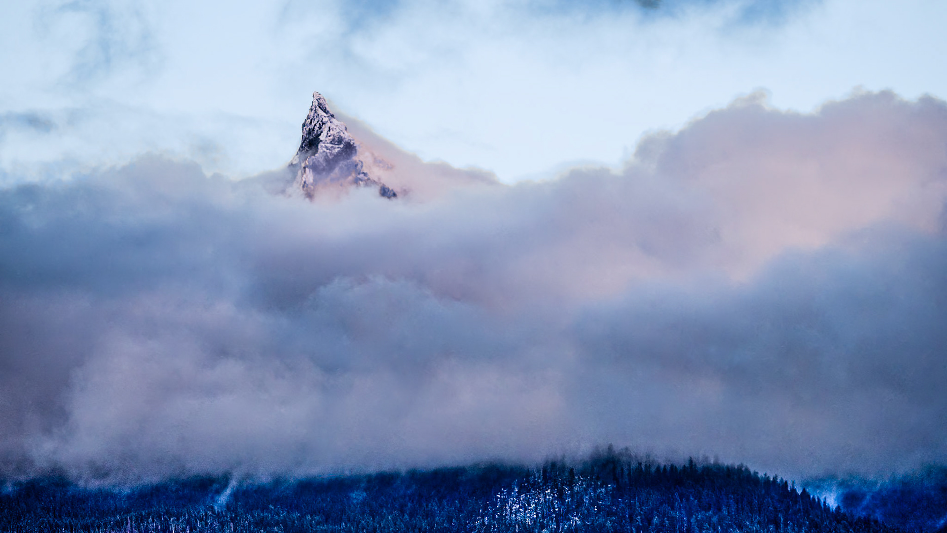
Mt. Thielsen - A Cascade Alp: Mt. Thielsen near Diamnond Lake Oregon peeks through cloud cover showing off its fresh coat of fall snow.
Mt. Mazama After Sunset: Mt. Mazama wears a cloak of clouds following a refreshing day of wind, rain and snow that was greatly needed to drive away forest fire smoke. A slight mist rises from Diamond Lake in the foreground
Mt. Mazama After Sunset: Mt. Mazama wears a cloak of clouds following a refreshing day of wind, rain and snow that was greatly needed to drive away forest fire smoke. A slight mist rises from Diamond Lake in the foreground
Mt. Mazama After Sunset: Mt. Mazama wears a cloak of clouds following a refreshing day of wind, rain and snow that was greatly needed to drive away forest fire smoke. A slight mist rises from Diamond Lake in the foreground
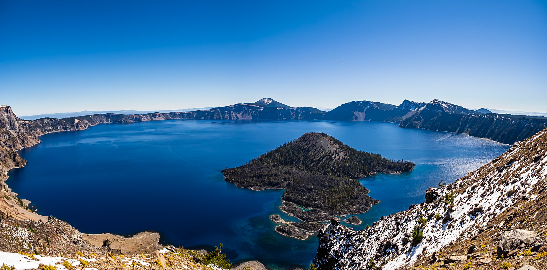
Crater Lake: A clear fall day at Crater Lake National Park provides a view across the 5-mile wide caldera of Mt. Mazama featuring Wizard Island in the foreground.
Cascade Mountains: Fresh snow on the Washington Cascades.
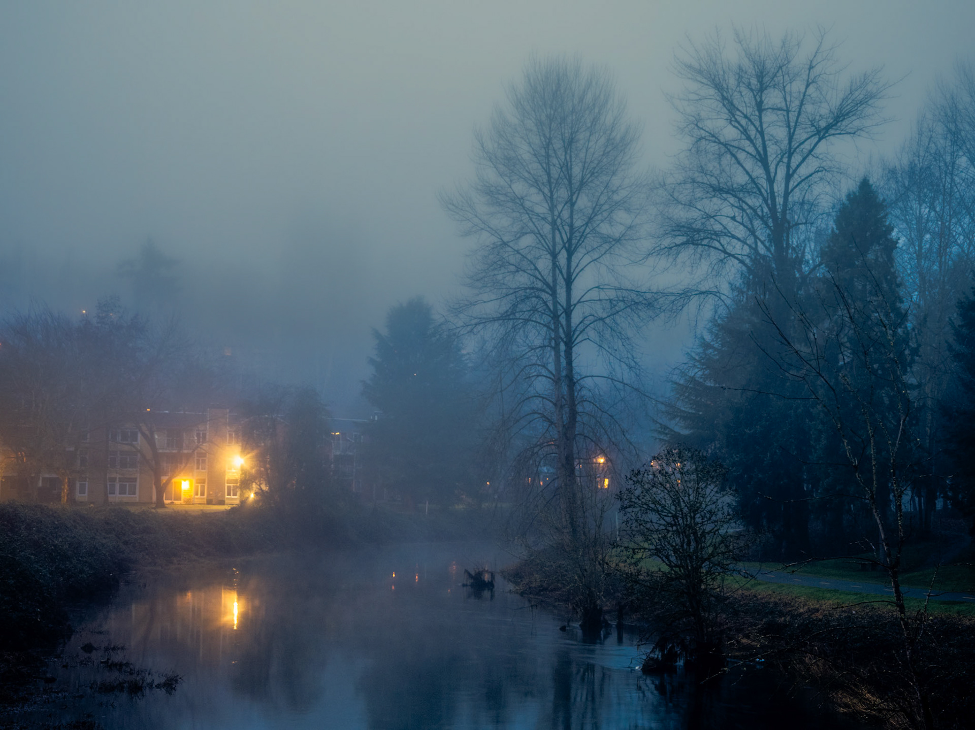
Mornng Fog: A foggy January morning over the Sammamish River.
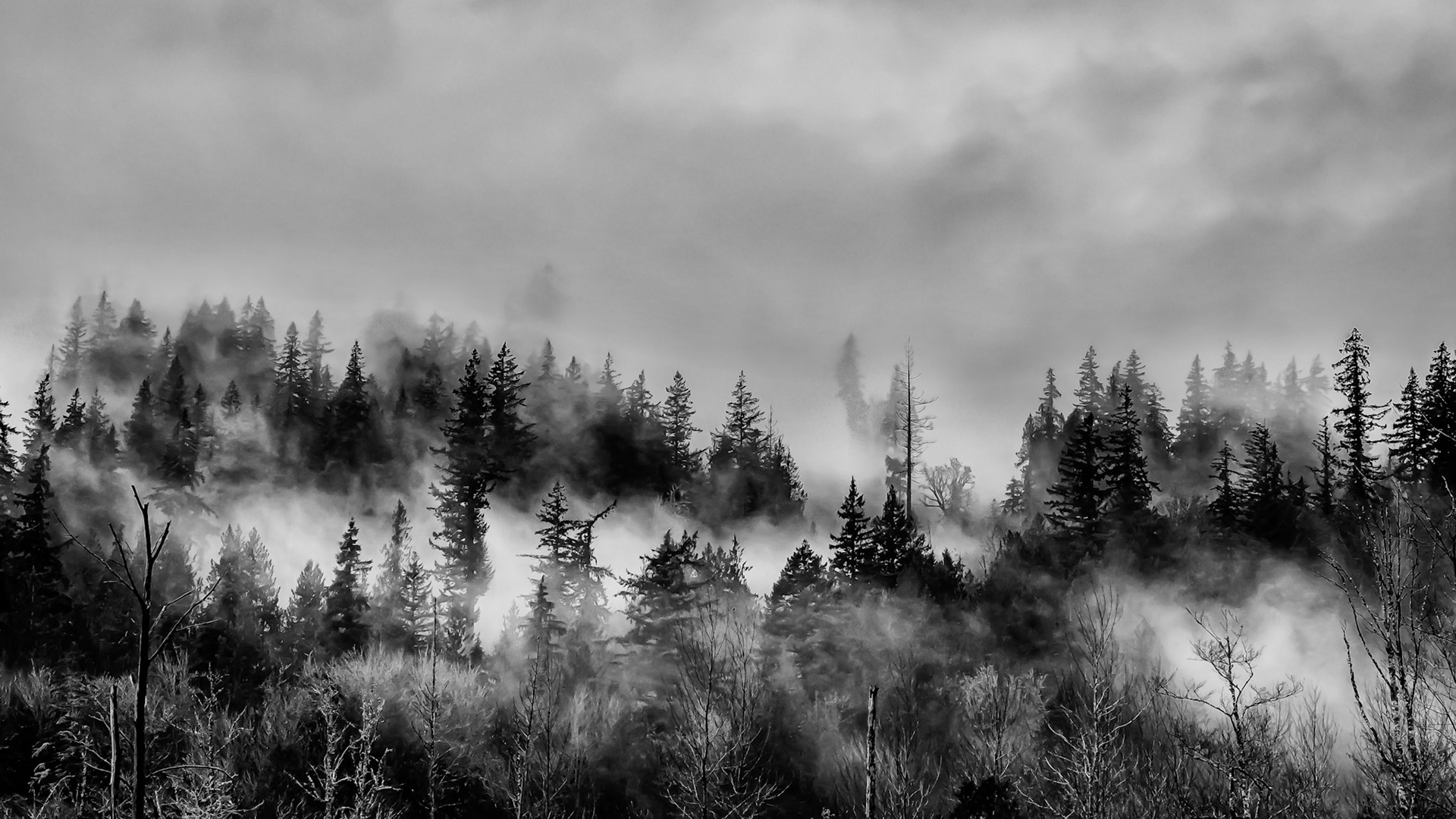
Cascade Mist: Fog rises from the Cascade Mountains foothills on a misty day.
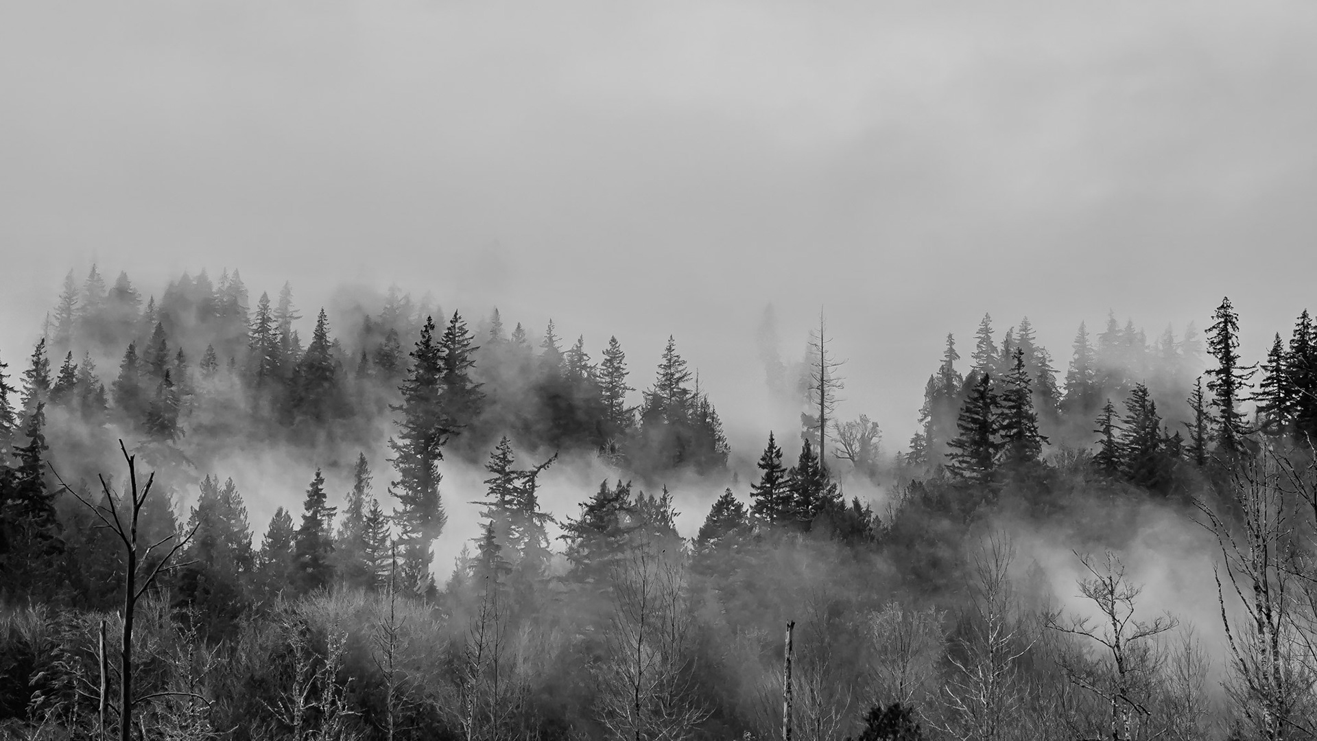
Cascade Mist: Fog rises from the Cascade Mountains foothills on a misty day.
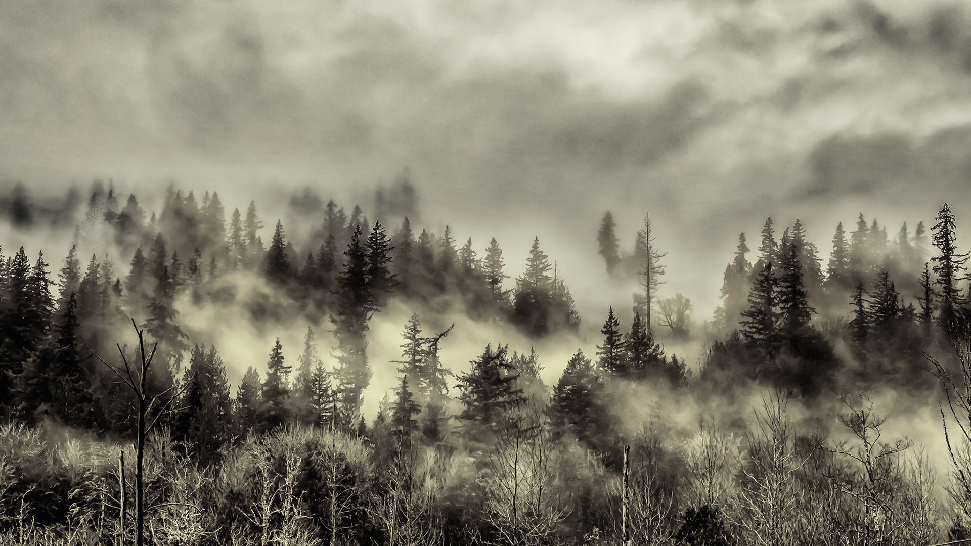
Cascade Mist: Fog rises from the Cascade Mountains foothills on a misty day.
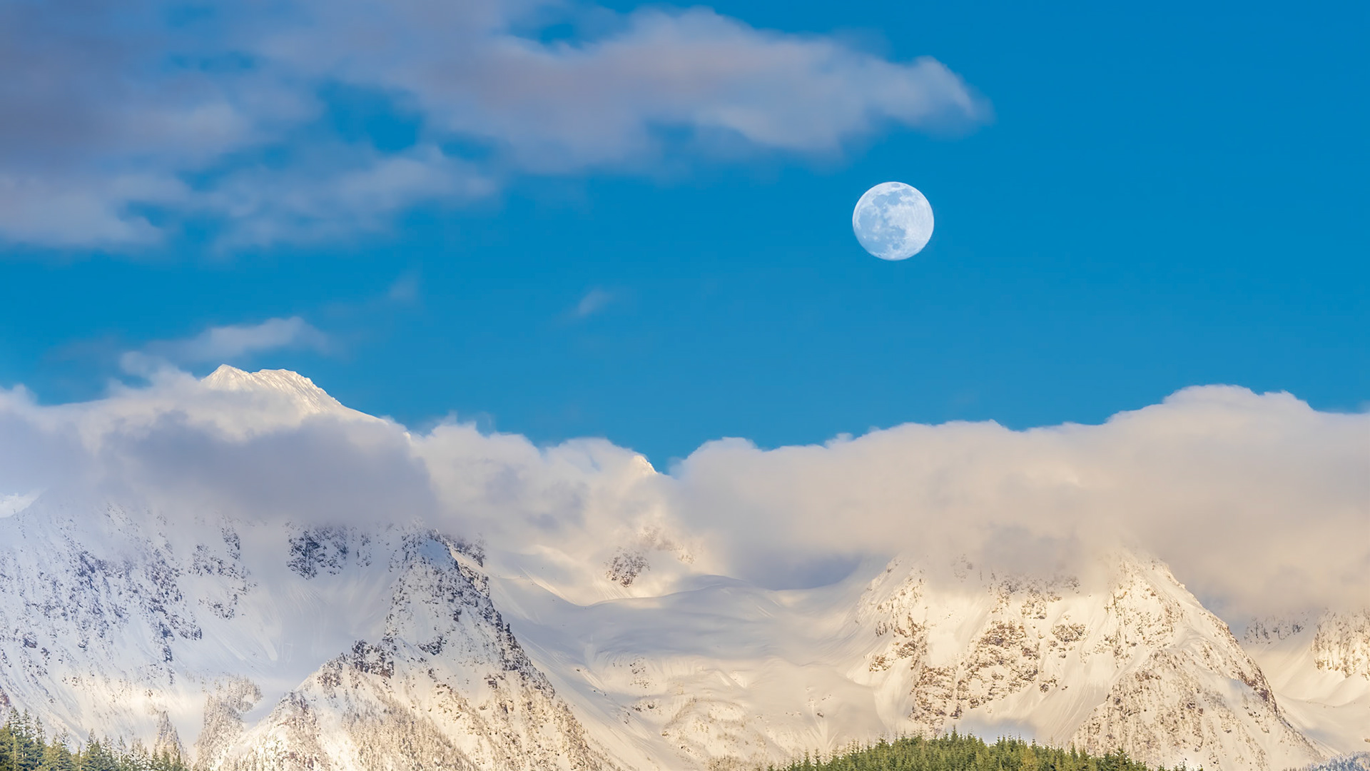
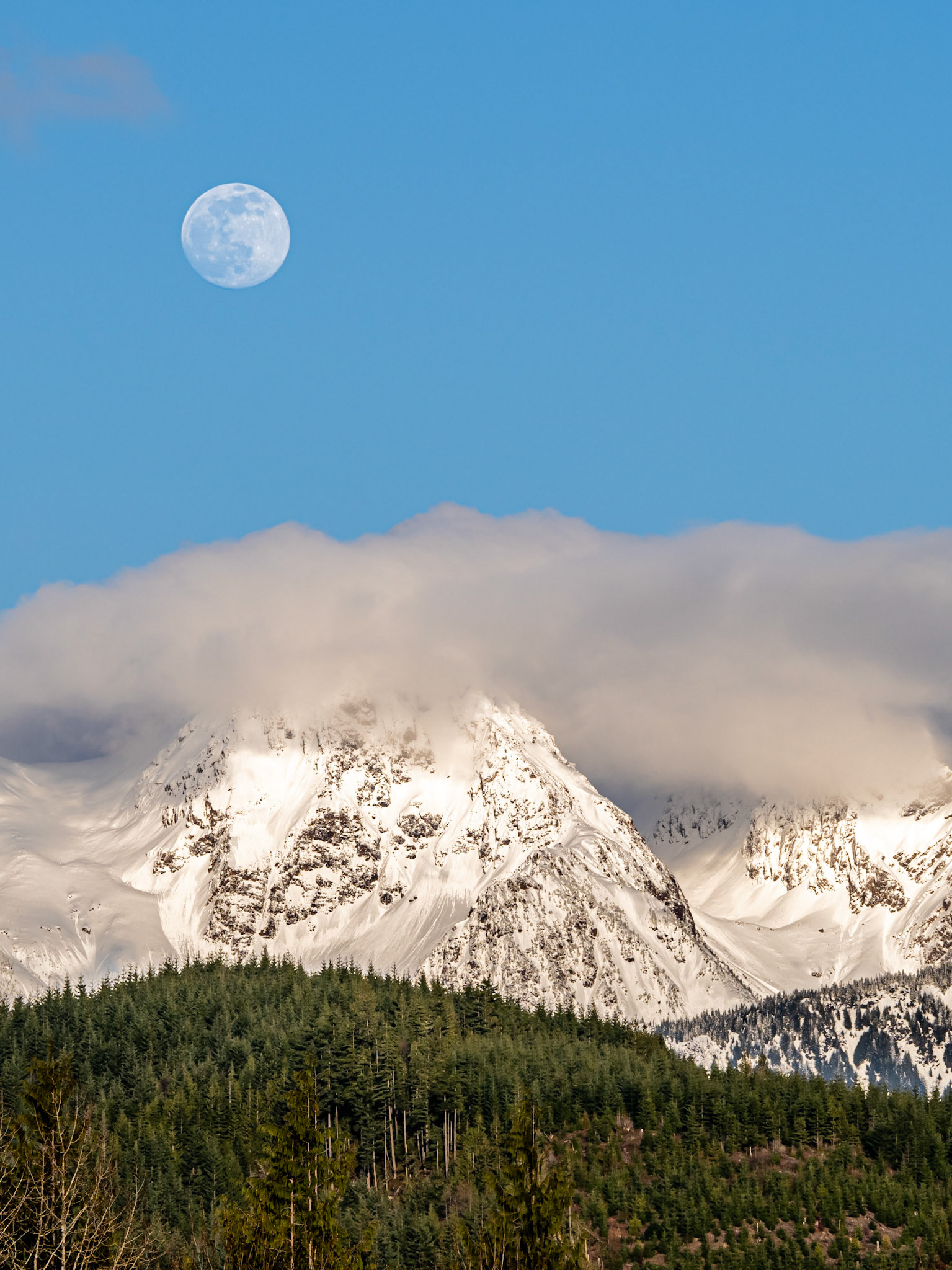
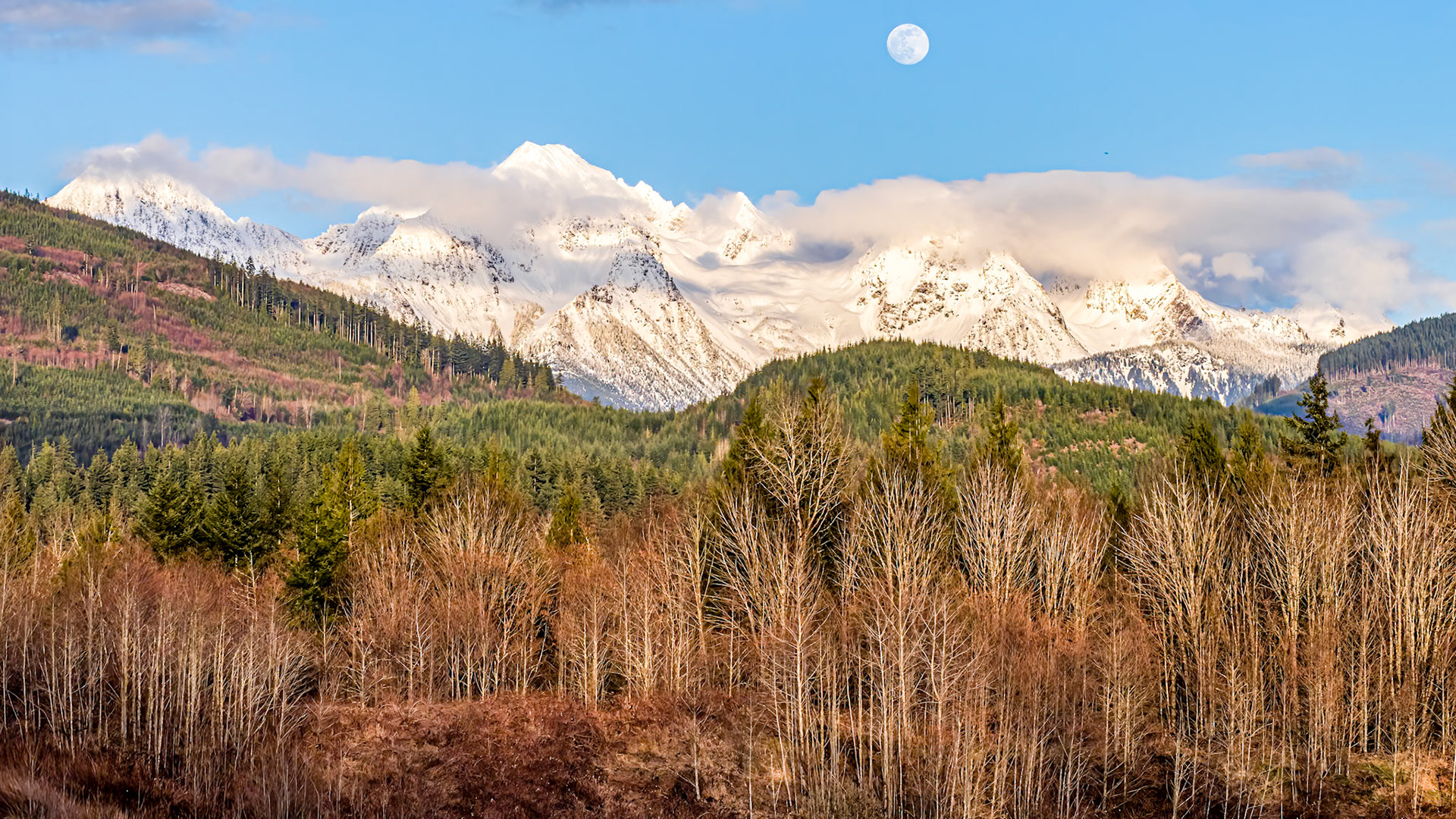
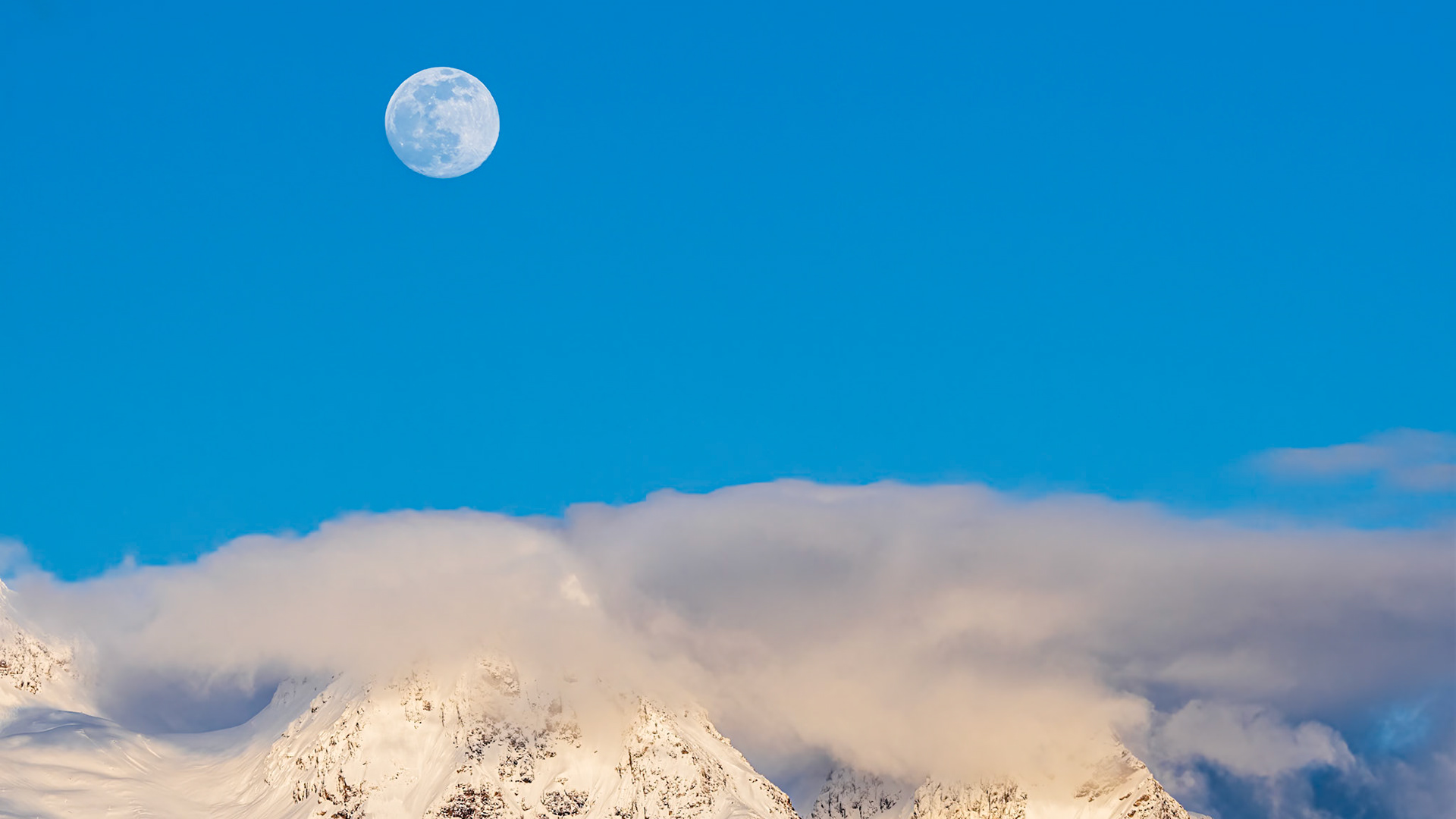
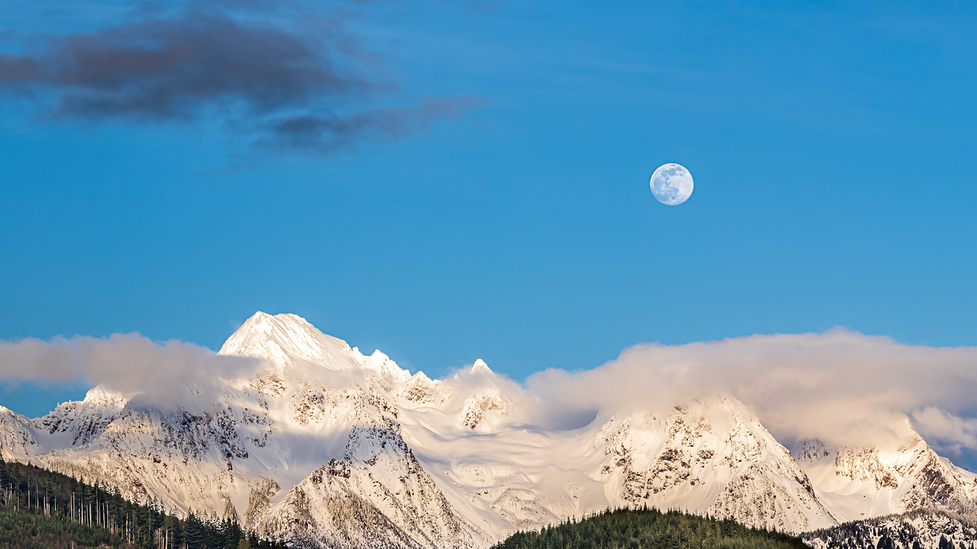
Twin Peaks Moonrise 1: The clouds parted on an overcast day to reveal the moon rising above Twin Peaks near Mt. Baker in the Washington Cascades
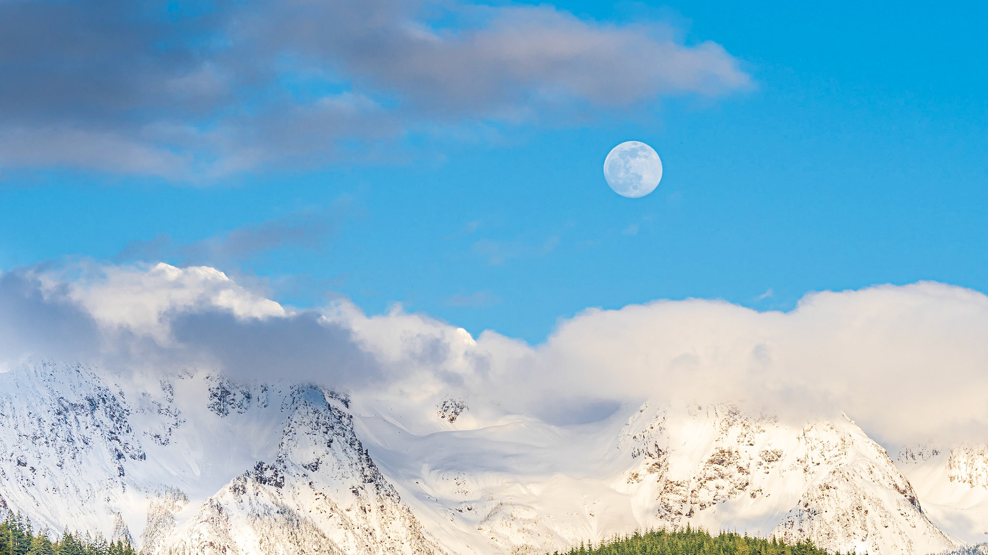
Twin Peaks Moonrise 1: The clouds parted on an overcast day to reveal the moon rising above Twin Peaks near Mt. Baker in the Washington Cascades
Twin Peaks Moonrise Panorama 1: The clouds parted on an overcast day to reveal the moon rising above Twin Peaks near Mt. Baker in the Washington Cascades
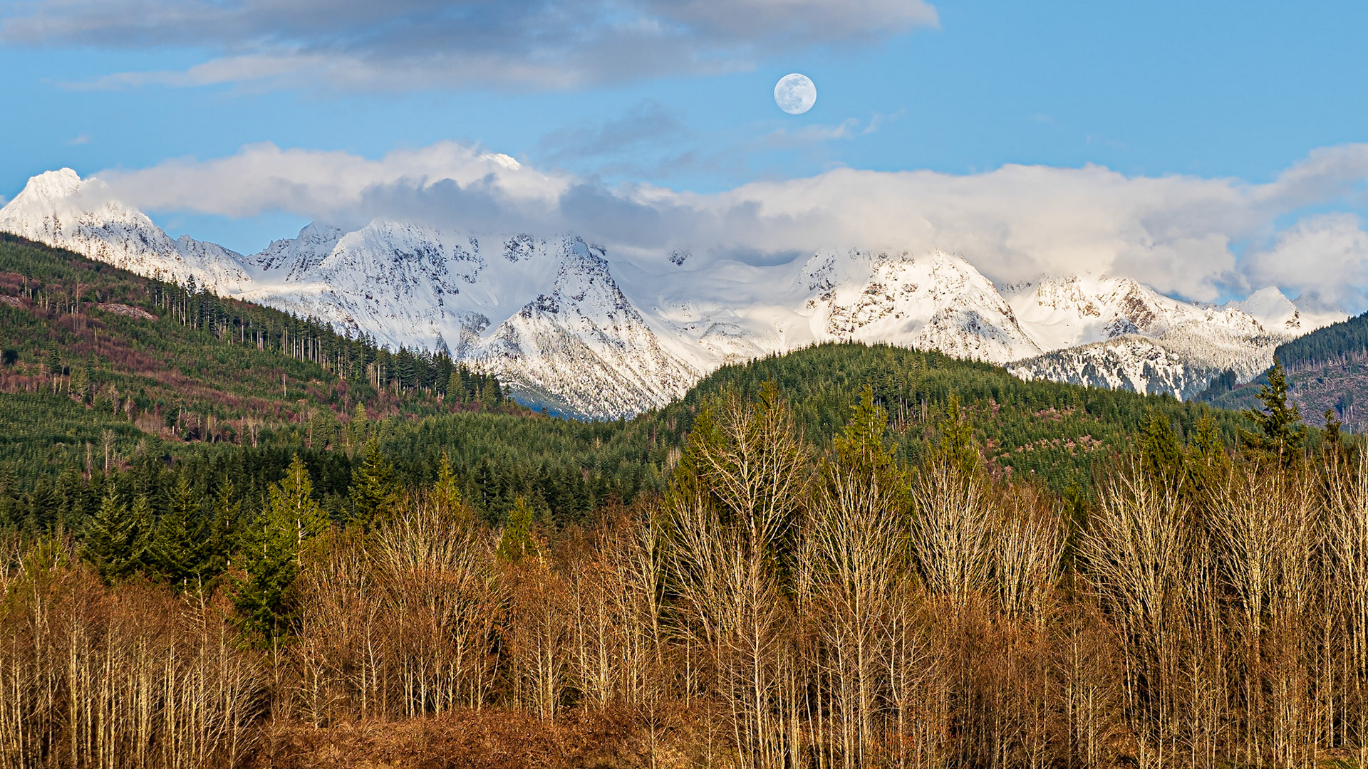
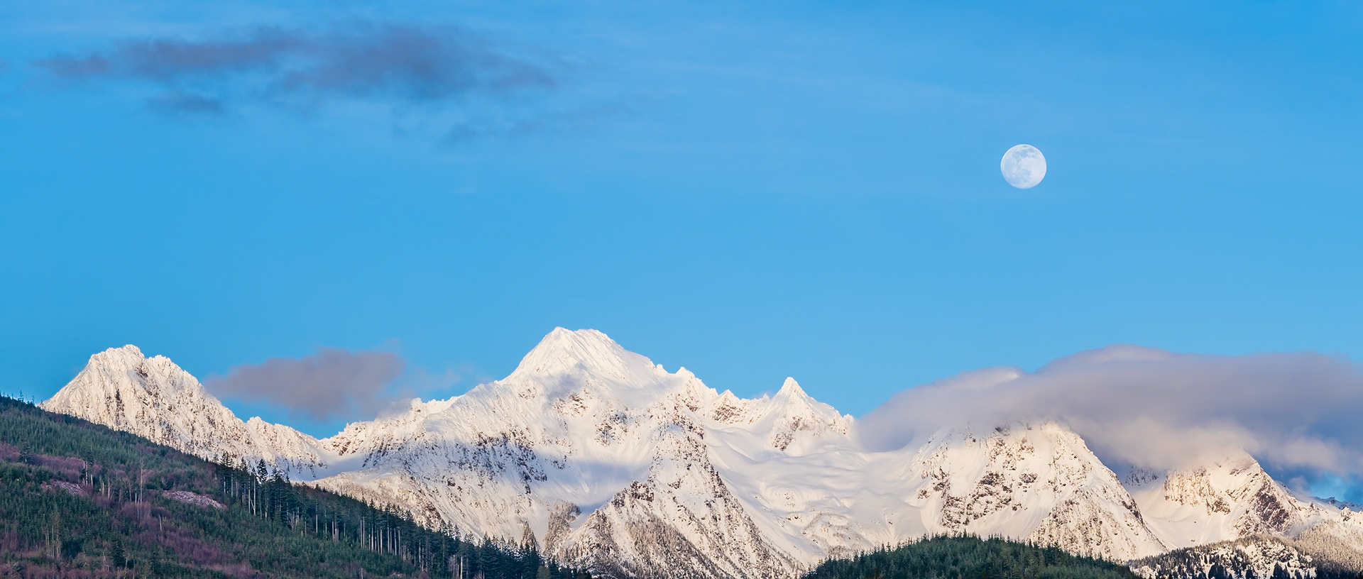
Cascade Moonrise Panorama: The clouds parted on an overcast day to reveal the moon rising above Twin Peaks near Mt. Baker in the Washington Cascades
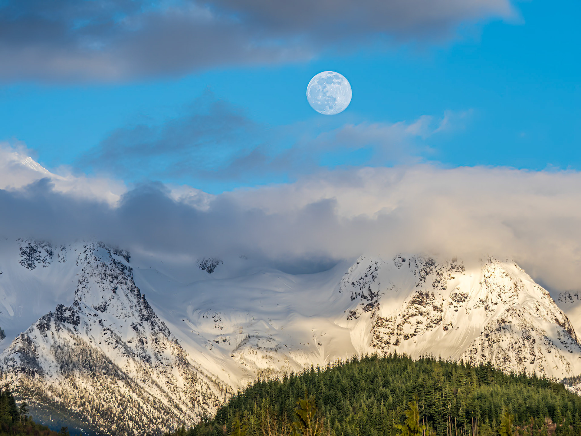
Cascade Moonrise: The clouds parted on an overcast day to reveal the moon rising above Twin Peaks near Mt. Baker in the Washington Cascades
Twin Peaks Moonrise 2: The clouds parted on an overcast day to reveal the moon rising above Twin Peaks near Mt. Baker in the Washington Cascades
Twin Peaks Moonrise Panorama 2: The clouds parted on an overcast day to reveal the moon rising above Twin Peaks near Mt. Baker in the Washington Cascades
Cascade Moonrise Panorama 2: The clouds parted on an overcast day to reveal the moon rising above Twin Peaks near Mt. Baker in the Washington Cascades
Cascade Moonrise Panorama 3: The clouds parted on an overcast day to reveal the moon rising above Twin Peaks near Mt. Baker in the Washington Cascades
Twin Peaks Moonrise Panorama 4: The clouds parted on an overcast day to reveal the moon rising above Twin Peaks near Mt. Baker in the Washington Cascades
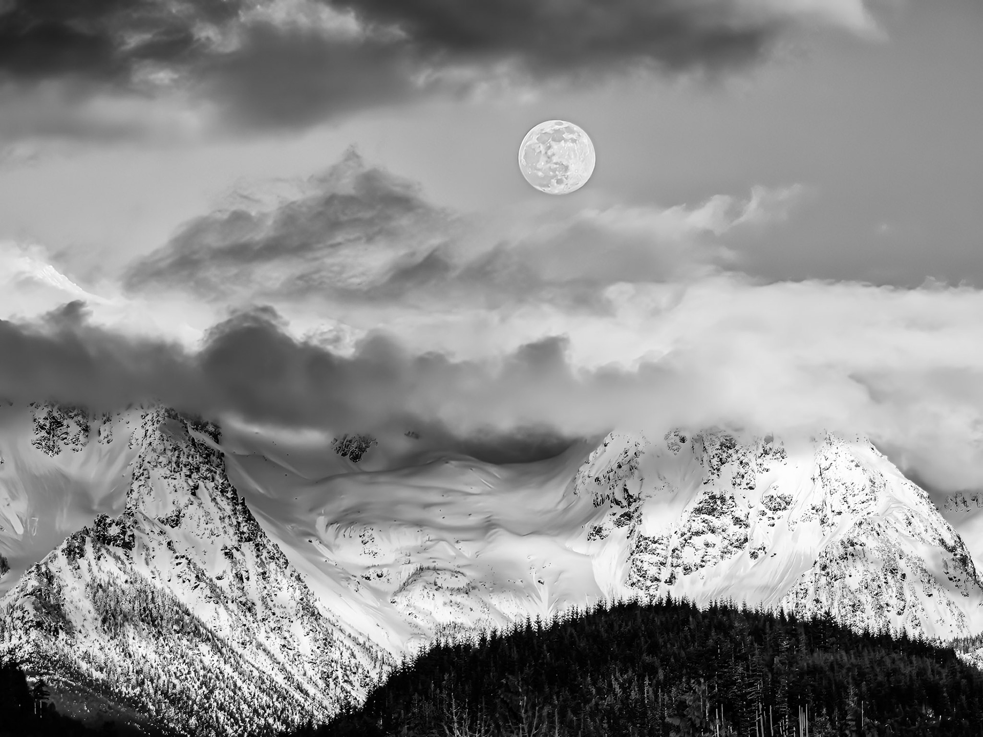
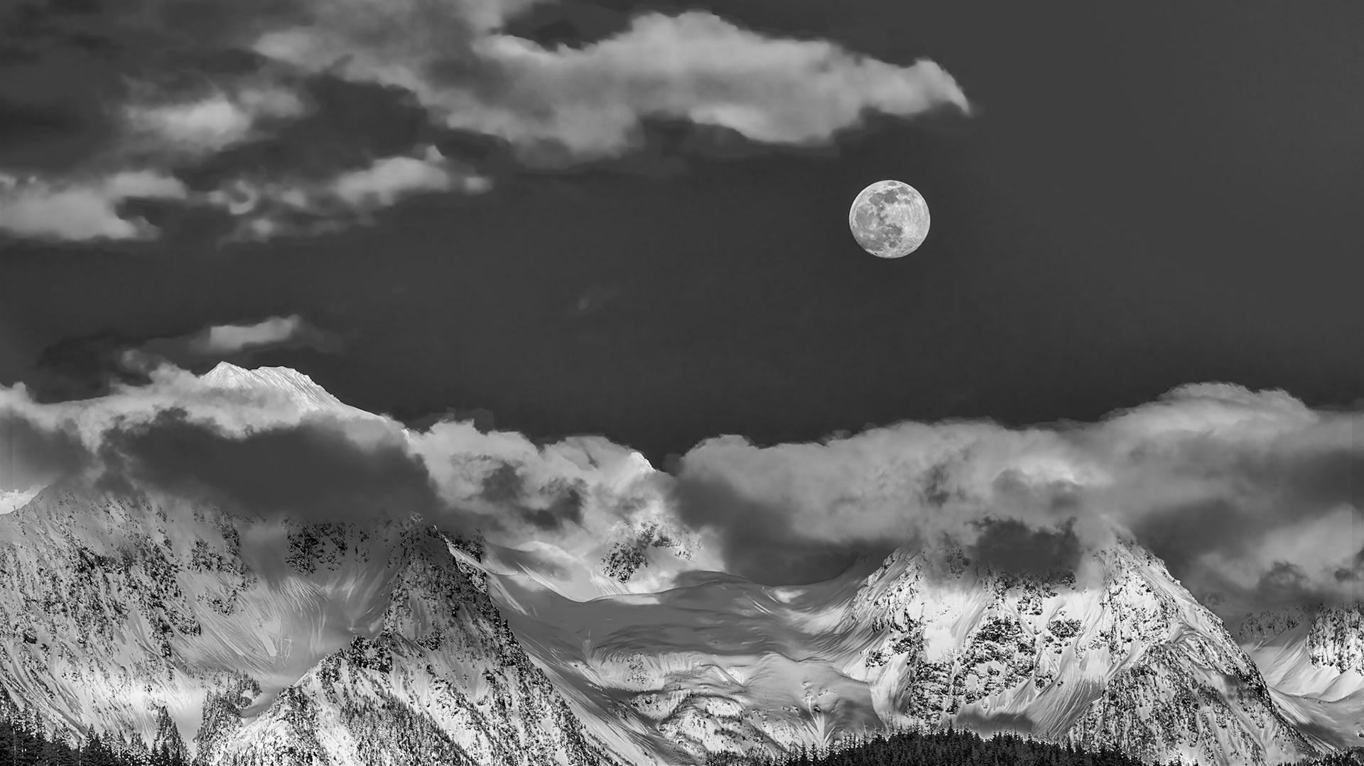
Cascade Moonrise B&W: The clouds parted on an overcast day to reveal the moon rising above Twin Peaks near Mt. Baker in the Washington Cascades
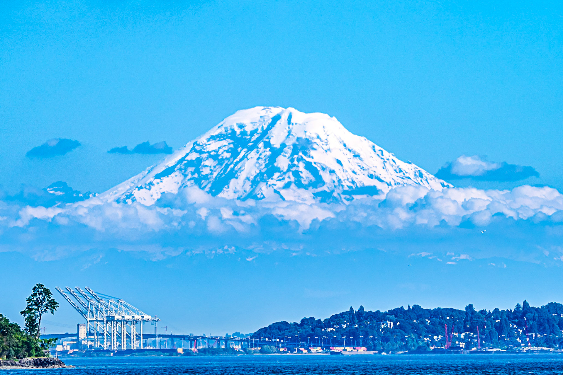
Island in the Sky: Rising above surrounding clouds Mt. Rainier seems to float like an island in the sky over the Seattle waterfront.
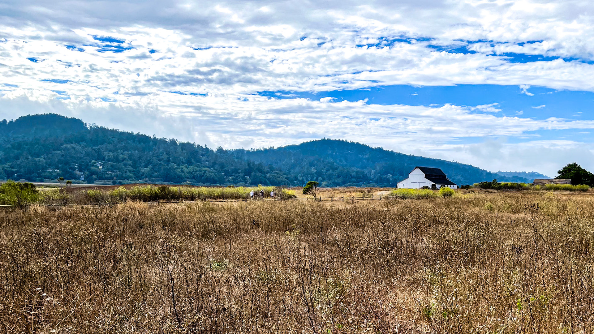
Point Reyes Station Farmland: Located at the head of Tomales Bay California
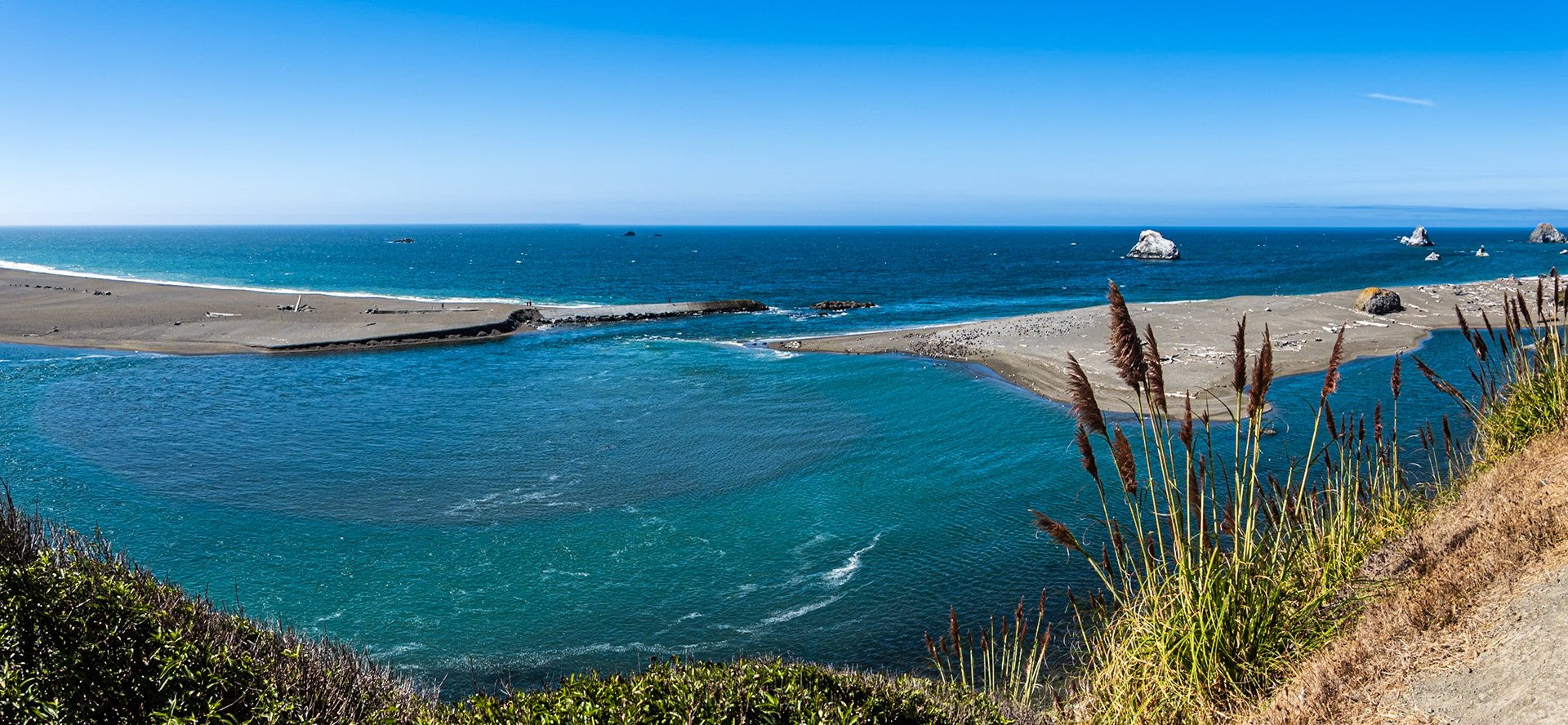
Russian River Estuary: Near the Jenner Headlands, California,
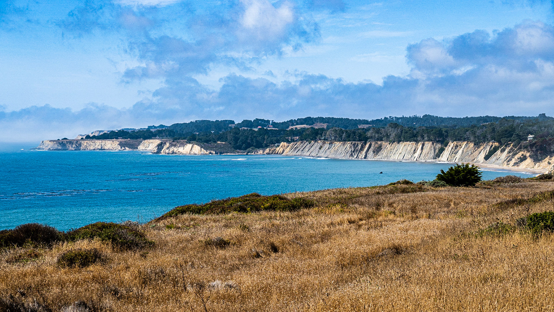
Jenner Headlands - Coastal Prairie: Fog lifting over the coastal prairie at the Jenner Headlands Preserve located north of the Russian River estuary.
Steep Cliffs: Steep cliffs descend to the ocean south of Point Arena California.
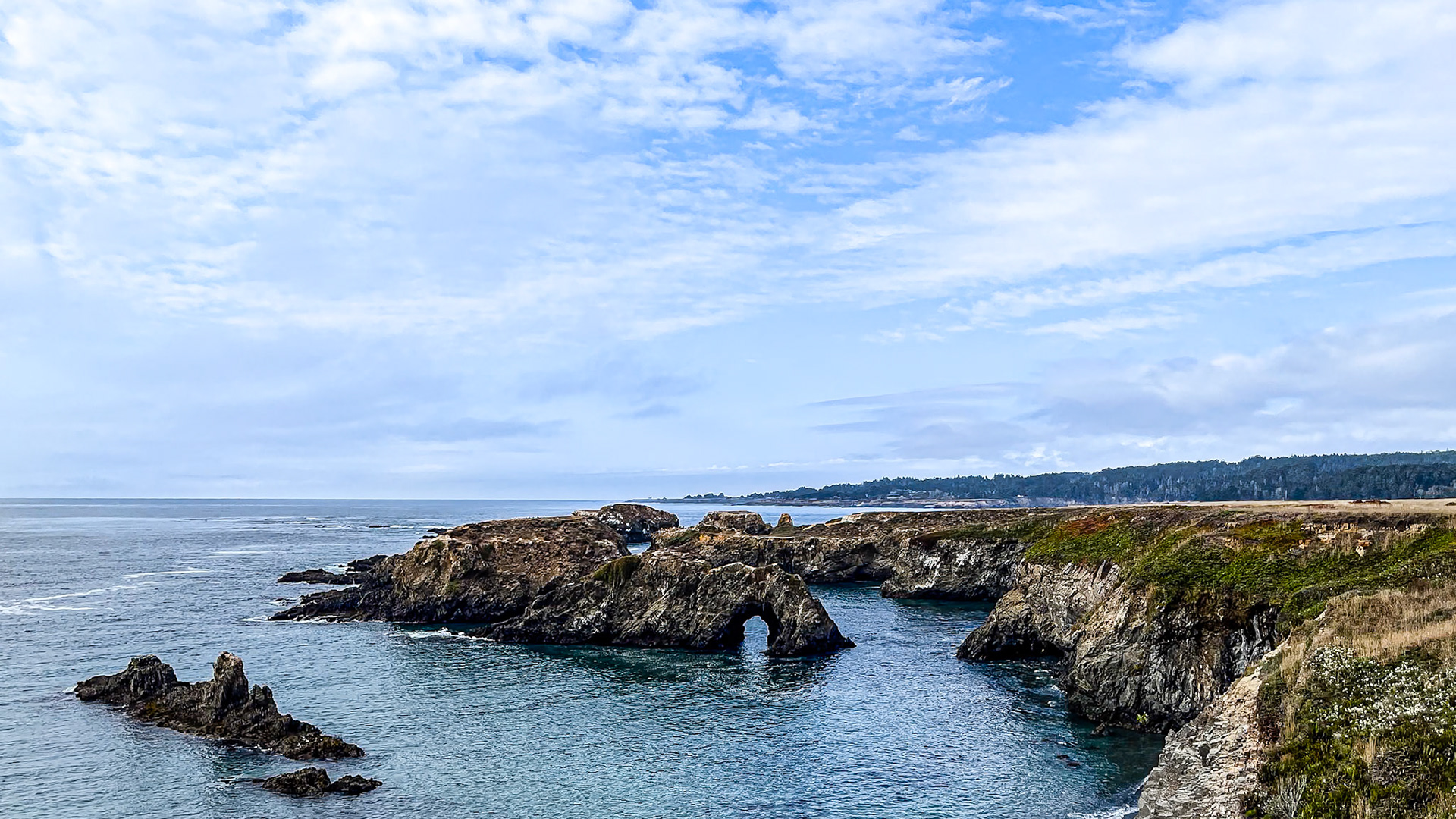
Sea Arch and Sea Stacks: At the Mendocino Headlands California.
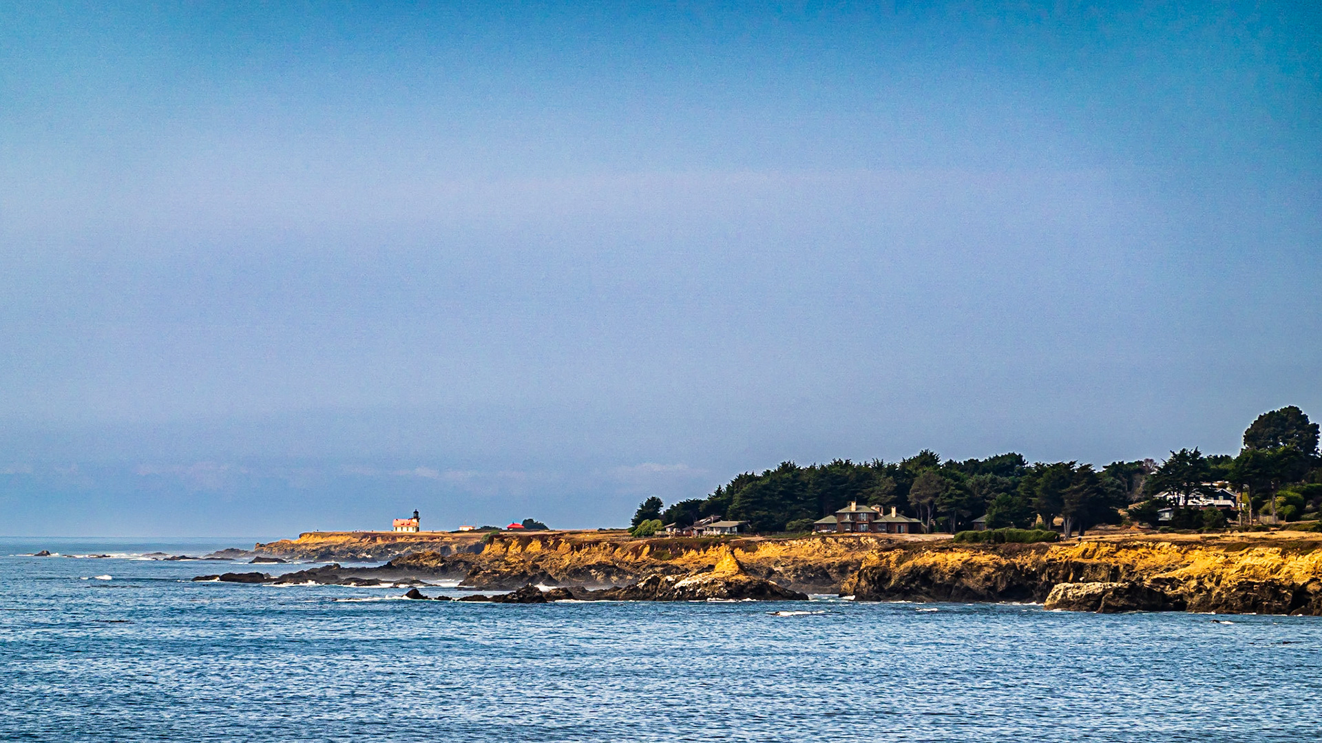
Point Cabrillo California: A light station sits on the exposed coastal terrace of Point Cabrillo, California.
Cloudy Sunset: At Seal Rock Oregon
Cloudy Sunset: At Seal Rock Oregon
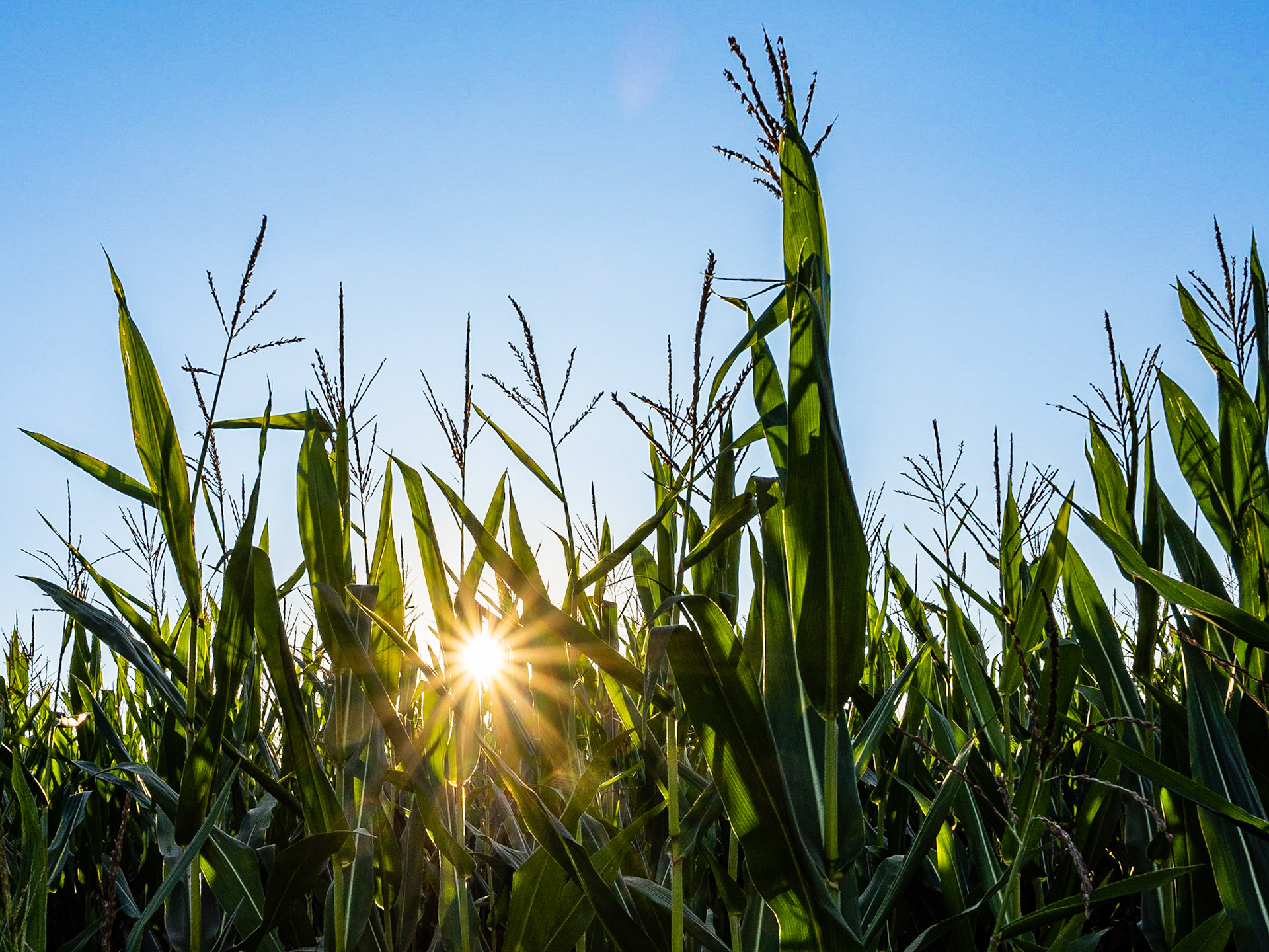
Corn Maze Sun: The sun peaks through the corn maze at the Muddy Boots Pumpkin Patch in Duvall Washington.
After Susnet: At Rattlesnake Lake Washington
Golden Hour Trees: At the shoreline of Rattlesnake Lake Washington
After Susnet: At Rattlesnake Lake Washington
Blue Hour Clouds: Just after sunset at Rattlesnake Lake Washington
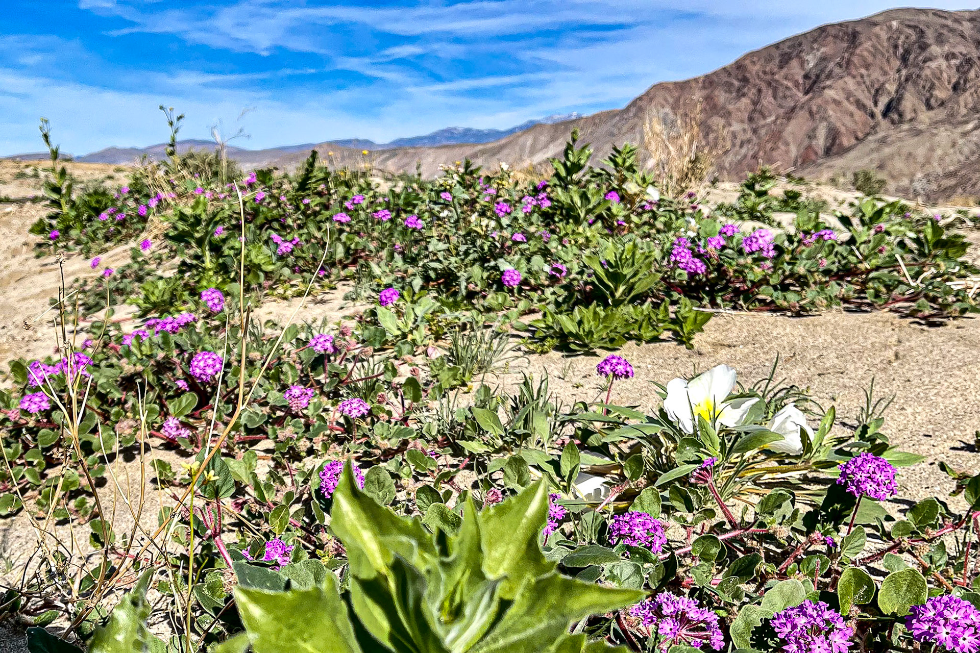
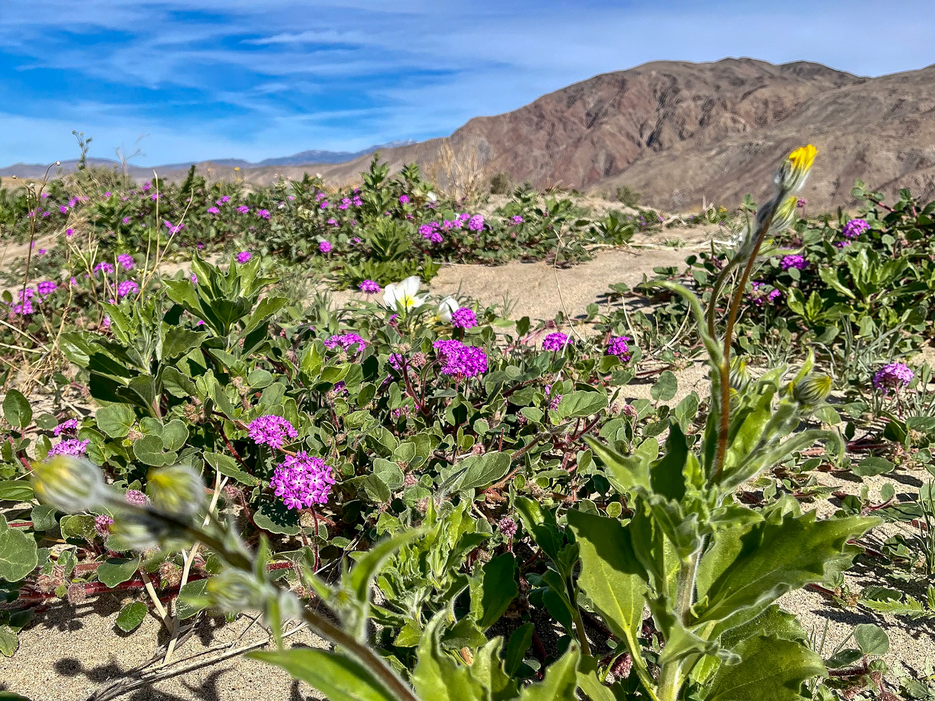
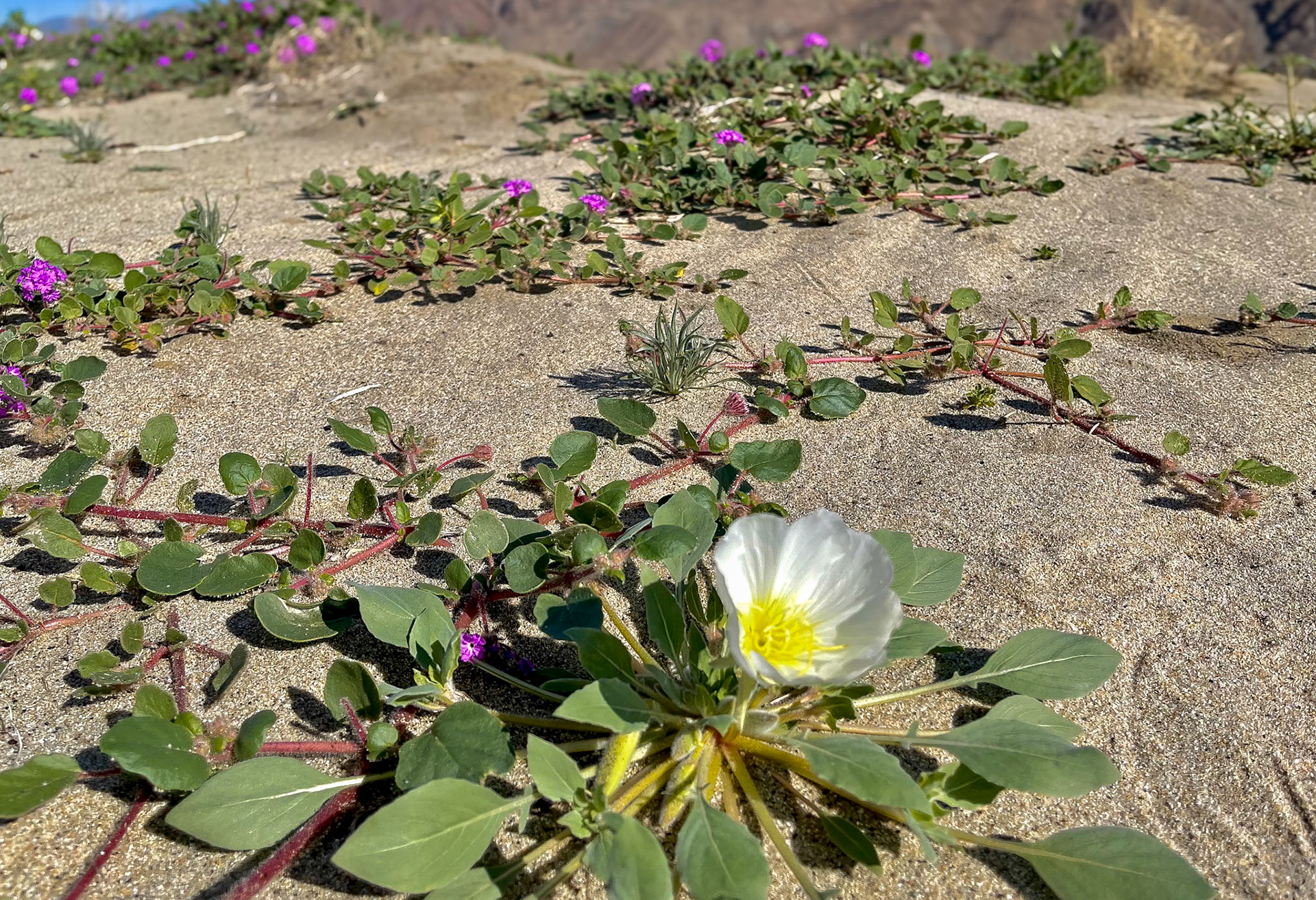
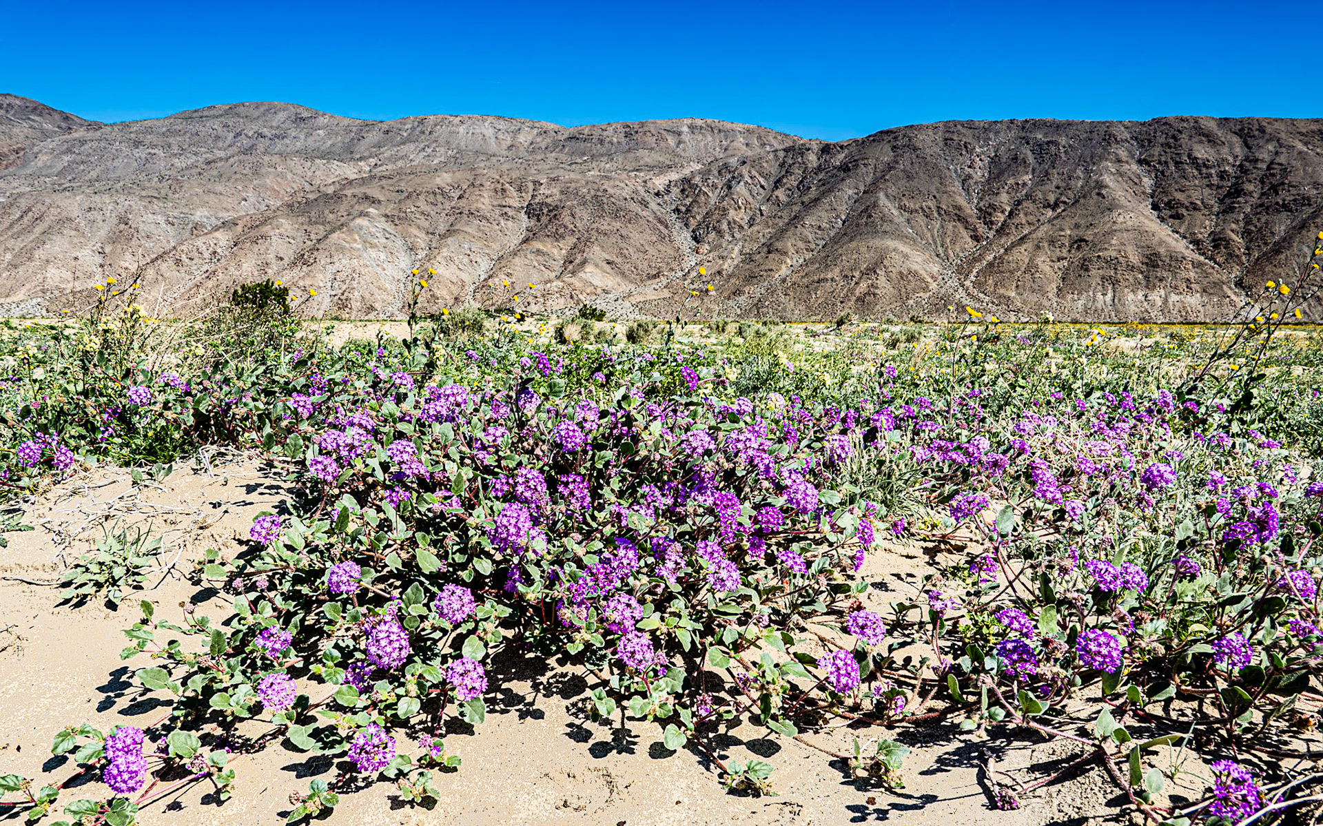
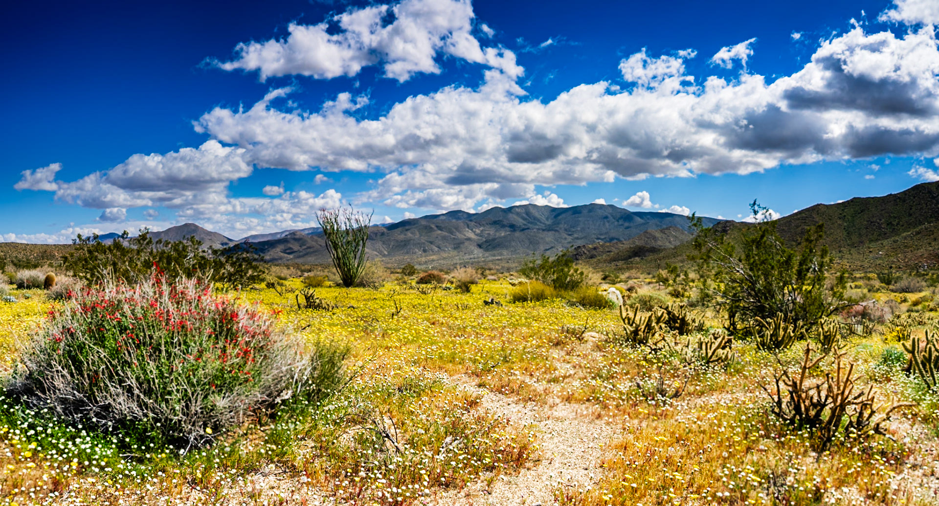
Desert Wildflower Blooms: Sand Verbena and Dune Evening Primrose near Henderson Road in Borrego Springs CA.
Desert Wildflower Blooms: Sand Verbena, Dune Evening Primrose and Desert Sunflower near Henderson Road in Borrego Springs CA.
Desert Wildflower Blooms: Sand Verbena and Dune Evening Primrose near Henderson Road in Borrego Springs CA.
Wind Caves: Near Split Mountain in the Anza-Borrgo Desert.
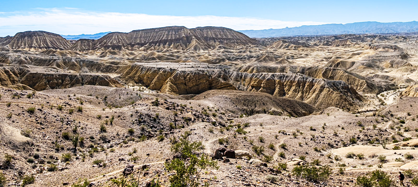
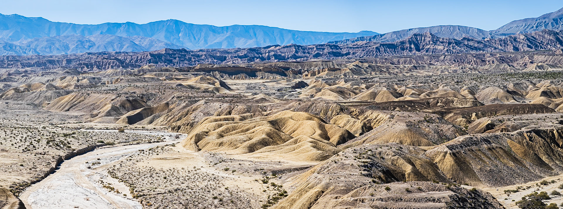
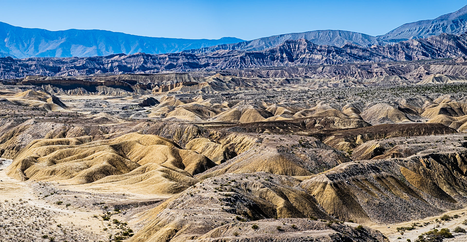
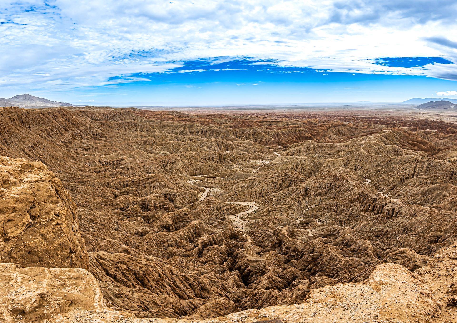
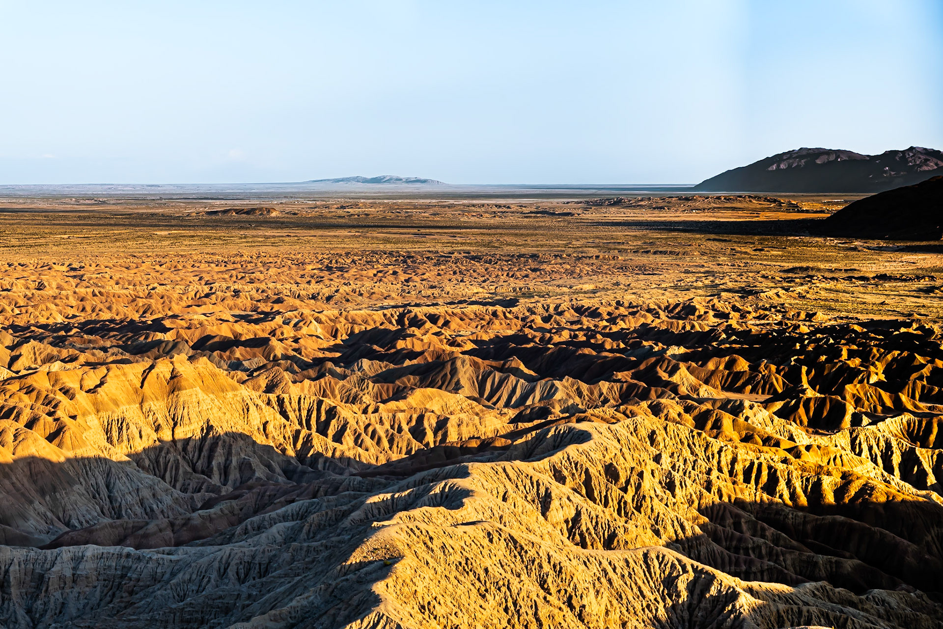
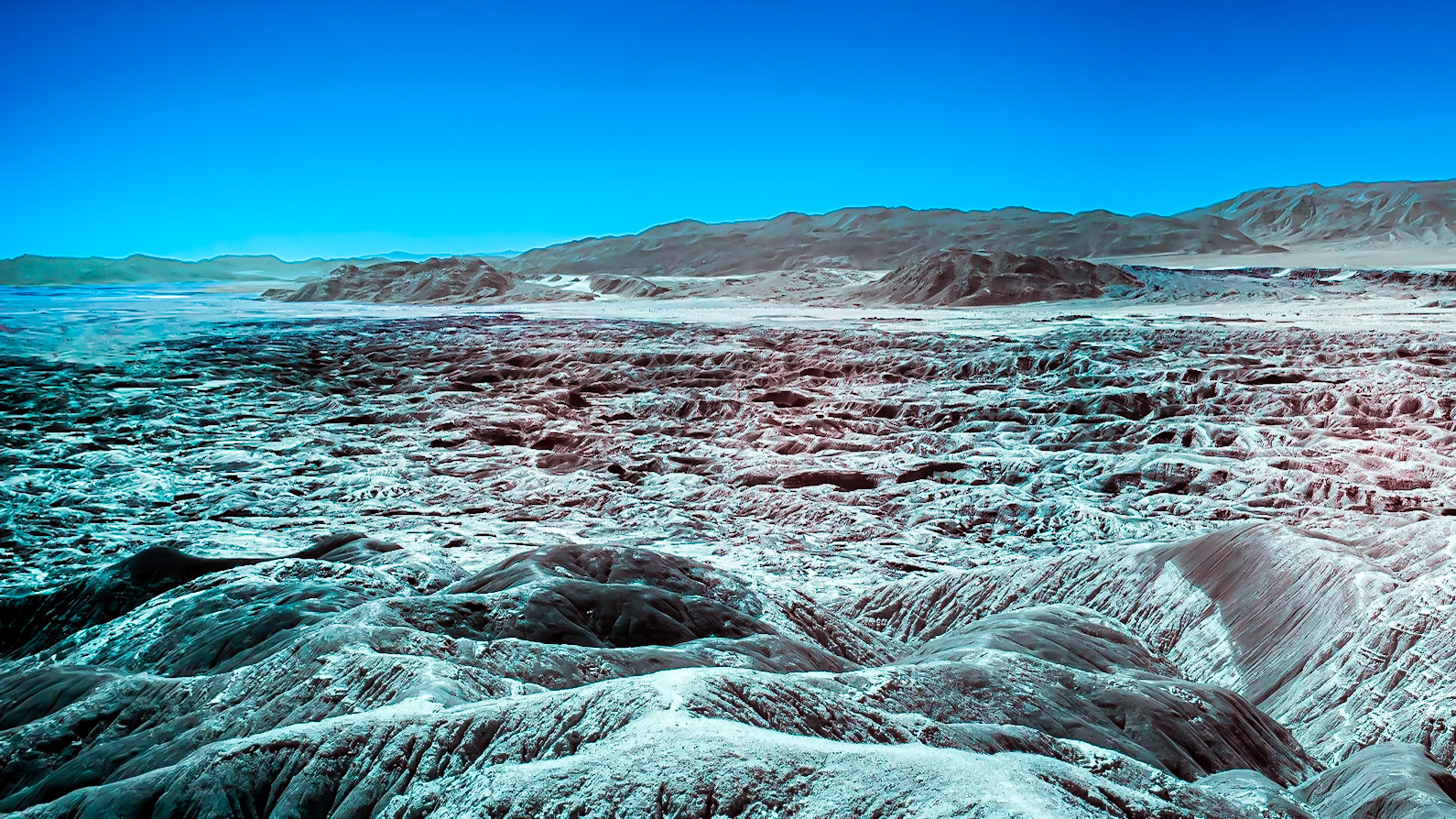
Elephant Knees in the Carrizo Badlands: Viewed from the Wind Caves in the Anza-Borrego Desert.
Carrizo Badlands: Viewed from the Wind Caves in the Anza-Borrego Desert.
Carrizo Badlands: Viewed from the Wind Caves in the Anza-Borrego Desert.
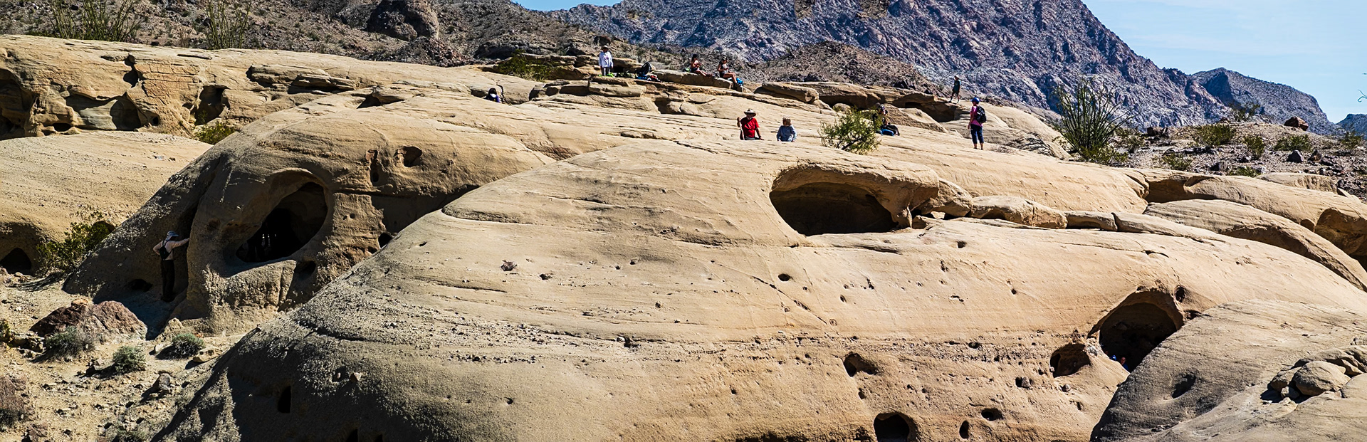
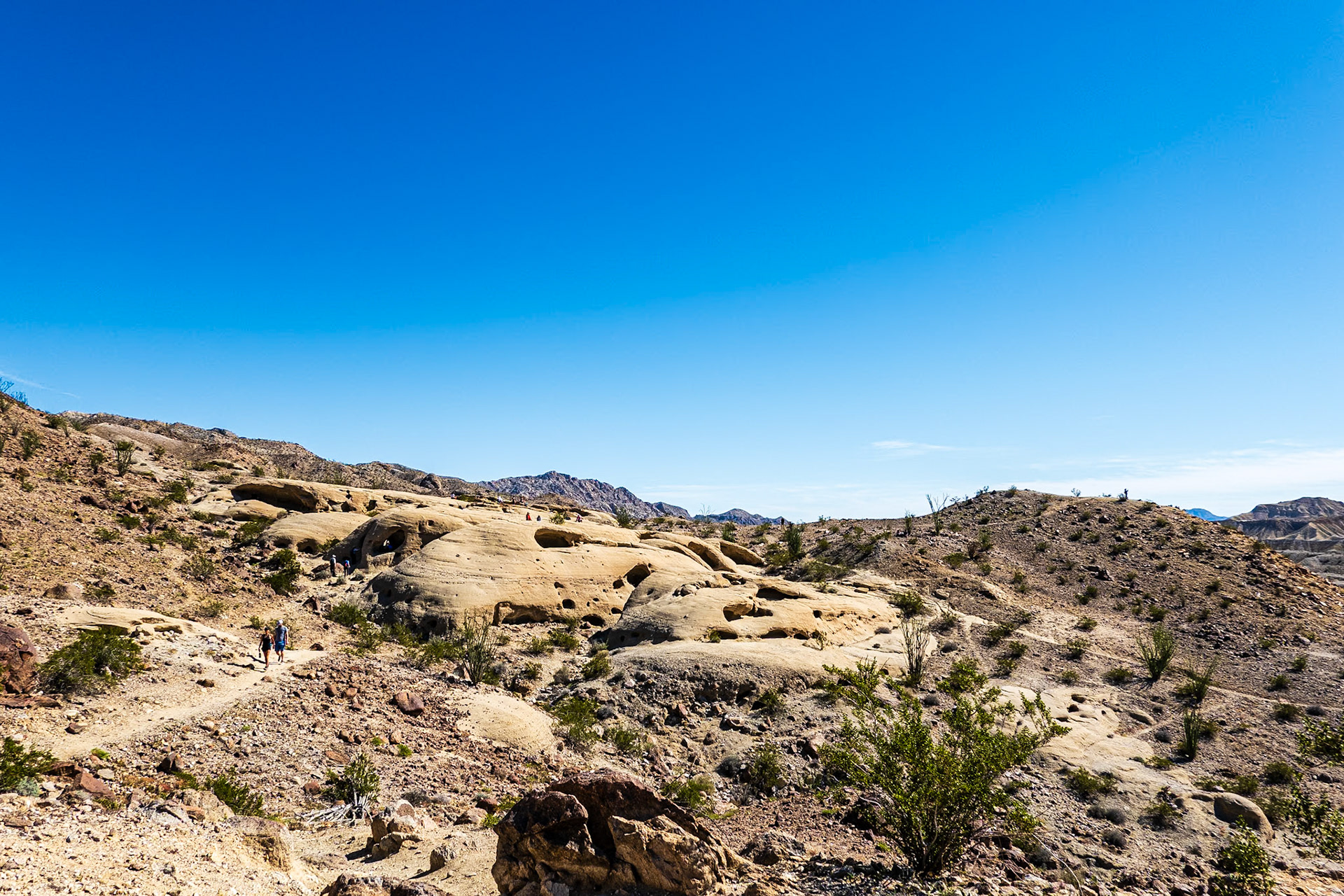
Hike to the Wind Caves: Overlooking the Carizzo Badlands, the Wind Caves are wind-eroded pockets found on a short hike from the Split Mountain Road.
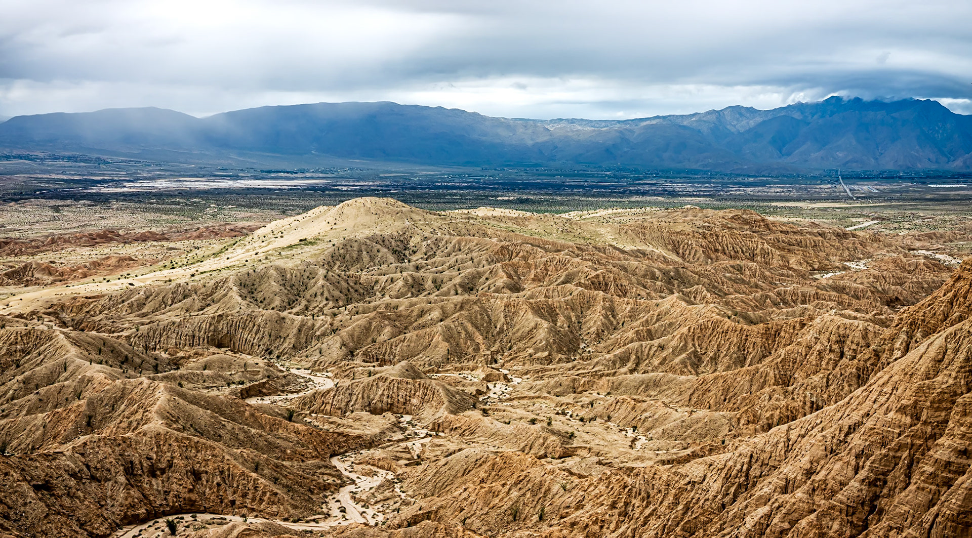
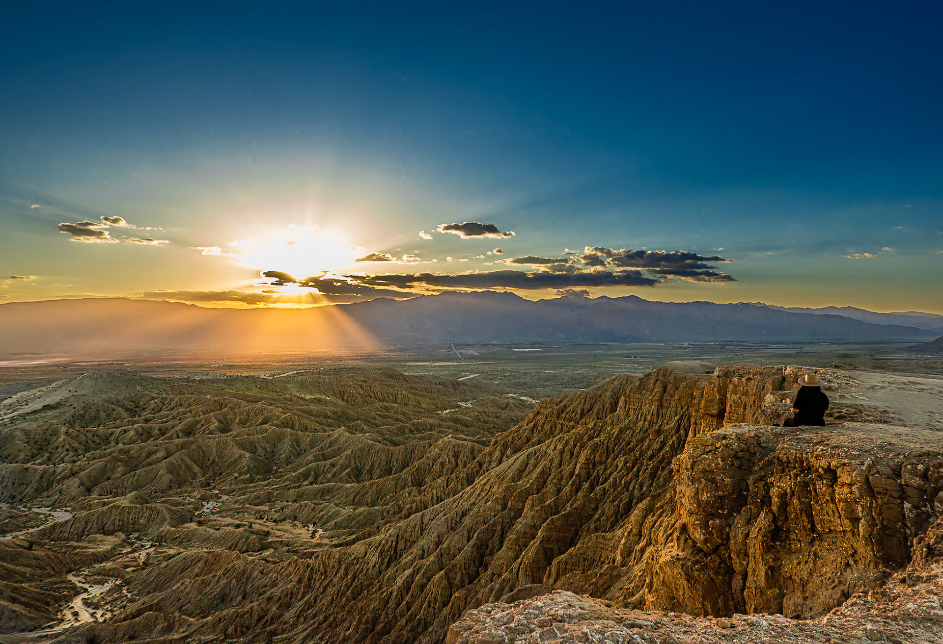
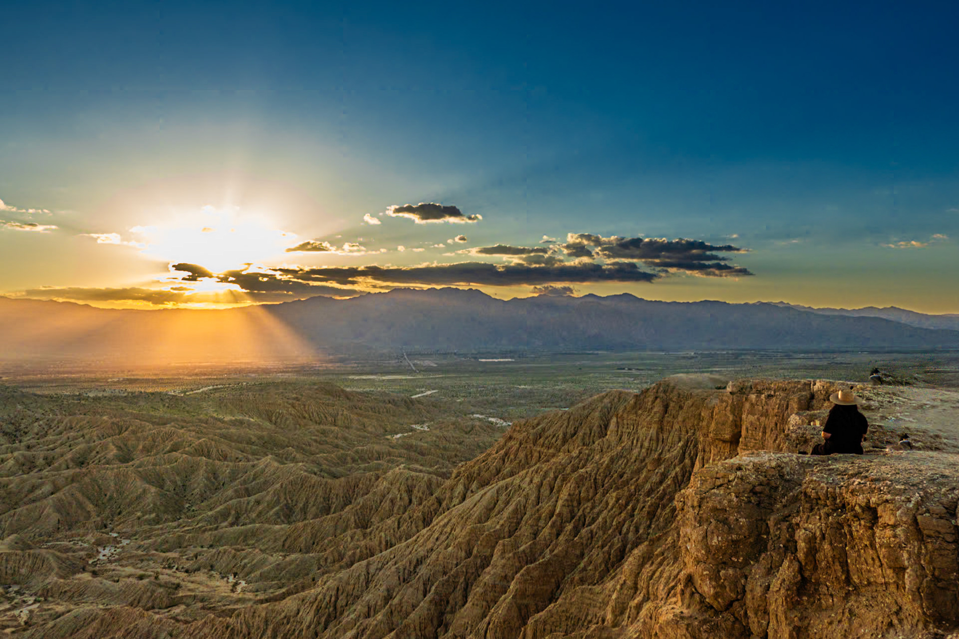
Borrego Badlands East: Viewed from Font's Point in the Anza-Borrego Desert looking east towards the Salton Sea.
Borrego Badlands West: Viewed from Font's Point in the Anza-Borrego Desert looking west towards Borrego Springs and the San Ysidero Mountains.
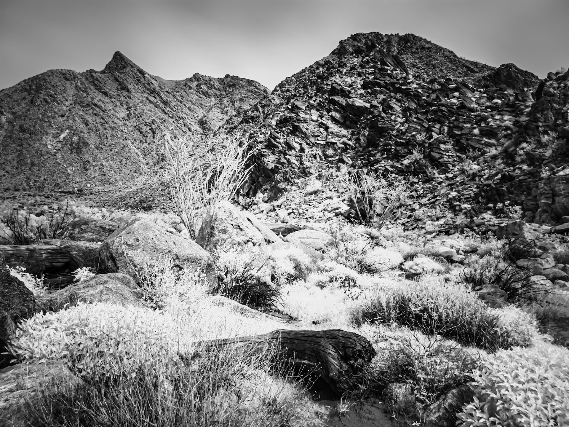
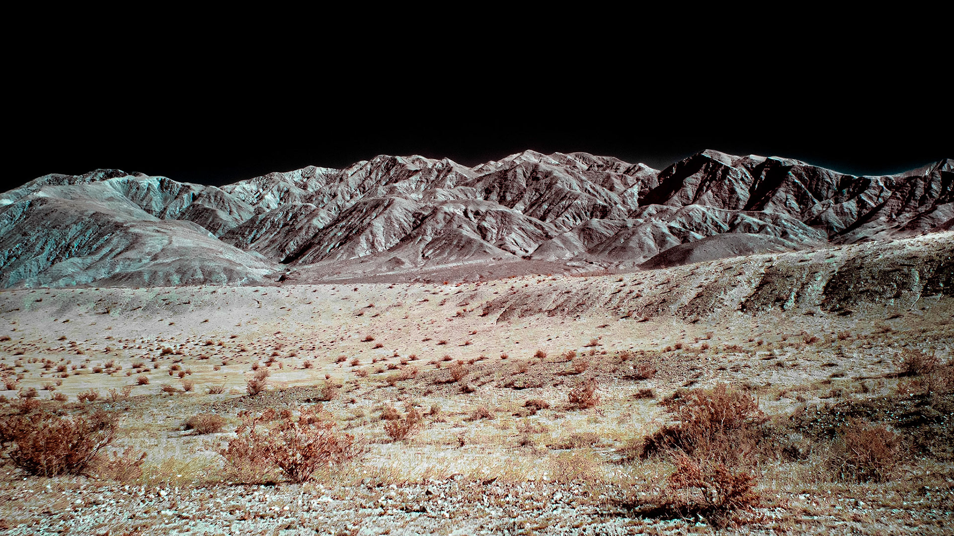
San Ysidero Mountains: Infrared image of the San Ysidro Mountains viewed from the Visitors Center at Anza-Borregro State Park.
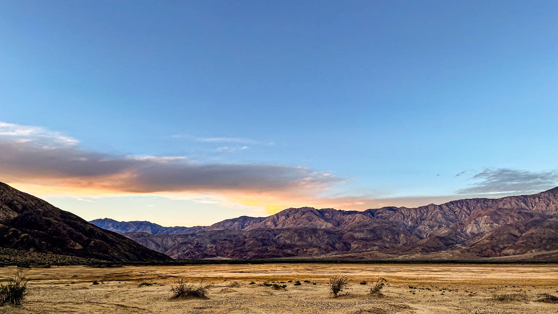
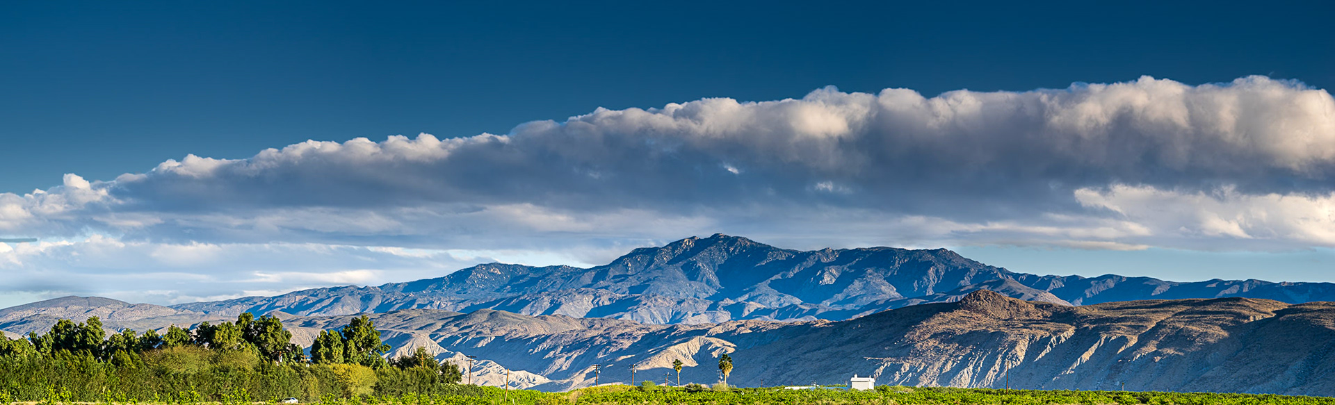
Santa Rosa Mountains: Viewed from Clark Dry Lake in tghe Anza-Borrego Desert.
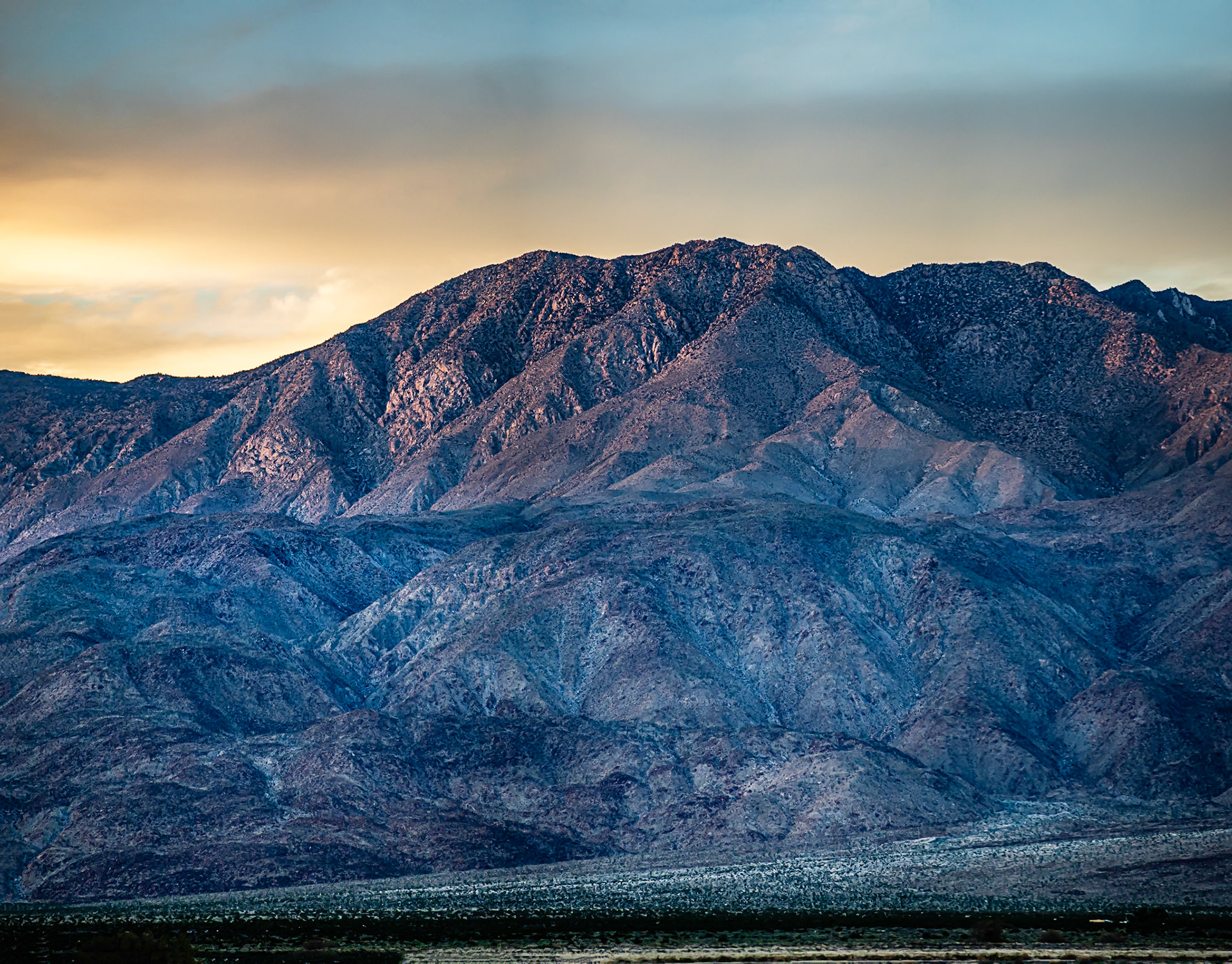
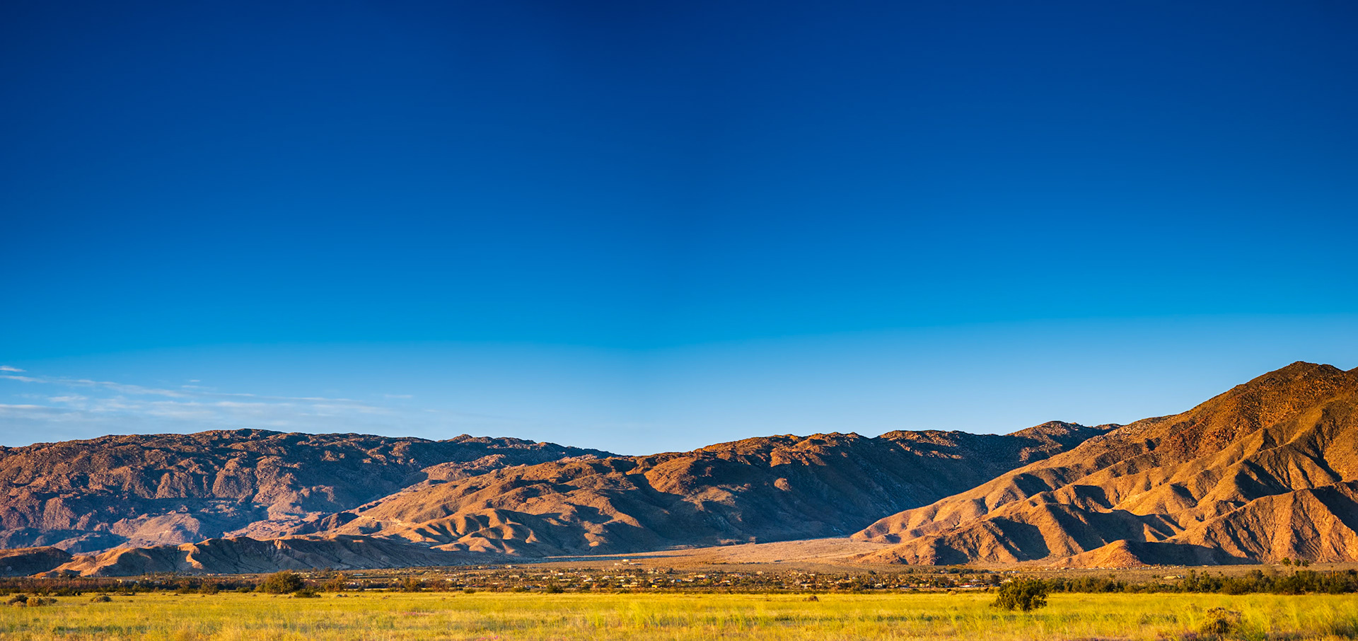
Evening Light on the Santa Rosa Mountains: In the Anza-Borrego Desert near Borrego Springs CA.
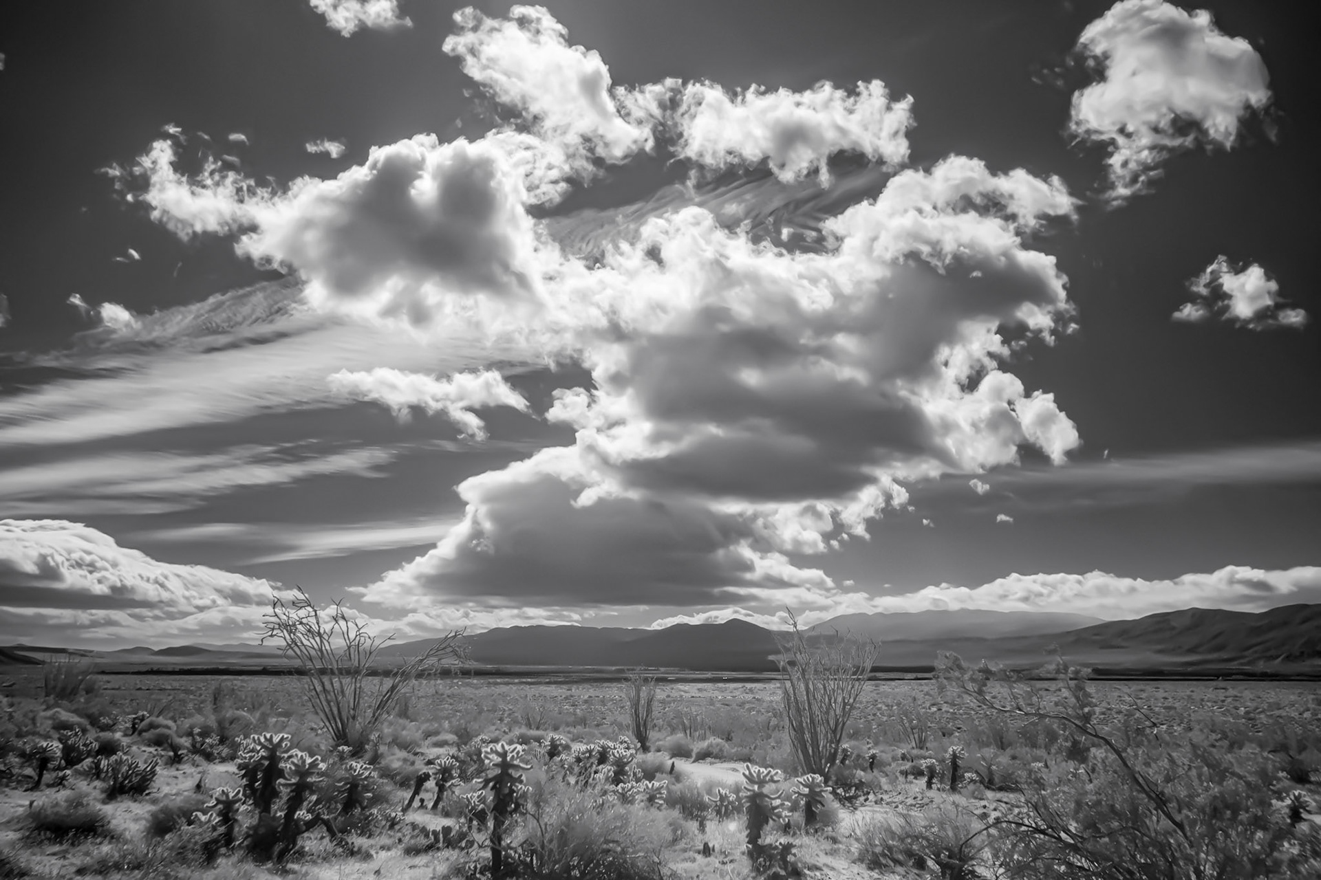
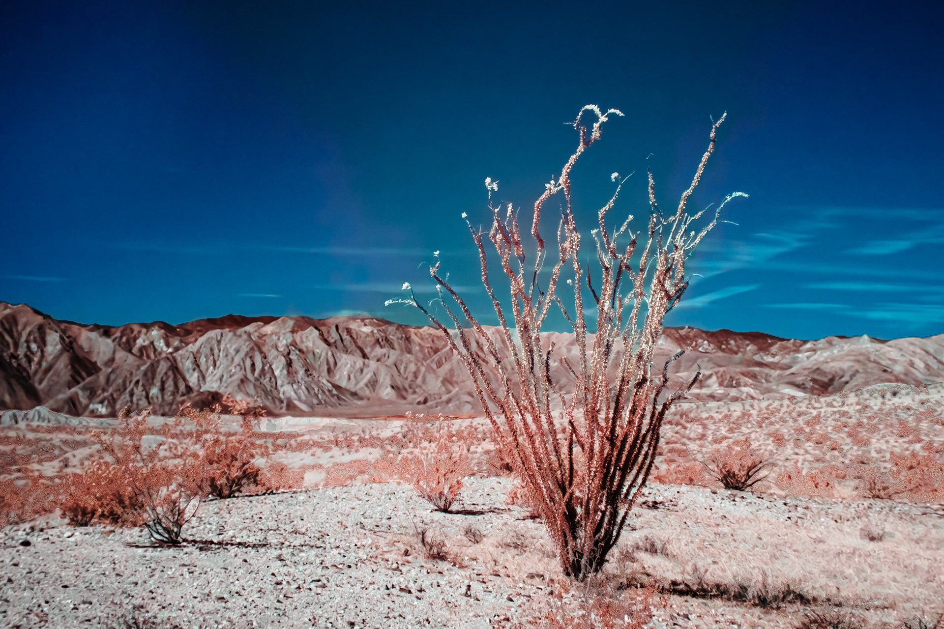
Ocotillo in the Anza-Borrego Desert: This is an infra-red image converted to black and white.
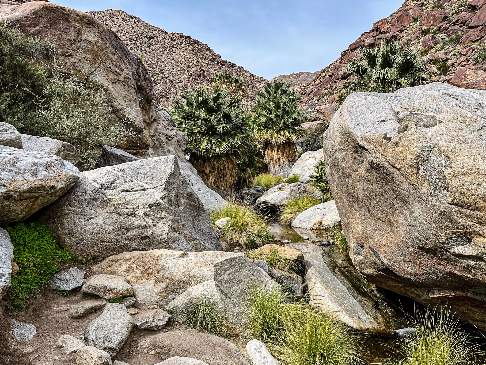
Palm Grove and Springs: The palm grove in Palm Canyon in the Anzo-Borrego Desert state park. The Grove is located along an ephemeral stream fed by runoff of infrequent rain intercepted by the surrounding San Ysidro mountains.
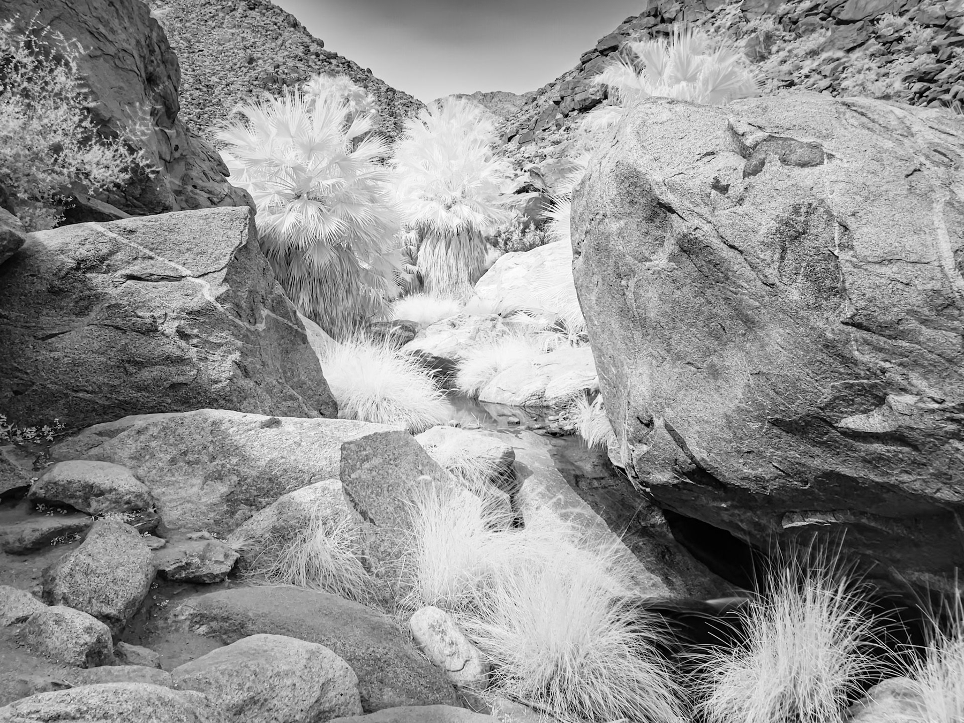
Palm Grove and Springs in Infrared: At the head of the Palm Canyon in Anza-Borrefgo State Park CA. This is an infrared image converted to black and white.
Sand Verbena & Desert Sunflower: Found along Henderson Canyon Road with Coyote Mountain in the background near Borrego Springs CA.
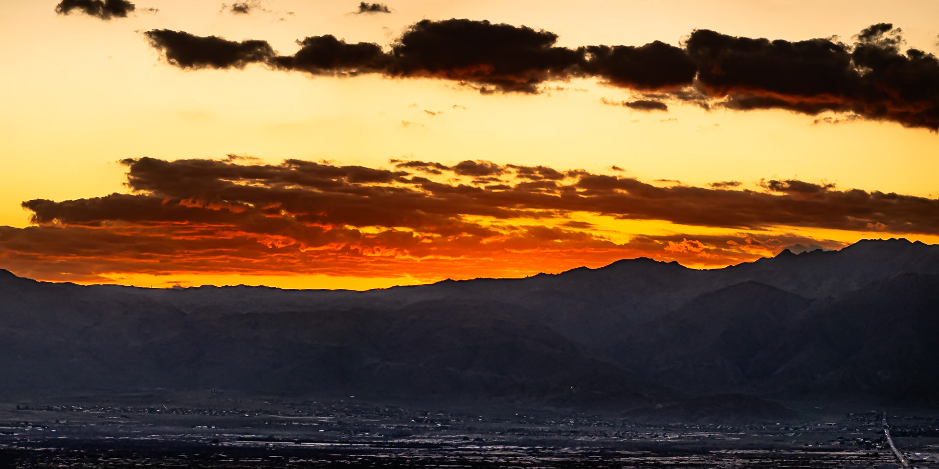
Borrego Badlands Golden Hour: Looking southeast towards the Salton Sea from Font's Point in the Anza-Borrego Desert near Borrego Springs CA.
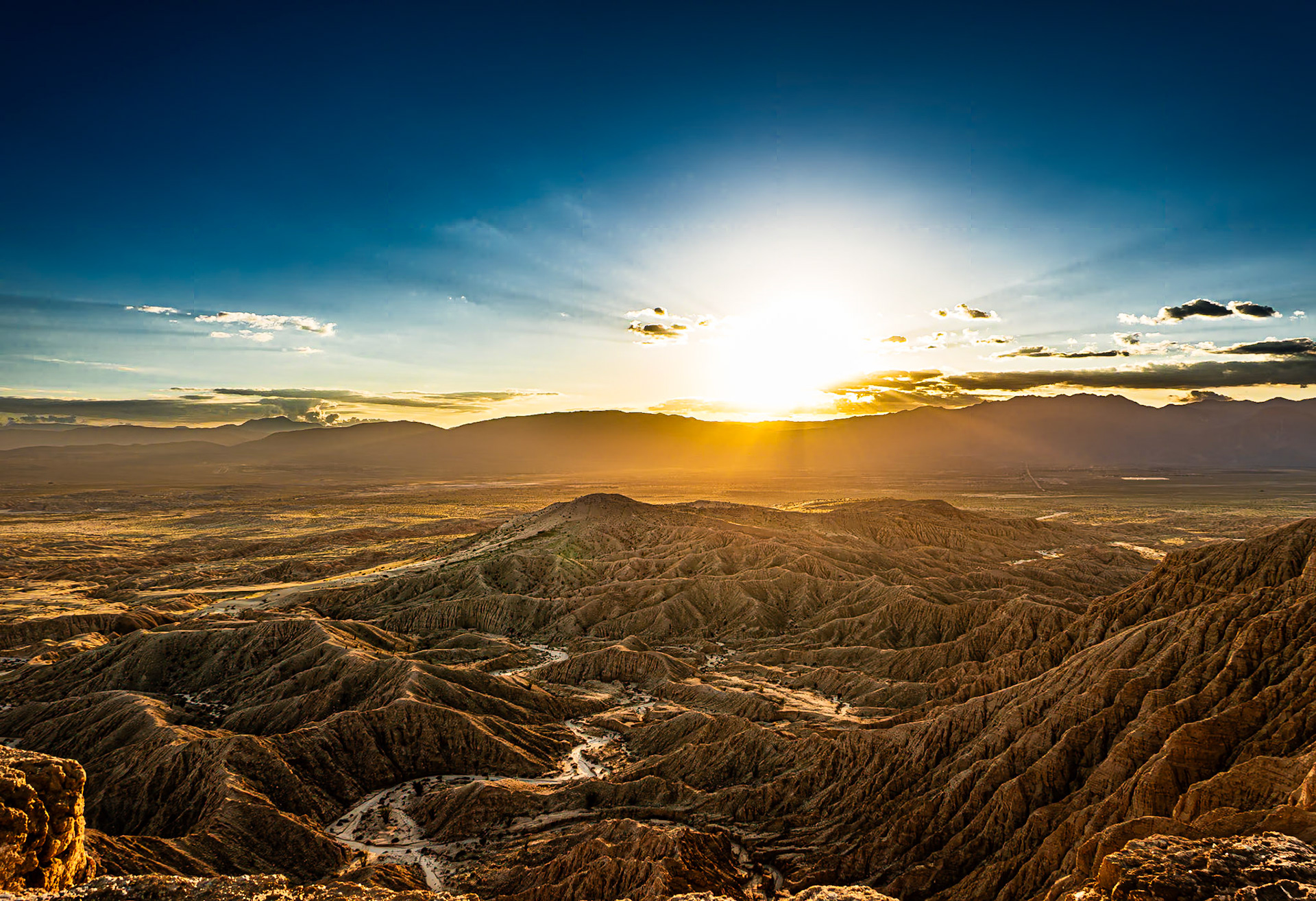
Borrego Sunset and Badlands: Sunset over the San Ysidro Mountains with the Borrego Valley and Badlands in the foreground. viewed from Font's Point in the Anza-Borrego Desert.
Borrego Valley Golden Hour: Dusk settles over Borrego Spings and the Borrego Valley as the sunsets behind the San Ysidro Mountains.
Sunset over the San Ysidro Mountains with the Borrego Valley and Badlands in the foreground. viewed from Font's Point in the Anza-Borrego Desert.
Borrego Sunset: Sunset over the San Ysidro Mountains with the Borrego Valley and Badlands in the foreground. viewed from Font's Point in the Anza-Borrego Desert.
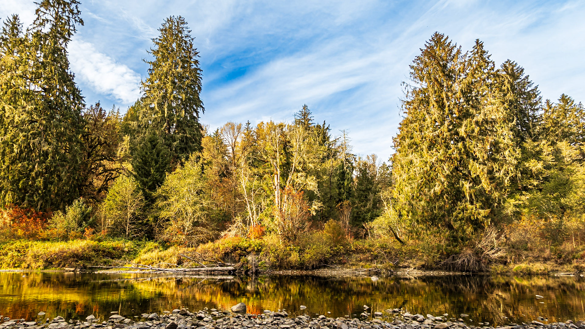
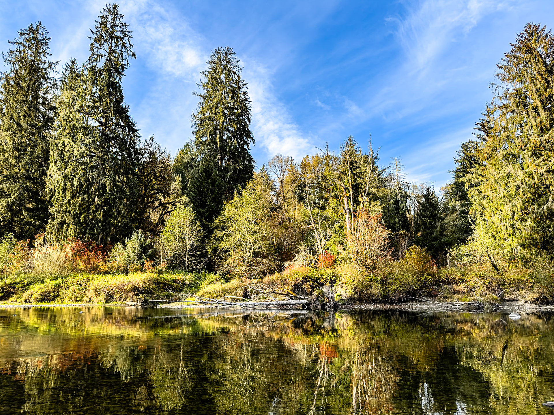
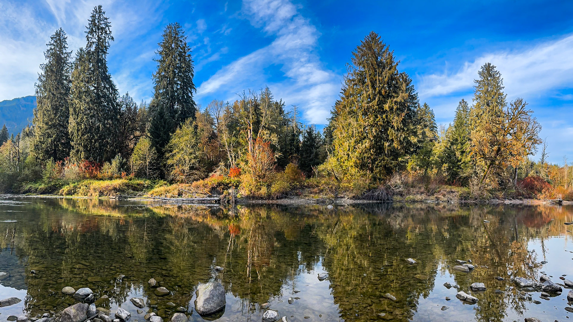
Fall River Reflection: A quiet reach on the Middle Fork of the Snoqualmie River.
Reflecting Pool: On the Middle Fork of the Snoqualmie River.
Autumn River Panorama: Low and calm water on the Middle Fork of the Snoqualmie River reflects mixed evergreen and autumn foliage colors.
San Ysidro Panorama: Clouds gathering to push over the San Ysidro Mountains onto the Anza-Borrego Dersert.
Road to Coyote Canyon FCIR: Clouds threaten rain over the San Ysidro Mountains at the head of Coyote Caanyon in the Anza-Borrego Desert State Park. False color infrared (720 nm) image.
Desert Clouds Over Cholla and Ocotilo IR B&W.: Desert clouds pass over Coyote Canyon following a late winter rain in the Anza-Borrego Desert State Park. Infrared image (720 nm) coverted to B&W.
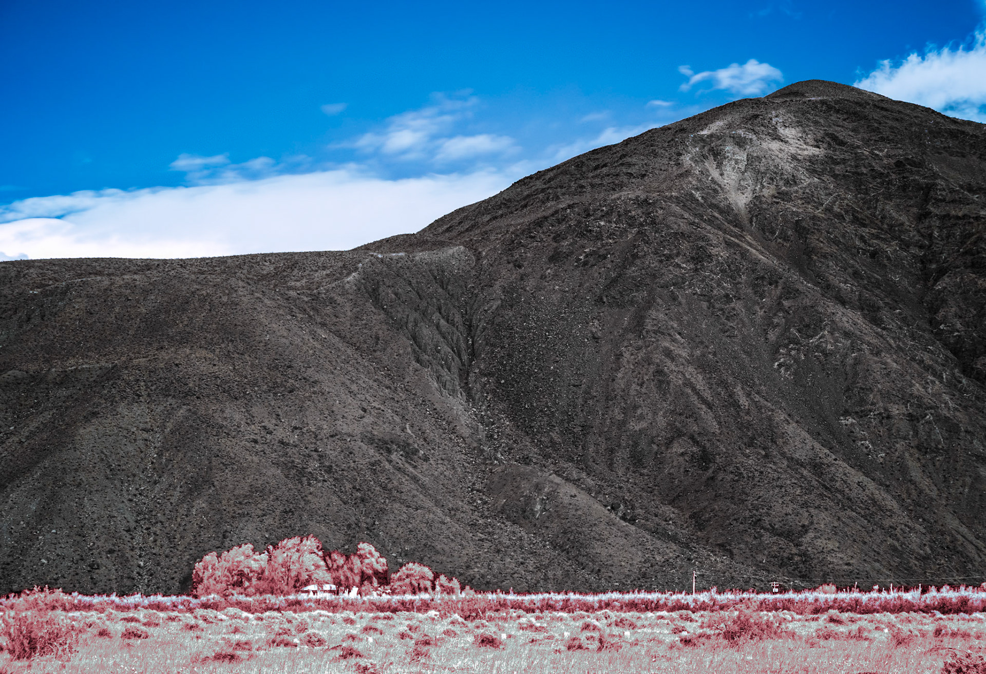
Farmhouse Under the Mountain IRFC: A farmhouse sits in a copse of trees a the base of Coyote Mountain in Anza-Borrego Desert State Park. Infrared (720 nm) false color image.
Desert Clouds Panorama- IRFC: Clouds drift over Coyote Canyon in Anza-Borrego Desert State Park. The panorama is a composite of multiple Infrared (720 nm) false color images.
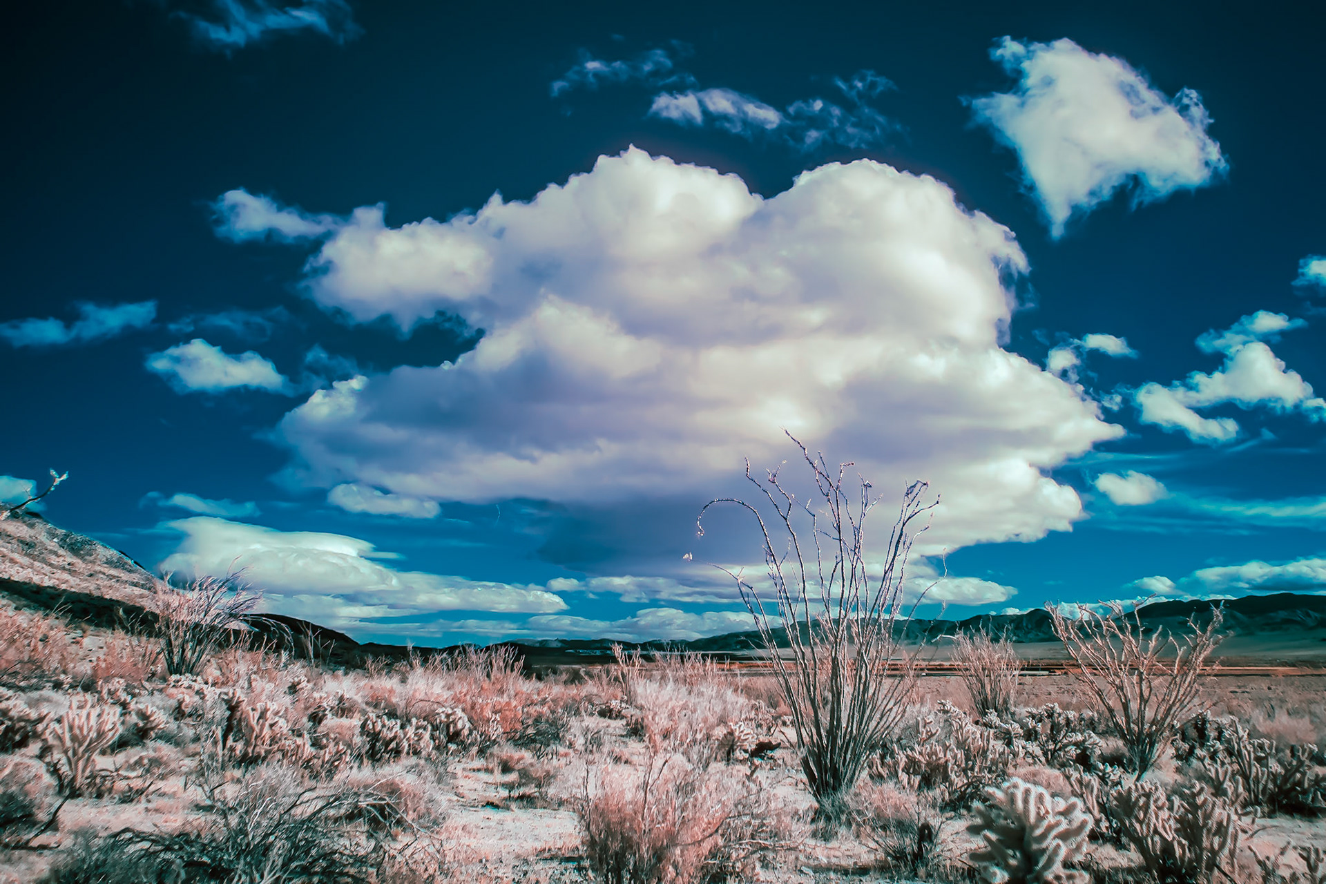
Ocotillo and Cholla Under a Cloud - IRFC: In Coyote Canyon, Anza-Borrego Desert State Park. Infrared (720 nm) false color image.
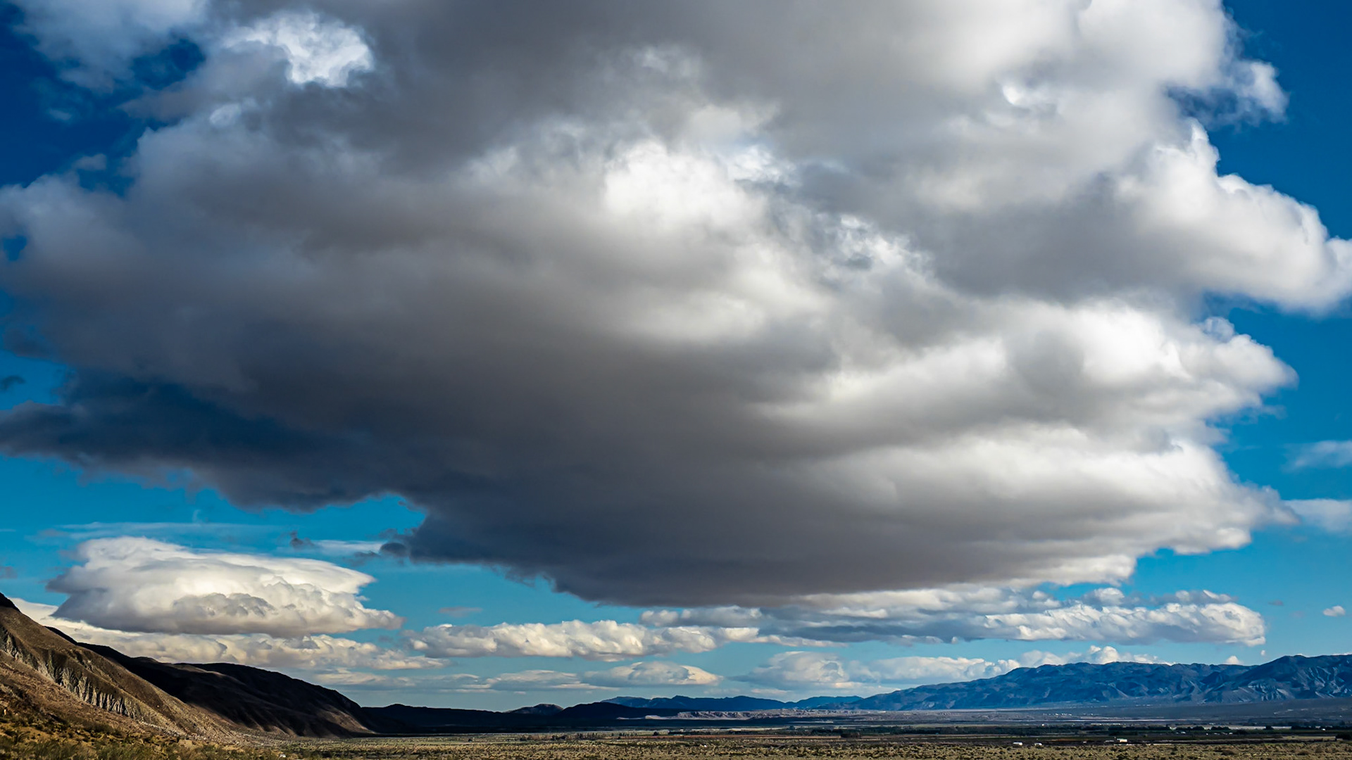
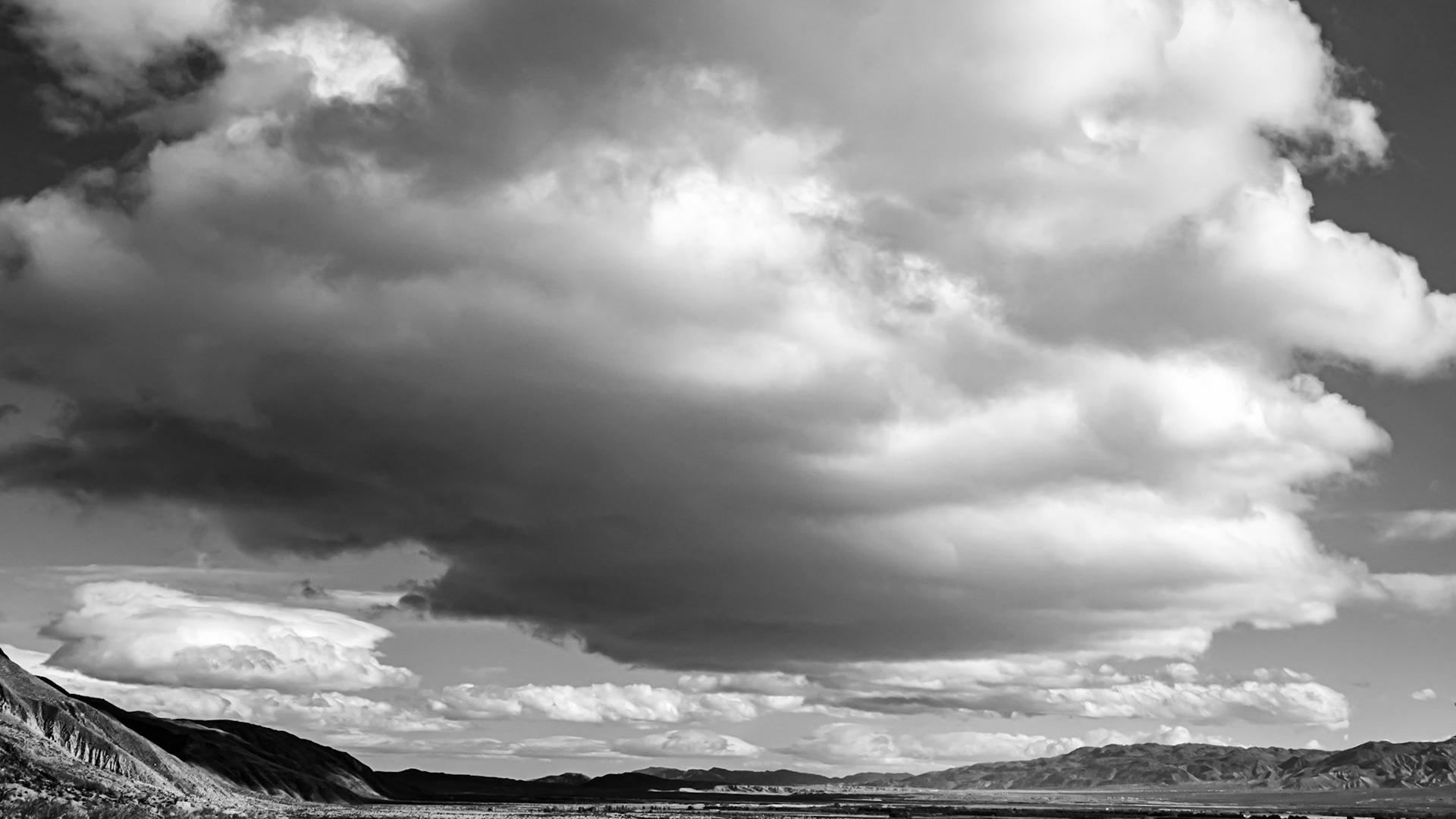
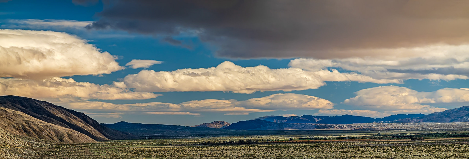
Desert Clouds: These puffy stratocumulus clouds look ominous but usually signify dry weather or light rain.
Desert Clouds - B&W: These puffy stratocumulus clouds look ominous but usually signify dry weather or light rain.
Desert Clouds: These puffy stratocumulus clouds look ominous but usually signify dry weather or light rain.
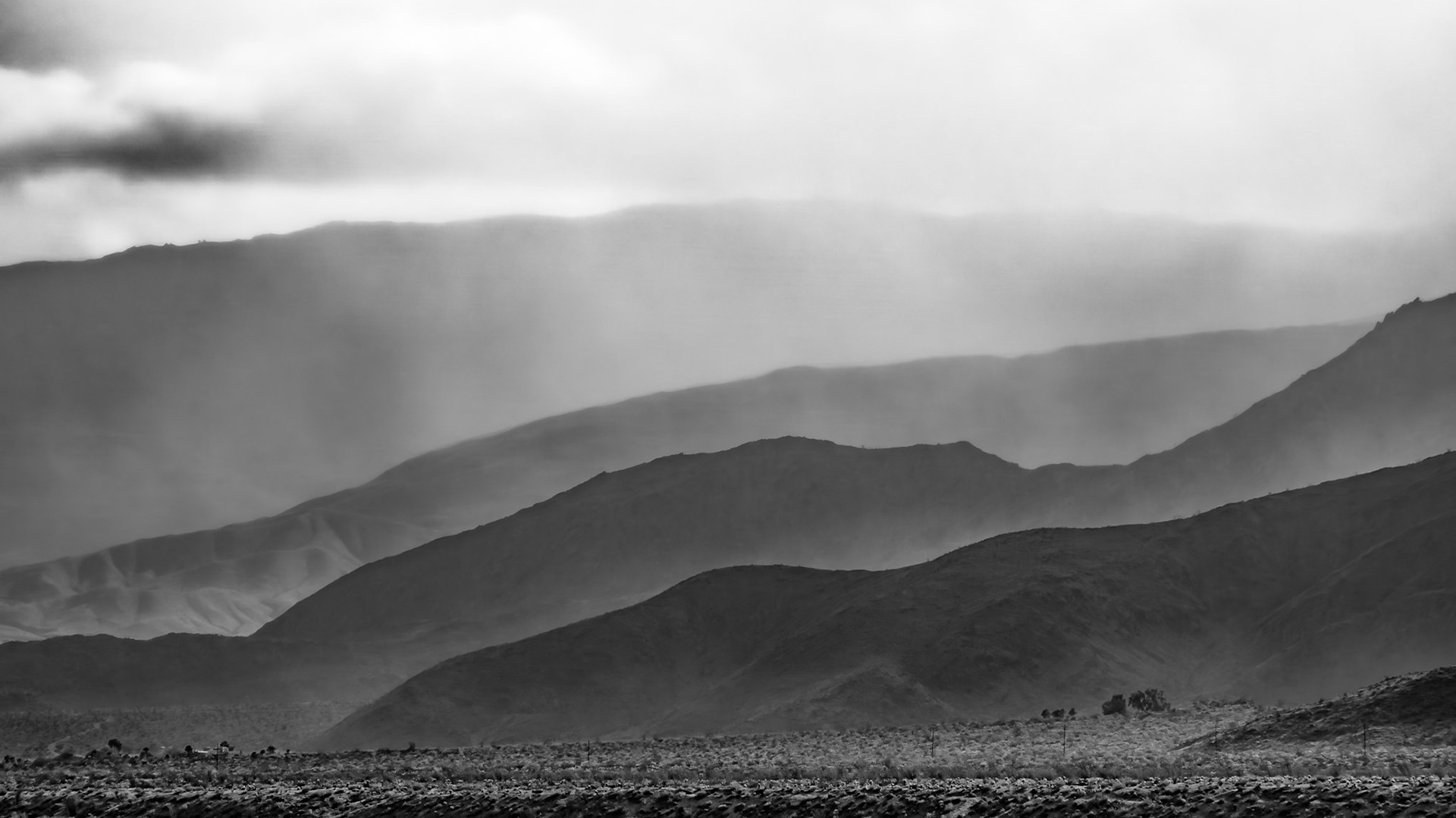
Misty Ridges: Low clouds and mist rising over the ridges and valleys that flank Indian Head mountain in the Anza-Borrego Desert State Park.
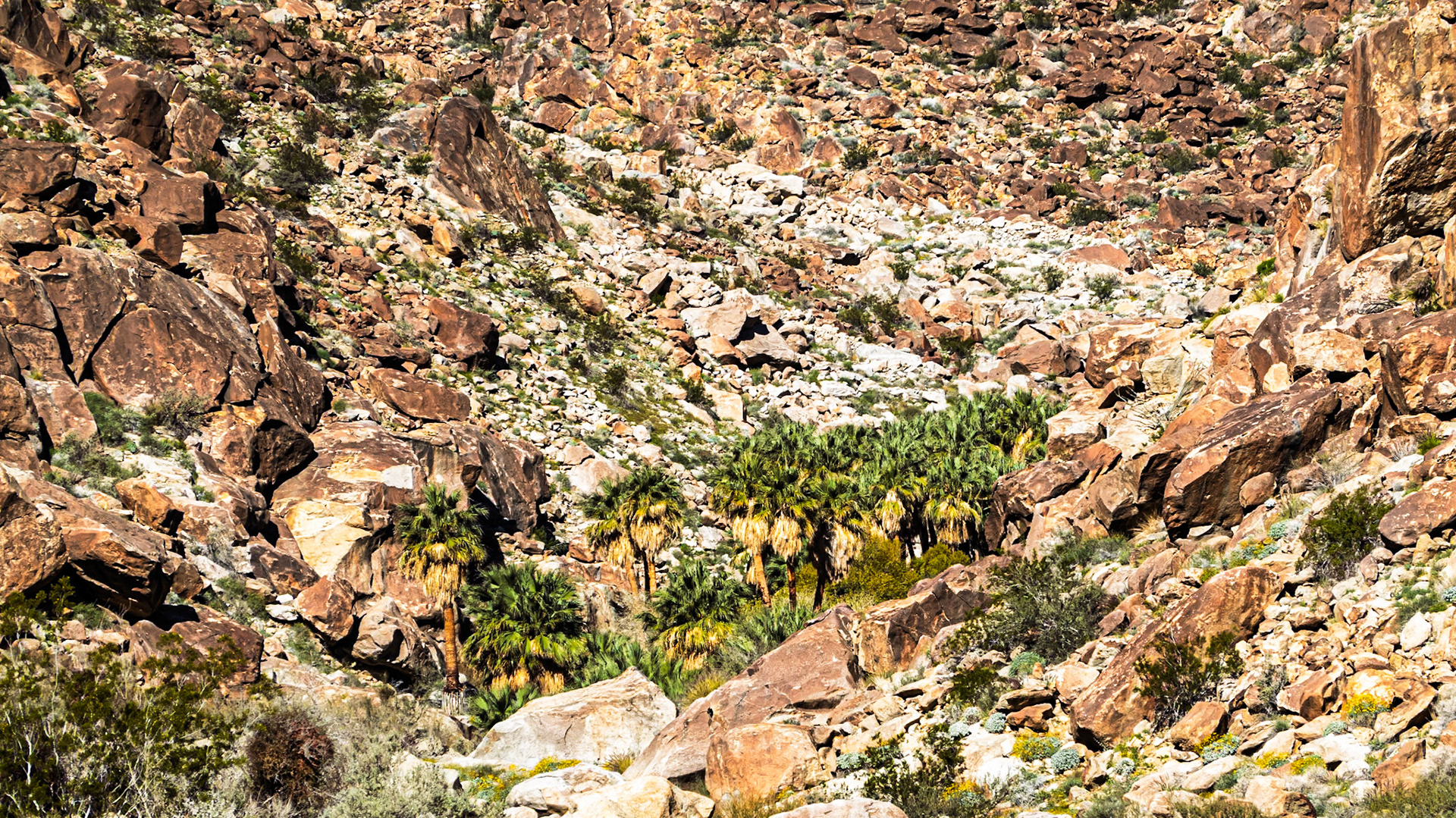
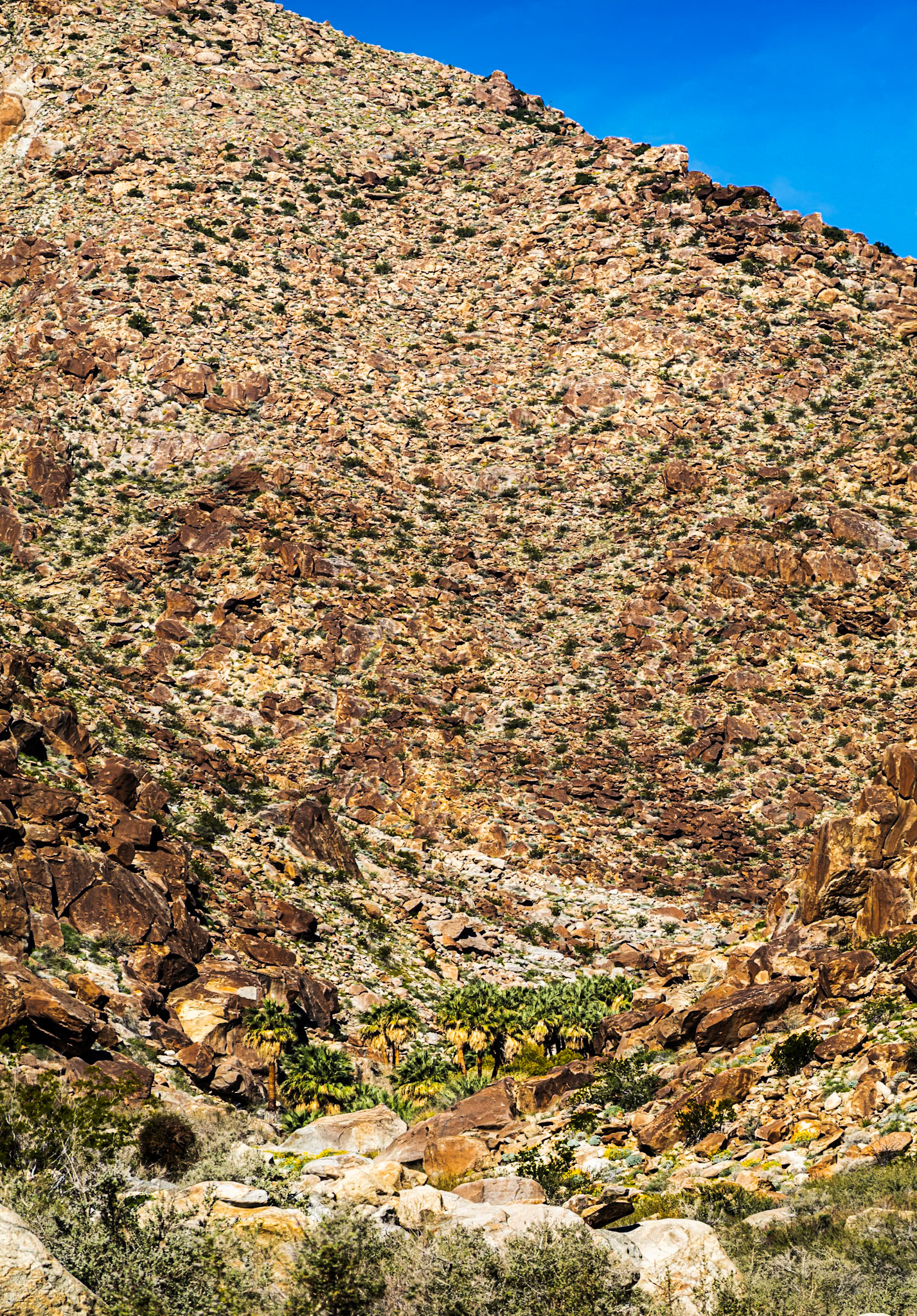
Palm Oasis: A desert oasis at the head of Palm Canyon is fed by rain captured as runoff from the surroudning San Ysidro Mountains or by spring-fed groundwater. The oasis is frequently visited by bighorn sheep.
Palm Canyon Oasis: A desert oasis at the head of Palm Canyon is fed by rain captured as runoff from the surroudning San Ysidro Mountains or by spring-fed groundwater. The oasis is frequently visited by bighorn sheep.
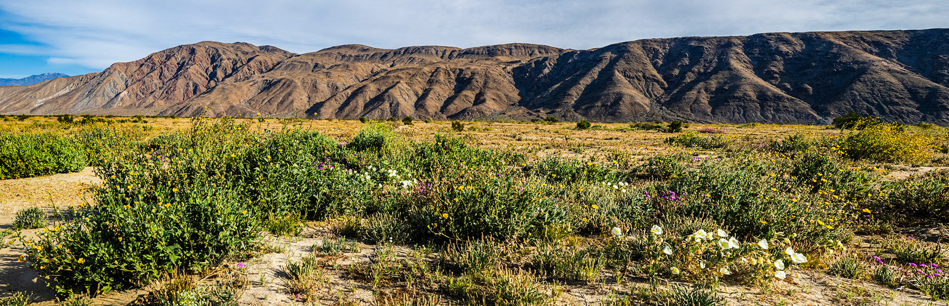
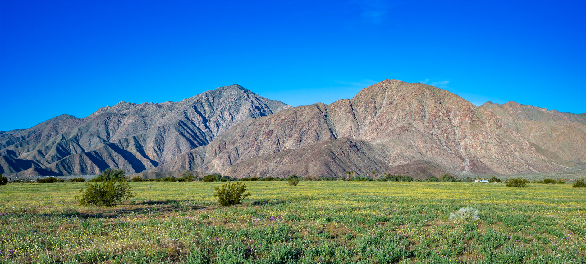
Borrego Valley Wildflowers: Wildflowers carpet the Borrego Valley at the foot of Coyote Mountain in the Anza-Borrego Desert.
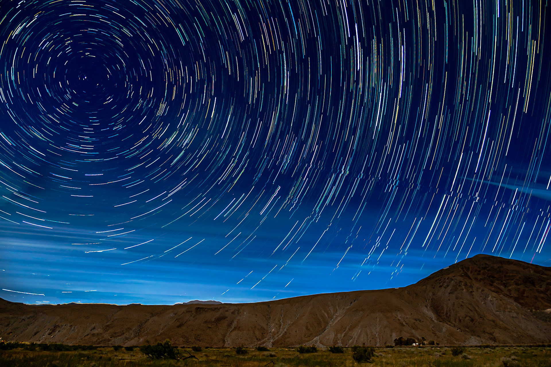
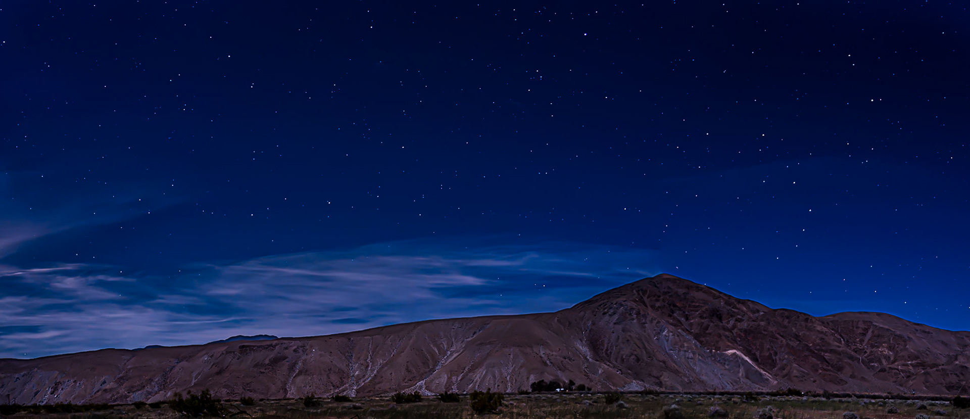
Borrego Valley Startrails: Startrails swirl over a solitary Borrego-Valley farmhouse seen at the foot of Coyote Peak on a soft moonlit night.
:
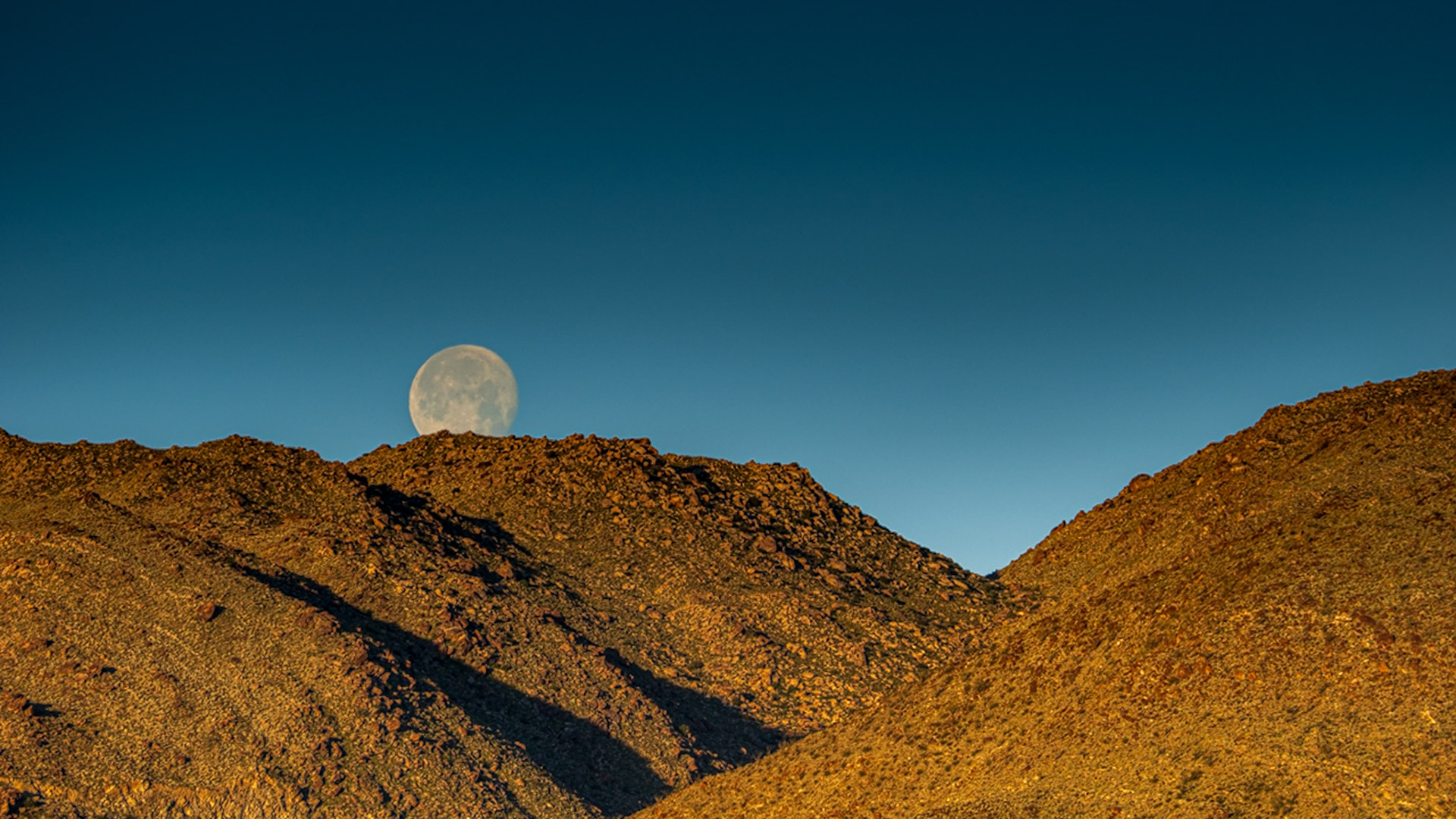
Moon Light on Coyote Mountain: A waxing gibbous moon gives faint illumination to Coyote Mountain and a desert homestead nestled in a copse of trees near the entrance to Coyote Canyon in the Anza-Borrego Desert State Park.
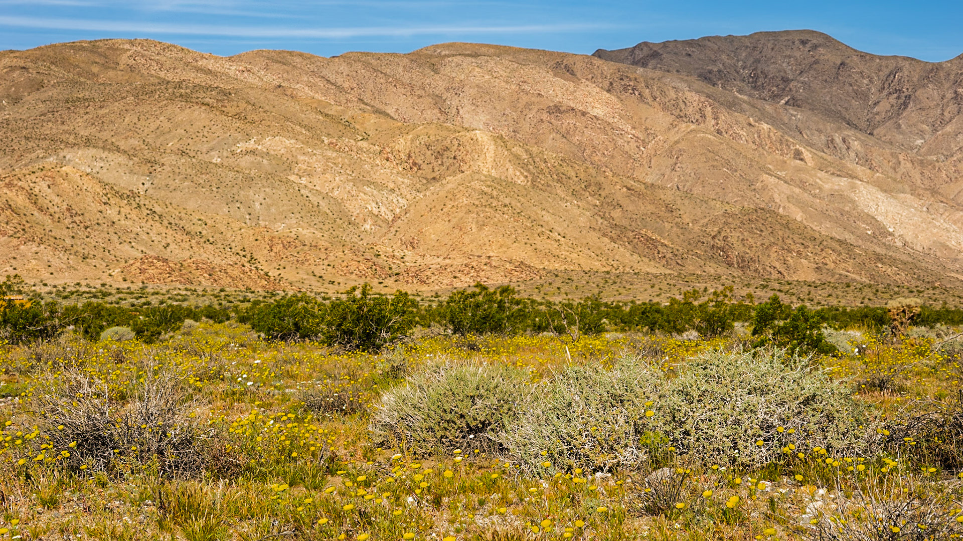
Desert Dandelion Meadows: A carpet of desert dandelion turns toward the morning light in the Borrego Valley.
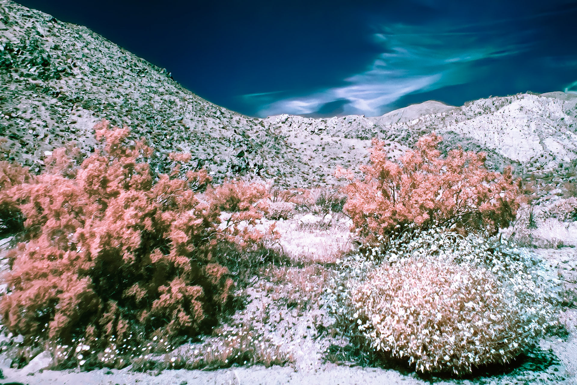
Desert Shrubs- IRFC: Creosote Bush and Cheesebush at the head of Butler Canyon in Anza-Borrego Desert State Park. Infrared (720 nm) false color image.
Green and Yellow Desert: Yellow flowers of desert dandelion amid the green and yellow of creostoe bush and burrobushsprinkled across the Clark Valley and the slopes of the Santa Rosa Mountains in the Anza-Borrego Desert.
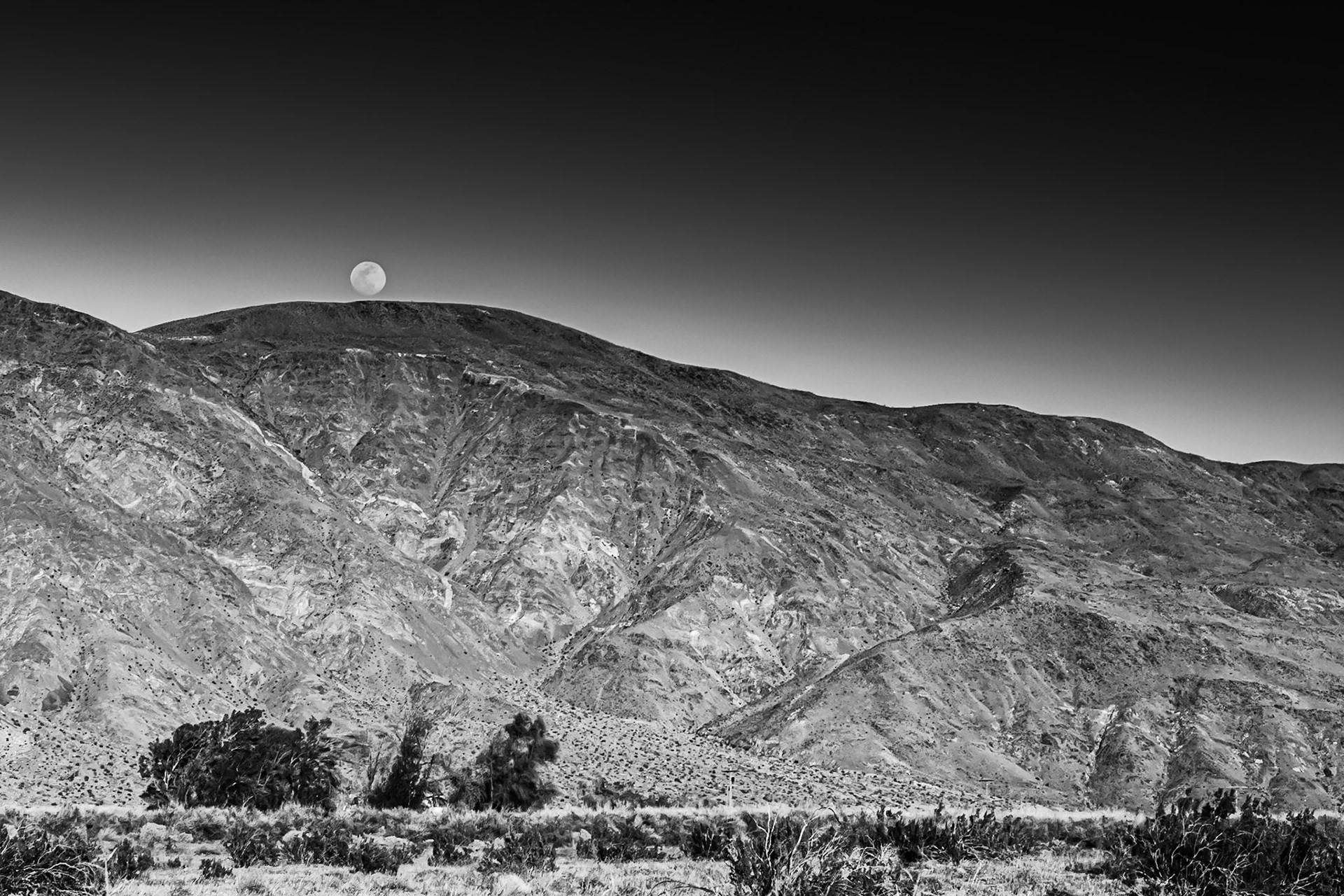
Moonrise over Coyote Mountain : Viewed across the creosote-bush studded, alluvial plain near the entrance to Coyote Canyon in the Anza-Borrego Desert. A house nestled in a copse of willows sites at the far side of the plain at the foot of the mountain.
Moonrise over Coyote Mountain : Viewed across the creosote-bush studded, alluvial plain near the entrance to Coyote Canyon in the Anza-Borrego Desert. A house nestled in a copse of willows sites at the far side of the plain at the foot of the mountain.
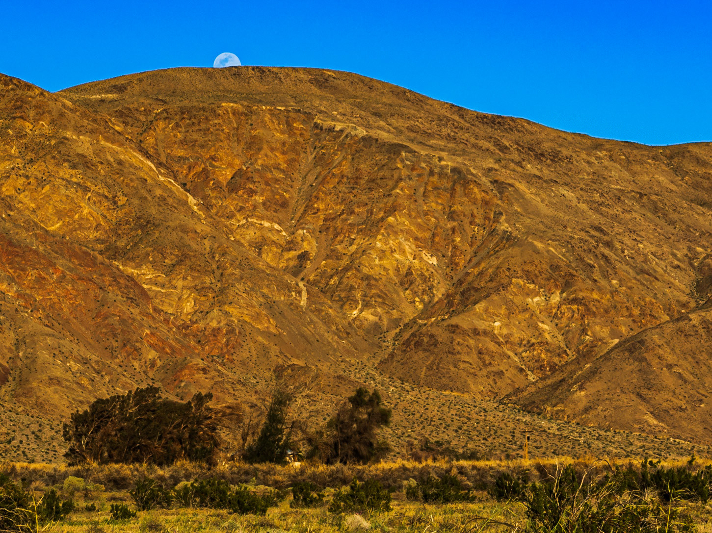
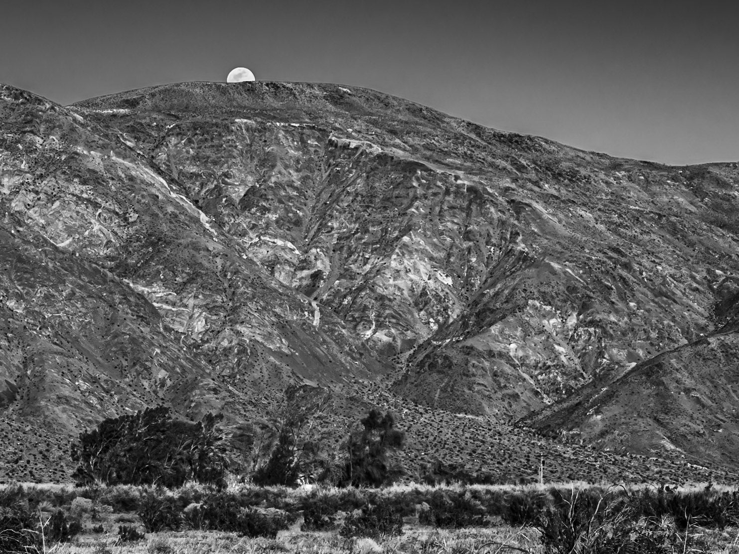
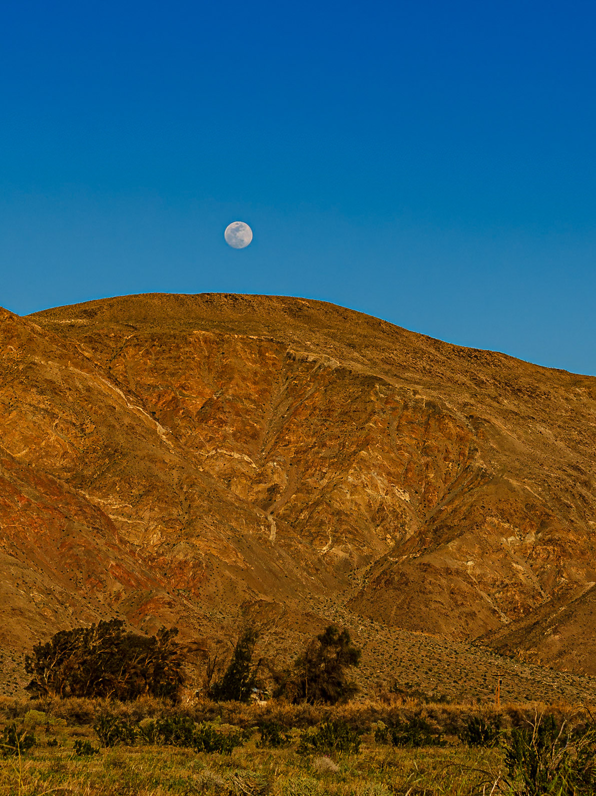
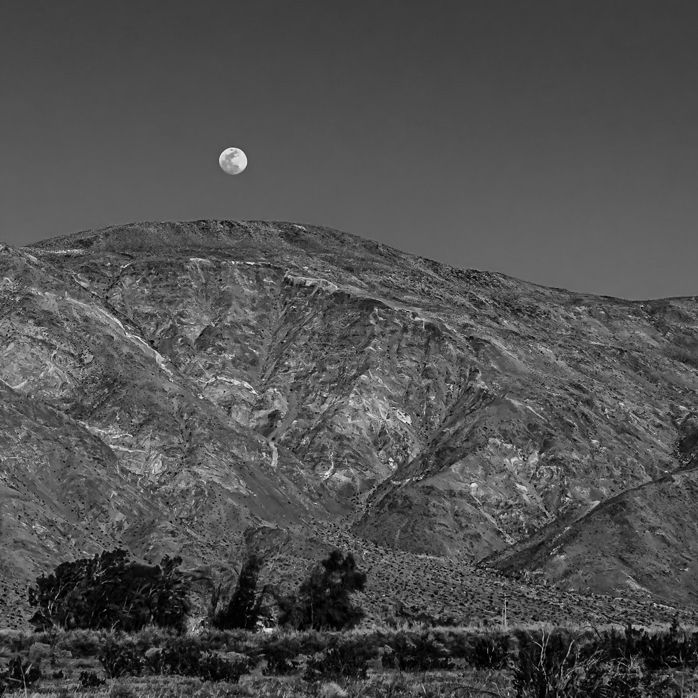
Evening Moonrise: Viewed across the creosote-bush studded, alluvial plain near the entrance to Coyote Canyon in the Anza-Borrego Desert. A house nestled in a copse of willows sites at the far side of the plain at the foot of the mountain.
Evening Moonrise: Viewed across the creosote-bush studded, alluvial plain near the entrance to Coyote Canyon in the Anza-Borrego Desert. A house nestled in a copse of willows sites at the far side of the plain at the foot of the mountain.
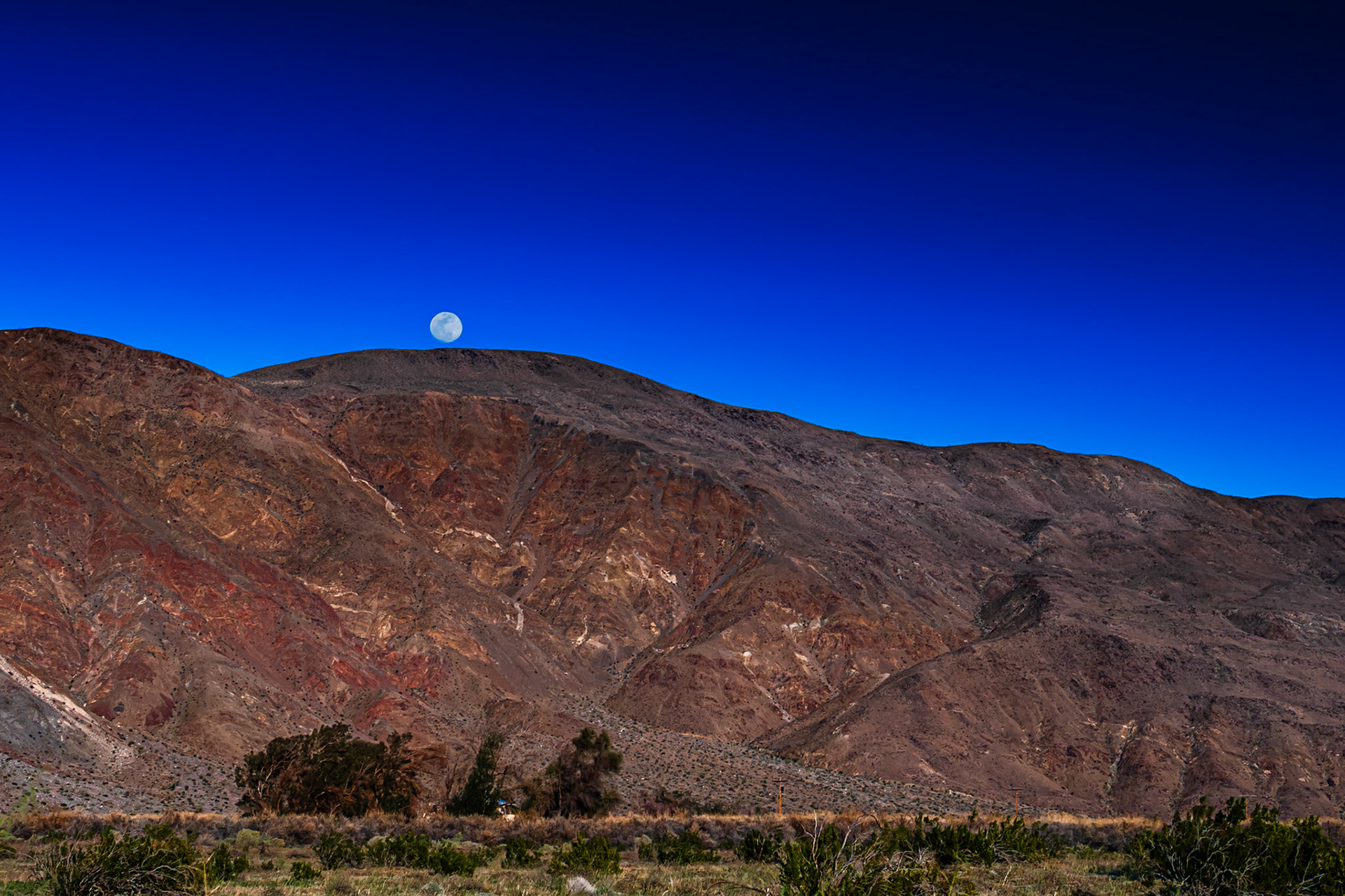
Golden Hour Moonrise over Coyote Mountain : Viewed across the creosote-bush studded, alluvial plain near the entrance to Coyote Canyon in the Anza-Borrego Desert. A house nestled in a copse of willows sites at the far side of the plain at the foot of the mountain.
Golden Hour Moonrise over Coyote Mountain : Viewed across the creosote-bush studded, alluvial plain near the entrance to Coyote Canyon in the Anza-Borrego Desert. A house nestled in a copse of willows sites at the far side of the plain at the foot of the mountain.
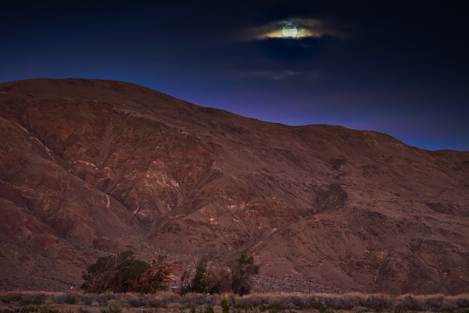
An Eye in the Sky: The rising moon peeks through the cloud cover looking over a farmhouse nestled in a copse of trees at the foot of Coyote Mountain in the Anza-Borrego Desert.
Santa Rosa Mountains IRFC: The Santa Rosa mountains viewed from the short wash section of the Thimble Trail in the Anza-Borrego Desert State Park. Infrared (720 nm) false color image.
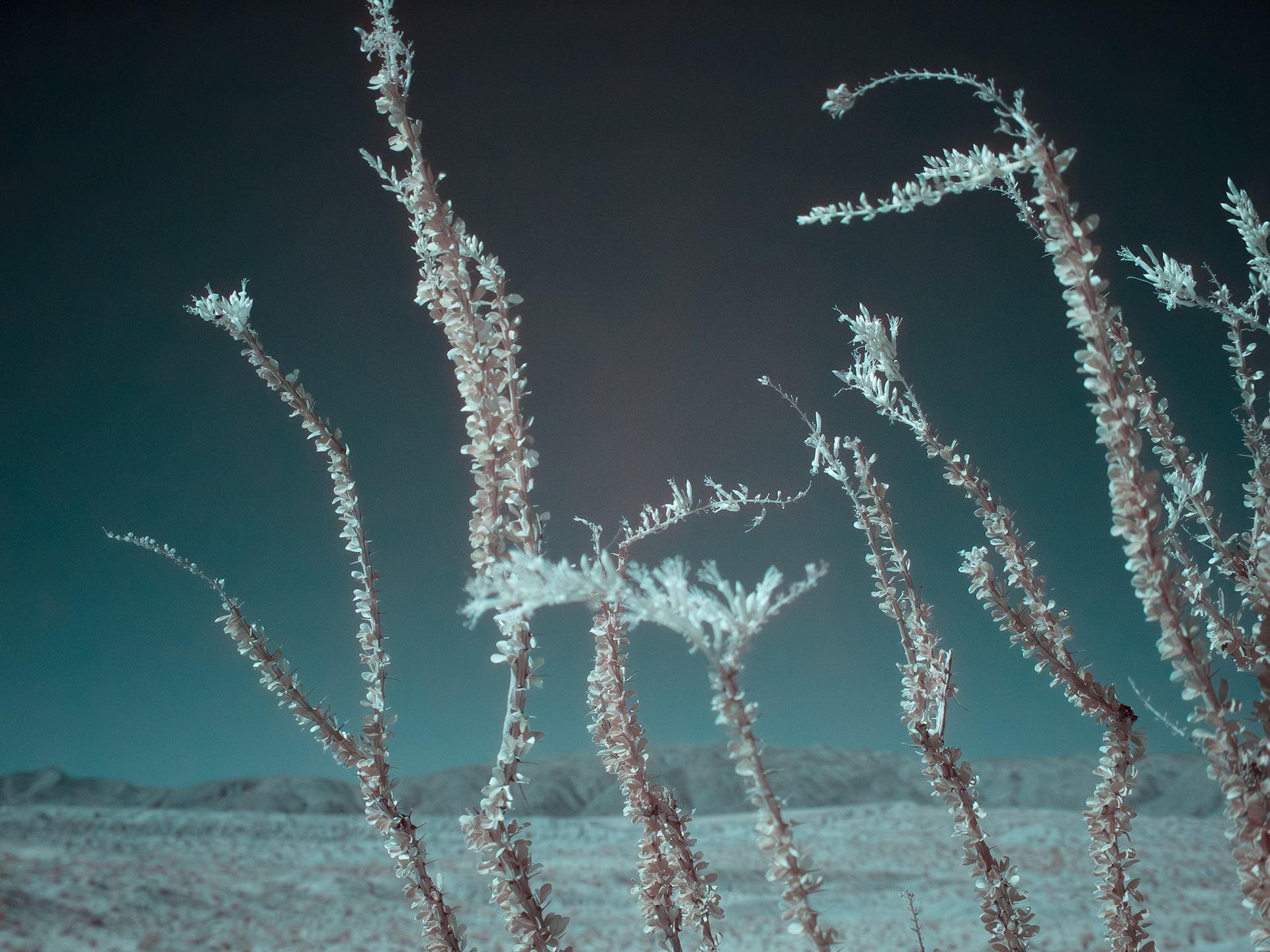
Ocotillo in Bloom - IRFC: Ocotillo in bloom along the Thimble Trail in the Anza-Borrego Desert State Park, Infrared false color image, 720 nm filter.
Ocotillo Blooms - IRFC: Ocotillo blooms along the Thimble Trail in Anza-Borrego Desert State Park. Infrared false color image taken through a 720 nm filterr.
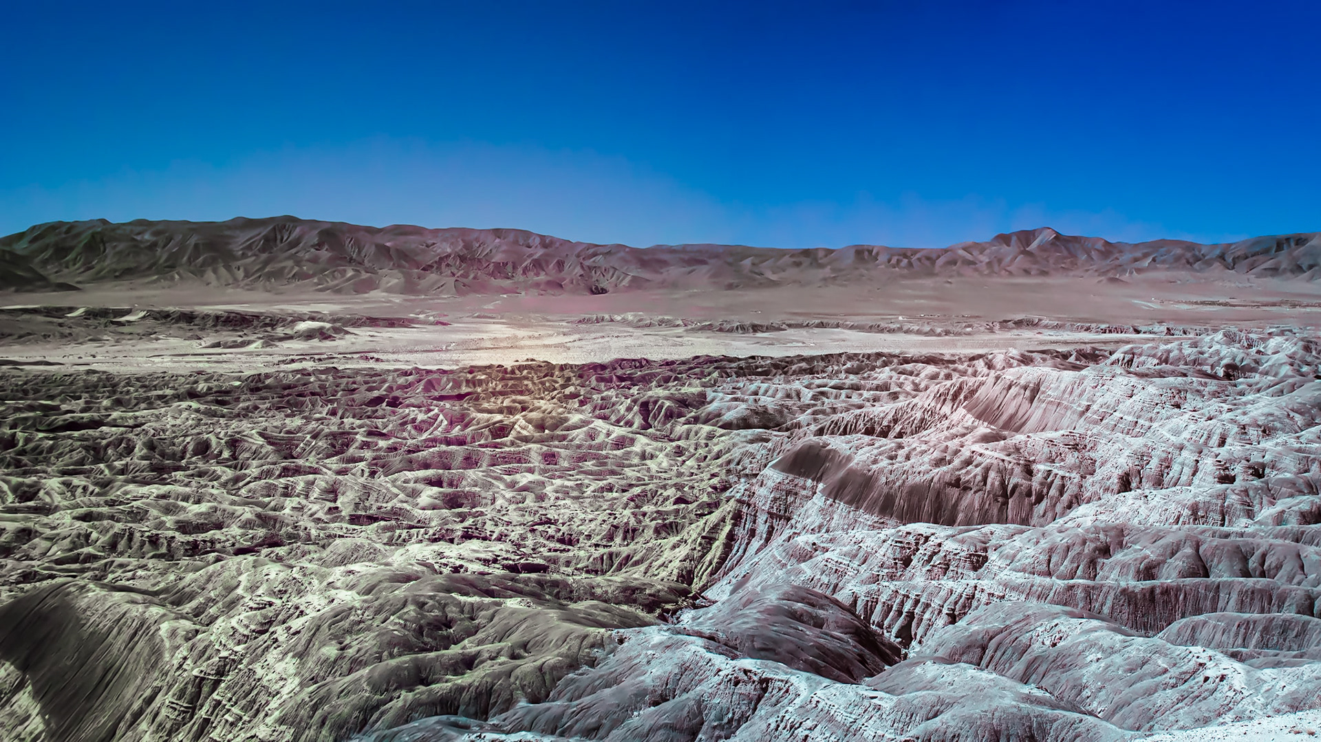
Borrego Badlands and Twin Buttes - IRFC: The Borrego Badlands, the East and West Buttes of Borrego Mountain and the Salton Sea viewed from Vista del Malpais. Panorama of several infrared (720 nm) false color photos.
Borrego Badlands & San Ysidro Mountains - IRFC: Infrared (720 nm) false color image of the Borrego Badlands & San Ysidro Mountains viewed from Vista del Malpais.
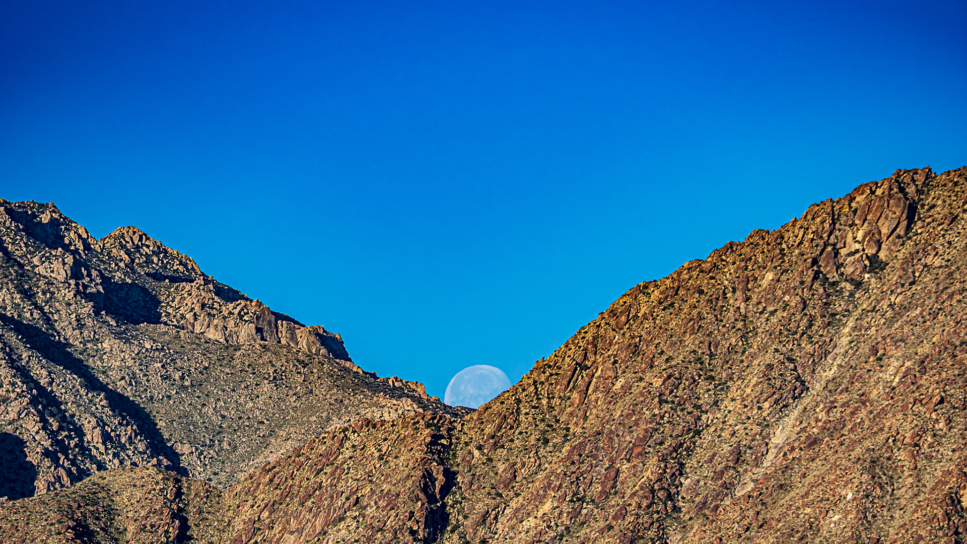
San Ysidro Moonset: Moon set behind the San Ysidro Mountians drenched in the cinnamon glow of dawn's early morning light.
Blue Hour Moonset : A notch of the San Ysidro Mountains near Indianhead peak catches a setting moon in early March morning.
Mountain Clouds Panorama: Stormy weather threatens over the San Ysidro Mountains, Anza-Borrego Desert State Park.
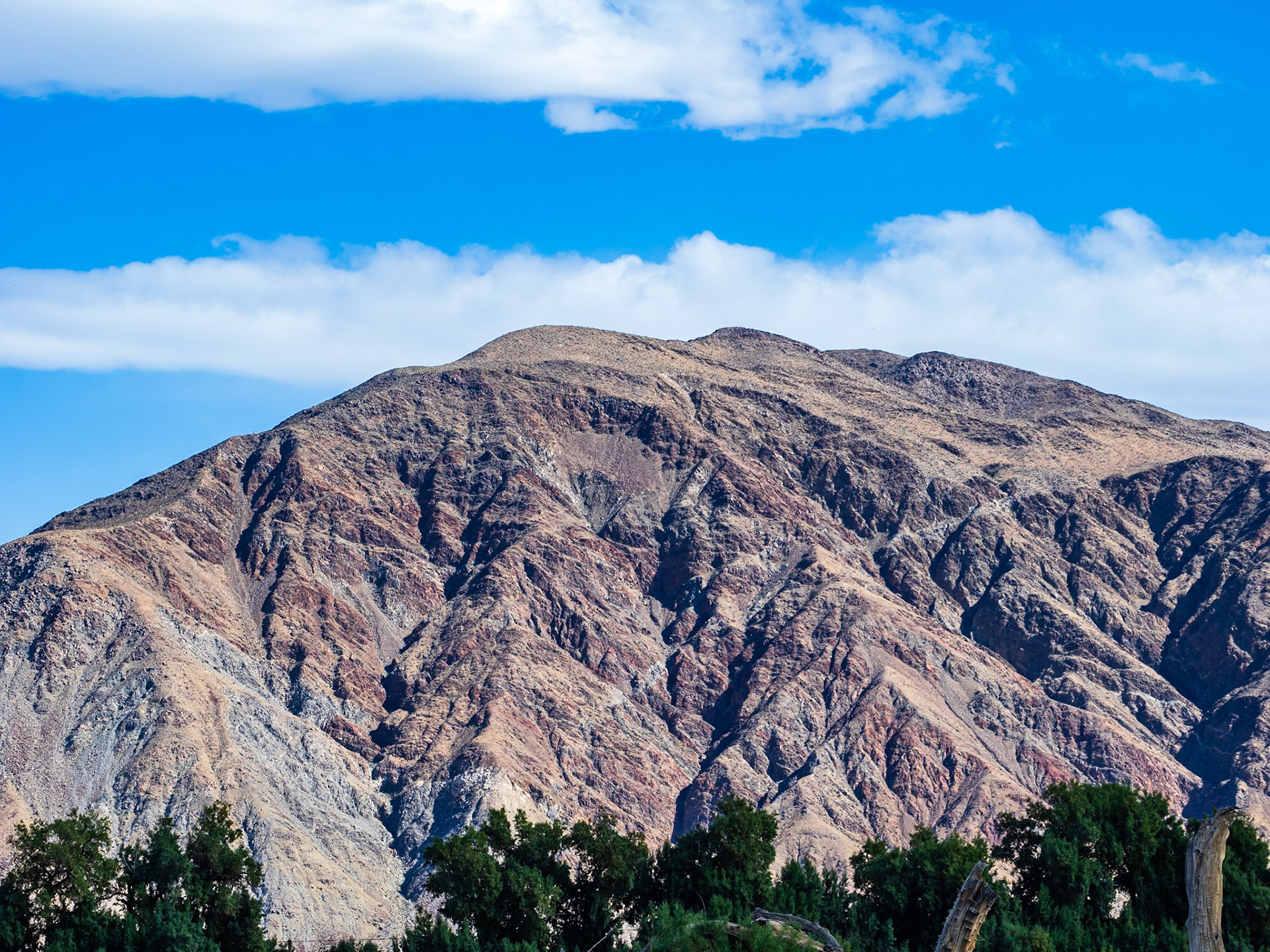
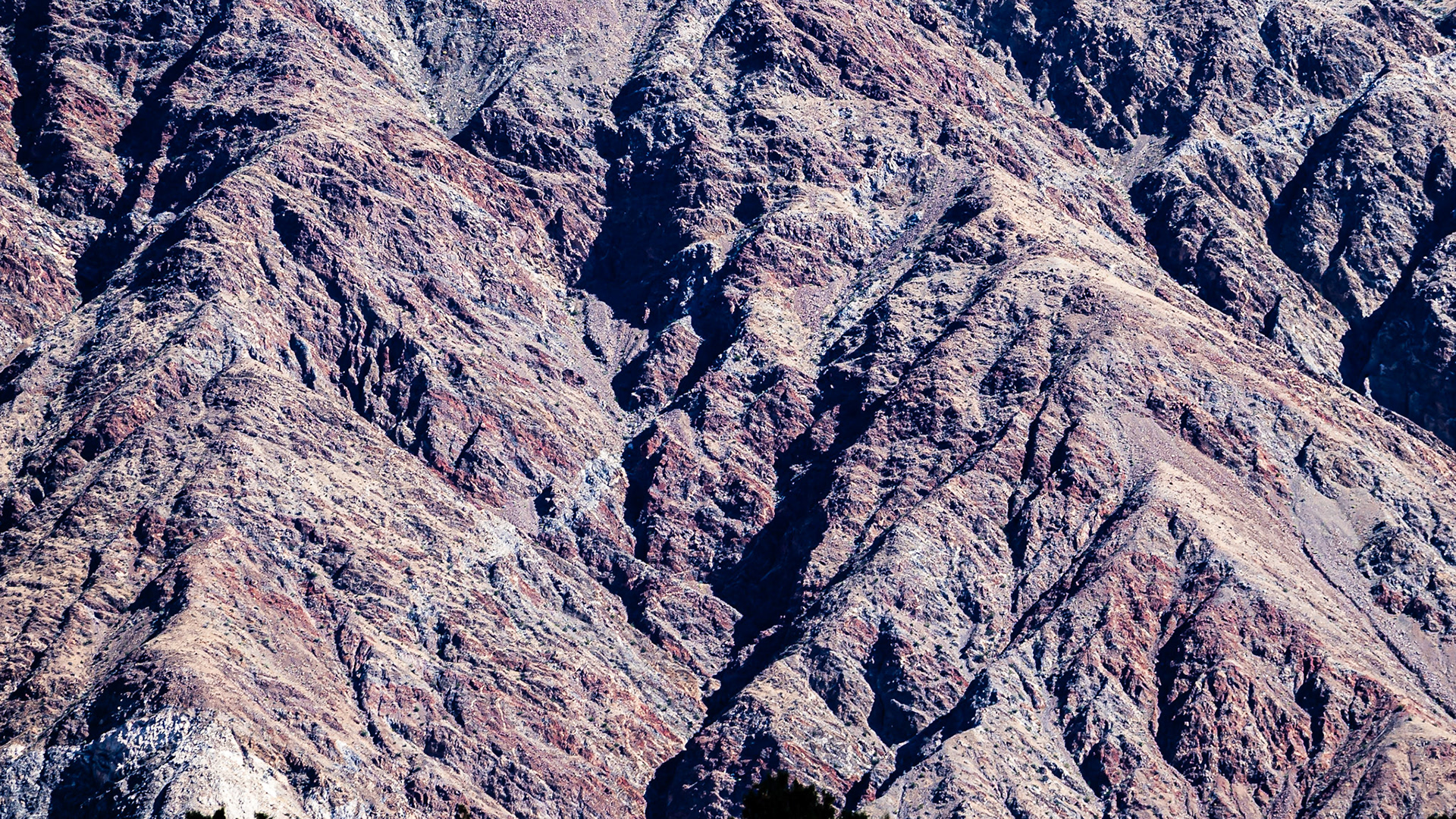
Coyote Mountain: In the Anza-Borrego Desert State Park
Coyote Mountain Abstract: In the Anza-Borrego Desert State Park
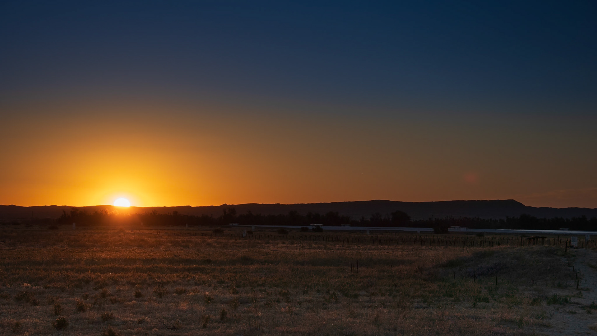
Borrego Valley Sunrise : Looking across the Borrego Valley alluvial plain towards Font's Point.
Desert Dandelion: A carpet of desert dandelion turns toward the morning light in the Borrego Valley.
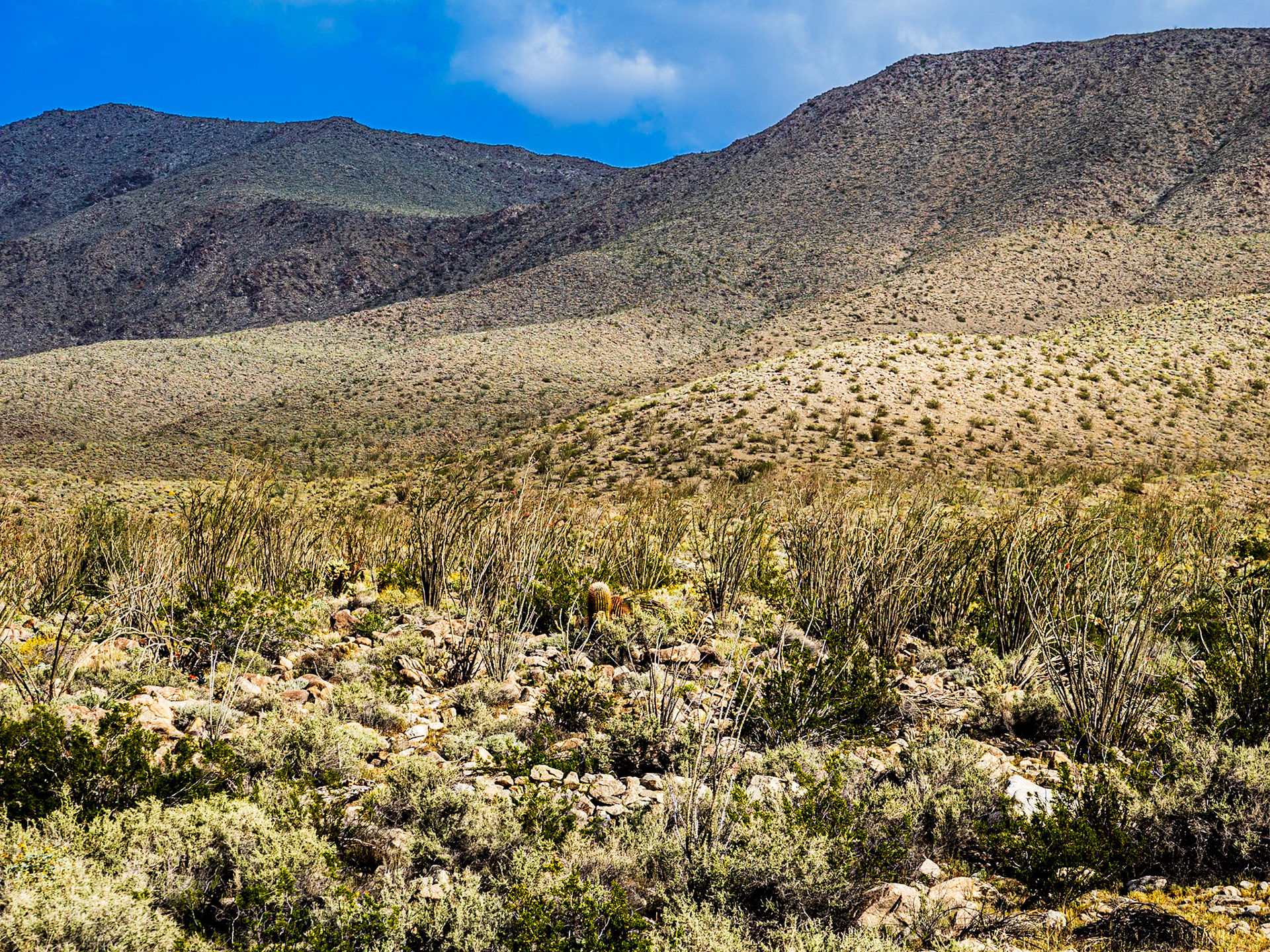
Yaqui Flats: A barrell cactus shares space on this rocky slope dominated by a community of Ocotillo cacti.
Yellow Desert: Creosote bush,chuparosa, barrel cactus and teddy bear cholla seem to float on a sea of desert dandelion. Yaqui Flats in the Anza-Borrego Desert State Park.
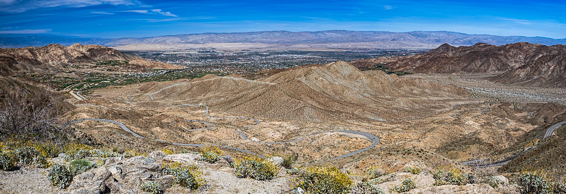
Serpentine Road: A serpentine road winds its way from Palm Desert up to the Santa Rosa and San Jacinto mountains.
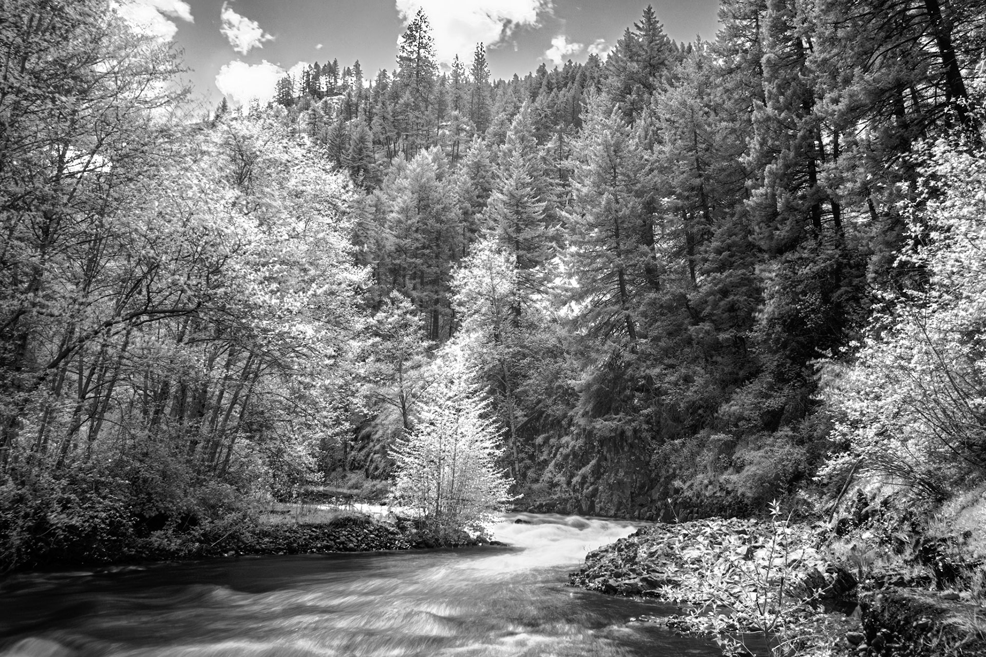
South Fork IRFC: The South Fork of the Walla Wall River flows from the Blue Mountains in northeast Oregon - IR (720 nm infrared B&W conversion)
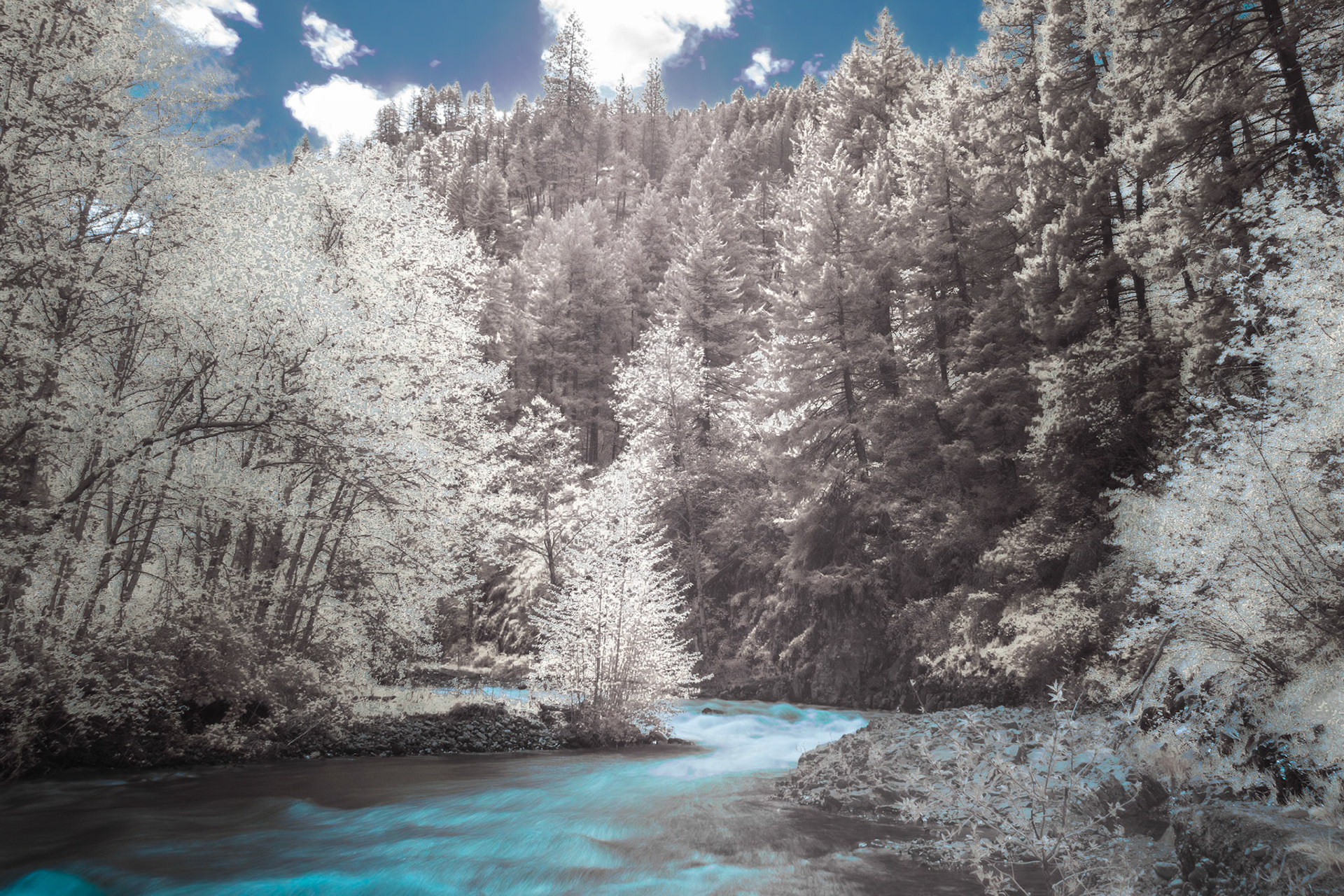
South Fork IRFC: The South Fork of the Walla Wall River flows from the Blue Mountains in northeast Oregon - IRFC (720 nm infrared false color image).
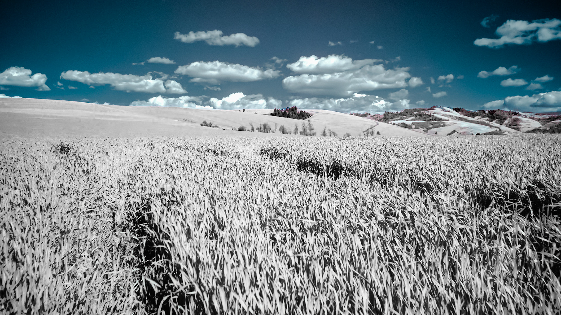
Wheat Fields - IRFC: Rolling hills of wheat blend into the Blue Mountains in southeast Washington near Walla Walla. IRFC (720 nm infrared false color image).
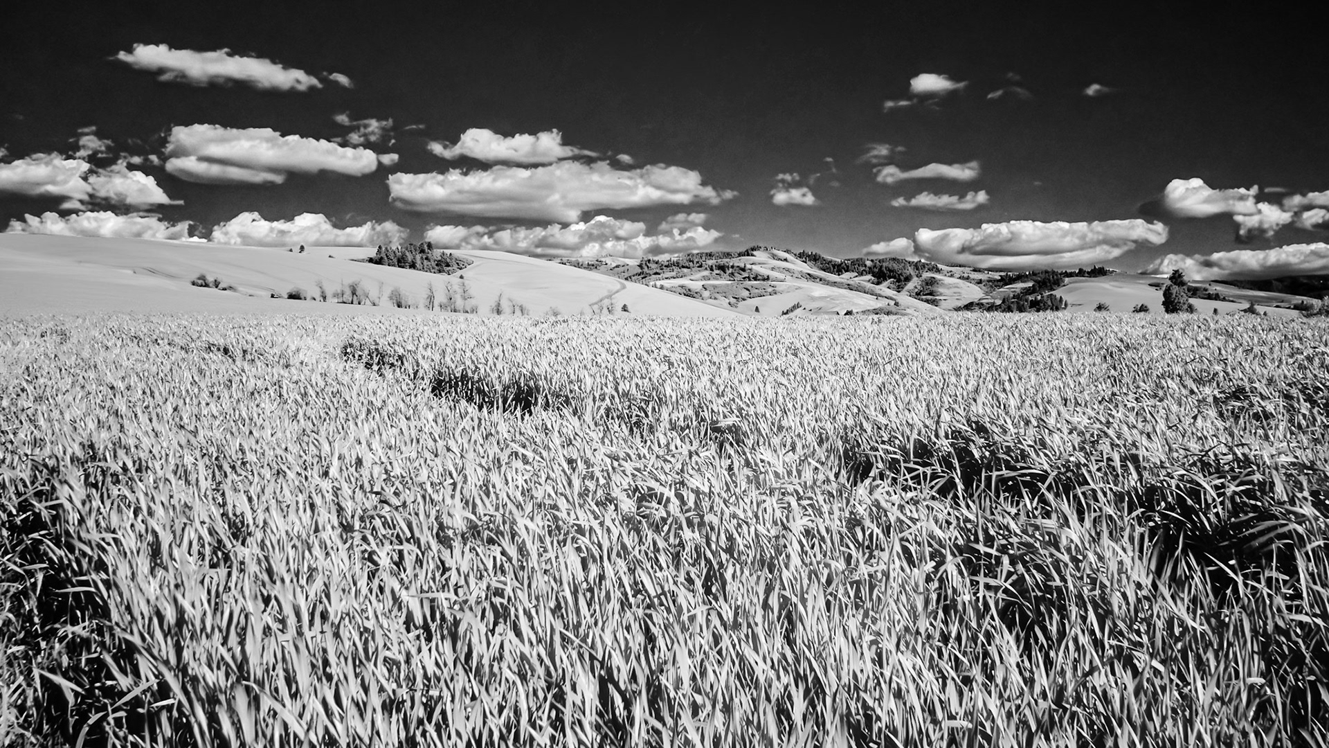
Wheat Fields - IRFC: Rolling hills of wheat blend into the Blue Mountains in southeast Washington near Walla Walla. IRFC (720 nm infrared B&W image).
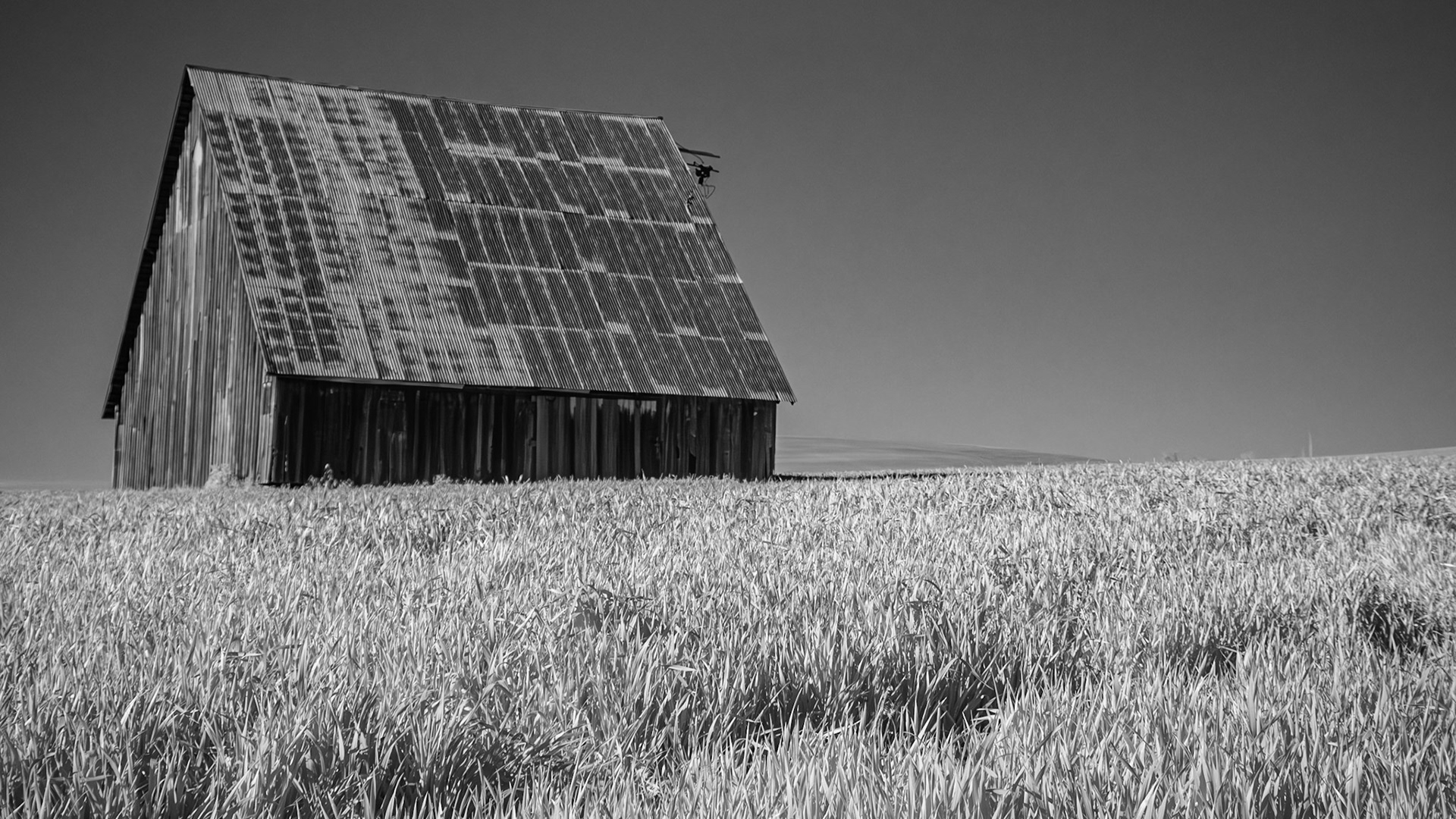
Old Barn - IR B&W: An old barn in a wheat field in the Mill Creek plain just west of the Blue Mountains near Wallla Walla Washington (720 nm infrared B&W image).
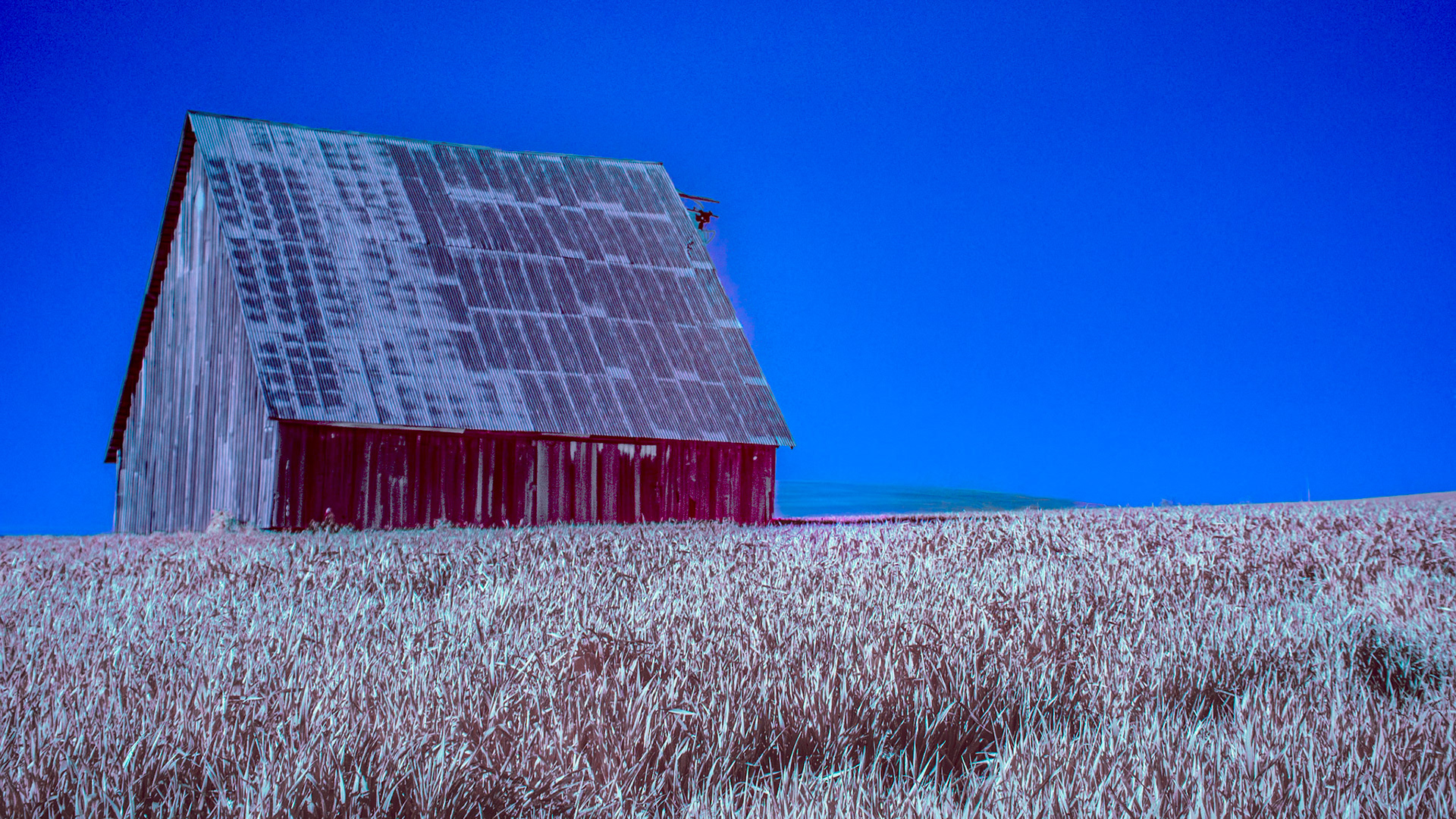
Old Barn - IRFC: An old barn in a wheat field in the Mill Creek plain just west of the Blue Mountains near Wallla Walla Washington (720 nm infrared false color image).
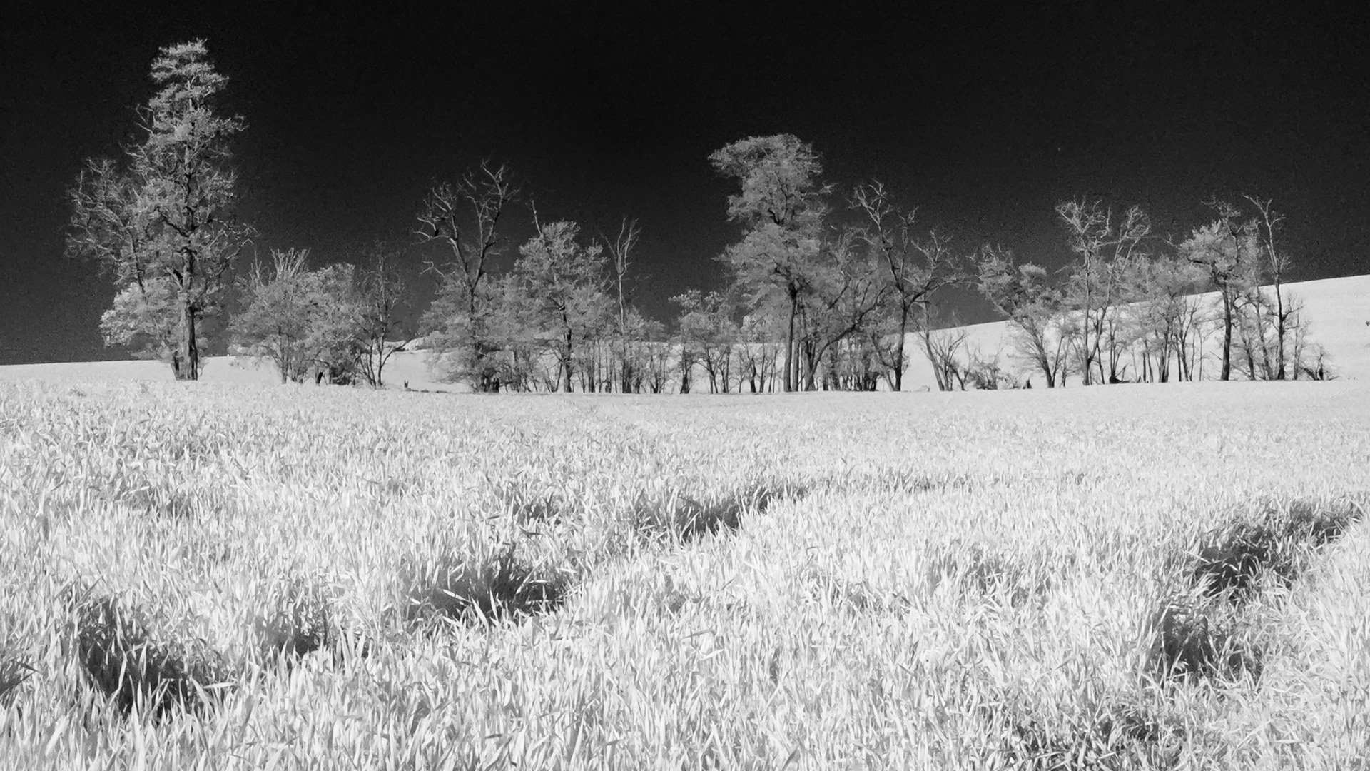
Wheat and Trees: A copse of black alder grows in a wheat field in the Mill Creek plain just west of the Blue Mountains
Canola Fields: Near Walla Walla Washington